
British Columbia Road Maps | Detailed Travel Tourist Driving
Exploring the nation with ancient uniqueness with the best Map
British Columbia has an extremely differing ethnic populace, with a substantial number of settlers having lived in the region for a long time or less. Original foreigners from the British Isles remain a solid segment of nearby society in spite of constraints on movement from Britain since the completion of uncommon status for British subjects in the 1960s.
British Columbia is comprised of four physical districts and it is bound through with lakes, swamps, waterways and streams that bolster untamed life in plenitude. It has an exceptionally praised arrangement of parks, made to ensure its various biological systems for preservation, open air amusement, training and logical review.
The Rockies bring out pictures of towering, snow-topped pinnacles, turquoise lakes, falling waterfalls and thick evergreen woods. The territory is like wise all inclusive note worthy as a result of the Burgess Shale fossil site, which appears in astonishing point of interest what the Earth resembled the greater part a billion years back.
It is the planets biggest in place beach front calm rain woods. The Great Bear is a worshiped and ensured wild territory.
It is additionally home to a wealth of marine life, from whales to dolphins to ocean otters. Whistler Blackcomb is in summer, is bursting at the seams with explorers, mountain bikers, golfers and individuals watchers.
If you plan to visit British Columbia then rely on our maps and explore the country in such a way that you become a localite in a foreign country. The places in the map are defined in such a way that even a kid can read and guide others without being wrong. The accurate distances, colored and highlighted routes make it just the perfect partner you ever wanted on an adventure tour. After using our maps, I am sure you will definitely fall for the same.
British Columbia Road Maps for Tourists and TravelersDetailed Road Map of British ColumbiaBuy travel maps for British Columbia tourist attractions, road trips, street guide, driving directions and more |
British Columbia
- $24.95 + $6.80 p&h or $16.80 foreign delivery
Item Code : ROUT21244
 Scale 1:300,000. Route Master edition.
 - $10.95
Item Code : ROUT21245
 Scale 1:1,600,000. Route Master edition.
 - $10.95
Item Code : ROUT21249
 Scale 1:185,000. Route Master edition.
 - $21.95 + $6.80 p&h or $16.80 foreign delivery
Item Code : ROUT21251
 Scale 1:25,000. Route Master edition.
 - $12.95
Item Code : MART21349
MapArt edition. Laminated province road maps. Longlasting, ideal for wet or muddy conditions. - $12.95
Item Code : MART5658
Scale 1:25,000. Size 28"x40". MapArt edition. Also includes city street plans of Hope, Mission, Squamish, and Whistler. Detailed city street map. - $20.95 + $6.50 p&h or $16.80 foreign delivery
Item Code : MART5659
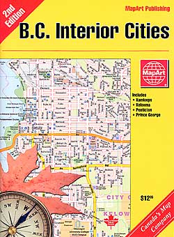
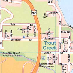 Various scales. Size 6?"x9". 97 pages. MapArt edition. featuring 100 Mile House, Armstrong, Ashcroft, Cache Creek, Canoe, Carrs Landing, Castlegar, Cedar Grove, Chase, Coldstream, Cranbrook, Enderby, Fernie, Fruitvale and much more.
 - $26.95 + $6.50 p&h or $26.80 foreign delivery
Item Code : GMJO5661
 "various scales". Size 8?"x11". 64 pages. G.M. Johnson edition.
 - $12.95
Item Code : MART5662
Scale 1:25,000. Detailed city street map. - $14.95
Item Code : GMJO8790
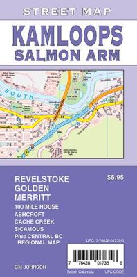
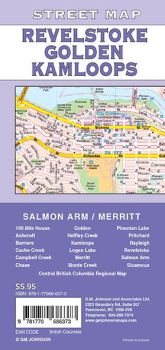 Scale 1:25,000. Size 27"x39". G.M. Johnson edition. This Map Coverage Area are 100 Mile House, Ashcroft, Barriere, Cache Creek, Campbell Creek, Chase, Golden, Heffley Creek, Kamloops, Logan Lake, Monte Creek, Merritt, Pinantan Lake, Pritchard, Rayleigh, Revelstoke, Salmon Arm, Sicamous, Central British Columbia Regional Map.
 - $12.95
Item Code : MART21401
Scale 1:25,000. MapArt edition. Detailed city street map. - $14.95
Item Code : GMJO7800
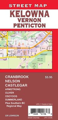
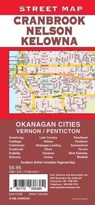 Scale 1:25,000. Size 27"x39". G.M. Johnson edition. This Map Coverage Area are Armstrong, Castlegar, Coldstream, Cranbrook, Enderby, Kelowna, Lake Country, Nelson, Okanagan Landing, Oliver, Osoyoos, Oyama, Peachland, Penticton, Summerland, Vernon, West Kelowna, Winfield, Southern British Columbia Regional Map.
 - $14.95
Item Code : GMJO5663
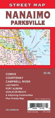
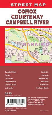 Scale 1:31,000. Size 27"x39". G.M. Johnson edition. This Map Coverage Area are Campbell River, Comox, Courtenay, Dolphin Beach, Gabriola Island, Ladysmith, Lantzville, Nanaimo, Nanoose Bay, Parksville, Port Alberni, Qualicum Beach, Plus Vicinity Map.
 - $12.95
Item Code : MART21417
Scale 1:25,000. MapArt edition. Detailed city street map. - $12.95
Item Code : MART21421
Scale 1:25,000. MapArt edition. Detailed city street map. - $12.95
Item Code : MART21427
Scale 1:25,000. MapArt edition. Detailed city street map. - $12.95
Item Code : MART5664
 Scale 1:25,000. Size 24"x38". MapArt edition. Detailed city street map.
 -
- $12.95
Item Code : MART21433
Scale 1:25,000. MapArt edition. Detailed city street map. - $17.95
Item Code : ITMB5600
 Scale 1:800,000. International Travel Maps edition. The ITM map of the southern half of British Columbia is one of our most popular titles. It covers the area between Vancouver and Calgary, but more importantly, includes everything from the westernmost edge of Vancouver Island to a line just east of Calgary and from Seattle north to a ways beyond Prince George. Thus the entire Rocky Mountain stretch of national parks from Banff north to Jasper is included. BC is mountain country, with few motorways, but those that exist are shown in blue. The Trans-Canada Hwy 1 between Kamloops and Banff is in the process of being upgraded to motorway levels, but this is a project taking many years to complete, so for the moment, we are showing only the portions in Alberta as being consistently complete. The map also includes inset maps of downtown Vancouver and Victoria. BC is as large as Western Europe, with a population of just over 4 million, so is wilderness country for 98% of its area. This map would be excellent for someone planning to fly in to Calgary and rent a motorhome for two weeks, or for someone wanting to explore the back roads and camping sites of an interesting part of the world. This edition has been printed on waterproof paper made from crushed stones. It is tear-resistant, durable, and completely biodegradable.
| Postage and handling is $4.40 for the first map and $1.80 for each additional map. ~ ~ ~ ~ ~ ~ Foreign delivery is $15.80 for the first map and $7.60 for each additional map. ~ ~ ~ ~ ~ ~ Canada delivery is $15.80 for the first map and $7.60 for each additional map. |
Exploring the nation with ancient uniqueness with the best Map
British Columbia has an extremely differing ethnic populace, with a substantial number of settlers having lived in the region for a long time or less. Original foreigners from the British Isles remain a solid segment of nearby society in spite of constraints on movement from Britain since the completion of uncommon status for British subjects in the 1960s.
British Columbia is comprised of four physical districts and it is bound through with lakes, swamps, waterways and streams that bolster untamed life in plenitude. It has an exceptionally praised arrangement of parks, made to ensure its various biological systems for preservation, open air amusement, training and logical review.
The Rockies bring out pictures of towering, snow-topped pinnacles, turquoise lakes, falling waterfalls and thick evergreen woods. The territory is like wise all inclusive note worthy as a result of the Burgess Shale fossil site, which appears in astonishing point of interest what the Earth resembled the greater part a billion years back.
It is the planets biggest in place beach front calm rain woods. The Great Bear is a worshiped and ensured wild territory.
It is additionally home to a wealth of marine life, from whales to dolphins to ocean otters. Whistler Blackcomb is in summer, is bursting at the seams with explorers, mountain bikers, golfers and individuals watchers.
If you plan to visit British Columbia then rely on our maps and explore the country in such a way that you become a localite in a foreign country. The places in the map are defined in such a way that even a kid can read and guide others without being wrong. The accurate distances, colored and highlighted routes make it just the perfect partner you ever wanted on an adventure tour. After using our maps, I am sure you will definitely fall for the same.
British Columbia Road Maps for Tourists and TravelersDetailed Road Map of British ColumbiaBuy travel maps for British Columbia tourist attractions, road trips, street guide, driving directions and more |
