
British Columbia Road Maps | Detailed Travel Tourist Driving
Exploring the nation with ancient uniqueness with the best Map
British Columbia has an extremely differing ethnic populace, with a substantial number of settlers having lived in the region for a long time or less. Original foreigners from the British Isles remain a solid segment of nearby society in spite of constraints on movement from Britain since the completion of uncommon status for British subjects in the 1960s.
British Columbia is comprised of four physical districts and it is bound through with lakes, swamps, waterways and streams that bolster untamed life in plenitude. It has an exceptionally praised arrangement of parks, made to ensure its various biological systems for preservation, open air amusement, training and logical review.
The Rockies bring out pictures of towering, snow-topped pinnacles, turquoise lakes, falling waterfalls and thick evergreen woods. The territory is like wise all inclusive note worthy as a result of the Burgess Shale fossil site, which appears in astonishing point of interest what the Earth resembled the greater part a billion years back.
It is the planets biggest in place beach front calm rain woods. The Great Bear is a worshiped and ensured wild territory.
It is additionally home to a wealth of marine life, from whales to dolphins to ocean otters. Whistler Blackcomb is in summer, is bursting at the seams with explorers, mountain bikers, golfers and individuals watchers.
If you plan to visit British Columbia then rely on our maps and explore the country in such a way that you become a localite in a foreign country. The places in the map are defined in such a way that even a kid can read and guide others without being wrong. The accurate distances, colored and highlighted routes make it just the perfect partner you ever wanted on an adventure tour. After using our maps, I am sure you will definitely fall for the same.
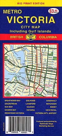
British Columbia Road Maps for Tourists and TravelersDetailed Road Map of British ColumbiaBuy travel maps for British Columbia tourist attractions, road trips, street guide, driving directions and more |
British Columbia
- $17.95
Item Code : BORC5666
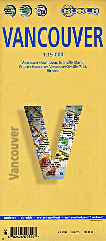
 Scale 1:15,000. Size 20"x26". Borch edition. Indexed. Printed on both sides. English and multilingual legends. Laminated, easy-fold, flexi-map.
 - $10.95
Item Code : MEAS5667

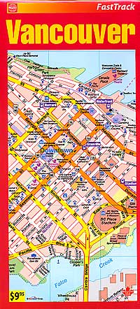
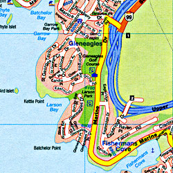
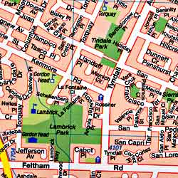
 Scale 1:7,000. Size 18"x27". Map Easy edition. Actually 5 maps in 1. Includes a central street plan of Vancouver City, plus Granville Island, Stanley Park, the Neighborhoods of Vancouver, and an "Out of Town" adventures. Perfect for the intrepid or armchair traveller, this charming map combines the best of a guidebook and a location map, all in one. The map is color coded to include information about the city's hotels, restaurants, shops, and sites. Printed on tear-proof, water-resistant, lightweight, paper-like plastic, that is incredibly durable. Also includes sketches of the landscape and interesting details about the area. You'll love this map! Vancouver, situated between the mountains and the ocean, is both beautiful and entertaining. Spend some time with MapEasy as we explore the history of Gastown, the ethnic charm of Chinatown, or the shopping district along Robson Street. Ready for some Pacific Rim cuisine? We will show you where to go for the best in town. For an alternative, lets us guide you through Granville Island, with its many artists shops, restaurants, and boutiques. For some exercise, we offer a concise guide to Stanley Park__offering not only the peace of walking trails, but sweeping views as well! The Vancouver Guidemap includes detailed sections for Robson Street, Granville Island, Stanley Park, and Out-of-Town.
 - $10.95
Item Code : RAND5668
 Scale 1:47,000. Size 27"x39". Rand McNally edition. Detailed city street map.
 - $17.95
Item Code : ITMB5669
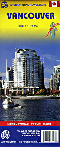
 Scale 1:20,000. Size 27"x36". International Travel Maps edition. Detailed city street map. Indexed. English text and legends. Elevations and topographic features are shown by hypsometric color tints. Includes considerable useful travel information. Printed on waterproof, tear-resistant, lightweight paper-like plastic.
 - $14.95
Item Code : GMJO5670
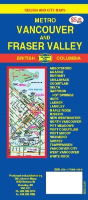
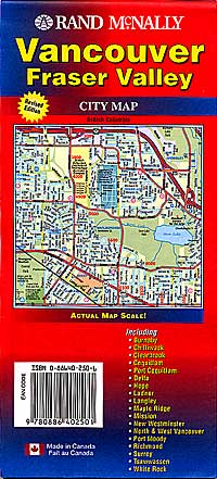
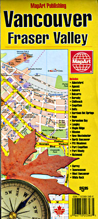
 Scale 1:43,000. Size 27x39. G.M. Johnson edition. Detailed city street map. This Map Coverage Area are Abbotsford, Agassiz, Burnaby, Chilliwack, Coquitlam, Delta, Harrison, Hot Springs, Hope, Ladner, Langley, Maple Ridge, Mission, New Westminster, North Vancouver, Pitt Meadows, Port Coquitlam, Port Moody, Richmond, Surrey, Tsawwassen, Vancouver City, West Vancouver, White Rock.
 - $12.95
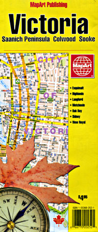
Item Code : MART5672
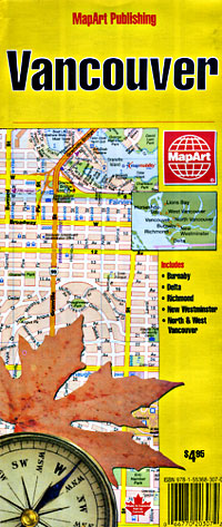
 Scale 1:31,000. Size 19"x26". MapArt edition. Detailed city street map.
 - $12.95
Item Code : MART5673
 Scale 1:32,000. Size 28"x40". MapArt edition.
 - $12.95
Item Code : MART5674
 Scale 1:36,000. Size 36"x44". MapArt edition. Detailed city street map.
 - $16.95
Item Code : NATL5675

 Scale 1:13,700. Size 18"x25". National Geographic edition.
 - $26.95 + $6.80 p&h or $16.80 foreign delivery
Item Code : GMJO5671
 Scale 1:22,000. Size 8?"x11". 88 pages. G.M. Johnson edition.
 - $24.95 + 6.80 p&h or $16.80 foreign delivery
Item Code : MART21381
Various scales. Size 9"x 11". MapArt edition. Coverage includes Abbotsford, Aldergrove, Anniedale, Bayshores, Belcarra, Brackendale, Bridgeport, Brio, British Properties, Brookswold, Burkville and much more! - $24.95 + 6.80 p&h or $16.80 foreign delivery
Item Code : MART21382
Various scales. Size 7"x 9". MapArt edition. Covers Abbotsford, Aldergrove, Anniedale, Bayshores, Belcarra, Brackendale, Bridgeport, Brio, British Properties, Brookswold, Burkville, Burnaby, Chilliwack, Coquitlam, Delta, Elgin and much more. -
- $12.95
Item Code : MART5677
 Scale 1:25,000. Size 11"x24". MapArt edition. Detailed city street map.
 - $14.95
Item Code : GMJO5678
 Scale 1:25,000. Size 27"x39". G.M. Johnson edition.
 - $12.95
Item Code : MART5679
 Scale 1:25,000. Size 27"x40". MapArt edition. Detailed city street map.
 - $10.95
Item Code : ROUT21250
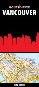 Scale 1:31,250. Route Master edition.
| Postage and handling is $4.40 for the first map and $1.80 for each additional map. ~ ~ ~ ~ ~ ~ Foreign delivery is $15.80 for the first map and $7.60 for each additional map. ~ ~ ~ ~ ~ ~ Canada delivery is $15.80 for the first map and $7.60 for each additional map. |
Exploring the nation with ancient uniqueness with the best Map
British Columbia has an extremely differing ethnic populace, with a substantial number of settlers having lived in the region for a long time or less. Original foreigners from the British Isles remain a solid segment of nearby society in spite of constraints on movement from Britain since the completion of uncommon status for British subjects in the 1960s.
British Columbia is comprised of four physical districts and it is bound through with lakes, swamps, waterways and streams that bolster untamed life in plenitude. It has an exceptionally praised arrangement of parks, made to ensure its various biological systems for preservation, open air amusement, training and logical review.
The Rockies bring out pictures of towering, snow-topped pinnacles, turquoise lakes, falling waterfalls and thick evergreen woods. The territory is like wise all inclusive note worthy as a result of the Burgess Shale fossil site, which appears in astonishing point of interest what the Earth resembled the greater part a billion years back.
It is the planets biggest in place beach front calm rain woods. The Great Bear is a worshiped and ensured wild territory.
It is additionally home to a wealth of marine life, from whales to dolphins to ocean otters. Whistler Blackcomb is in summer, is bursting at the seams with explorers, mountain bikers, golfers and individuals watchers.
If you plan to visit British Columbia then rely on our maps and explore the country in such a way that you become a localite in a foreign country. The places in the map are defined in such a way that even a kid can read and guide others without being wrong. The accurate distances, colored and highlighted routes make it just the perfect partner you ever wanted on an adventure tour. After using our maps, I am sure you will definitely fall for the same.
British Columbia Road Maps for Tourists and TravelersDetailed Road Map of British ColumbiaBuy travel maps for British Columbia tourist attractions, road trips, street guide, driving directions and more |
