
British Columbia Road Maps | Detailed Travel Tourist Driving
Exploring the nation with ancient uniqueness with the best Map
British Columbia has an extremely differing ethnic populace, with a substantial number of settlers having lived in the region for a long time or less. Original foreigners from the British Isles remain a solid segment of nearby society in spite of constraints on movement from Britain since the completion of uncommon status for British subjects in the 1960s.
British Columbia is comprised of four physical districts and it is bound through with lakes, swamps, waterways and streams that bolster untamed life in plenitude. It has an exceptionally praised arrangement of parks, made to ensure its various biological systems for preservation, open air amusement, training and logical review.
The Rockies bring out pictures of towering, snow-topped pinnacles, turquoise lakes, falling waterfalls and thick evergreen woods. The territory is like wise all inclusive note worthy as a result of the Burgess Shale fossil site, which appears in astonishing point of interest what the Earth resembled the greater part a billion years back.
It is the planets biggest in place beach front calm rain woods. The Great Bear is a worshiped and ensured wild territory.
It is additionally home to a wealth of marine life, from whales to dolphins to ocean otters. Whistler Blackcomb is in summer, is bursting at the seams with explorers, mountain bikers, golfers and individuals watchers.
If you plan to visit British Columbia then rely on our maps and explore the country in such a way that you become a localite in a foreign country. The places in the map are defined in such a way that even a kid can read and guide others without being wrong. The accurate distances, colored and highlighted routes make it just the perfect partner you ever wanted on an adventure tour. After using our maps, I am sure you will definitely fall for the same.
British Columbia Road Maps for Tourists and TravelersDetailed Road Map of British ColumbiaBuy travel maps for British Columbia tourist attractions, road trips, street guide, driving directions and more |
British Columbia
- $12.95
Item Code : GEMT5599
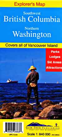
 Scale 1:840,00. Size 26"x39". Gem Trek edition. Close-up large-scale detail to the most important and popular tourist areas. British Columbia road map.
 - $12.95
Item Code : ROUT21242
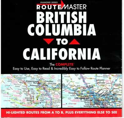 Route Master edition.
 - $17.95 + $6.80 p&h or $16.80 foreign delivery
Item Code : ITMB5601
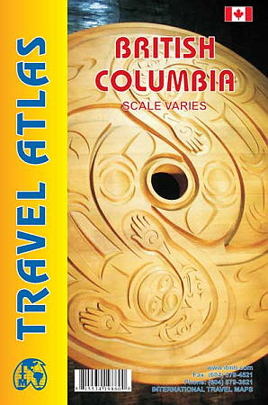
 Various scales. International Travel Maps edition. BC is the most visited province of Canada and yet is too big to fit on to a standard sized map sheet, even double-sided, and show off its assets to best advantage. An atlas format (4"x6") allows us space to show the roads and points of interest at a better scale and in a convenient format for driving. Also included are inset maps of Vancouver, Victoria, and Whistler, as well as a detailed place names index.
 - $38.95 + $6.80 p&h or $18.80 foreign delivery
Item Code : MSIO5602
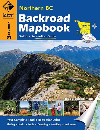
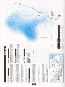
 Scale 1:150,000. Size 8?"x11". 165 pages. Mussio Ventures Ltd edition. Welcome to the third edition of the Northern BC Backroad Mapbook. Readers of our previous editions will see several significant improvements in this edition. In addition to countless new roads we have also tracked down hundreds of new trails (hiking and motorized) and continued to add to the impressive number of recreation opportunities up north. Complementing the maps, our reference section has been greatly expanded and now includes new sections for Hunting, ATV Trails and Snowmobile Trails on top of many additions in the other sections (from Fishing to Winter Recreation). Of all the areas in British Columbia covered by our mapbooks, this is easily the most diverse. From prairies and open farmland around Dawson Creek, across the spine of the Rocky Mountains, through the heart of BC via the Rocky Mountain Trench and the Central Plateau, all the way to the Pacific Ocean. It is an area marked by vast, unsettled spaces, few main roads and lots of lakes and streams, including some of the finest fishing rivers in the world.
 - $38.95 + $6.80 p&h or $18.80 foreign delivery
Item Code : MSIO5603
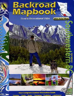
 British Columbia Southwest Road and Recreation Atlas. Includes Vancouver and the southwest British Columbia Coast going inland approximately 50% of the width of the province and northern approximately 50% to the north of the province. Scale 1:150,000. Size 8?"x11". 152 pages. Mussio Ventures Ltd edition.
 - $55.95 Rolled + $8.80 p&h or $36.80 foreign delivery
Item Code : ITMB5605
 Scale 1:1,250,000. International Travel Maps edition. Laminated.
 - $44.95 Rolled + $8.80 p&h or $36.80 foreign delivery
Item Code : ITMB5604
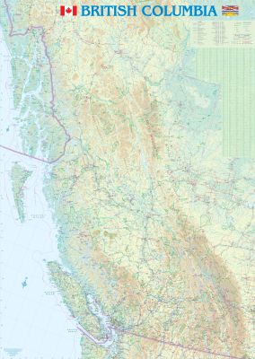 Scale 1:1,250,000. International Travel Maps edition. Years ago, the BC government published the one and only wall map of the province, known as 1A. This map was discontinued in 1996, when ITMB purchased all the remaining inventory of Maps BC. 1A ran out of copies in 2000. For a while, flattened road maps of BC had to do, but they were too small and too lacking in detail for what was needed. ITMB re-worked our BC map into a larger-size wall map format and published a large, proper, wall map. This ran out of copies last year. Now, we launch the 2nd edition of this map. It is quite large, being 28" x 80". While theoretically being available for worldwide distribution, the market for this particular map is almost always within BC. We can ship it to distributors/retailers in a shipping tube. The information on the map is the same as for our BC travel map but formatted as something suitable to hand on a wall. It is very good and is the largest and most detailed wall map of the province in print. We can also laminate it on demand and frame it for customers. However, in a practical sense, it would be difficult to market internationally, although we would welcome orders.
 - $14.95
Item Code : GMJO5606
 Scale 1:1,400,000. Size 26"x20". G.M. Johnson edition. This Map Coverage Area are Kamloops, Kelowna, Nanaimo, Penticton, Prince George, Summerland, Vancouver, Vernon, Victoria.
 - $16.95
Item Code : HLWG5607
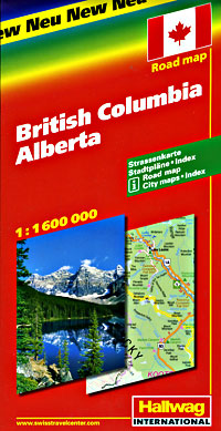
 Scale 1:1,600,000. Size 39"x54". Hallwag edition.
 - $12.95
Item Code : MART5608
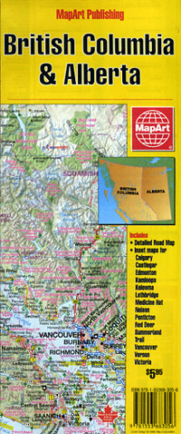
 Scale 1:2,000,000. Size 27"x40". MapArt edition.
 - $17.95
Item Code : ITMB5611
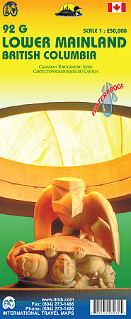
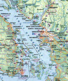
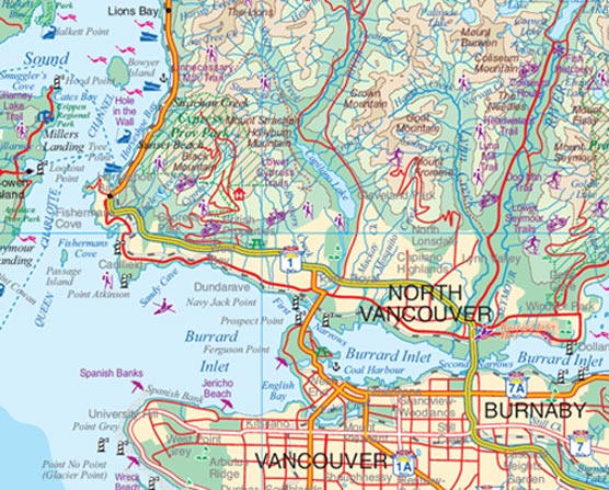
 Scale 1:250,000. International Travel Maps edition. This waterproof map is double sided using the topographic maps of the area. One side is featuring Richmond and New Westminster (92G2/3) and the other side the lower mainland (92G). 92G2/3 covers the south of the metropolitan area from South Vancouver, Burnaby, New Westminster, Surrey, Richmond, Langley, Tsawwassen and White Rock. You can see the main roads and streets, administrative boundaries and natural areas. We have also added a few features to the already furnished government legend, for example, the picnic areas, golf courses, campsites, beaches, fishing spots, parking and so on. 92G side shows the entire Lower Mainland, the southeast portion of the Vancouver island and the Pacific Ranges in the north (92J). From this map, you will be able to see how to get to many popular tourist destinations in BC including Squamish, Whistler, Pemberton, and Garibaldi Provincial Park from the lower mainland. The legend shows how to organize your journey, either for a road trip, a pic nic or a sporty journey: Beaches, ferries, campground, hangliding, ATV areas, Hiking, skiing, snowmobiling, diving, paddling, golf course, fishing, bird sanctuary, and so on.
 - $20.95 + $6.80 p&h or $16.80 foreign delivery
Item Code : MSIO5612
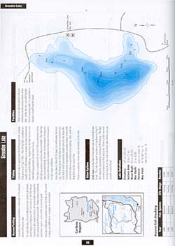
 "various scales". Size 8?"x11". 95 pages. Mussio Ventures Ltd edition.
 - $17.95
Item Code : ITMB5610
North East Region Road and Travel Reference Map, British Columbia, Canada. - $17.95
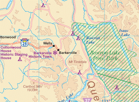
Item Code : ITMB5614
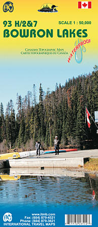
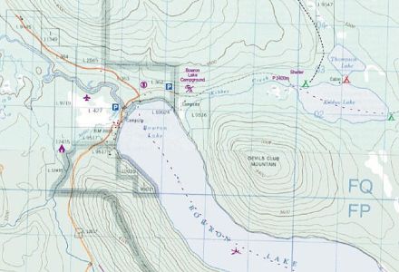 Scale 1:50,500. International Travel Maps edition. This topographic map covers the Bowron Lake Provincial Park in the Cariboo Mountains in northern BC. It is double sided with LANEZI and ISAAK LAKES (093H02/07) on one side, and Indianpoint lake and the spectacles Lakes (093H03/H06) on the other side. You can admire the landscape of 12 lakes in this area and plan your canoe circuit along the waters. The map features the mountains range, roads as long as the multiple trails available in the mountain (Hiking, horseback riding,canoeing,skiing).
 - $17.95
Item Code : ITMB5615
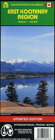
 Scale 1:1,300,000. International Travel Maps edition.
 - $36.95 + $6.80 p&h or $16.80 foreign delivery
Item Code : MSIO5616
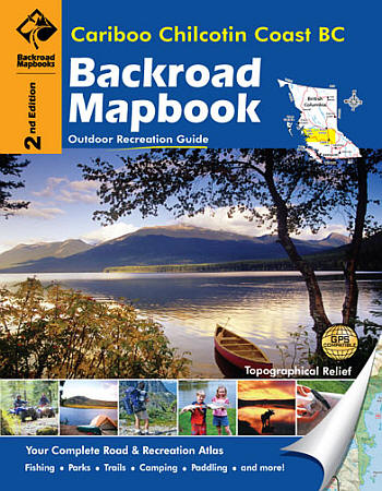
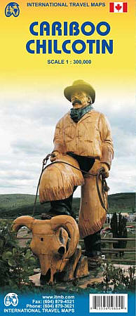
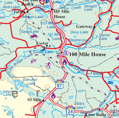
 Scale 1:150,000. Size 8?"x11". 136 pages. Mussio Ventures Ltd edition. Welcome to the third edition of the Cariboo Chilcotin Coast Backroad Mapbook. We have spent countless hours updating the book, most notably are the new look maps that are much easier to read, and now include contour labels. This book opens up one of BC’s final frontiers. There are places far removed from the nearest road and relatively untouched by human development and industry. It is an area to preserve and to treasure. Included in this dynamic area are a few relatively quiet highways that open up a lifetime of recreational fun. Highway 20 bisects the rolling plateau of the Chilcotin and provides a lifeline for the small communities out west. Names like Bella Coola and Alexis Creek might not mean much down south, but out here they are major centres. Branching from the highway are a few main arteries that lead past remote parks and lakes, eventually petering out near the mountains or major river crossings. This highway also takes visitors through the heart of Tweedsmuir Provincial Park into the lush Central Coast region. This beautiful region should not be missed. It is an area dominated by rugged terrain with towering, glacier-clad mountains forming an impressive background.
 - $20.95 + $6.80 p&h or $16.80 foreign delivery
Item Code : MSIO5617
 Various scales. Size 8?"x11". 103 pages. Mussio Ventures Ltd edition.
 - $12.95
Item Code : MART5660
Scale 1:25,000. Size 28"x40". MapArt edition. Also includes city street plans of Maple Ridge, Port Coquitlam, and Port Moody - $17.95
Item Code : ITMB5620
 Scale 1:100,000. Size 27"x38". International Travel Maps edition. Indexed. English text and legends. Elevations and topographic features are shown by hypsometric color tints. Includes considerable useful travel information.
 - $17.95
Item Code : ITMB5622
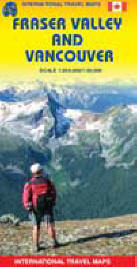
 Scale 1:250,000. International Travel Maps edition
| Postage and handling is $4.40 for the first map and $1.80 for each additional map. ~ ~ ~ ~ ~ ~ Foreign delivery is $15.80 for the first map and $7.60 for each additional map. ~ ~ ~ ~ ~ ~ Canada delivery is $15.80 for the first map and $7.60 for each additional map. |
Exploring the nation with ancient uniqueness with the best Map
British Columbia has an extremely differing ethnic populace, with a substantial number of settlers having lived in the region for a long time or less. Original foreigners from the British Isles remain a solid segment of nearby society in spite of constraints on movement from Britain since the completion of uncommon status for British subjects in the 1960s.
British Columbia is comprised of four physical districts and it is bound through with lakes, swamps, waterways and streams that bolster untamed life in plenitude. It has an exceptionally praised arrangement of parks, made to ensure its various biological systems for preservation, open air amusement, training and logical review.
The Rockies bring out pictures of towering, snow-topped pinnacles, turquoise lakes, falling waterfalls and thick evergreen woods. The territory is like wise all inclusive note worthy as a result of the Burgess Shale fossil site, which appears in astonishing point of interest what the Earth resembled the greater part a billion years back.
It is the planets biggest in place beach front calm rain woods. The Great Bear is a worshiped and ensured wild territory.
It is additionally home to a wealth of marine life, from whales to dolphins to ocean otters. Whistler Blackcomb is in summer, is bursting at the seams with explorers, mountain bikers, golfers and individuals watchers.
If you plan to visit British Columbia then rely on our maps and explore the country in such a way that you become a localite in a foreign country. The places in the map are defined in such a way that even a kid can read and guide others without being wrong. The accurate distances, colored and highlighted routes make it just the perfect partner you ever wanted on an adventure tour. After using our maps, I am sure you will definitely fall for the same.
British Columbia Road Maps for Tourists and TravelersDetailed Road Map of British ColumbiaBuy travel maps for British Columbia tourist attractions, road trips, street guide, driving directions and more |
