
Hawaii Road Maps | Detailed Travel Tourist Driving
Hawaii is a quintessential part of United States continent which comprises of a complete chain of islands located in the midst of the Pacific Ocean. Being the only state which is not located in the North America, Hawaii offers endless options for the travel enthusiasts to spend quality and memorable time in exploring its outstanding scenic beauty. Find perfect escape from your daily routine by planning a trip to Hawaii with the large scale Hawaii road map of Great Journeys Inc.
Land of Irresistible Beauty
Once you come across our Hawaii detailed road map, you will consequently discover itas an island which is formed with the combination of eight major islands including Maui, Kahoolawe, Oahu, Kauai, Lanai, Niihau, Molokai along with Hawaii. Moreover, several smaller islands also contribute to its tempting beauty for the travelers. We, at Great Journeys Inc. make sure that every significant location has been highlighted in our Hawaii road map to render maximum level of satisfaction as well as convenience to the travelers.
Hawaii Tourist Road Map
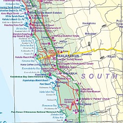
Our all-inclusive Hawaii tourist road map will provide you a complete overview about both the urban as well as rural roads which are well developed. Besides this, a clear indication of various popular tourist destinations like Kohala Mountain, Ataka Falls, Hilo harbor, Kailau Kona, Volcanoes and many more can also be found in our Hawaii travel map. Our well laid maps will also provide you comprehensive information about the distances between these places along with proper index.
Pick Your Choice
With our wide diversity of road maps, the travelers can find the most eligible Hawaii road mapof their choice as per their individual pre requisites. You will definitely acquire a smooth travel experience with our guiding maps.
Write us at great-journeys@maps2anywhere.com if you face any difficulty to find your appropriate road map. We will get back to you with in one working day.
All the best for your Journey
Great Journeys Inc.
|
Hawaii Road Maps |
| What you’ll find in this section, all arranged in the following order: a. Click Here to go to "Hawaii (the Big Island)" b. Click Here to go to "Kauai" & "Lanai" c. Click Here to go to "Maui" & "Molokai" d. Click Here to go to "Oahu" |
Hawaii
- $19.95
Item Code : REIS8784

 Scale 1:200,000. Size 27"x40". Reis Know How edition. Very detailed Hawaii road map. English and multi-lingual legends. Printed on tear-resistant, waterproof, paper-like plastic. It can bend and fold without cracking and is writable as normal paper, non-toxic and recyclable. Perfect for tourist adventures and independent travel and for driving tours. Includes topographic contour lines and hypsometric color tints which show height levels, along with elevation numbers. Shows all major and secondary roads and tertiary roads, with distances between points in kilometers. Fully indexed. Beautiful cartography. The Hawaii road map will tell you exactly where all the worth visiting island, hotels, restaurants, and shops are located. The Mapping Software will help your GPS find its way through Hawaii!
 - $17.95
Item Code : NELS8785
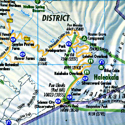
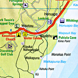
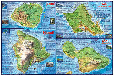
 Scale 1:150,000 and 1:300,000. Size 20"x36". Nelles Verlag edition. Printed on both sides. Each island is blown up and shown individually as an inset map, so there is lots of detail on this map. Includes all types of roads, road numbers, distances between points in miles, paths, trails, mountain peaks, altitudes in feet and in meters, cities, towns, villages, national parks, forest reserves, golf courses, places of interest, beaches, camping grounds, ancient sites, caves, churches, temples, and hotels. BIG >> SAMPLE MAP << Small sample map
 - $17.95
Item Code : BORC8786
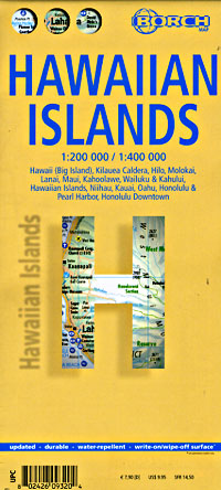
 Scale 1:200,000. Size 20"x39". Laminated. Borch edition.
 - $13.95
Item Code : HAMD8787

 Scale 1:270,000. Size 40"x59" (this is a big beautiful map!). Hammond edition.
 - $12.95
Item Code : FRKO8788
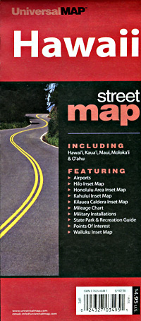
 Various Scales. Size 14"x21". Printed on waterproof, tear-resistant, lightweight, paper-like plastic.
 - $11.95
Item Code : RAND8790
 Various scales. Size 18"x37". Rand McNally edition.
 - $17.95
Item Code : ITMB8791
 Scale 1:150,000 and 1:400,000 Size 36" across x 27" high. International Travel Maps edition.
 -
-
- $10.95
Item Code : FRKO8794
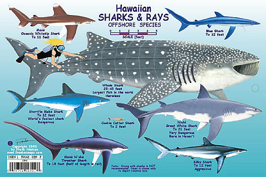
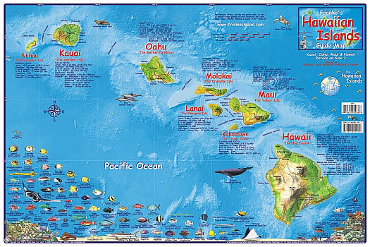
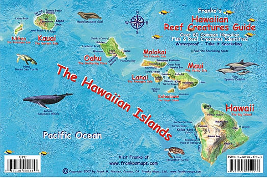
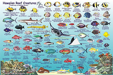
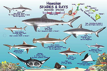 Size 6"x9". Franko maps edition. Laminated. Laminated plastic fish card, with a hole for a lanyard. Side one shows the inshore Hawaiian sharks & rays. Side two shows the offshore Hawaiian sharks & rays.
 - $27.95 + $7.50 p&h or $32.50 foreign delivery
Item Code : DELR8797
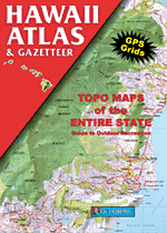
 Scale 1:82,000 (large-scale). 64 Pages. Full size, 11"x15?". Indexed. DeLorme edition. Designed for those who want to get off the beaten path, this atlas shows all types of roads and tracks, cities, towns, hamlets, and provides topographic maps that show hiking trails, campgrounds, fishing spots, ski areas, and more. Contains a guide to state and national parks and recreation areas, historic sites, and unique natural areas. Comprehensive index enables the user to find locations quickly and easily. Great for car or backpack! Saddle-stitched, durable laminated paper cover.
 - $26.95 Rolled + $6.80 p&h or $38.80 foreign delivery
Item Code : NATL8801
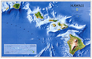
 Scale 1:773,000. Size 23"x35". National Geographic edition. Laminated.
 - $19.95 Rolled + $6.80 p&h or $38.80 foreign delivery
Item Code : NATL8802

 Scale 1:773,000. Size 23"x35". National Geographic edition.
 - $17.95
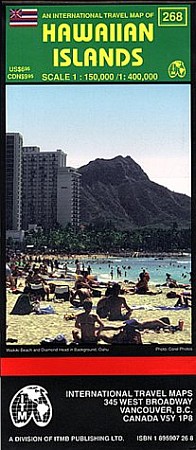
Item Code : ITMB22734
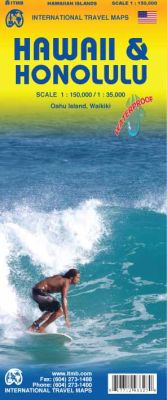
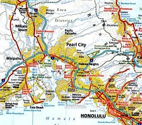
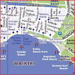
 Scale 1:150,000/1:135,000. Size 27"x39". International Travel Maps edition. This Hawaii map is an excellent accompaniment for a trip to Americas vacation treasure. It is an excellent map of the island of Oahu, the main destination for visitors, along with a very good street map of Honolulu with expanded insets for the Waikiki and Pearl City areas. On the other side is a detailed map of the state, showing each island. There are several inset maps of various urban areas on different islands.
 - $11.95
Item Code : VDAM22736

 Van Dam Maps edition. VanDam's award winning Hawaii StreetSmart maps all top attractions including museums, major architecture, hotels, historic sites, beaches, state parks, and more - all at an immensely legible super-scale, complete with 3-D building illustrations. Clear information design allows users to read the map from three feet away and has earned VanDam maps a place in the MoMA Collection. Hawaii StreetSmart includes a stunning dimensional detail of each island, as well as details of Honolulu, Waikiki Beach, and Diamond Head. Simplicity reigns supreme in information design to make complex cities clear and understandable. Our typography creates character and reveals the true bones of the islands. VanDam uses a letter grid to identify locations on maps - no confusing and cluttering K-28 or V-34s - its just the city from A-Z. Our covers map the icons of each city and turn them into collectible graphic art. Each sleek and laminated city map package opens to 24" x 9" and then easily folds down to 4" x 9" to snuggly fit into a shirt pocket or purse. Gain instant Hawaiian.
 - $249.95 + $24.80 p&h (add $40 for spring rollers)
Item Code : UNIV8800
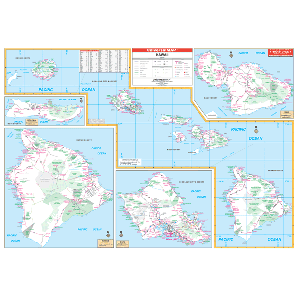 Scale 1:650,000. Size 57" W x 40" H. Printed in color with a markable and washable laminated surface. Provided with hanging rails mounted top and bottom. Cities and counties are indexed on the face of the map. Details include all state highways, all federal highways, secondary roads, cities and towns, major airports, major waterways, state universities, military installations, state/national parks, latitude/longitude lines, and major points of interest. Railed wall maps can be turned into pull down maps on spring rollers for an additional $40.
 - $16.95
Item Code : NATL20951
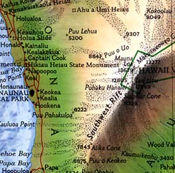
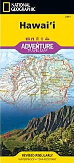 Scale 1:220,0000. Size 26"x38". National Geographic edition. National Geographic's Hawaii Adventure Map is designed to meet the unique needs of adventure travelers with its durability and accurate information. This folded map provides global travelers with the perfect combination of detail and perspective, highlighting hundreds of points of interest and the diverse and unique destinations within the state. The front side of the Hawaii map shows the big island of Hawai’i. This side details the districts of North Kohala, South Kohala, Hamakua, South Hilo, North Hilo, North Kona, Puna, South Kona and Ka’u. The reverse side of the map shows the islands of Kaua’i, Ni’ihau, O’ahu, Moloka’i, Lana’i, Maui, and Kaho’olawe with an inset of an overview of all the Hawaiian islands. The map includes the locations of cities and towns with a user-friendly index, plus a clearly marked road network complete with distances and designations for major highways, main roads, and tracks and trails for those seeking to explore more remote regions. Every Adventure Map is printed on durable synthetic paper, making them waterproof, tear-resistant and tough—capable of withstanding the rigors of international travel. Key Features: Waterproof and tear-resistant Detailed interpretive information and local travel tips Detailed topography complete with activity symbols, ideal for exploring the country City overview maps Hundreds of points of interest, including the location of World Heritage sites, national parks and nature reserves, aboriginal settlements and protected lands, mines, archeological sites, wildlife parks and more Thousands of place names Important travel aids including airports, lighthouses, ferry routes and rail lines Developed in cooperation with local agencies Updated regularly to ensure accuracy
 - $11.95
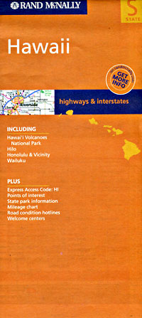
Item Code : RAND22733
 Rand McNally edition. Detailed road map of the Hawaiian Islands. Includes detailed inset maps of Hawaii Volcanoes National Park, Hilo, Honolulu & Vicinity, Wailuku. Size is 25 x 37 inches when opened.
| Postage and handling is $3.50 for the first map and $1.50 for each additional map. ~ ~ ~ ~ ~ ~ Foreign delivery is $7.80 for the first map and $5.00 for each additional map. |
| ** Click here! to view our collection of Hawaii Travel VIDEOS ** |
| ** Click here! to view our collection of Hawaiian Language Courses ** |
Hawaii is a quintessential part of United States continent which comprises of a complete chain of islands located in the midst of the Pacific Ocean. Being the only state which is not located in the North America, Hawaii offers endless options for the travel enthusiasts to spend quality and memorable time in exploring its outstanding scenic beauty. Find perfect escape from your daily routine by planning a trip to Hawaii with the large scale Hawaii road map of Great Journeys Inc.
Land of Irresistible Beauty
Once you come across our Hawaii detailed road map, you will consequently discover itas an island which is formed with the combination of eight major islands including Maui, Kahoolawe, Oahu, Kauai, Lanai, Niihau, Molokai along with Hawaii. Moreover, several smaller islands also contribute to its tempting beauty for the travelers. We, at Great Journeys Inc. make sure that every significant location has been highlighted in our Hawaii road map to render maximum level of satisfaction as well as convenience to the travelers.
Hawaii Tourist Road Map
Our all-inclusive Hawaii tourist road map will provide you a complete overview about both the urban as well as rural roads which are well developed. Besides this, a clear indication of various popular tourist destinations like Kohala Mountain, Ataka Falls, Hilo harbor, Kailau Kona, Volcanoes and many more can also be found in our Hawaii travel map. Our well laid maps will also provide you comprehensive information about the distances between these places along with proper index.
Pick Your Choice
With our wide diversity of road maps, the travelers can find the most eligible Hawaii road mapof their choice as per their individual pre requisites. You will definitely acquire a smooth travel experience with our guiding maps.
Write us at great-journeys@maps2anywhere.com if you face any difficulty to find your appropriate road map. We will get back to you with in one working day.
All the best for your Journey
Great Journeys Inc.
|
Hawaii Road Maps |
| What you’ll find in this section, all arranged in the following order: a. Click Here to go to "Hawaii (the Big Island)" b. Click Here to go to "Kauai" & "Lanai" c. Click Here to go to "Maui" & "Molokai" d. Click Here to go to "Oahu" |
