
Must Visit Destinations
While driving through the beautiful lanes of China, you will significantly come across outstanding grasslands, mountain ranges, deserts, rivers and lakes. Moreover, some of the must visit destinations of China which you should not miss include the Great Wall of China, modern architecture and historic sites of Beijing, skyscrapers of Shanghai, Terracotta Army, and Mount Huang etc. Find highly informative and reliable description about the distances between these places along with all ferry routes and scenic routes in our China Road map.
Choose the Best
We encompass an extensively wide range of road maps and travels maps of China for the ultimate comfort of the travelers across the world. Choose the best as per your particular requirement amongst all.
Write us at great-journeys@maps2anywhere.com if you face any difficulty to find your appropriate map. We will get back to you with in one working day.
All the best for your Journey
Great Journeys Inc.
|
~ China Road Maps ~ |
China Road Maps
- $17.95
Item Code : FREY6255
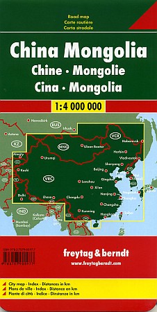
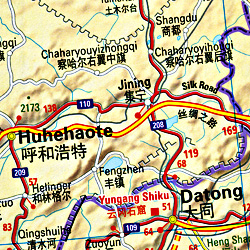 These China road maps will please the keen eye of every cartographer. Designed with precise detail and accuracy, these road maps are a great way to learn about roads and ways of China. Scale 1:4,000,000. Size 28"x35". Printed on both sides. Indexed. Freytag-Berndt edition. Beautiful large-scale map, with clear, easy-to-read cartography. English and multilingual legends.
 - $14.95
Item Code : HEMA6256
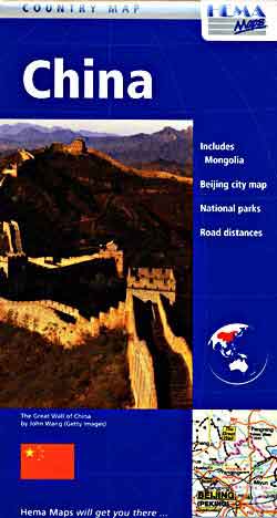
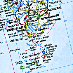
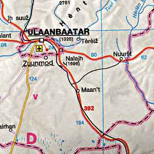 Scale 1:4,000,000. Size 36"x52". Hema edition. This is another large-scale map. Very detailed. Beautiful cartography. Indexed. English legends and text. Includes the national parks and a Beijing city street map.
 - $19.95
Item Code : HLWG6257

 Scale 1:4,000,000. Size 34"x50" (this is a big map). Printed on one side. Indexed. Hallwag edition. English and multilingual legends.
 - $19.95
Item Code : REIS6258
 Scale 1:4,000,000. Reis Know How edition. Very detailed China road map. English and multi-lingual legends. Printed on tear-resistant, waterproof, paper-like plastic. It can bend and fold without cracking and is writable as normal paper, non-toxic and recyclable. Perfect for tourist adventures and independent travel and for driving tours. Includes topographic contour lines and hypsometric color tints which show height levels, along with elevation numbers. Shows all major and secondary roads and tertiary roads, with distances between points in kilometers. Fully indexed. Beautiful cartography.
 - $17.95
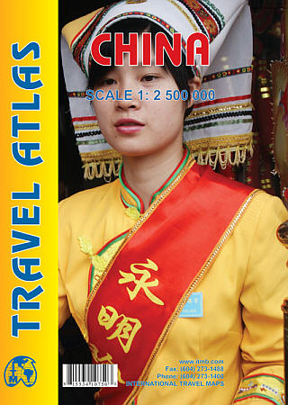
Item Code : ITMB6261
Scale 1:4,000,000. Size 27"x39". Indexed. International Travel Maps edition.
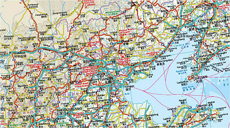
This edition is printed on waterproof, tear-resistant paper, and has a new cover picture showing a portion of the Great Wall. A cursory glance at the map will show an incredible number of motorways. We still show some as being under construction, but updating the road network is now essentially completed.
The amazing rapid rail network is now also essentially complete and all such train lines are noted on the map in a red-dashed format. Inset maps of Beijing and Shanghai are shown on side 2, as well as a list of Top Attractions.
We continue to show contentious political disputed territories based on practical administrative control, so India's northeast is shown as being under India's control, whereas parts of the northwest are shown under Chinese control. Taiwan is shown, simply because it is geographically close to mainland China. We do not wish to be drawn into the question of the future status of the island; it is independently operating, as it has been doing since 1949.
- $17.95
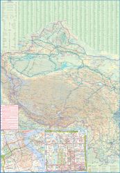
Item Code : GIZI6262
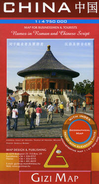
 Scale 1:4,750,000. Size 35"x48". Gizi edition.
 - $14.95
Item Code : CLNS6263
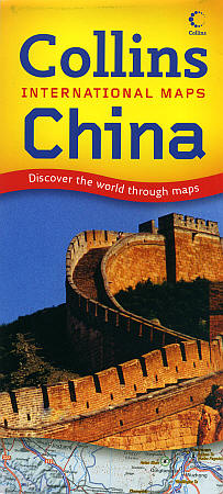
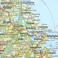
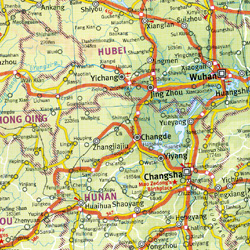
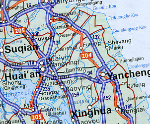 Scale 1:5,000,000. Size 38"x41". Collins edition. Fully indexed. Shows main road and secondary roads, road numbers, distances between points in kilometers, car ferries, railways, airports, border crossings, administrative boundaries, ancient sites and ruins, museums and heritage sites, religious sites, shrines, and temples; monuments and historic buildings, cultural centers, national parks, bird reserves, animal preserves, botanical gardens, zoological parks, scenic areas, viewpoints, beaches, theme parks, sport stadiums, water sports, trekking and walking areas, ski centers, and fishing. A good travel and physical map. Very detailed.
 - $13.95
Item Code : HILD6264
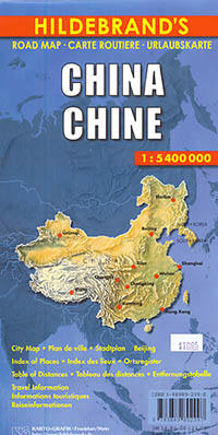
 Scale 1:5,400,000. Hildebrand edition. Size 29" x 43". Laminated card cover. Another good travel map. Very detailed.
 - $12.95
Item Code : PERI6265
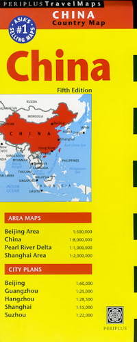
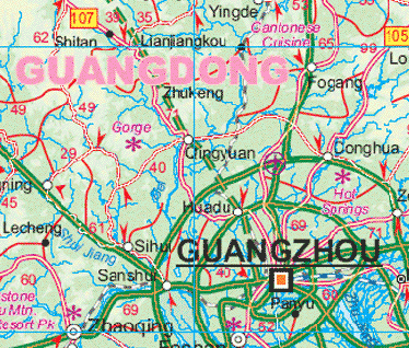
 Scale 1:8,000,000. Size 20"x38". Periplus edition. English text and legends. Includes inset maps of the Beijing Area, Shanghai Area, and the Pearl River Delta, as well as inset detailed city street maps of Beijing, Shanghai, Hangzhou, Suzhou, and Guangzhou. Very useful travel information.
 - $14.95
Item Code : CART6266
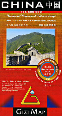
 Scale 1:6,000,000. Size 28"x35". Cartographia edition. Beautiful cartography.
 - $17.95
Item Code : GIZI6267
 Scale 1:6,500,000. Size 26"x38". Gizi edition.
 - $17.95
Item Code : MRCO20869
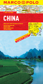 Scale 1:4,000,000. Marco Polo maps feature completely up-to-date, digitally generated mapping. The high quality cartography with distance indicators and scale converters aid route planning. Includes a city map of Beijing and a comprehensive index. A fold-out overview map is ideal for route planning and 7 self-adhesive Marco Polo mark-it stickers can be used to pin-point a destination or route for future reference. Scenic routes and places of interest are highlighted - ideal for touring holidays.
 - $16.95
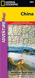
Item Code : NATL20945
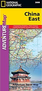 Scale 1:2,950,000. Size 26"x38". National Geographic edition. National Geographic's China East Adventure Map is designed to meet the unique needs of adventure travelers with its durability and detailed, accurate information. The map includes the locations of thousands of cities and towns with a user-friendly index, plus a clearly marked road network complete with distances and designations for major highways, major routes and secondary roads. The China Adventure Map is printed in the United States on a durable synthetic paper, making it waterproof, tear-resistant and tough—capable of withstanding the rigors of international travel. The China East Adventure Map differs from a traditional road map for it includes hundreds of points of interest that highlight diverse and unique destinations in the region. UNESCO World Heritage sites, national parks and reserves, archaeological sites, temples, caves and points of interest such as the Great Wall of China and the Wall of Genghis Khan are included, making it an invaluable resource to travelers hoping to experience all the history and culture China has to offer. Additional travel aids include the location of airports, ports and ferry routes. The front side of the China East map details the northeast region of the country, from its border with Russia and Mongolia to the north, to the North Korean border to the east, and extending south to the city of Nanjing. The reverse side of the map details China’s southeastern region, extending from Xi’an and Zhengzhou south to Hong Kong; west to the country’s borders with India and Myanmar (Burma); and east to the Vietnamese border and the shores of the South and East China Seas. Key Features: Waterproof and tear-resistant Detailed topography complete with activity symbols, ideal for exploring the country Hundreds of points of interest, including the location of World Heritage sites, national parks and reserves, archeological sites, temples, the Great Wall of China and more Thousands of place names Important travel aids including airports, ferry routes, and rail lines
 - $16.95
Item Code : NATL20950
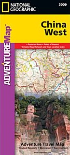 Scale 1:2,950,0000. Size 26"x38". National Geographic edition. National Geographic's China West Adventure Map is designed to meet the unique needs of adventure travelers with its durability and detailed, accurate information. The map includes the locations of thousands of cities and towns with a user-friendly index, plus a clearly marked road network complete with distances and designations for major highways, major routes and secondary roads. The China Adventure Map is printed in the United States on a durable synthetic paper, making it waterproof, tear-resistant and tough—capable of withstanding the rigors of international travel. The China West Adventure Map differs from a traditional road map for it includes hundreds of points of interest that highlight diverse and unique destinations in the region. UNESCO World Heritage sites, national parks and reserves, archaeological sites, temples, mosques, museums, ruins, caves and points of interest such as the Great Wall of China are included, making it an invaluable resource to travelers hoping to experience all the history and culture China has to offer. The front side of the China West map details the western region of the country, from its border with Russia, Kazakhstan and Kyrgyzstan, to its border with India and Bhutan in the south. The autonomous region of Tibet is featured as well as the city of Urumqi. The reverse side of the map covers the area extending south of Mongolia and includes the cities of Baotao, Chengdu, Chongqing, Hohhot, Lanzhou, Shijiazhuang, Taiyuan, Xi’an, Yinchuan and Zhengzhou. Key Features: Waterproof and tear-resistant Detailed topography complete with activity symbols, ideal for exploring the country Hundreds of points of interest, including the location of World Heritage sites, national parks and reserves, archeological sites, temples, the Great Wall of China and more Thousands of place names Important travel aids including airports, ferry routes, and rail lines
 - $16.95
Item Code : NATL20971
 Scale 1:4,375,000. Size 26"x38". National Geographic edition. National Geographic's China Adventure Map is designed to meet the unique needs of adventure travelers with its durability and detailed, accurate information. The map includes the locations of thousands of cities and towns with a user-friendly index, plus a clearly marked road network complete with distances and designations for major highways, major routes and secondary roads. The China Adventure Map differs from a traditional road map because it includes hundreds of points of interest that highlight diverse and unique destinations in the region. UNESCO World Heritage sites, national parks and reserves, archaeological sites, temples, caves and points of interest such as the Great Wall of China are included, making it an invaluable resource to travelers hoping to experience all the history and culture China has to offer. Additional travel aids include the location of airports, harbors and ferry routes. The China Adventure Map is printed in the United States on a durable synthetic paper, making it waterproof, tear-resistant and tough—capable of withstanding the rigors of international travel. Key Features: Waterproof and tear-resistant Detailed topography complete with activity symbols, ideal for exploring the country Hundreds of points of interest, including the location of World Heritage sites, national parks and reserves, archeological sites, temples, the Great Wall of China and more Thousands of place names Important travel aids including airports, ferry routes, and rail lines.
 - $24.95 Rolled + $8.80 p&h or $36.80 foreign delivery
Item Code : NATL6268
 Scale 1:7,800,000. Size 23"x30". National Geographic edition. Laminated.
 - $18.95 Rolled + $8.80 p&h or $36.80 foreign delivery
Item Code : NATL6269
 Scale 1:7,800,000. Size 24"x30". National Geographic edition.
 - $25.95 + $7.50 p&h or $16.80 foreign delivery
Item Code : ITMB6272
 Various scales. International Travel Maps edition.
 - $79.95 + $7.50 p&h or $28.80 foreign delivery
Item Code : SINO6274
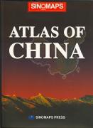
 Sino Maps. In English. A good reference atlas. It includes 189 pages of maps and text. Each province has a physical/road map, a city map of the main city, and one or more pages of descriptive text. There are also 20+ pages of general thematic maps. With 93 pages of index.
 - $39.95 + $7.50 p&h or $28.50 foreign delivery
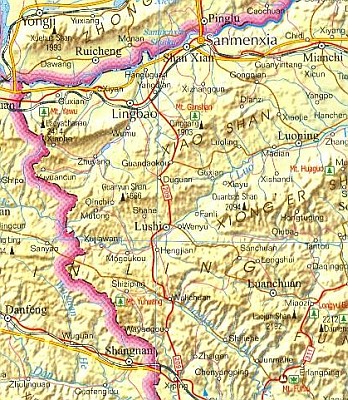
Item Code : NATL6273
Hardcover. Boasting more than 300 full-color maps and illustrations, this essential atlas dramatically highlights the tremendous changes occurring within China--the world's fastest growing economy and most populous place--as well as their global implications. National Geographic maps the entire country with sections covering all provinces--including towns, cities, and transportation networks--to provide rich, comprehensive, and meticulously researched coverage of China's dynamic landscape. Ten major cities receive an entire spread with detailed maps and fact boxes. And as Shanghai prepares to host the 2010 World's Fair--China's first, expected to draw 70 million visitors--this important destination is charted extensively as well. Fascinating thematic maps accurately post the latest information on trade, energy, natural resources, population, military strength, religion, languages, tourism, transportation, and more. A substantial place-name index helps the reader navigate to thousands of specific locations. A historical time line, commentaries, graphs, travel info, and photos complete the thorough yet succinct coverage of today's China. For the millions of vacationers who tour the country each year, companies doing business with China, students of history and geography, and others interested in world events, this timely reference will prove indispensable.
| Postage and handling is $3.50 for the first map and $1.50 for each additional map. ~ ~ ~ ~ ~ ~ Foreign delivery is $7.80 for the first map and $5.00 for each additional map. |
| ** Click here! to view our beautiful collection of China Travel VIDEOS ** |
| ** Click here! to view our collection of Mandarin Chinese Language Courses ** |
| ** Click here! to view our collection of Cantonese Language Courses ** |
Must Visit Destinations
While driving through the beautiful lanes of China, you will significantly come across outstanding grasslands, mountain ranges, deserts, rivers and lakes. Moreover, some of the must visit destinations of China which you should not miss include the Great Wall of China, modern architecture and historic sites of Beijing, skyscrapers of Shanghai, Terracotta Army, and Mount Huang etc. Find highly informative and reliable description about the distances between these places along with all ferry routes and scenic routes in our China Road map.
Choose the Best
We encompass an extensively wide range of road maps and travels maps of China for the ultimate comfort of the travelers across the world. Choose the best as per your particular requirement amongst all.
Write us at great-journeys@maps2anywhere.com if you face any difficulty to find your appropriate map. We will get back to you with in one working day.
All the best for your Journey
Great Journeys Inc.
|
~ China Road Maps ~ |
