
Exploring the nation with ancient uniqueness with the best Map
British Columbia has an extremely differing ethnic populace, with a substantial number of settlers having lived in the region for a long time or less. Original foreigners from the British Isles remain a solid segment of nearby society in spite of constraints on movement from Britain since the completion of uncommon status for British subjects in the 1960s.
British Columbia is comprised of four physical districts and it is bound through with lakes, swamps, waterways and streams that bolster untamed life in plenitude. It has an exceptionally praised arrangement of parks, made to ensure its various biological systems for preservation, open air amusement, training and logical review.
The Rockies bring out pictures of towering, snow-topped pinnacles, turquoise lakes, falling waterfalls and thick evergreen woods. The territory is like wise all inclusive note worthy as a result of the Burgess Shale fossil site, which appears in astonishing point of interest what the Earth resembled the greater part a billion years back.
It is the planets biggest in place beach front calm rain woods. The Great Bear is a worshiped and ensured wild territory.
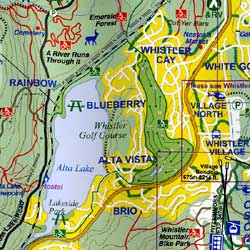
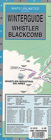
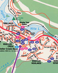
It is additionally home to a wealth of marine life, from whales to dolphins to ocean otters. Whistler Blackcomb is in summer, is bursting at the seams with explorers, mountain bikers, golfers and individuals watchers.
If you plan to visit British Columbia then rely on our maps and explore the country in such a way that you become a localite in a foreign country. The places in the map are defined in such a way that even a kid can read and guide others without being wrong. The accurate distances, colored and highlighted routes make it just the perfect partner you ever wanted on an adventure tour. After using our maps, I am sure you will definitely fall for the same.
British Columbia Road Maps for Tourists and TravelersDetailed Road Map of British ColumbiaBuy travel maps for British Columbia tourist attractions, road trips, street guide, driving directions and more |
British Columbia
- $20.95 + $6.80 p&h or $16.80 foreign delivery
Item Code : MART5649
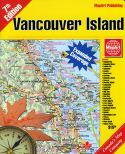
 Various scales. Size 7"x9". 148 pages. MapArt edition. Full index of streets and points of interest, coverage includes Courtenay, Nanaimo, Parksville, Saanich, Victoria and all major Vancouver Island cities and Towns plus a road map.
 - $36.95 + $6.80 p&h or $16.80 foreign delivery
Item Code : MSIO5650

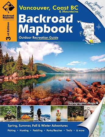
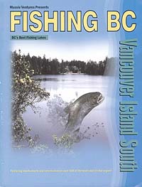
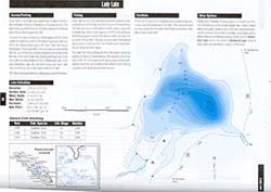
 Scale 1:150,000. Size 8?"x11". 144 pages. Mussio Ventures Ltd edition. Welcome to the sixth edition of the Backroad Mapbook for Vancouver and the Gulf Islands. Inside this guidebook, you will find the most comprehensive outdoor recreation resource available for all of the Islands. Vancouver Island rises from the ocean, and stretches for the heavens, reaching altitudes high enough that there are areas where the snow never melts. It is a land of contrasts and sometimes contradictions, from the proper and civilized city of Victoria at its southern tip to Cape Scott, at its north, a wet, wild frontier that settlers tried and failed to settle. The west coast of Vancouver Island is buffeted by some of the wildest winter storms in the country, while in the summer, the east coast of the island, less than 100 kilometres away, features some of the warmest lakes in the province. And it is the place to go for tourists looking for BC’s iconic Orcas. For outdoor adventurers, the Island offers everything from remote boat access only marine parks to world class hiking destinations. In addition to Vancouver Island, this book also includes the Gulf Islands. These island gems are strung together by BC Ferries, and while many Vancouverites have taken to commuting from the Gulf Islands to work every morning, they still retain their rustic charm and relaxed pace that has made them popular getaways for folks from the mainland and from Vancouver Island alike.
 - $36.95 + $6.80 p&h or $16.80 foreign delivery
Item Code : MSIO5651
 Scale 1:150,000. Size 8?"x11". 145 pages. Mussio Ventures Ltd edition. This mapbook, originally called Southwestern BC, was the start of what has proven to be a very popular outdoor recreation mapbook series. With over 1.5 million books on dashboards across the country we are very proud to be Canada’s source for maps when planning an outdoor adventure! This book covers the southwest corner of beautiful British Columbia, Canada. Vancouver, Gibsons and Powell River frame the western edge of the area, while Hope, Manning Park, Boston Bar and Lillooet make up the eastern edge. Chilliwack, Maple Ridge, Squamish, Whistler and Gold Bridge are just a few of the prominent cities or towns.
 - $17.95
Item Code : ITMB5652
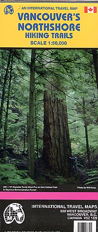
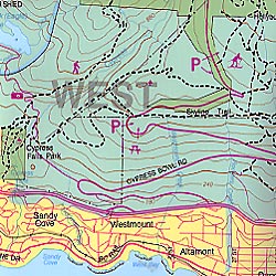 Scale 1:50,000. Size 24"x38". International Travel Maps edition. Indexed. English text and legends. Elevations and topographic features are shown by hypsometric color tints. Includes considerable useful travel information.
 - $17.95
Item Code : ITMB5653
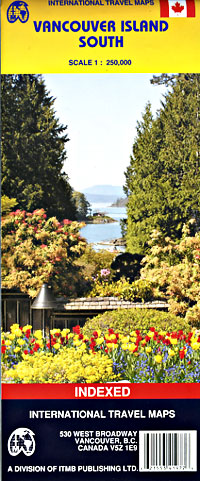
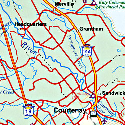 Scale 1:250,000. Size 27"x39". International Travel Maps edition. Indexed. English text and legends. Elevations and topographic features are shown by hypsometric color tints. Includes considerable useful travel information.
 - $20.95 + $6.80 p&h or $16.80 foreign delivery
Item Code : MSIO5654
 Various scales. Size 8?"x11". 104 pages. Mussio Ventures Ltd edition.
 - $17.95
Item Code : ITMB5655

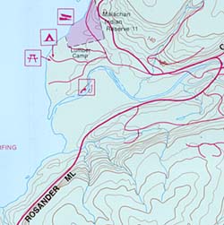 Scale 1:50,000. Size 27"x34". International Travel Maps edition. Indexed. English text and legends. Elevations and topographic features are shown by hypsometric color tints. Includes considerable useful travel information. This map is a specialized hiking map of one of the toughest trails in North America. It takes a week to hoof it from Bamfield to Port Renfrew along the western coastline of British Columbia’s West Coast Trail. Hiking the trail is so popular that it is necessary to reserve a start time well in advance of arriving! The trail is contained within a national park, so camping sites are controlled and must be adhered to. The map has a secondary purpose; it is a recreational map at a detailed scale for anyone wanting to explore the old-growth forests of this part of Vancouver Island. This includes the Broken Islands group, which is also part of the national park, and the Carmanah Valley Provincial Park, home of some of the tallest and oldest trees in the world. By the nature of a rectangular sheet of paper, the map also includes a wealth of logging roads, shorter hikes, whitewater kayaking areas, wilderness campsites, and the canoeing routes of Nitinat Lake. This is truly an amazing adventure map. The artwork is that of the Canada Map Office, with recreational information added by ITMB.
 - $17.95
Item Code : ITMB5656
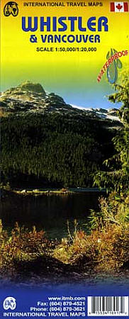
 Scale 1:50,000. Size 24"x37". International Travel Maps edition. Indexed. English text and legends. Elevations and topographic features are shown by hypsometric color tints. Includes considerable useful travel information. Printed on waterproof, tear-resistant, lightweight paper-like plastic.
 - $14.95
Item Code : GMJO5657
 Scale 1:35,500. Size 11"x20". G.M. Johnson edition.
 - $17.95
Item Code : ITMB5619
Cranbrook Region, Road and Travel Reference Map, British Columbia, Canada. - $17.95
Item Code : ITMB5618
National Centennial Trail, Road and Travel Reference Map, British Columbia, Canada. - $17.95
Item Code : ITMB5625
Invermere and Region, Road and Travel Reference Map, British Columbia, Canada. - $17.95
Item Code : ITMB5632
Scale 1:25,000. - $17.95
Item Code : ITMB5636
Saltspring Island, Road and Travel Reference Map, British Columbia, Canada. - $17.95
Item Code : ITMB5637
South Langley, Road and Travel Reference Map, British Columbia, Canada. - $17.95
Item Code : ITMB5639
 Scale 1:250,000. International Travel Maps edition.
 - $17.95
Item Code : ITMB5640
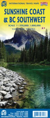
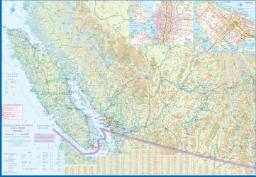
Scale 1:250,000/1:800,000. Size 27"x39". 2nd Edition. International Travel Maps edition.
The coastline of Canada's British Columbia is long and varied. The best-known portion is the part just north and west of Vancouver, known as Sunshine Coast. The rugged Coast Mountain Range makes road-building impractical for much of the interior, so communities such as Gibsons, Sechelt, and Powell River are joined together by Highway 101 and by ferries. many Riords take kayakers deep into pristine wilderness areas, and former logging roads are now commonly used for wilderness hikers. The famous Strait of Georgia, used by cruise ships to Alaska, cuts through the middle of the map, with the largely unpopulated and wild Bute Inlet leading to Waddington Glacier and the vast Homathko Icefield. Side 2 of the map covers southwestern BC, includings all of Vancouver Island and the southern interiror as far as Nelson and north to 100 Mile House. Insets of downtown Vancouver and Victoria are included. - $14.95
Item Code : GMJO8710
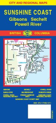 Scale 1:36,000. Size 27"x20". G.M. Johnson edition. This Map Coverage Area are Gibsons, Earls Cove, Sechelt, Halfmoon Bay, Sunshine Coast, Powell River, Roberts Creek, Powell River Regional District, Pender Harbour Area, Sunshine Coast Regional District.
 - $17.95
Item Code : ITMB21179
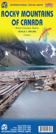 Scale 1:900,000. International Travel Maps edition. Printed in waterproof paper. 2 sides maps. Included Inset of Calgary City. The Rockies are a Canadian icon; the entire country can be divided into east of the Rockies and la-la land west of the Rockies. Seriously, the Rocky Mountain chain stretches from Alaska to Texas (technically from the Himalayan ‘knot’ to Antarctica) and its highest peaks are in the region between Banff and Jasper. Earlier, we published Canadian Rockies, but that map covers only the southern portion of the range. This map extends from the US border to the Yukon, a two to three day drive. The focus is on what to see both inside the range of peals and on adjacent sides; for example, the Columbia, Selkirk, and Monashee mountain ranges are included in British Columbia as well as Calgary, Grand Prairie, and Peace River in Alberta. This map would be ideal for anyone exploring this vast mountainous region.
 - $17.95
Item Code : ITMB21199
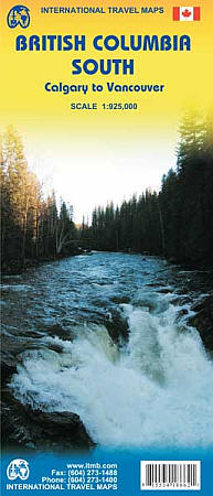 Scale 1:900,000. We are pleased to be able to announce the release of our 3rd edition of what is proving to be a very popular title. There isn’t much to note in the way of changes to the map’s artwork, because at 1:900,000 scale the changes that are taking place tend not to show up. For example, there are two new bridges across the Fraser River in the vicinity of Vancouver, one going north to Maple Ridge, and the other replacing an older bridge on the Trans-Canada Highway. This latter bridge is apparently the widest bridge ever made, at 10 lanes of traffic. The provincial government has also announced plans to extend the motorway east of Kamloops towards the Alberta border. As construction has not yet started, this major road improvement won’t show up until the next edition. The Calgary to Vancouver coverage is proving to be excellent.
| Postage and handling is $4.40 for the first map and $1.80 for each additional map. ~ ~ ~ ~ ~ ~ Foreign delivery is $15.80 for the first map and $7.60 for each additional map. ~ ~ ~ ~ ~ ~ Canada delivery is $15.80 for the first map and $7.60 for each additional map. |
Exploring the nation with ancient uniqueness with the best Map
British Columbia has an extremely differing ethnic populace, with a substantial number of settlers having lived in the region for a long time or less. Original foreigners from the British Isles remain a solid segment of nearby society in spite of constraints on movement from Britain since the completion of uncommon status for British subjects in the 1960s.
British Columbia is comprised of four physical districts and it is bound through with lakes, swamps, waterways and streams that bolster untamed life in plenitude. It has an exceptionally praised arrangement of parks, made to ensure its various biological systems for preservation, open air amusement, training and logical review.
The Rockies bring out pictures of towering, snow-topped pinnacles, turquoise lakes, falling waterfalls and thick evergreen woods. The territory is like wise all inclusive note worthy as a result of the Burgess Shale fossil site, which appears in astonishing point of interest what the Earth resembled the greater part a billion years back.
It is the planets biggest in place beach front calm rain woods. The Great Bear is a worshiped and ensured wild territory.
It is additionally home to a wealth of marine life, from whales to dolphins to ocean otters. Whistler Blackcomb is in summer, is bursting at the seams with explorers, mountain bikers, golfers and individuals watchers.
If you plan to visit British Columbia then rely on our maps and explore the country in such a way that you become a localite in a foreign country. The places in the map are defined in such a way that even a kid can read and guide others without being wrong. The accurate distances, colored and highlighted routes make it just the perfect partner you ever wanted on an adventure tour. After using our maps, I am sure you will definitely fall for the same.
British Columbia Road Maps for Tourists and TravelersDetailed Road Map of British ColumbiaBuy travel maps for British Columbia tourist attractions, road trips, street guide, driving directions and more |
