
Michigan Road Maps | Detailed Travel Tourist Drivig
|
Michigan Road Maps |
Michigan
- $10.95
Item Code : RAND10576
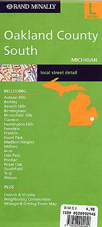
 Scale 1:40,000. Size 28"x40". Rand McNally edition.
 - $10.95
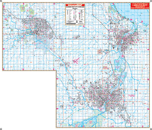
Item Code : UNIV10577
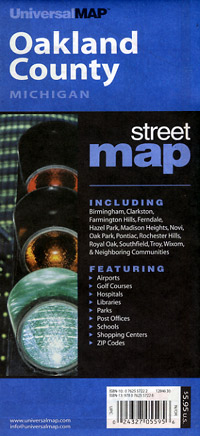
 Scale 1:43,000. Size 37"x46". Universal Map edition.
 - $14.95
Item Code : GMJO22885
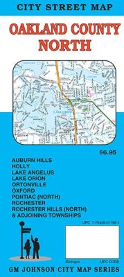
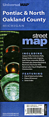
 G.M Johnson Maps edition. An up-to-date and accurate detailed city street map of North Oakland County, Michigan. Covers Auburn Hills, Holly, Lake Angelus, Lake Orion, Ortonville, Oxford, Pontiac (North), Rochester, Rochester Hills (North) & Adjoining communities.
 - $14.95
Item Code : GMJO22886
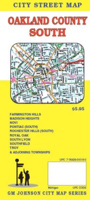
 Scale 1:41,000. Size 27"x39". G.M. Johnson edition. This Map Coverage Area are Auburn Hills, Berkley, Beverly Hills, Bingham Farms, Birmingham, Bloomfield Hills, Clawson, Farmington, Farmington Hills, Ferndale, Franklin, Hazel Park, Huntington Woods, Keego Harbor, Lathrup Village, Madison Heights, Milford, Northville, Novi, Oak Park, Orchard Lake Village, Pleasant Ridge, Pontiac, Rochester, Rochester Hills, Royal Oak, South Lyon, Southfield, Sylvan Lake, Troy, Walled Lake, Wixom, Wolverine Lake.
 - $19.95 + $7.50 p & h or $28.50 foreign delivery
Item Code : UNIV10578
 Scale 1:32,000. Size 8?"x11". 94 pages. Universal Map edition.
 - $249.95 + $24.80 p&h (add $40 for spring rollers)
Item Code : UNIV10580
 Scale 1:2,800. Size 60" W x 62" H. Laminated. Printed in color and laminated making it markable and washable. Street indexing appears in a separate book. Measures 60" W x 62" H. Area of coverage: North: to the LaPeer County line; South: to the Wayne County line; East: to the Macomb County line; West: to the Livingston County line. Details include all streets and highways, post offices, hospitals, water features, recreational parks, mileage circles, city limits and annexations, cemeteries, shopping centers, block numbers, golf courses and country clubs, ZIP codes and zip code boundaries, airports and railroads, government buildings, fire and police stations, educational facilities, longitude and latitude lines, section/township/range lines, and other points of interest. Special feature: Grid to Range, Township and Section lines are compatible with existing realtor grids, including realtor area numbers. Framing rails are included on top and bottom for easy wall mounting. Railed wall maps can be turned into pull down maps on spring rollers for an additional $40.
 - $10.95
Item Code : UNIV10581
 Scale 1:45,000. Size 28"x40". Universal Map edition.
 - $10.95
Item Code : UNIV10582
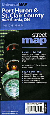
 Clair County, Michigan, America. Scale 1:35,000. Size 24"x36". Universal Map edition.
 - $14.95
Item Code : GMJO22887

 Scale 1:36,000. Size 27"x20". G.M. Johnson edition. This Map Coverage Area are Algonac, Capac, Marine City, Marysville, Memphis, Saint Clair, Yale.
 - $12.95
Item Code : AMER22890
American Maps edition. - $249.95 + $24.80 p&h (add $40 for spring rollers)
Item Code : UNIV10583
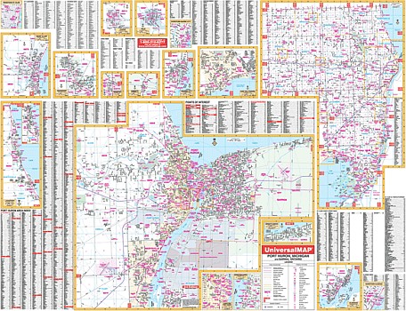 Scale 1:2,085. Size 66" W x 52" H. Laminated. The 2nd edition Port Huron and St. Clair County, Michigan Wall Map by Universal Map. Printed in color with a markable/washable-laminated surface. Streets are indexed on the map's face. Includes hanging rails mounted top and bottom. The area of coverage is as follows: Section One Port Huron (scale of 1" = 2,085 ft.)-- includes Port Huron, Sarnia, and Ontario, Canada. Range: North: to include Ft. Gratiot; South: to include Marysville; East: to include Sarnia; West: to Crystal Lake, 1 mile past Wadhams Road. It includes insets of Algonac, Downtown Algonac, Bright's Grove, Capac, Emmett, Lakeport/Burtchville/Worth, Marine City, Downtown Marine City, Memphis, New Baltimore, Downtown Port Huron, Downtown Sarnia, Richmond, St. Clair, Downtown St. Clair, and Yale. Section Two-St. Clair County (scale of 1" = 7,350 ft.) includes all of St. Clair County. Includes all streets and highways, post offices, hospitals, water features, recreational parks, mileage circles, city limits and annexations, cemeteries, shopping centers, block numbers, golf courses and country clubs, ZIP codes and ZIP code boundaries, airports and railroads, government buildings, fire and police stations, educational facilities, longitude and latitude lines, section/township/range lines, and other points of interest. Railed wall maps can be turned into pull down maps on spring rollers for an additional $40.
 -
- $10.95
Item Code : RAND10588
St. Joseph and Benton, Michigan, America. - $10.95
Item Code : UNIV10584
 Scale 1:30,000. Size 27"x39". Universal Map edition.
 - $249.95 + $24.80 p&h (add $40 for spring rollers)
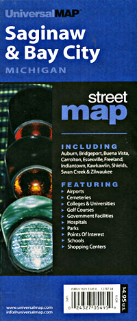
Item Code : UNIV10586
 Size 68" W x 54" H. Laminated. The Saginaw Valley, Michigan Wall Map, provides up-to-date cartography, is printed in color, laminated, and indexed for cities on the face of the map. Includes hanging rails on top and bottom. Railed wall maps can be turned into pull down maps on spring rollers for an additional $40.
 - $249.95 + $24.80 p&h (add $40 for spring rollers)
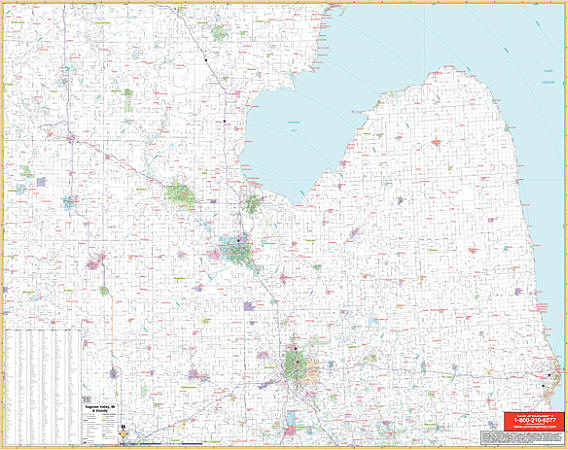
Item Code : UNIV10587
 Scale 1:2,640. Size 70" W x 60" H. Laminated. Provides up-to-date cartography with new streets and changes. Printed in color with a markable/washable-laminated surface. Streets are indexed on the face of the map. Provided with hanging rails mounted top and bottom. Covers all of Saginaw, Midland, and Bay City: North: Bay City Recreation area; 3 miles north of Midland city limits; South: Shiawassee national wildlife refuge; Exit 144 on I-75; East: 2 ? miles east of Essexville; West: 3 miles west of Midland city limits. Details included: all streets and highways, government buildings, airports, water features, fire/police stations, hospitals, shopping centers, educational facilities, railroads, recreational parks, golf/country clubs, post offices, mileage circles, city limits/annexations, cemeteries, longitude/latitude, ZIP codes/boundaries, and points of interest. Railed wall maps can be turned into pull down maps on spring rollers for an additional $40.
 - $14.95
Item Code : GMJO12479
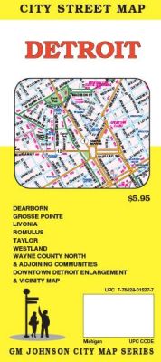
 Scale 1:40,000. Size 27"x39". G.M. Johnson edition. This Map Coverage Area are Allen Park, Dearborn, Dearborn Heights, Detroit, Ecorse, Garden City, Grosse Pointe, Grosse Pointe Farms, Grosse Pointe Park, Grosse Pointe Shores, Grosse Pointe Woods, Hamtramck, Harper Woods, Highland Park, Inkster, Lincoln Park, Livonia, Melvindale, Plymouth, River Rouge, Riverview, Romulus, Southgate, Taylor, Wayne, Westland, Wyandotte.
 - $10.95
Item Code : UNIV10589
 "Various scales". Size 22"x34". Universal Map edition.
 - $10.95
Item Code : RAND10590
 Scale 1:38,000. Size 28"x40". Rand McNally edition.
 - $14.95
Item Code : GMJO5879

 Scale 1:32,000. Size 27"x39". G.M. Johnson edition. This Map Coverage Area are Auburn, Bay City, Essexville, Frankenmuth, Midland, Saginaw, Saint Charles, Zilwaukee.
|
Michigan Road Maps |
