
Michigan Road Maps | Detailed Travel Tourist Drivig
|
Michigan Road Maps |
Michigan
- $14.95
Item Code : GMJO22876
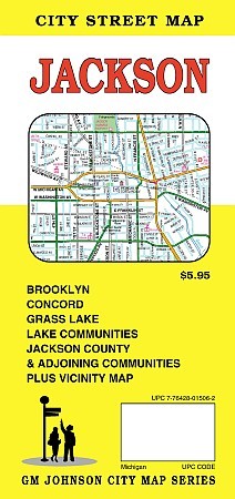
 G.M Johnson Maps edition. Includes Brooklyn, Concord, Grass Lake and adjoining communities.
 - $14.95
Item Code : GMJO22877
 G.M Johnson Maps edition. Includes Brooklyn, Concord, Grass Lake and adjoining communities.
 -
- $249.95 + $24.80 p&h (add $40 for spring rollers)
Item Code : UNIV10548
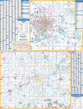 Scale 1:2,410. Size 50" W x 65" H. Laminated. Provided is up-to-date cartography with new streets and changes. Printed in color with a markable and washable laminated surface. Streets are indexed on the face of the map. The area of coverage is as follows: Section One which is the city of Jackson -scale of 1" = 2,410 feet ranges: North: to the State Prison Farm; Root Station Rd: South: to Jackson Community College; Crouch Rd. & Stoney Lake Rd; East: to Wolf Lake Rd; Waterloo Recreation Area; West: to Reynolds Municipal Airport; Hickory Hills Golf Course: Section Two is Jackson County provides. Other details and data found with this map include all streets and highways, post offices, hospitals, water features, recreational parks, mileage circles, city limits and annexations, cemeteries, shopping centers, block numbers, golf courses and country clubs, ZIP codes and ZIP code boundaries, airports and railroads, government buildings, fire and police stations, educational facilities, longitude and latitude lines, section/township/range lines, and other points of interest. Framing rails are included on top and bottom for easy wall mounting. Railed wall maps can be turned into pull down maps on spring rollers for an additional $40.
 - $10.95
Item Code : UNIV10549
 Scale 1:31,000. Size 25"x37". Universal Map edition.
 - $10.95
Item Code : RAND10550
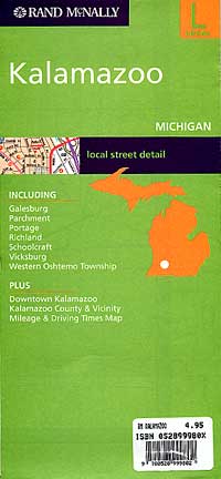
 Scale 1:27,000. Size 26"x37". Rand McNally edition.
 - $14.95
Item Code : GMJO22878
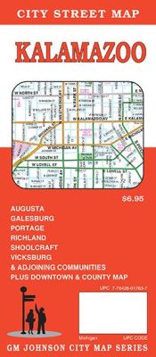
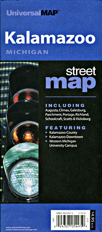
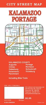 Scale 1:32,000. Size 27"x39". G.M. Johnson edition. This Map Coverage Area are An accurate and detailed city street map of Kalamazoo, MI. Also covers Augusta, Galesburg, Portage, Richland, Shoolcraft, Vicksburg & Adjoining communities plus downtown and county map.
 - $229.95 + $24.80 p&h (add $40 for spring rollers)
Item Code : UNIV10551
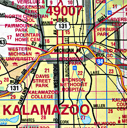
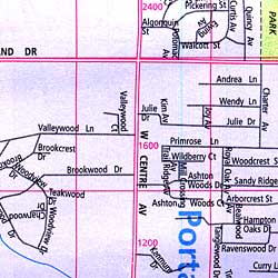
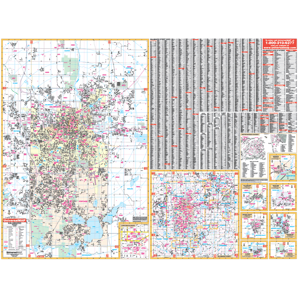 Scale 1:1,920. Size 65" W x 51" H. Laminated. The Kalamazoo, Michigan Wall Map by Universal Map. Printed in color with a markable and washable laminated surface. Streets are indexed on the face of the map. Framing rails are included on top and bottom for easy wall mounting. The area of coverage ranges: North: to Cooper Center; South: to Prairie View Park; East: to Richland and Comstock; West: to Oshtemo and Texas Corners. Insets are Augusta, Galesburg, Richland, Schoolcraft, Vicksburg, Climax, Scotts, Kalamazoo County, Downtown Kalamazoo, and Western Michigan University. Details include all streets and highways, post offices, hospitals, water features, recreational parks, mileage circles, city limits and annexations, cemeteries, shopping centers, block numbers, golf courses and country clubs, ZIP codes and ZIP code boundaries, airports and railroads, government buildings, fire and police stations, educational facilities, section/township/range lines, and other points of interest. Railed wall maps can be turned into pull down maps on spring rollers for an additional $40.
 - $10.95
Item Code : RAND10552
 Scale 1:36,000. Size 24"x36". Rand McNally edition.
 - $10.95
Item Code : UNIV10553
 Scale 1:30,000. Size 24"x36". Universal Map edition.
 - $10.95
Item Code : UNIV10554
 Scale 1:38,000. Size 34"x44". Universal Map edition.
 - $10.95
Item Code : UNIV10558
 Scale 1:70,000. Size 23"x35". Universal Map edition.
 - $10.95
Item Code : UNIV10559
 Scale 1:41,000. Size 27"x39". Universal Map edition.
 - $10.95
Item Code : UNIV10561
 Scale 1:170,000. Size 22"x34". Universal Map edition.
 - $19.95 + $7.50 p & h or $28.50 foreign delivery
Item Code : UNIV10555
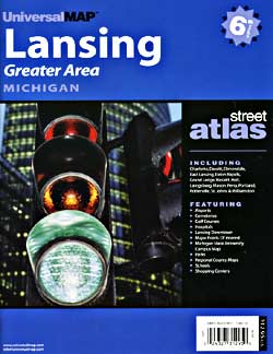
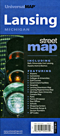
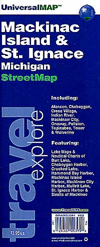
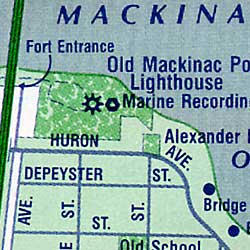
 Scale 1:38,000. Size 8?"x11". 59 pages. Universal Map edition.
 - $13.95
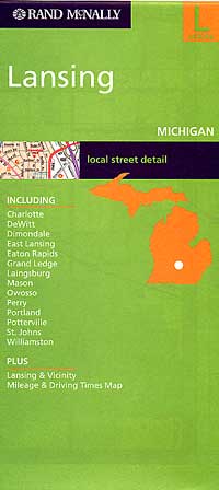
Item Code : GMJO22879
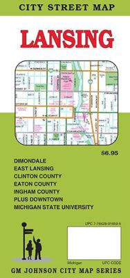
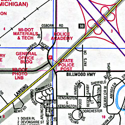
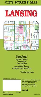 Scale 1:32,000. Size 27"x39". G.M. Johnson edition. This Map Coverage Area are An up-to-date and accurate city street map of Lansing, Michigan. Also covers Dimondale, East Lansing, Clinton County, Eaton County, Ingham County, and downtown Michigan State University.
 - $249.95 + $24.80 p&h (add $40 for spring rollers)
Item Code : UNIV10556
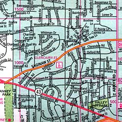
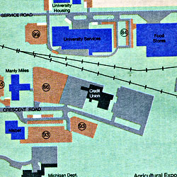
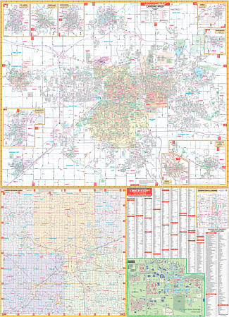 Scale 1:3,120. Size 54" W x 74" H. Laminated. Includes up-to-date cartography with new streets and changes. Printed in color with a markable/washable-laminated surface. Streets indexed in a separate book. Hanging rails mounted top and bottom. Boundaries as follows: North: Includes city of DeWitt; South: Includes the city of Potterville; East: To Meridian Road; West: Includes city of Grand Ledge. Map Insets include: Eaton Rapids, Laingsburg, Grand Ledge, Charlotte, Mason, Perry, Portland, St. Johns, Williamston, Michigan State University and Downtown Lansing. A new addition for this map is a Regional map of Eaton, Ingham, and Clinton Counties with a portion of Ionia and Shiawassee Counties. The special features and data are as follows: all streets, all highways, railroads, educational facilities, hospitals, government buildings, golf and country clubs, ZIP codes and boundaries, post offices, fire/police stations, shopping centers, airports, cemeteries, recreational parks, points of interest, city limits and annexations, water features, railroads, township names, range/twp/section lines, longitude and latitude lines, and block numbers. Railed wall maps can be turned into pull down maps on spring rollers for an additional $40.
 - $249.95 + $24.80 p&h (add $40 for spring rollers)
Item Code : UNIV10557
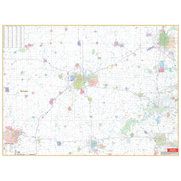 Scale 1:130,000. Size 70" W x 54" H. Laminated. Printed in color with a markable, washable-laminated surface. Cities are indexed on the map's face. Includes hanging rails mounted top and bottom. The area of coverage includes the following counties: Eaton, Ingham, Clinton, Livingston, and Shiawassee with portions of Barry, Genesee, Oakland, Washtenaw, Jackson, Calhoun, and Ionia. Northeast: 50 miles including cities of Flint/Burton; Southeast: 55 miles including city of Ann Arbor; Southwest: 50 miles including city of Battle Creek; South: 40 miles including city of Jackson; Northwest: 35 miles including Ionia. Details include major streets and all highways, county lines and names, mileage circles, ZIP codes and boundaries, airports and parks, and water features. Railed wall maps can be turned into pull down maps on spring rollers for an additional $40.
 - $249.95 + $24.80 p&h (add $40 for spring rollers)
Item Code : UNIV10560
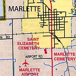
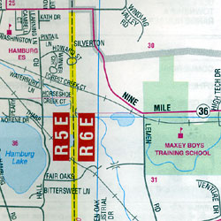
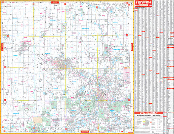 Scale 1:2,640. Size 67" W x 54" H. Laminated. The 4th edition Livingston County, Michigan Wall Map by Universal Map shows complete street detail. In addition, for your convenience, indexing is on the map's face. Provides up-to-date cartography with new streets and changes. Printed in color with a markable and washable laminated surface. Framing rails are included top and bottom for easy wall mounting. Boundaries as follows: North: To Shiawasee and Genesee Co. Line. South: To Washtenaw County line. East: To Oakland County line. West: To Ingham County Line. The special features and data are as follows: all streets, all highways, educational facilities, government buildings, shopping centers, hospitals, ZIP codes and boundaries, post offices, fire and police stations, airports, cemeteries, recreational parks, golf and country clubs, points of interest, city limits and Annexations, railroads, mileage circles, water features, range, township and section lines, block numbers, and longitude/ latitude lines. Railed wall maps can be turned into pull down maps on spring rollers for an additional $40.
 - $10.95
Item Code : UNIV10562
 Scale 1:180,000. Size 22"x34". Universal Map edition.
|
Michigan Road Maps |
