
World Wall Maps | Flat Political Physical Decorative
|
World Wall Maps |
World Wall Maps, Flat
- $48.95 Rolled + $12.80 p&h or $44.80 foreign delivery
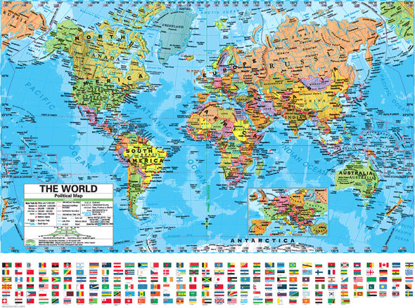
Item Code : INTL14713
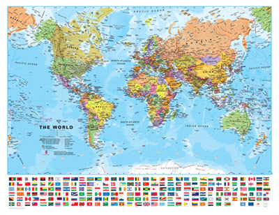
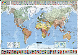
 Scale 1:30,000,000. Size 39"x54". LAMINATED. Beautiful map!
 - $34.95 Rolled + $8.80 p&h or $32.80 foreign delivery
Item Code : HEMA14714

 Scale 1:40,000,000. Size 29"x41". Hema maps edition.
 - $26.95 Rolled + $12.80 p&h or $49.80 foreign delivery
Item Code : MICH14716
 Scale 1:28,500,000. Size 40"x56". Michelin edition.
 - $44.95 Rolled + $12.80 p&h or $49.80 foreign delivery
Item Code : MICH14717
 Scale 1:28,500,000. Size 40"x56". Michelin edition. Laminated.
 - $130.95 + $34.80 p&h
Item Code : DEFS14723

 Size 86" W x 118" H. Defense Mapping Agency edition. This is a huge map! 7 feet wide by 10 feet high, approximately.
 - $24.95 Rolled + $7.80 p&h or $29.80 foreign delivery
Item Code : NATL14741
 Size 20"x31". National Geographic edition.
 - $24.95 Rolled + $7.80 p&h or $29.80 foreign delivery
Item Code : NATL14742
 Size 21"x32". National Geographic edition.
 - $36.95 Rolled + $8.80 p&h or $32.80 foreign delivery
Item Code : NATL14743

 Size 28"x43". National Geographic edition. Laminated.
 - $24.95 Rolled + $8.80 p&h or $32.80 foreign delivery
Item Code : NATL14744
 Size 28"x42". National Geographic edition.
 - $24.95 Rolled + $8.80 p&h or $32.80 foreign delivery
Item Code : NATL14745
 Size 30"x46". National Geographic edition.
 - $18.95 Rolled + $8.80 p&h or $29.80 foreign delivery
Item Code : NATL14746
 Scale 1:48,000,000. Size 22"x36". National Geographic edition.
 - $19.95 Rolled + $7.80 p&h or $29.80 foreign delivery
Item Code : NATL14747
 Size 22"x35". National Geographic edition.
 - $44.95 Rolled + $12.80 p&h or $49.80 foreign delivery
Item Code : UNIV14718
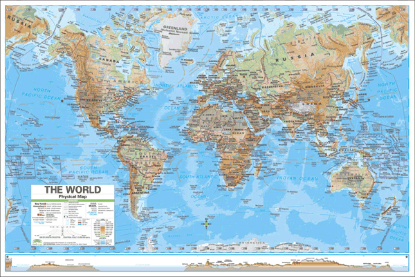 Scale 1:20,000,000 approximately. Size 50" W x 38" H. Universal Map edition. Laminated. The World Advanced Physical Laminated Rolled Map displays the Mercator Projection and offers complete coverage, including an inset of Europe. Physical World shows wetlands, desert locations, ocean currents and an inset section with color bar.
 - $44.95 Rolled + $12.80 p&h or $49.80 foreign delivery
Item Code : UNIV14719
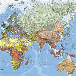
 Scale 1:24,000,000 approximately. Size 50" W x 38" H. Universal Map edition. Laminated. Features a wealth of information including national and world capitals and cities, state boundaries and capitals, major waterways, ocean currents, deserts and wetlands, lines of latitude and longitude, time zones and international date line, and relief shading that shows mountains, deserts and wetlands. . This is a another beautiful world map with detailed cartography.
 - $229.95 + $24.80 p&h (add $40 for spring rollers)
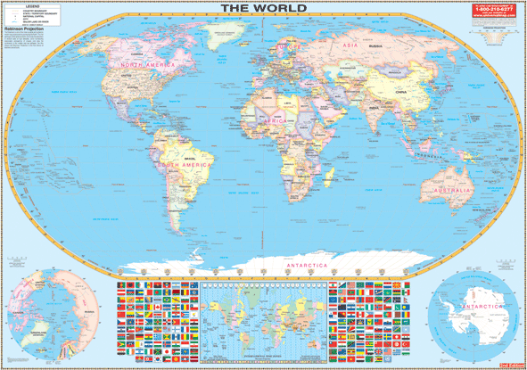
Item Code : UNIV14720
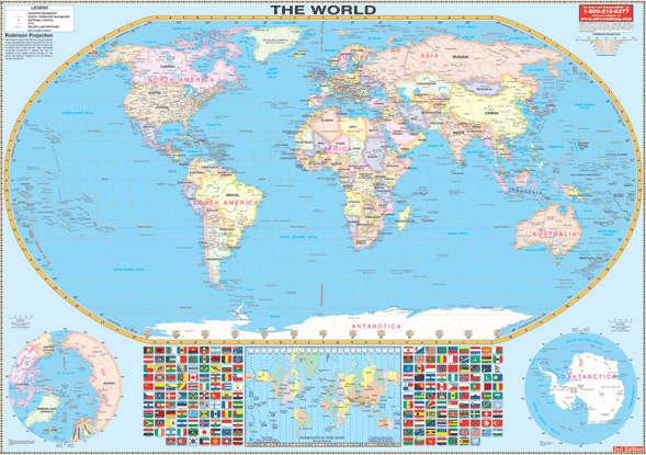 Size 74" W x 53" H. Universal Map edition. Laminated. The Robinson Projection Wall Map of the World by Universal Map is laminated, provides color-coded countries, major and capital cities, major water features, national flags, country names, state boundaries, longitude/latitude lines, and international time zones. Framing rails are included on top and bottom for easy wall mounting. Railed wall maps can be turned into pull down maps on spring rollers for an additional $40.
 - $350.95 + $34.80 p&h
Item Code : UNIV14721
 This is a HUGE Map! Size 108" W x 78" H. Universal Map edition. Laminated. This World Wall Map by Universal Map is printed on a laminated surface that is both markable and washable. Includes color-coded countries, major and capital cities, major water features, flags of the nations, country names, state boundaries, longitude/latitude lines, and International Time Zones.
 - $180.95 + $24.80 p&h
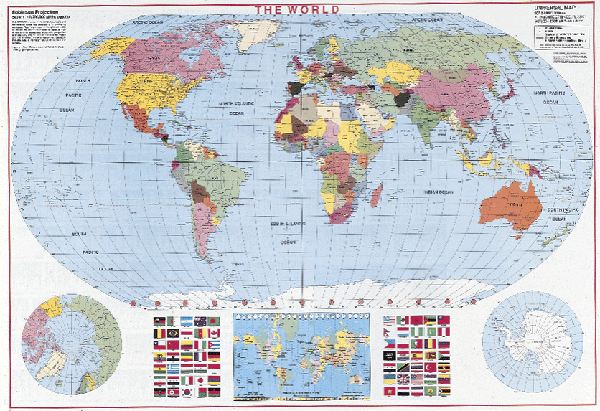
Item Code : UNIV14722
 Small? This is still a large map. Size 60" W x 42" H. Universal Map edition. Laminated. This is the edition Robinson Projection small wall map of the World. Contains a laminated surface that is both markable and washable and contains framing rails on top and bottom for easy wall mounting. Details include color coded countries, major and capital cities, major water features, flags of the nations, country names, state boundaries, longitude and latitude lines, and International Time Zones.
 - $29.95 + $8.80 p&h or $49.80 foreign delivery
Item Code : UNIV14724
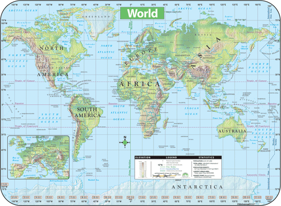 Size 28" W x 38" H. Universal Map edition. Laminated. The World Shaded Relief Topographical Wall Map by Universal Map is full-color and laminated, making it durable, markable, and easy to read. Features an inset map of Europe, an elevation table showing feet and meters, national capitals, major cities, latitude/longitude lines, Prime Meridian, International Date Line, and a distance scale measured in miles and kilometers.
 - $179.95 Rolled + $24.80 p&h
Item Code : UNIV14725
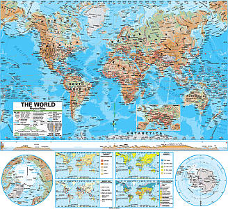 Size 54"x64". Universal Map edition. Laminated. The World Advanced Physical Classroom Wall Map features innovative shaded relief detail of the world. This high quality series is appropriate for grades 6-12, and includes content that meets national and state curriculum standards. Four thematic inset maps enhance the value of the main map. The world map features the Van Der Grinten projection. Wall maps measure 64" x 54". Also available in a compact 13" x 18" deskoad map format.
 - $179.95 Rolled + $24.80 p&h
Item Code : UNIV14726
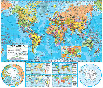 Size 54"x64". Universal Map edition. Laminated. The World Advanced Political Wall Map features a a wealth of valuable information, including country boundaries, as well as capitals, major waterways, and major cities. Created with legibility in mind, these brightly colored maps highlight the world with detailed cartography. Appropriate for grades 6-12 and satisfying state and national curriculum standards, the Advanced Political Classroom Wall Map is a must for every classroom. Wall maps measure 64" x 54". Also available in a compact 13" x 18" deskoad map format.
|
World Wall Maps |
