
World Wall Maps | Flat Political Physical Decorative
|
World Wall Maps |
World Wall Maps, Flat
- $179.95 Rolled + $24.80 p&h
Item Code : UNIV14727
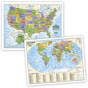
 Size 54"x64". Universal Map edition. Laminated. Beginner classroom wall maps are ideal for pre-K through 1st. grade. Features bright colors with easy-to-identify land masses and major bodies of water. The World edition identifies only continents and oceans. This product is ideal for public, private, parochial, and home schools.
 - $139.95 Rolled + $24.80 p&h
Item Code : UNIV14728
 Size 54"x64". Universal Map edition. Laminated. Beginner floor maps create a hands-on learning experience with these durable vinyl floor maps of the United States and the World. Grommeted corners for easy hanging. This product is ideal for public, private, parochial, and home schools.
 - $179.95 Rolled + $24.80 p&h
Item Code : UNIV14729
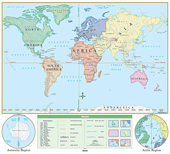
 Size 54"x64". Universal Map edition. Laminated. The World Essential Classroom Wall Map presents the Mercator projection and avoids splitting countries or landmasses. Includes special polar projections. National capitals and major cities are identified. Measures 64" x 54". The Essential Series is mounted on roller with backboard. Features the same clear concise maps as the primary series, but with an enhanced legend and pictorial landform illustrations for intermediate level use. Also shows deserts and wetlands. The inset map locator illustrates the location of each continent in the world. Appropriate for grades 4 through 8. This product is ideal for public, private, parochial, and home schools.
 - $179.95 Rolled + $24.80 p&h
Item Code : UNIV14730
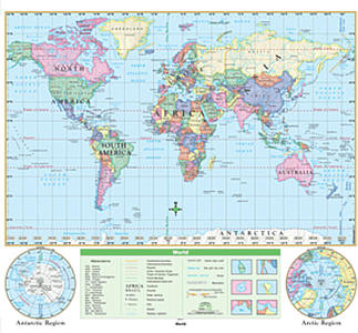
 Size 54"x64". Universal Map edition. Laminated. This is one of the most essential maps for classroom and business use. 'The World Classroom Wall Map from Universal Map features updated, full-color cartography with political boundaries, capitals, major cities and more. Mounted on roller with backboard. This product is ideal for public, private, parochial, and home schools.
 - $139.95 Rolled + $24.80 p&h
Item Code : UNIV14731
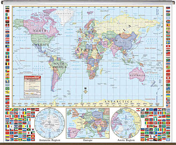
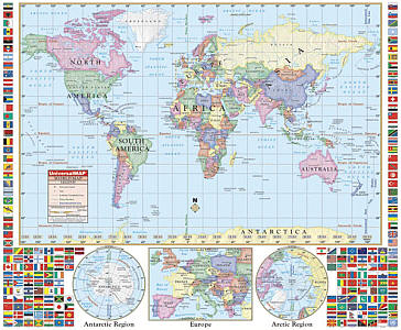 Size 54"x64". Universal Map edition. Laminated. This is one of the most essential maps for classroom and business use. The World Classroom Wall Map from Universal Map features updated, full-color cartography with political boundaries, capitals, major cities and more. Special features include country flags as well as insets of Europe and the poles. Includes rails on top and bottom for easy hanging; 64" x 54". This product is ideal for public, private, parochial, and home schools.
 - $16.95 Rolled + $6.80 p&h or $24.80 foreign delivery
Item Code : NATL14732
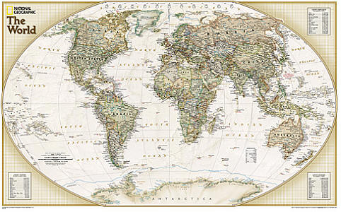 Scale 1:51,969,000. Size 24"x30". National Geographic edition. One of our most popular and accurate world maps is now available in our rich, antique-inspired Executive style. Contains up-to-date place names including Sri Lanka's new capital Sri Jayawadenapura Kotte. The World Explorer Executive uses the Winkel-Tripel Map Projection, which strikes the best balance of accuracy, aesthetics, and proportion, eliminating the issue found in many other maps where Greenland appears larger than South America. Map features include: accurate political boundaries and place names, time zone chart, latitude and longitude grids, and three inset tables with the world's largest countries by size and population, and the population of the world's largest urban areas.
 - $19.95 Rolled + $6.80 p&h or $28.80 foreign delivery
Item Code : NATL14733
 Scale 1:51,969,000. Size 24"x30". National Geographic edition. One of our most popular and accurate world maps is now available in our rich, antique-inspired Executive style. Contains up-to-date place names including Sri Lanka's new capital Sri Jayawadenapura Kotte. The World Explorer Executive uses the Winkel-Tripel Map Projection, which strikes the best balance of accuracy, aesthetics, and proportion, eliminating the issue found in many other maps where Greenland appears larger than South America. Map features include: accurate political boundaries and place names, time zone chart, latitude and longitude grids, and three inset tables with the world's largest countries by size and population, and the population of the world's largest urban areas.
 - $29.95 Rolled + $8.80 p&h or $36.80 foreign delivery
Item Code : NATL14734
 Scale 1:51,969,000. Size 24"x30". National Geographic edition. Laminated. One of our most popular and accurate world maps is now available in our rich, antique-inspired Executive style. Contains up-to-date place names including Sri Lanka's new capital Sri Jayawadenapura Kotte. The World Explorer Executive uses the Winkel-Tripel Map Projection, which strikes the best balance of accuracy, aesthetics, and proportion, eliminating the issue found in many other maps where Greenland appears larger than South America. Map features include: accurate political boundaries and place names, time zone chart, latitude and longitude grids, and three inset tables with the world's largest countries by size and population, and the population of the world's largest urban areas.
 - $24.95 Rolled + $8.80 p&h or $38.80 foreign delivery
Item Code : NATL14735
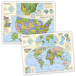
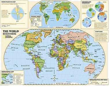 Scale 1:30,000,000. Size 37"x51". National Geographic edition. This is a very exciting year for National Geographic Maps, as we are launching our new series of maps designed specifically for the kids. Our new graded-series of maps are the first to address the unique needs of K-12 students as they advance their understanding of our World. Unlike other classroom poster maps, ours utilize the Winkel-Triple projection, which provides the best combination of size, shape, and distance giving the student the best visual representation of the Earth's surface. This solves the effect seen on other maps where Greenland appears larger than South America. Our new maps start early elementary kids off right. Our Beginner Series, grades K-3, contains an easy to read maps of the World and United States. As kids progress, so do our maps! Our Political Series, grades 4-12, has up-to-date World and U.S. maps, increasing the detail of information for the teacher and student to utilize. Finally, our Physical Series, grades 6-12, helps advancing students understand the World's diverse landform, Oceans, and our Nation's terrain.
 - $34.95 Rolled + $8.80 p&h or $36.80 foreign delivery
Item Code : NATL14736
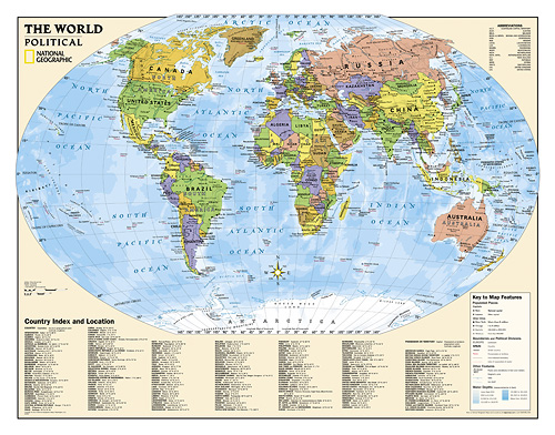
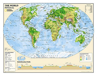
 Size 37"x51". National Geographic edition. This is a very exciting year for National Geographic Maps, as we are launching our new series of maps designed specifically for the kids. Our new graded-series of maps are the first to address the unique needs of K-12 students as they advance their understanding of our World. Unlike other classroom poster maps, ours utilize the Winkel-Triple projection, which provides the best combination of size, shape, and distance giving the student the best visual representation of the Earth's surface. This solves the effect seen on other maps where Greenland appears larger than South America. Our new maps start early elementary kids off right. Our Beginner Series, grades K-3, contains an easy to read maps of the World and United States. As kids progress, so do our maps! Our Political Series, grades 4-12, has up-to-date World and U.S. maps, increasing the detail of information for the teacher and student to utilize. Finally, our Physical Series, grades 6-12, helps advancing students understand the World's diverse landform, Oceans, and our Nation's terrain.
 - $24.95 Rolled + $8.80 p&h or $36.80 foreign delivery
Item Code : NATL14737
 Scale 1:32,970,000. Size 37"x51". National Geographic edition. This is a very exciting year for National Geographic Maps, as we are launching our new series of maps designed specifically for the kids. Our new graded-series of maps are the first to address the unique needs of K-12 students as they advance their understanding of our World. Unlike other classroom poster maps, ours utilize the Winkel-Triple projection, which provides the best combination of size, shape, and distance giving the student the best visual representation of the Earth's surface. This solves the effect seen on other maps where Greenland appears larger than South America. Our new maps start early elementary kids off right. Our Beginner Series, grades K-3, contains an easy to read maps of the World and United States. As kids progress, so do our maps! Our Political Series, grades 4-12, has up-to-date World and U.S. maps, increasing the detail of information for the teacher and student to utilize. Finally, our Physical Series, grades 6-12, helps advancing students understand the World's diverse landform, Oceans, and our Nation's terrain.
 - $34.95 Rolled + $8.80 p&h or $36.80 foreign delivery
Item Code : NATL14738
 Size 37"x51". National Geographic edition. This is a very exciting year for National Geographic Maps, as we are launching our new series of maps designed specifically for the kids. Our new graded-series of maps are the first to address the unique needs of K-12 students as they advance their understanding of our World. Unlike other classroom poster maps, ours utilize the Winkel-Triple projection, which provides the best combination of size, shape, and distance giving the student the best visual representation of the Earth's surface. This solves the effect seen on other maps where Greenland appears larger than South America. Our new maps start early elementary kids off right. Our Beginner Series, grades K-3, contains an easy to read maps of the World and United States. As kids progress, so do our maps! Our Political Series, grades 4-12, has up-to-date World and U.S. maps, increasing the detail of information for the teacher and student to utilize. Finally, our Physical Series, grades 6-12, helps advancing students understand the World's diverse landform, Oceans, and our Nation's terrain.
 - $24.95 Rolled + $8.80 p&h or $36.80 foreign delivery
Item Code : NATL14739
 Scale 1:32,970,000. Size 37"x51". National Geographic edition. This is a very exciting year for National Geographic Maps, as we are launching our new series of maps designed specifically for the kids. Our new graded-series of maps are the first to address the unique needs of K-12 students as they advance their understanding of our World. Unlike other classroom poster maps, ours utilize the Winkel-Triple projection, which provides the best combination of size, shape, and distance giving the student the best visual representation of the Earth's surface. This solves the effect seen on other maps where Greenland appears larger than South America. Our new maps start early elementary kids off right. Our Beginner Series, grades K-3, contains an easy to read maps of the World and United States. As kids progress, so do our maps! Our Political Series, grades 4-12, has up-to-date World and U.S. maps, increasing the detail of information for the teacher and student to utilize. Finally, our Physical Series, grades 6-12, helps advancing students understand the World's diverse landform, Oceans, and our Nation's terrain.
 - $44.95
Item Code : INTR20824
 Size 38"x50". Maps International edition. Rolled Laminated Wall Map features distinctive color-banded borders for easy recognition, and physical relief shading highlighting the area's mountains and valleys. Originally designed for classroom use, it displays equally well in a home or office setting. The laminated surface enhances the colors and permits annotation with dry-erase markers. Chart the route of friends, relatives and associates as they traverse the globe. It's an eye-catching geography lesson, room enhancer, or sales and marketing presentation waiting to happen.
 - $34.95
Item Code : INTR20825
 Size 38"x50". Maps International edition. NOT Laminated. Features distinctive color-banded borders for easy recognition, and physical relief shading highlighting the area's mountains and valleys. Originally designed for classroom use, it displays equally well in a home or office setting. Chart the route of friends, relatives and associates as they traverse the globe. It's an eye-catching geography lesson, room enhancer, or sales and marketing presentation waiting to happen.
 - $79.95 + $16.80 p&h or $44.80 foreign delivery
Item Code : INTR21172
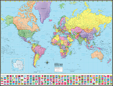
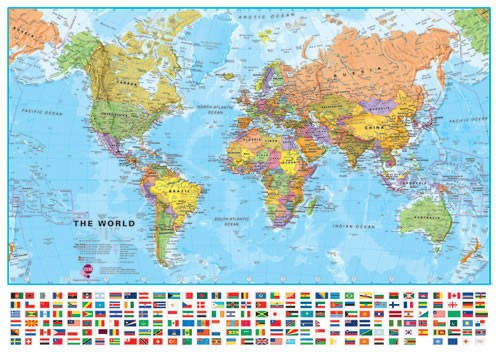 Maps International edition. Our large politically coloured world wall map features every country in a different colour, with country boundaries shown clearly. All major towns and cities are highlighted on our world wall map and capital cities are clearly shown. The map contains hill and sea shading bringing the map to life. The panel of flags along the base of the map and population facts and figures makes this map really interactive.
|
World Wall Maps |
