
Nepal Trekking Maps | Detailed, Travel, Tourist, Topographic, Hiking, Annapurna
|
Nepal Trekking Maps |
Nepal Trekking Maps (Annapurna, etc)
- $17.95
Item Code : NEPA10922
Scale 1:125,000. Nepa edition. The map covers Gorkha, Arughat, Jagat, Lho, Sama Gomba, Larkya Pass, Bimtang, Bensi Shahar, Dumre, Rupina Pass, Chhulung Glacier, Himalchuli Base Camp, Torogompa Glacier, Shar Khola, Tsum, Chule, and Mu Gomba. Indexed. A good regional topographic map. The map has latitude/longitude tick markings along the side but no grid, and the map is at an angle from north. - $19.95
Item Code : NEPA10944
Scale 1:80,000. Nepa edition. This detailed topographic map highlights the various trekking routes to Makalu Base Camp. The map covers Tumlingtar, Num, Tashigaon, Mumbuk, Shipton's Pass, Sherson, and the Makulu Base Camp -
- $16.95
Item Code : NEPA10923
Scale 1:125,000. Nepa edition. Indexed. With 125 meter contours and latitude/longitude markings. Covers Jomosom, Kagbent, Ty, Tangbe, Chusang, Chele, Samar, Ranchung Chorten Cave, Shyammochen, Ge-Ling, Ghami, Tramar, Tsarang, Lo Manthang, Namgyal Gomba, Thinkar, Kyamaling, Namidrol, Kore La, Photu La, Garphu, Nyphu, Tubten, Chosar, Surkhan, Lhori, Damodar, Kund, Te, Tangya, Tetang, Muktinath, and Kagbeni -
- $18.95
Item Code : NATL10920
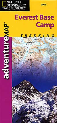
 Scale 1:50,000. Size 24"x36". Printed on waterproof, tear-resistant, lightweight, paper-like plastic. Follow National Geographic to one of the world's most exotic locations with this comprehensive adventure map. Includes overview and detail maps, along with useful guide and trekking information. Features a Trails Illustrated folded topographic map with trekking routes from Lukla to Everest Base Camp, Sagarmatha National Park. Full map of Nepal and detail map of Kathmandu on the reverse side.
 -
- $18.95
Item Code : NATL10921
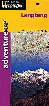
 Scale 1:125,000. Size 24"x36". Nepa edition. The map covers Trisuli Bazaar, Dhunche, Syabru, Lama Hotel, Ghora Tabela, Lantang Village, Kyanjim Gomba, Yala Peak, Kanjala, Morimoto Base Camp, Lanshisa Glacier, Tilman's Pass, Sherpagaon, and Syabrubesi. Indexed. A good regional topographic map, although it lacks latitude/longitude markings. Printed on waterproof, tear-resistant, lightweight, paper-like plastic.
 -
-
- $17.95
Item Code : NEPA10925
Scale 1:75,000. Nepa edition. The map covers Birethanti, Ghorapani, Tatopani, Dana, Ghasa, Larjung, Tukuche, Marpha, Syan, Jomosom, Lupra, Kagbeni, and Muktinath. This map is a good 1:75,000 topographic map with hiking information overlain. The map has latitude/longitude markings - $17.95
Item Code : NEPA10914
Trekking Routes From Pokhara to Annapurna Base Camp. Scale 1:50,000. Indexed. Nepa edition. This map covers Landruk, Chomrong, Bamboo Lodge, Himalayan Hotel, Hinko, Machhapucchhare Base Camp, Annapurna Base Camp, Ghandruk, Birethanti, and Pokhara. With latitude/longitude markings and 40 meter contours. Shows national park boundaries, roads, main trekking routes, minor trekking routes, heights in meters, peaks, passes, helipads, campsites, hotels, settlements, post offices, check points, health posts, temples, monasteries, waterfalls, rivers, bridges, lakes, caves, hot springs, forests, and contour lines. Also indicates suggested trekking routes for the 5-day main trek and approximates the length of time for each trek (hint: the first day is the longest with 7.25 hours). Also suggests a number of side trips of various lengths. Laminated card cover. Excellent map. SAMPLE MAP - $16.95
Item Code : NEPA10903
1:1,000,000. A shaded relief map of Nepal, highlighting national parks, tourist sites, and major trekking trails. Includes an index. - $17.95
Item Code : NEPA10926
Scale 1:50,000. Indexed. Nepa edition. With detailed trails-walking distances-altitudes. The map covers Dhampus, Landrung, Ghorapani, Poon Hill, Sikha, Tatopani, Chomrong, Birethanti, and Chandrakot. A good detailed topographic map with hiking information overprinted. The map has latitude/longitude tick markings along the sides of the map. - $17.95
Item Code : NEPA10927
Scale 1:25,000. Indexed Nepa edition. The map covers Nagarkot, Sankih, Bajrajogini, Changu Narayan, Sundarijal, Shivapuri, Budanilkantha, Panauti, Godavari, Phulchoki, Ichangu, Nagarjun, Kakani, and Balaju. A good detailed topographic map with hiking information overprinted. The map has latitude/longitude noted along the side of the map, but there are no tick marks or grid. - $16.95
Item Code : NEPA10943
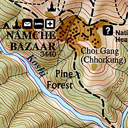
The Everest Trail. Scale 1:125,000. This topographic map covers the Everest Trail, via Jiri, Lukla, Namche Bazaar, and Sagamatha (Everest) National Park and the old routes to Tibet across the Nangpa La and Manjung La. The map covers Lamosangu, Jiri, Shivalaya, Bhandar, Lamjura Pass, Junbesi, Trakshindo Pass, Jubin, Khari Khola, Poyan, Lukla, Phakding, Monjo, Manche Bazaar, Syangboche, Khumjung, Tyangboche, Pheriche, Lobuche, Gorak Shep, Kala Patthar, Everest Base Camp, Gokyo, Phortse, Thame Og, Nangpa La, Tesi Lapcha Pass, and Manlung Pass - $16.95
Item Code : NEPA10940
The Cradle of the Malla Civilization. Scale 1:135,000. Nepa edition. The topographic map covers Jumla, Ghumurti, Chere, Danphe Lagna, Nyawre, Kabra, Bhara, Chautha, Bhulbule, Gurchi Langa, Dhotu, Jhyari, Rara Lake, Majhghatta, Gorosingha, Okarpata, Sinja, Jaljala Chaur, Chere, and Jumla - $16.95
Item Code : NEPA10952
Scale 1:250,000. Includes the Koshi Tappu Wildlife Reserve. - $16.95
Item Code : NEPA10947
Scale 1:150,000. Nepa edition. A topographic map of this popular rafting river in Nepal. The map covers Betrawati, Trisuli Bazaar, Denighat, Baireni, Mugling, Narayanghat, and Chitwan - $16.95
Item Code : NEPA10948
Scale 1:150,000. Nepa edition. Covers this popular national park. Includes jungle safaris, river rafting, and bird watching information
|
Nepal Trekking Maps |
