
Wyoming Road Maps | Detailed Travel Tourist Driving
|
Wyoming Road Maps |
Wyoming
- $17.95
Item Code : TRAL14774
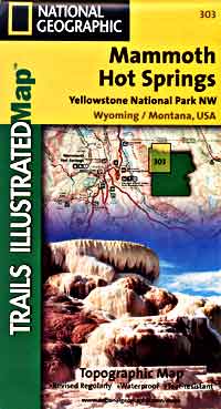
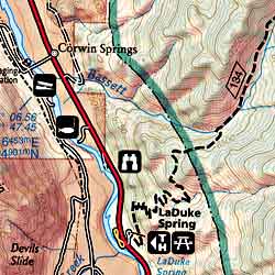 Scale 1:63,000. Size 19"x26". Trails Illustrated edition. Printed on waterproof, tear-resistant, lightweight, paper-like plastic. This Trails Illustrated topographic map is the most comprehensive recreational map for the Mammoth Hot Springs area of northwest Yellowstone National Park. Coverage includes Gallatin BMA, Absaroka Beartooth Wilderness, Richard's Pond BMA, Washburn BMA, Blacktail BMA. West Entrance, North Entrance, Mammoth Hot Springs, Madison, and Norris. Includes UTM grids for use with your GPS unit.
 - $17.95
Item Code : TRAL14775
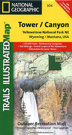
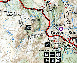
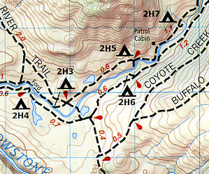 Scale 1:63,000. Size 19"x26". Trails Illustrated edition. Printed on waterproof, tear-resistant, lightweight, paper-like plastic. This Trails Illustrated topographic map is the most comprehensive recreational map for the Tower/Canyon area of northeast Yellowstone National Park. This map includes: Canyon Village; Tower-Roosevelt Washburn BMA; Antelope BMA; Mirror Plateau BMA; Absaroka Beartooth Wilderness; Gallatin National Forest. Includes UTM grids for use with your GPS.
 - $17.95
Item Code : TRAL14776
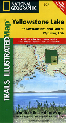
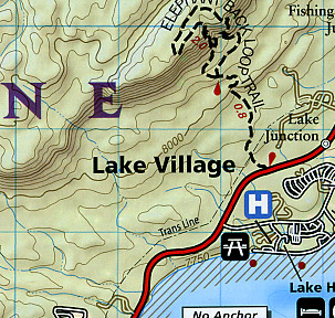 Scale 1:63,000. Size 19"x26". Trails Illustrated edition. Printed on waterproof, tear-resistant, lightweight, paper-like plastic. Coverage of the Yellowstone Lake area of Yellowstone National Park includes: Pelican Valley BMA; Clear Creek BMA; Lake Spawn Area; North Absaroka Wilderness; Washakei Wilderness; Shoshone National Forest; Heart Lek BMA; Two Ocean BMA; Teton Wilderness; Fishing Bridge. Includes UTM grids for use with your GPS.
 - $17.95
Item Code : TRAL14777
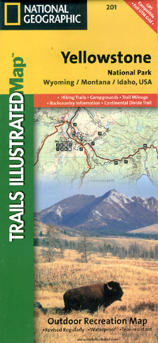
 Scale 1:127,000. Size 26"x37". Trails Illustrated edition. Printed on waterproof, tear-resistant, lightweight, paper-like plastic. Detailed and accurate coverage for Yellowstone National Park. Includes a detailed road network and popular trails, complete with use restrictions, mileages, elevation gains, and difficulty ratings. Popular attractions and park services are clearly identified. UTM and Latitude/Longitude grids ensure ease of use with GPS or compass navigation.
 - $12.95
Item Code : EART14778
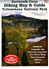
 Scale 1:106,000. Size 27"x39". Earthwalk Press edition.
 - $39.95
Item Code : NATL14779
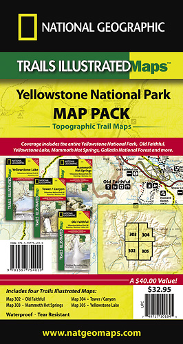
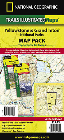 Scale 1:126,720 & 1:80,000. Size 26"x38". National Geographic edition. Seeking the best combination of detailed maps and value for your Yellowstone National Parks trip, then get our bundle pack. It includes four Yellowstone National Park Trails Illustrated maps, providing you coverage of the entire map region, while saving you over 15%. Like all Trails Illustrated maps, the Yellowstone National Park Bundle set is frequently revised and printed on waterproof, tear-resistant material to stand up to all conditions. This detailed topographic recreation map bundle contains carefully researched trails, campsites, forest service roads, and points-of-interests. Includes UTM grids for use with your GPS unit. Coverage includes the entire Yellowstone National Park, Old Faithful, Yellowstone Lake, Mammoth Hot Springs, Gallatin National Forest and more.
 - $37.95
Item Code : NATL14780
 Scale 1:63,360. Size 22"x32". National Geographic edition.
|
Wyoming Road Maps |
My Wish List
Last Added Items
You have no items in your wish list.
