
Washington Road Maps | Detailed Travel Tourist Driving
|
Washington Road Maps |
Washington State
- $17.95
Item Code : ITMB19903

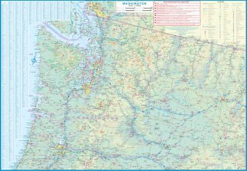
Scale 1:12,500/700,000. Size 27"x39". 3rd Edition on waterproof paper. International Travel Maps edition.
This is a new tittle for ITMB, in that it is the first time we have mapped the State of Washington. The actual area of the map includes Portland and northern Oregon and Vancouver and the border area with the USA. A small portion of Idaho is also shown. Wilderness campsites, parks such as Rainier, Olympic, and Baker, are shown. Seattle as a city, stretches far beyond the confines of a practical map in that it stretches from Everett to Tacoma.
Our map covers from the University in the north to the Beacon hill neighbourhood in the south and from the waterfront to Lake Washington. An inset map of the greater region is included. The rapid transit line is also included on the map and on the back cover. The reverse side of the sheet shows all the roads of Washington State in excellent Olympic, and Baker, state parks, touristic sites, beaches, ferry routes, native reserves, motorways, and even the ill-fated Hanford nuclear site are included. The map is printed on ITM waterproof paper for durability.
- $17.95
Item Code : ITMB19390
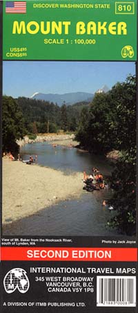
 Scale 1:100,000. Size 27"x40". International Travel Maps edition. Indexed. English text and legends. Elevations and topographic features are shown by hypsometric color tints. Includes considerable useful travel information.
 - $16.95
Item Code : NATL19391
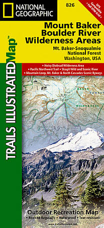
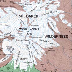
 Scale 1:75,000. Size 26"x38". National Geographic edition. One of five Trails Illustrated maps for the Washington Cascades region offering the most detailed and up-to-date map for the forest, carefully researched and developed in co-operation with local land managers and agencies. Each map contains easy to read trails, numbered forest service roads, campsites, access points, scenic points-of-interests, and important facilities. Three narrow spires—North, Middle, and South Peaks—known collectively as Three Fingers anchor the center of Boulder River Wilderness. Boulder River, the primary drainage, runs northwesterly from a north-south ridge that rises to a high point of 6,850 feet on South Peak. Mountain climbers flood onto Mount Baker Wilderness Area in spring and summer before fall opens numerous large crevasses. Hundreds of climbers may be seen on the mountain in a single day. The Heliotrope Ridge Trail winds 2.7 miles to the Coleman Glacier, the most popular climbing route on the mountain. A well-developed and very busy trail system provides access to the lower country. Coverage includes: Noisy Diobsud Wilderness Area, Mount Baker National Recreation Area, Skagit Wild and Scenic River, Mount Baker, Mountain Loop and North Cascades Scenic Byways. Wilderness Coverage: Mount Baker, Boulder River, Noisy Diobsud. Other Attractions: Mount Pilchuck & Wallace Falls State Parks, Baker & Spada Lakes, Lake Shannon, hiking trails, mountain biking, scenic back roads, boat ramps, mountain climbing, sno-parks, ski areas, fishing, snowmobile trails, cross-country skiing, waterfalls, day use areas, dispersed camping areas, picnic areas, campgrounds.
 - $17.95
Item Code : TRAL19392
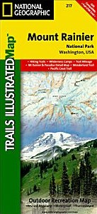
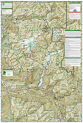
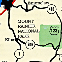
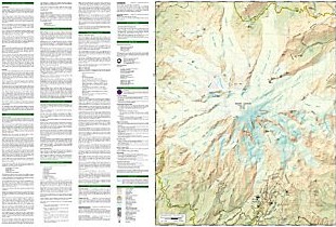 Scale 1:55,000. Size 26"x38". Trails Illustrated edition. Printed on waterproof, tear-resistant, lightweight, paper-like plastic. This Trails Illustrated topographic map is the most comprehensive recreational map for Washington's Mount Rainier National Park. Within the park, there is detailed coverage of Mount Rainier and its many glaciers; Eagles Roost, Cataract Valley, Mystic, Emmons Overlook, Indian Bar, Maple Creek, Snow Lake, Paradise River, Jackson and many other camping areas are also included. A detailed inset gives you a close-up view of the peak and trails leading to its glaciers.
 - $12.95
Item Code : EART19393
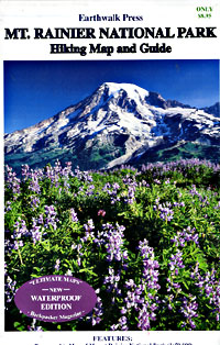
 Scale 1:50,000. Size 27"x39". Earthwalk Press edition.
 - $16.95
Item Code : NATL19396
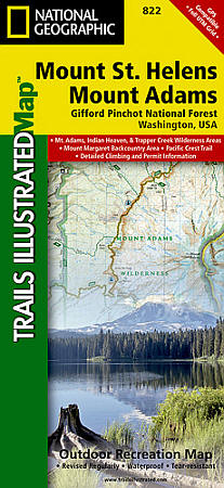
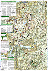 Scale 1:75,000. Size 26"x38". National Geographic edition. The Gifford Pinchot National Forest, located in southwest Washington State, is one of the oldest National Forests in the United States. The Forest is 1,368,330 acres in size and includes the 110,300-acre Mount St. Helens National Volcanic Monument established by Congress in 1982. Coverage highlights: Mount Adams, Indian Haven and Trapper Creek Wilderness Areas, Mount St. Helens National Volcanic Monument, Mount Margaret Backcountry Area, Pacific Crest Trail, Spirit Lake Memorial Highway, Detailed Climbing and Permit Information. Wilderness coverage: Mount Adams, Indian Haven, Trapper Creek. Other attractions: Mount St. Helens National Volcanic Monument, Mount Margaret Backcountry Area, hiking trails, mountain biking, scenic back roads, mountain climbing, campgrounds, sno-parks, fishing, snowmobile trails, cross-country skiing, waterfalls.
 - $12.95
Item Code : TOMH19394
Scale 1:50,000. Tom Harrison Press edition - $17.95
Item Code : TRAL19397
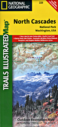
 Scale 1:100,000. Size 25"x37". Trails Illustrated edition. Printed on waterproof, tear-resistant, paper-like plastic. This Trails Illustrated map features detailed trails and topographic information for Washington state's North Cascades National Park, Ross Lake National Recreation Area, and Lake Chelan National Recreation Area. The map includes detailed coverage of Mount Baker Wilderness, Snoqualmie National Forest, Glacier Peak Wilderness, Stephen Mather Wilderness, Ross Lake National Recreation Area, Noisy Diobsub Wilderness, Pasayten Wilderness, Wenatchee National Forest, Lake Chelan, Ross Lake, and much more. Includes UTM grids for use with your GPS unit.
 - $17.95
Item Code : TRAL19399
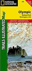
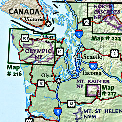 Scale 1:100,000. Size 25"x38". Trails Illustrated edition. Printed on waterproof, tear-resistant, lightweight, paper-like plastic. This Trails Illustrated topographic map is the most comprehensive recreational map for Washington's Olympic National Park. Within the park, there is detailed coverage of Mount Olympus, Tshletshy Ridge, Hurricane Ridge, Huelsdonk Ridge, Bailey Range, camping areas, facilities, ranger stations, nature trails, waterfalls, boat launches, and much more. Also included are the Mount Skokomish Wilderness, Ozette Lake, Lake Pleasant, Lake Crescent, Lake Mills, and Olympic National Forest.
 - $10.95
Item Code : RAND19400
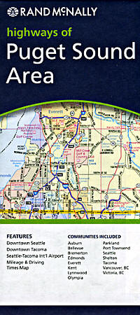
 Scale 1:235,000. Size 26"x37". Rand McNally edition.
 - $10.95
Item Code : GPAC19403
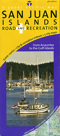
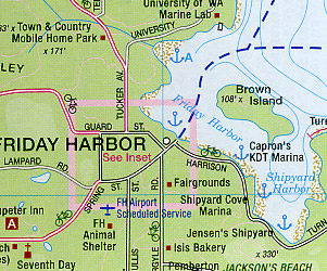 Scale 1:70,000. Size 24"x36". Great Pacific Recreation Maps edition.
 - $17.95
Item Code : ITMB19402
Scale 1:70,000. International Travel Maps edition
|
Washington Road Maps |
