
|
Tennessee Road Maps |
Tennessee
- $11.95
Item Code : RAND13731
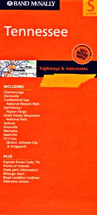
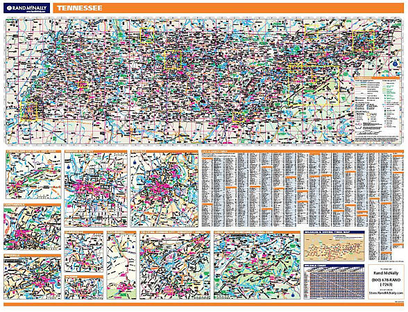
 Scale 1:906,000. Size 26" across x 37" high. Indexed. Rand McNally edition. Shows all types of roads, road numbers, distances between points in miles, scenic routes, railways, airports, cities, towns, villages, national parks, state parks, campsites, rest areas (toilets), wayside stop, places of interest, information centers, and the Great River Road. Also includes an enlarged inset tourist road and shaded relief map of the Great Smoky Mountains National Park, a list of all the State Parks and the facilities contained in each park, a mileage chart for 73 cities and towns in Tennessee, a list of golf courses, and a very useful "Events Calendar" indicating that the "Brownsville Blues Festival" is held in September in what town? On the reverse side there are inset detailed city street plans of Nashville, and Memphis, plus principal street plans of Chattanooga, Knoxville, and the Tri-Cities of Kingsport, Johnson City, and Bristol, and lots of narrative tourist information describing the more important points of interest. BIG >> SAMPLE MAP << Small sample map
 - $10.95
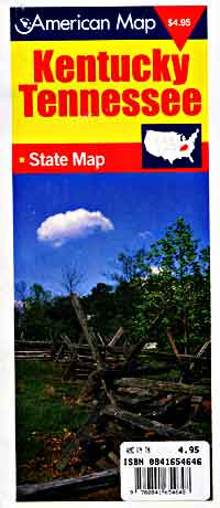
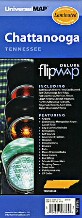
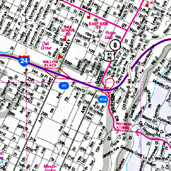
Item Code : AMER13735
 Scale 1:1,200,000. Size 10"x21". American Map Company edition. Laminated.
 - $11.95
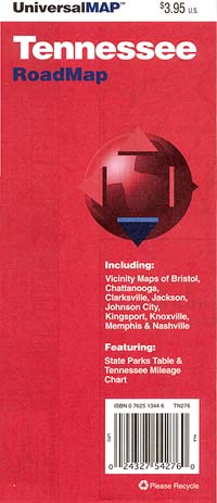
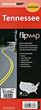
Item Code : UNIV13733

 Scale 1:1,300,000. Size 11"x30". Universal Map edition. Laminated.
 - $10.95
Item Code : AMER13736
Scale 1:1,100,000. American Map Company edition. - $10.95
Item Code : AMER13737
 Scale 1:1,100,000. American Map Company edition.
 - $16.95
Item Code : NATL13734
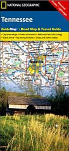 Scale 1:1,100,000. Size 18"x25". National Geographic edition. The front side features insets of Eastern Tennessee, Knoxville, Chattanooga, and Land Between the Lakes. The back includes maps and information for Memphis and Nashville, information for Great Smoky Mountains National Park, points of interest, scenic drives, and Park Service sites in Tennessee.
 - $10.95
Item Code : UNIV13732
 Scale 1:950,000. Size 27" across x 27" high. Universal Map company
 - $10.95
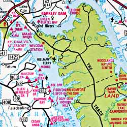
Item Code : UNIV13741
Scale 1:320,000. Size 36" across x 24" high. Universal Map Company - $10.95
Item Code : UNIV13745
Scale 1:350,000. Size 36" across x 24" high. Universal Map Company - $10.95
Item Code : UNIV13742
 Scale 1:320,000. Size 24"x36". Universal Map edition.
 - $27.95 + $6.80 p&h or $28.80 foreign delivery
Item Code : DELR13755
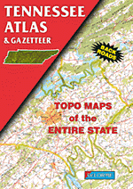
 Scale 1:150,000. Full size, 11"x15?". DeLorme edition. 72 pages. Designed for those who want to get off the beaten path, this atlas shows all types of roads and tracks, cities, towns, hamlets, and provides topographic maps that show hiking trails, campgrounds, fishing spots, ski areas, and more. Contains a guide to state and national parks and recreation areas, historic sites, and unique natural areas. Comprehensive index enables the user to find locations quickly and easily. Great for car or backpack! Saddle-stitched, durable laminated paper cover. Did you see that fish jumping? Go to the boat ramp, hop in your skiff and get over there quickly!
 - $259.00 Shipped rolled in a tube + $24.80 p&h
Item Code : RAND13750
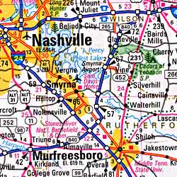
 Scale 1:558,000. Size 46"x60". Rand McNally edition. Laminated. Professional Grade. Rand McNally's regional wall map of Tennessee is ideal for anyone needing a comprehensive representation of the area for planning, routing, or reference. It's a great choice for business and sales strategy, urban development, social work outreach, education, and marketing. Tennessee residents, businesses, and government offices are sure to find this wonderful reference tool irreplaceable. ?The laminated wall map is printed with UV-resistant ink to help prevent color fading. ?Map details include state highways, federal highways, county highways, county boundaries, city shading, cities and towns, major waterways, state/national parks, campsites, exit numbers, rest areas, military installations, airports, golf courses, universities, and much more. ?You'll also find a city/county index on the map, a mileage chart with 900 mileage pairs between 30 cities, and a driving times map between major cities in the region. ?This truly complete wall map even includes a hanging kit with rails for easy mounting just about anywhere. Inset maps include: Chattanooga; Clarkesville; Gatlinburg; Jackson; Knoxville; Memphis; Nashville; Tri-Cities (Kingsport, Johonson City, and Bristol); Cumberland Gap National Historic Park; and Great Smoky Mountains National Park.
 - $249.95 + $24.80 p&h (add $40 for spring rollers)
Item Code : UNIV13751
 Size 70" W x 42" H. Laminated. The Tennessee Wall Map by Universal Map includes the following: All State Highways, All Federal Highways, Cities, Major Waterways, Major Airports, State Parks, towns, State Universities, Wildlife Areas, Military Installations, and Points of Interest. Map insets include the following: Bristol, Chattanooga, Clarksville, Kingsport, Knoxville, Jackson, Memphis, and Nashville. Special Features for this map include: Color Coded Counties, Mileage Chart Between Major Cities. The map is protected with a laminate finish, which is both markable and washable. In addition, for your convenience, cities are indexed on the face of the map. Framing rails are included on top and bottom for easy wall mounting. Railed wall maps can be turned into pull down maps on spring rollers for an additional $40.
 - $17.95
Item Code : TRAL13746
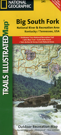
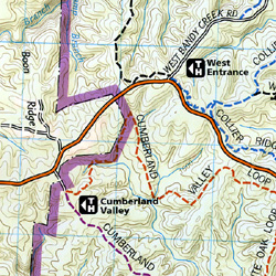 Scale 1:45,000. Size 26"x37". Trails Illustrated edition. Printed on waterproof, tear-resistant, lightweight, paper-like plastic. Big South Fork National River & Recreation Area straddles southern Kentucky and northern Tennessee. This is the most comprehensive guide for hiking, biking, exploring, climbing, camping, and sightseeing in this stunning area. The map includes: Daniel Boone National Forest; Scott State Forest; Cumberland River; Little South Fork; Big South Fork and Clear Fork; New River; Lake Cumberland; Yahoo Falls Scenic Area; Blue Heron Area; Bandy Creek Campground; Leatherwood Ford; Honey Creek; Burnt Mill Bridge; Alum Ford; John Muir Trail; Bear Creek Overlook. Includes UTM grids for use with your GPS.
 - $229.95 + $24.80 p&h (add $40 for spring rollers)
Item Code : UNIV13757
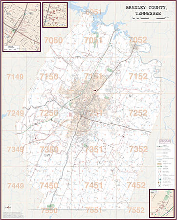 Scale 1:2,200. Size 54" W x 67" H. Laminated. Printed in color with a markable/washable--laminated surface. Street index provided on the face of the map. Framing rails are included on top and bottom for easy wall mounting. Railed wall maps can be turned into pull down maps on spring rollers for an additional $40. Area of coverage: All of Bradley County with the following boundaries: North: McMinn and Meigs County line; South: Georgia State line; East: Polk County line; West: Hamilton County line. Includes an inset map of Downtown Cleveland. Details include all streets and highways, government buildings, airports, water features, fire/police stations, hospitals, shopping centers, educational facilities, railroads, recreational parks, golf/country clubs, post offices, city limits/annexations, cemeteries, ZIP codes/boundaries, and points of interest.
 - $11.95
Item Code : UNIV13763
 Scale 1:40,000. Size 23"x26". Universal Map edition. Laminated.
 - $10.95
Item Code : UNIV13767
 Scale 1:53,000. Size 28"x40". Universal Map edition.
 - $16.95
Item Code : NATL21036
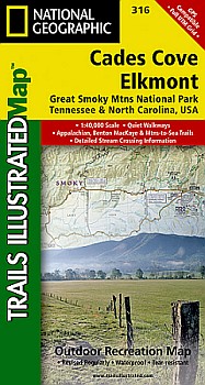
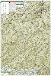 Scale 1:40000. National Geographic edition. One of our more popular Trails Illustrated maps provides an increased scale of one of the most visited National Parks in the US and greater detail to the backcountry users and Appalachian Trail through-hikers. Great Smoky Mountains National Park is a hiker’s paradise with over 800 miles of maintained trails ranging from short leg-stretchers to strenuous treks that may require backcountry camping. But hiking is not the only reason for visiting the Smokies. Car camping, fishing, picnicking, wildlife viewing and auto touring are popular activities. Coverage Highlights for this and the related 317 map: Appalachian Trail, Benton Mackaye Trail, Mountains-to-Sea Trail, Backcountry Campsites, Detailed Trail Mileages, Footbridges, Fords/Stream Crossings, Nature/Interpretive Trails, Scenic Overlooks/Roadside Pull-outs, Cades Cove Driving Loop, Chilowee Mountain, Little Mountain, and the Cataloochee Divide, Blue Ridge Parkway, National Forest Service Lands (Cherokee, Pisgah and Nantahala National Forests), Little Tennessee and Tuckasegee Rivers, Chilhowee and Fontana Lakes, Maryville Tennessee, Gatlinburg Tennessee, Waynesville North Carolina, and much more.
 - $249.95 + $24.80 p&h (add $40 for spring rollers)
Item Code : UNIV13765
 Size 54" W x 77" H. Laminated. The Chattanooga and Hamilton County, Tennessee Wall Map by Universal Map features up-to-date cartography of Hamilton County in complete street detail. Includes a laminated surface which is both markable and washable. A street index appears in a separate book. The area of coverage ranges: North: to Soddy Daisy and the Hamilton County line; South: to Rossville, Ft. Oglethorpe, Chattanooga National Park, and portions of Ringgold in Georgia; East: to Collegedale and the Bradley County line; West: to Hamilton County line, Signal, and Lookout Mountains. Insets include Downtown Chattanooga and Chickamauga, Georgia. Details are airports, post offices, hospitals, railroads, mileage circles, points of interest, government buildings, cemeteries, shopping centers, water features, recreational parks, city limits and annexations, all streets and highways, fire and police stations, educational facilities, golf courses and country clubs, zip codes and zip code boundaries. Framing rails are included on top and bottom for easy wall mounting. Railed wall maps can be turned into pull down maps on spring rollers for an additional $40.
 - $249.95 + $24.80 p&h (add $40 for spring rollers)
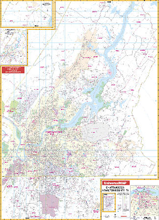
Item Code : UNIV13766
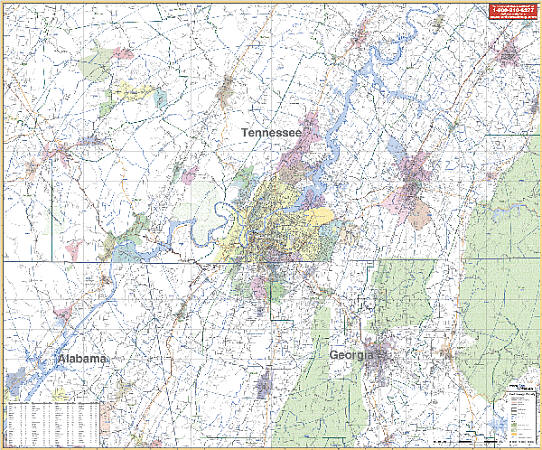 Scale 1:133,000. Size 64" W x 54" H. Laminated. Printed in color with a markable/washable laminated surface. Includes hanging rails mounted on top and bottom. Cities are indexed on the face of the map. The area of coverage includes Bradley, Grundy, Hamilton, Marion, Sequatchie, Counties with portions of Coffee, Bledsoe, Franklin, Meigs, McMinn, Polk and Rhea Counties in Tennessee; and in Georgia, includes all of Dade, Catoosa, Whitfield, Walker Counties with portions of DeKalb, Jackson, Murray, and Gilmen Counties, with the following boundaries: North: 35 miles north of Chattanooga, including Athens in McMinn County and Dayhton in Rhea County; South: 35 miles south of Chattanooga, including Resaca in Gordon County, GA; East: 40 miles east of Chattanooga, including Benton and Etowah in Polk County; West: 35 miles west of Chattanooga, including Sewanee, Monteagle, and Hollywood. Details include major streets, all highways, county lines, airports, parks, water features, mileage circles, ZIP codes and boundaries, and longitude/latitude lines. Railed wall maps can be turned into pull down maps on spring rollers for an additional $40.
|
Tennessee Road Maps |
