
Oregon Road Maps | Detailed Travel Tourist Driving
|
Oregon Road Maps |
Oregon
- $14.95
Item Code : GMJO12265
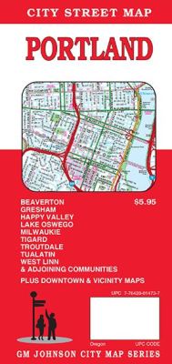
 Scale 1:32,000. Size 27"x39". G.M. Johnson edition. This Map Coverage Area are Clackamas, Durham, Fairview, Gladstone, Gresham, Happy Valley, Johnson City, Jennings Lodge, Lake Oswego, Metzger, Milwaukie, Maywood Park, Oatfield, Oak Grove, Portland, Raleigh Hills, Rivergrove, Sunnyside, Troutdale, Wood Village, Beaverton, King City, Oregon City, Tigard, Tualatin, West Linn, Vancouver, Cedar Hills, Cedar Mill, Raleigh Hills, Partial Coverage.
 - $10.95
Item Code : RAND12266
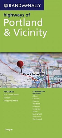
 Scale 1:32,000. Size 37"x45". Rand McNally edition. Rand McNally's folded map featuring the highways of Portland & vicinity is a must-have for anyone traveling in and around this part of the state, offering unbeatable accuracy and reliability at a great price. Our trusted cartography shows all Interstate, state, and county highways, along with clearly indicated points of interest, airports, county boundaries, and more.You'll see why Rand McNally folded maps have been the trusted standard for years.
 - $10.95
Item Code : UNIV12268
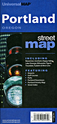
 Scale 1:32,000. Size 27"x39". Universal Map edition.
 - $26.95 + $5.80 p & h or $12.80 foreign delivery
Item Code : GMJO12269
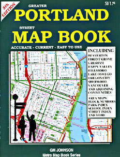
 Scale 1:22,000. Size 8?"x11". 112 pages. G.M. Johnson edition.
 - $249.95 + $24.80 p&h (add $40 for spring rollers)
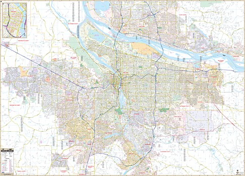
Item Code : UNIV12270
 Scale 1:180,000. Size 54" W x 64" H. Laminated. Printed in color with a markable and washable surface and indexed on the face of the map. Contains hanging rails mounted on the top and bottom. The area of coverage includes the counties of Clackamas, Columbia, Multnomah, Marion, Washington, and Yamhill; and portions of Benton, Polk, Linn, Hood River Counties in Oregon; and Clark County and portions of Cowlitz, Skamania and Wahkiakum Counties in Washington. Boundaries are as follows: North: 45 miles to include Longview, West Longview in Cowlitz County, Washington; South: 65 miles to include Albany and Millersburg in Linn County; East: 50 miles to include Parksdale in Hood River County; West: 40 miles to Tillamook County. Details include major streets and all highways, county lines/names, mileage circles, zip codes/boundaries, airports, parks, water features, and longitude/latitude lines. Railed wall maps can be turned into pull down maps on spring rollers for an additional $40.
 - $249.95 + $24.80 p&h (add $40 for spring rollers)
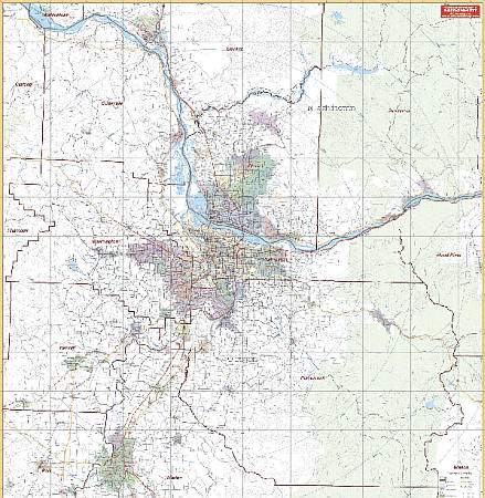
Item Code : KAPA21127
 Our Portland, OR Wall Map, with adjacent areas, measures 77" x 55" (6'5" W x 4'7" H) and features up-to-date cartography, with new streets and changes in complete street detail; is printed in color, with a markable and washable laminated surface; and offers a street index in a separate book-format. The area of coverage includes all Portland, with the following boundaries: - North to Vancouver, Washington, and Vancouver Mall - South to Oregon City, Wilsonville, and portions of Newberg - East to Washougal, WA, and Gresham and Troutdale - West to Hillsboro and North Plains The Portland, OR Wall Map also includes an inset map of Downtown Portland. Details and features include: - AIRPORTS - BLOCK NUMBERS - CEMETERIES - CITY LIMITS - EDUCATIONAL INSTITUTIONS - FIRE & POLICE STATIONS - GOLF & COUNTRY CLUBS - GOVERNMENT BUILDINGS - HOSPITALS - POINTS OF INTEREST - POST OFFICES - RAILROADS - RECREATIONAL PARKS - SECTION, TOWNSHIP & RANGE LINES - SHOPPING CENTERS - STREETS & HIGHWAYS - SUBDIVISIONS - WATER FEATURES - ZIP CODE BOUNDARIES Framing rails are included, top and bottom, for easy wall mounting. Spring roller mounting is also available, for an additional $40.
 - $14.95
Item Code : GMJO21256
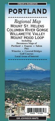
 Scale 1:192,000. Size 27"x39". G.M. Johnson edition. This Map Coverage Area are Mount St. Helens, Columbia River Gorge, Willamette Valley, Mount Hood Loop, Portland, Eugene, Salem.
 - $14.95
Item Code : GMJO12271
 Scale 1:32,500. Size 11"x24". G.M. Johnson edition. Laminated.
 - $14.95
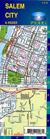
Item Code : GMJO12272
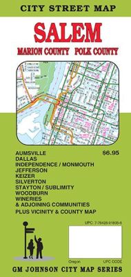
 Scale 1:32,000. Size 27"x39". G.M. Johnson edition. This Map Coverage Area are Aurora, Detroit, Donald, Falls City, Gates, Gervais, Hubbard, Idanha, Scotts Mills, St Paul, Turner, Aumsville, Jefferson, Mount Angel, Independence Silverton, Monmouth, Stayton, Dallas Sublimity, Keizer, Salem, Woodburn, Marion County, Polk County.
 - $10.95
Item Code : RAND12273
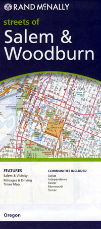
 Scale 1:25,000. Size 25"x37". Rand McNally edition.
 - $10.95
Item Code : GGSM12244
Santiam Pass, Winter Recreation and Road Map, Oregon, America. - $14.95
Item Code : GMJO12274
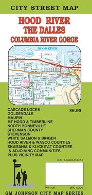
 Scale 1:32,000. Size 27"x39". G.M. Johnson edition. This Map Coverage Area are Antelope, Bingen, Cascade Locks, Dufur, Goldendale, Grass Valley, Hood River, Maupin, Moro, Mosier, North Bonneville, Mount Hood, Rufus, Shaniko, Stevenson, The Dalles, Timberline, Wasco, White Salmon, Cascade Locks, Goldendale, Maupin, Mt Hood, Timberline, North Bonneville, Stevenson, White Salmon, Bingen, Hood River County, Klikitat County, Sherman County, Skamania County, Wasco County, Clackamas County, Sherman County.
 - $10.95
Item Code : GGSM12245
Three Sisters Wilderness Area, Road and Recreation Map, Oregon, America. - $10.95
Item Code : BSKY12227
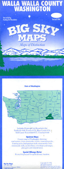
 Scale 1:145,000. Size 25"x37". Big Sky Maps edition.
 - $14.95
Item Code : GMJO12275
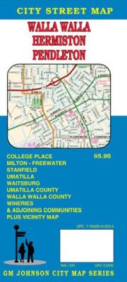
 Scale 1:32,000. Size 27"x39". G.M. Johnson edition. This Map Coverage Area are Adams, Athena, College Place, Echo, Helix, Hermiston, Mcnary, Milton-Freewater, Pendleton, Pilot Rock, Prescott, Stanfield, Ukiah, Umatilla, Waitsburg, Walla Walla, Weston, Umatilla County, Walla Walla County, Partial Coverage.
 - $10.95
Item Code : GGSM12246
Willamette Pass, Winter Recreation Area and Road Map, Oregon, America.
|
Oregon Road Maps |
