
|
Oregon Road Maps |
Oregon
- $11.95
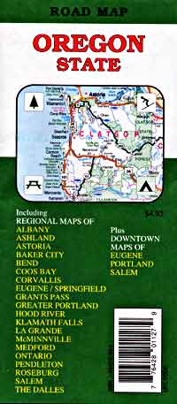
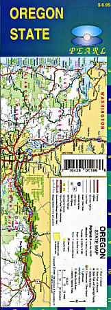
Item Code : RAND12220
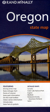
 Scale 1:1,100,000. Size 26"x37". Rand McNally edition.
 - $16.95
Item Code : NATL12221
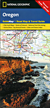
 Scale 1:1,300,000. Size 18"x25". National Geographic edition. The front side is an easy-to-read road map with insets of: Eugene. The back includes: Maps and information for Portland and Salem; Information for Crate Lake National Park; Points of interest; Scenic drive; National Park Service sites in Oregon.
 - $17.95
Item Code : ITMB4227
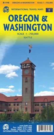
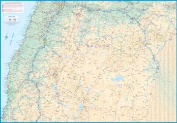
Scale 1:750,000. Size 27"x39". International Travel Maps edition.
This map has two covers, so could either be marketed and Washington and Oregon or the reverse. As we have another title called Washington and SE BC, we prefer to use Oregon & Washington to identify this title.
The two states constitute the bulk of what is known as the Pacific Northwest (Idaho is usually included, but not on this map). Side one consists of Washington State, along with an inset map of central Seattle, and small portions of Oregon and British Columbia. Side two is a detailed map of Oregon State (no room for insets) and a portion of northern California.
As with all ITMB maps, road quality is shown, highways are numbered, wilderness campsites noted, Amtrak lines shown, higher education institutes portrayed, airports, border crossings, hot springs, golf courses, parks, points of interest, and even isolated examples of gas stations are all shown. This is the latest map of our growing range of USA titles to be released. We’re mapping America, one portion at a time!
- $14.95
Item Code : GMJO12222
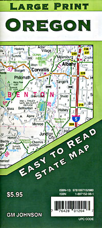
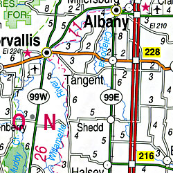 Scale 1:410,000. Size 27"x39". G.M. Johnson edition.
 - $14.95
Item Code : GMJO12223
 Scale 1:951,000. Size 22"x34". G.M. Johnson edition.
 - $10.95
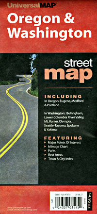
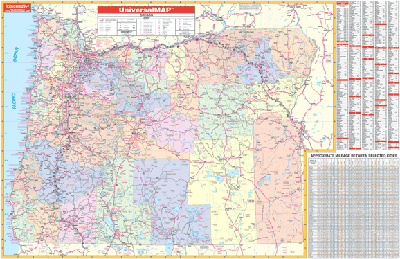
Item Code : UNIV12224
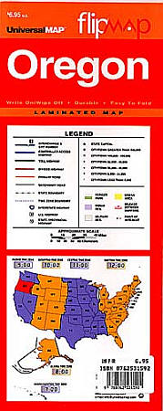
 Scale 1:2,500,000. Size 11"x24". Universal Map edition. Laminated.
 - $14.95
Item Code : GMJO12225
 Scale 1:1,250,000. Size 11"x24?". G.M. Johnson edition. Laminated.
 - $10.95
Item Code : UNIV12226
 "Various Scales". Size 24"x36". Universal Map edition.
 - $14.95
Item Code : BENC12241
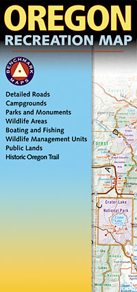
 Scale 1:750,000. Size 27"x34". Benchmark Maps edition.
 - $10.95
Item Code : GPAC12242
 "Various scales. Size 27"x36". Great Pacific Recreation Maps edition.
 - $10.95
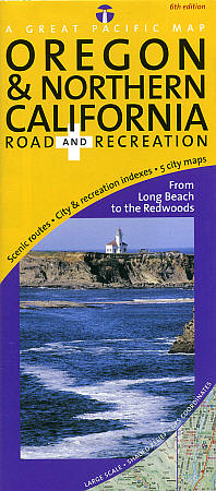
Item Code : GPAC12243
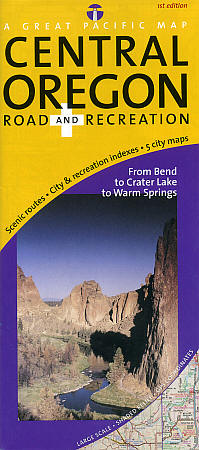
 Scale 1:250,000. Size 27"x36". Great Pacific Recreation Maps edition.
 - $14.95
Item Code : GMJO12247
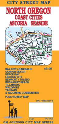
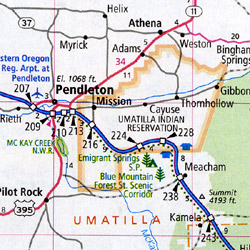
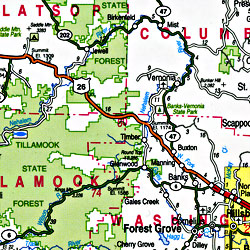
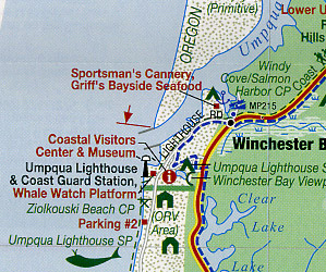
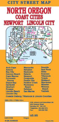 Scale 1:32,000. Size 27"x20". G.M. Johnson edition. This Map Coverage Area are Tillamook, Waldport, Yachats, Cannon Beach, Depoe Bay, Seaside, Astoria, Warrenton, Bay City, Garibaldi, Lincoln City, Newport, Toledo, Arch Cape, Cape Meares, Neskowin, Netarts, Oceanside, Pacific City, Panther Creek, Salishan, San Marine, Svensen, Gearhart, Knappa, Lincoln Beach, Manzanita, Nehalem, Wheeler, Siletz, Coronado Shores, Rockaway Beach, Winema Beach, Coastal Clatsop Tillamook & Lincoln Counties.
 - $14.95
Item Code : GMJO12248
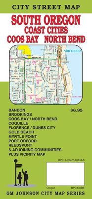
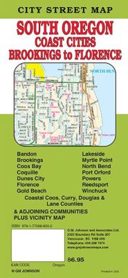 Scale 1:32,000. Size 27"x39". G.M. Johnson edition. This Map Coverage Area are Bandon, Brookings, Coquille, Gold Beach, Myrtle Point, Port Orford, Reedsport, Coos Bay, North Bend, Dunes City, Florence, Lakeside, Powers, Winchuck, Coastal Coos Curry Douglas & Lane Counties.
 - $27.95 + $7.50 p & h or $28.50 foreign delivery
Item Code : DELR12230
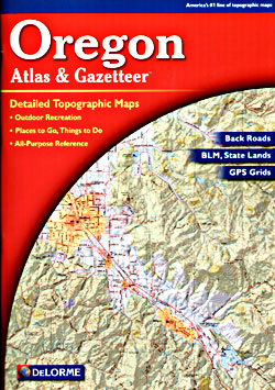
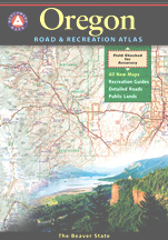
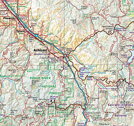
 Scale 1:150,000. Full size 11"x15?". 88 pages. Softcover. DeLorme Publishers edition.Designed for those who want to get off the beaten path, this atlas shows all types of roads and tracks, cities, towns, hamlets, and provides topographic maps that show hiking trails, campgrounds, fishing spots, ski areas, and more. Contains a guide to state and national parks and recreation areas, historic sites, and unique natural areas. Comprehensive index enables the user to find locations quickly and easily. Great for car or backpack! Saddle-stitched, durable laminated paper cover.
 - $29.95 + $7.50 p&h or $28.80 foreign delivery
Item Code : BENC12231
 Scale 1:250,000. Size 11"x16". 112 pages. Indexed. Benchmark Maps edition. Spectacular shaded relief cartography. Lots of wonderful information for recreation and outdoors enjoyment. This atlas is designed for for people who need an authoritative reference to the natural beauty, culture, and history of the American West. Nowhere else will the camper, boater, traveler, or armchair explorer find a more comprehensive guide and travel companion. At the heart of this atlas are the richly detailed Landscape Maps?, compiled by skilled cartographers using the latest digital technologies. They are simply the clearest, the most beautiful, and the most up to date of any now published. Much more than a collection of maps. these maps are so three-dimensional you can feel every bump in the road as well as every foothill, mountain and fault; plus more listings and a complete and seemingly infallible index." Every atlas contains a wealth of factual information, including locations, web sites, hours, and phone numbers for campgrounds, natural wonders, museums, historic sites, and more. We go to the trouble to field check and verify our data, then organize it for convenience and intuitive ease of use. Benchmark's leadership status in state atlas publishing is your assurance that you'll find cartographic and editorial excellence within our covers.
 - $259.00 Shipped rolled in a tube + $24.80 p&h
Item Code : RAND12233
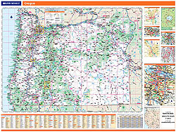
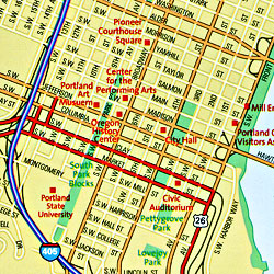
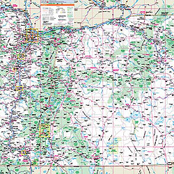 Scale 1:596,000. Size 46"x60". Rand McNally edition. Laminated. Professional Grade. Rand McNally's regional wall map of Oregon is ideal for anyone needing a comprehensive representation of the area for planning, routing, or reference. It's a great choice for business and sales strategy, urban development, social work outreach, education, and marketing. Oregon residents, businesses, and government offices are sure to find this wonderful reference tool irreplaceable. ?The laminated wall map is printed with UV-resistant ink to help prevent color fading. ?Map details include state highways, federal highways, county highways, county boundaries, city shading, cities and towns, major waterways, state/national parks, campsites, exit numbers, rest areas, military installations, airports, golf courses, universities, and much more. ?You'll also find a city/county index on the map, Rand McNally Express Access Codes for more information online, and a driving times map between major cities in the region. ?This truly complete wall map even includes a hanging kit with rails for easy mounting just about anywhere. Inset maps include: Corvallis; Eugene/Springfield; Medford; Portland & Vicinity; Downtown Portland; Salem; and Crater Lake National Park.
 - $249.95 + $24.80 p&h (add $40 for spring rollers)
Item Code : UNIV12234
 Scale 1:850,000. Size 64" W x 44" H. Laminated. Printed in color with a markable and washable laminated surface. Cities and counties are indexed on the face of the map. Includes rails on top and bottom for ease in hanging. Features color-coded counties and a mileage chart between major cities. Includes all state and federal highways, secondary roads, cities and towns, major airports, major waterways, state universities, military installations, county populations, state and national parks, points of interest, and ski areas. Railed wall maps can be turned into pull down maps on spring rollers for an additional $40.
 - $10.95
Item Code : RAND12249
 Scale 1:34,000. Size 28"x39". Rand McNally edition.
 - $14.95
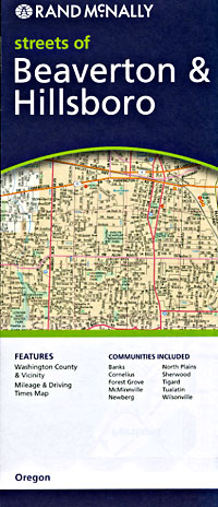
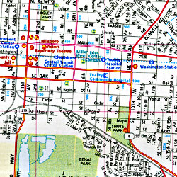
Item Code : GMJO12250
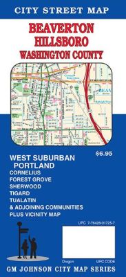
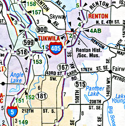
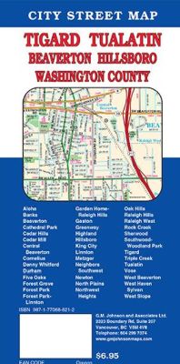 Scale 1:29,000. Size 27"x39". G.M. Johnson edition. This Map Coverage Area are Beaverton, Hillsboro, Tigard, Tualatin, Forest Grove, Cornelius, Sherwood, West Suburban, Portland, Tigard Tualatin, Washington County.
 - $14.95
Item Code : GMJO12251
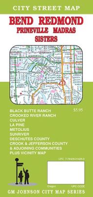
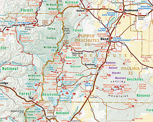
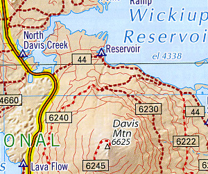
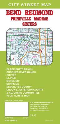 Scale 1:32,000. Size 27"x39". G.M. Johnson edition. This Map Coverage Area are Bend, Redmond, Prineville Madras, Sisters, Black Butte Ranch, Crooked River Ranch, Culver, La Pine, Metolius, Sunriver, Deschutes County, Crook County, Jefferson County.
|
Oregon Road Maps |
