
|
Ontario Road Maps |
Ontario
- $14.95
Item Code : GMJO8703
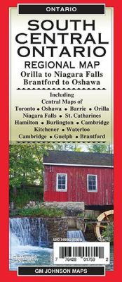
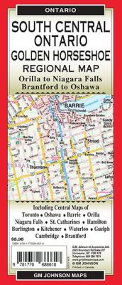 Scale 1:250,000. Size 27"x39". G.M. Johnson edition. This Map Coverage Area are South Central Ontario, Central Toronto, Oshawa, Barrie, Orillia, Niagara Falls, St.Catharines, Hamilton, Burlington, Kitchener, Waterloo, Cambridge, Guelph, Brantford.
 - $14.95
Item Code : GMJO7714
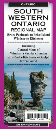
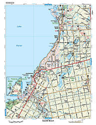
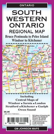 Scale 1:25,000. Size 27"x39". G.M. Johnson edition. This Map Coverage Area are South Western Ontario, Pelee Island, West Central Ontario, Central Windsor, Central Sarnia, Central London, Central Stratford, Central Kitchener, Central Guelph, Central Owen Sound.
 - $14.95
Item Code : GMJO8889
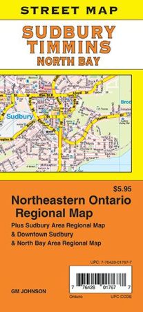
 Scale 1:25,000. Size 27"x39". G.M. Johnson edition. This Map Coverage Area are Adamsdale, Cache Bay, Callander, Copper Cliff, East Ferris, Lo-Ellen, Minnow Lake, New Sudbury, Nickeldale, North Bay, Sturgeon Falls, Sudbury, Timmins, West Nipissing, Northeastern Ontario Regional, Sudbury Area Regional, Downtown Sudbury, North Bay Area Regional Map.
 - $14.95
Item Code : GMJO7782
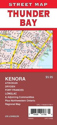
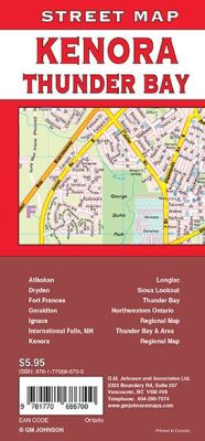 Scale 1:25,000. Size 27"x39". G.M. Johnson edition. This Map Coverage Area are Atikokan, Dryden, Fort Frances, Geraldton, Ignace, International Falls MN, Kenora, Longlac, Sioux Lookout, Thunder Bay, Northwestern Ontario Regional Map, Thunder Bay & Area Regional Map.
 - $14.95
Item Code : GMJO8880
Scale 1:31,000. Size 27"x39". G.M. Johnson edition. This Map Coverage Area are Toronto, East York, Etobicoke, North York, Scarborough, Downtown Toronto Map. - $14.95
Item Code : GMJO5557
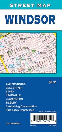
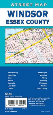 Scale 1:25,000. Size 27"x39". G.M. Johnson edition. This Map Coverage Area Amherstburg, Belle River, Essex, Harrow, Kingsville, Lakeshore, LaSalle, Leamington, Tecumseh, Tilbury, Wheatley, Willowood, Windsor, Essex County.
 - $17.95
Item Code : ITMB10401
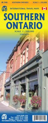 Scale 1:550,000. International Travel Maps edition. The Canadian province of Ontario is intimidatingly large. It is also mostly tundra with extremely few settlements and few roads; in fact, the geographic center of Ontario is about 1,500 kms north of the nearest road. The very first map I prepared, at age 10, was of Ontario; and it took me six weeks to trace all the lakes. My point is that the developed portion of the province is a much smaller wedge of fertile ground south of the mineral belt of the Great Canadian Shield. This double sided map focuses on the area south of Sudbury and North Bay and expands the scale to a much more useful purpose for most users. Imagine Detroit in the southwest corner of the map, with Highway 401 joining it to London and Toronto and a branch motorway cutting across to Buffalo. Add in the Bruce Peninsula and the major routes north to cottage country and you have side one. The other side stretches from Toronto east to the Quebec border and Ottawa, with the lovely Kawarthas region for exploring. My personal favourite highway is number 7, from Peterborough east through land settled two hundred years ago by Scottish Gaels. Perth is a perfectly preserved Scottish town of granite buildings. The map also includes a regional map of the main roads in the greater Toronto area and a separate inset of the downtown.
 - $12.95
Item Code : MART12184
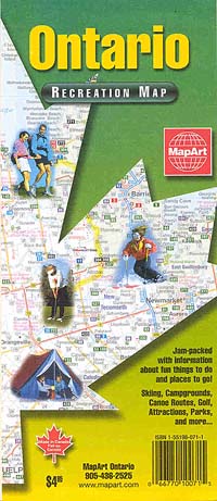
 Scale 1:862,000. Size 20"x26". MapArt edition.
 - $12.95
Item Code : MART12185
 Scale 1:1,725,000. Size 27"x40". MapArt edition.
 - $14.95
Item Code : GMJO7898
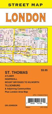
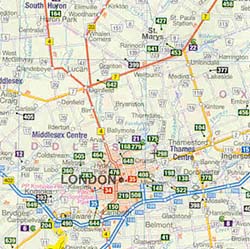
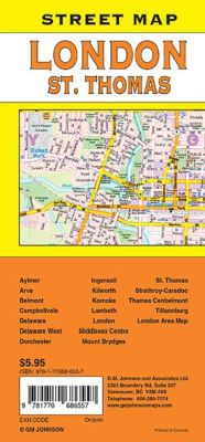 Scale 1:31,000. Size 27"x39". G.M. Johnson edition. This Map Coverage Area are Aylmer, Arva, Belmont, Campbellvale, Delaware, Delaware West, Dorchester, Ingersoll, Kilworth, Komoka, Lambeth, London, Middlesex Centre, Mount Brydges, St. Thomas, Strathroy-Caradoc, Thames Cenbelmont, Tillsonburg, London Area Map.
 - $17.95
Item Code : ITMB10410
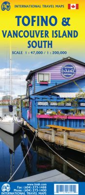
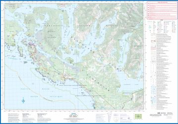
Scale 1:47,000/200,000. Size 27"x39". International Travel Maps edition.
Vancouver Island is one of the marvels of tourism in Canada. It is, in fact, so big that it needs to be explored in sections to reach its full potential. Tofino is the westernmost town on the island and is home to the great pacific fleet of fishing boats. It is also the westernmost leg of the ten thousand kilometre-long Trans-Canada Highway, and the beginning of the Trans-Canada National Hiking Trail.
Side 1 concentrates on the immediate surrounds of Tofino, Seven-Mile Beach, and Kennedy Lake.
Side 2 covers the southern half of the large island, from Victoria north to Courtenay, and includes the Broken Islands region off the west coast, the West Coast Hiking Trail. Cathedral Grove old growth forest, the Gulf Islands, and all the ferry connections with Vancouver and various islands, as well as all the Backroads, logging roads that are the main way to explore the interior of wonderful Vancouver Island.
- $12.95
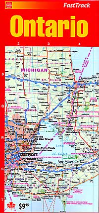
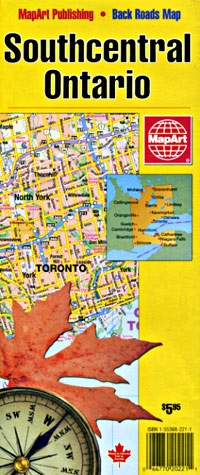
Item Code : MART12186
 Scale 1:250,000. Size 27"x40". MapArt edition.
 -
- $12.95
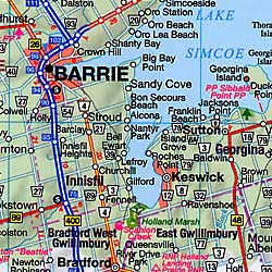
Item Code : MART12187
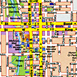 Scale 1:250,000. Size 27"x40". MapArt edition.
 - $28.95 + $7.80 p&h or $36.80 foreign delivery
Item Code : MART12188
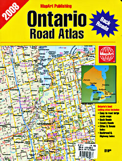
 Scale 1:250,000. Size 8"x11". 131 pages. MapArt edition. The Ontario Atlas allows you to see all the names and numbers of the Provinces backroads and Highways. Ideal for the weekend Cottager business person on the go.
 - $36.95 + $6.80 p&h or $16.80 foreign delivery
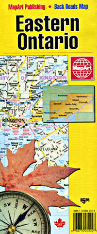
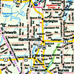
Item Code : MSIO12194
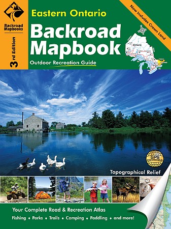
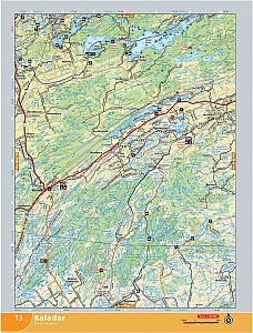
 Size 8?"x11". 112 pages. Mussio Ventures Ltd edition. Welcome to the Third Edition of the Eastern Ontario Backroad Mapbook. Inside this guidebook is the most comprehensive outdoor recreation resource available for the eastern part of Ontario. Eastern Ontario has long been referred to as a hidden gem of outdoor recreation in this province. From the rugged hills of the Canadian Shield and Madawaska Highlands to the low-lying rivers of the Ottawa Valley and St Lawrence Lowlands, the area holds a lifetime worth of outdoor fun just waiting to be discovered. For those looking to get away from it all, it is not all that difficult to find seclusion in Eastern Ontario. There is a well-established series of trail systems, canoe routes and winter routes that link the major urban centres and smaller towns to the freedom of the outdoors. From here, the scenic vistas, peaceful solitude and abundance of wildlife and wilderness can be appreciated.
 - $20.95 + $5.80 p&h or $14.80 foreign delivery
Item Code : MSIO12195
 Scale 1:130,000. Size 8?"x11". 75 pages. Mussio Ventures Ltd edition.
 - $36.95 + $6.80 p&h or $18.80 foreign delivery
Item Code : MSIO12196
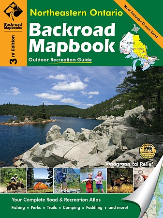
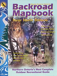
 Size 8?"x11". 166 pages. Mussio Ventures Ltd edition. Welcome to the third edition of the Northastern Ontario Backroad Mapbook. There have been many great changes to this book including an expanded Hunting section that provides information on each Wildlife Management Unit, more Backroad Attractions and updated Fishing and stocking information. The maps have also seen a lot of new road systems and trails added. Northeastern Ontario is a sprawling area that encompasses the Canadian Shield, a beautiful area made up of granite rocks, boreal forest, and thousands of lakes. The shield landscape is typical of the area around North Bay. Near Lake Temiskaming, the rocky landscape gives way to the flatter clay belt lands that typify the Tri-City area. Towards the northwest is the rolling Lake Superior region, marking some of the most scenic terrain in the province. And in the far north, the Canadian Shield gives way to the James Bay lowlands, and finally, Hudson Bay.
 - $36.95 + $6.80 p&h or $18.80 foreign delivery
Item Code : MSIO12197
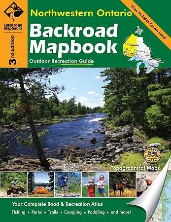
 Size 8?"x11". 166 pages. Mussio Ventures Ltd edition. Welcome to the third edition of the Backroad Mapbook for Northwestern Ontario! There have been many improvements to the maps and writing in this addition. We have added thousands of kilometres of new roads, expanded on the trail networks and enhanced the recreational symbols throughout. The writing has also seen significant work with more details on hunting, more fishing locations and new ATV and Snowmobile sections to name a few. Now visitors to the north can travel the whole area with confidence in a good map and countless recreational opportunities to explore. As you travel west from Lake Nipigon, the landscape passes through canyon country. This is an area marked by sheer cliffs and rugged topography. Further west, the land transforms into the picturesque territory of the Canadian Shield that is characterized by granite rocks, boreal forest and thousands of lakes. Near the Manitoba border, the rocky landscape gives way to the flatter prairie lands that typify the eastern plains.
 - $36.95 + $6.80 p&h or $18.80 foreign delivery
Item Code : MSIO12198
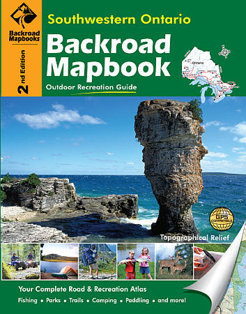
 Size 8?"x11". 144 pages. Mussio Ventures Ltd edition. Welcome to the Second Edition of the Backroad Mapbook for Southwestern Ontario! Inside this guidebook, those with a taste for adventure will find the most comprehensive outdoor recreation resource available for Southwestern Ontario. The second edition of this mapbook has been expanded and now covers the Greater Toronto area along with the famed Golden Horseshoe region and the ever popular Bruce Peninsula. Readers will also find some impressive changes to the maps including the addition of relief topography and coloured road systems. Not only do the maps look better, they are also much easier to read and things like the impressive network of trails and parks in Southwestern Ontario really stand out now. Surprising to some, Southwestern Ontario offers a lifetime of outdoor activities to discover. In recent years there has been a real push to establish quality outdoor recreation opportunities and the area now boasts the largest established trail network in the province. Trails, like the famous Bruce Trail and the Waterfront Trail, have helped make Southwestern Ontario the destination of choice for many trail lovers from all corners of the province. Adding to the incredible trail network is the push towards conservation. As a result, the region has established hundreds of public parks and conservation areas. These places have been put aside for all to enjoy, encompassing all sorts of year round activities and green spaces for the general public. From the lush marshlands of Rondeau Provincial Park to the unique rock formations found in Bruce Peninsula National Park there are some truly amazing destinations to explore.
|
Ontario Road Maps |
