
|
Oahu Road Maps |
Oahu
- $17.95
Item Code : NELS12019
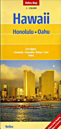
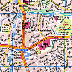 Scale 1:150,000. Size 20"x40". Includes an inset city street plan of Honolulu. Nelles Verlag edition. This is an excellent travel map. Description: Road and travel map of Oahu, featuring parks, preserves, natural areas, beaches and points of interest. Honolulu (1:35,000), Downtown Honolulu (1:15,000). Waikiki (1:15,000). La'ie (1:35,000). Kane'ohe, Kailua (1:35,000).
 - $12.95
Item Code : FRKO12020
 Scale 1:175,000. Size 14"x21". Franko maps edition. Laminated.
 - $17.95
Item Code : ITMB4709
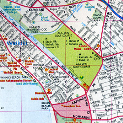
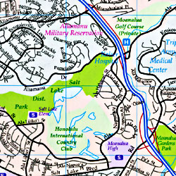
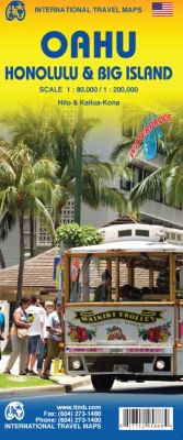 Scale 1:200,000/1:80,000. Size 27"x39". International Travel Maps edition. This is our second title on the State of Hawaii, concentrating on the southern, and most popular section in better detail than would be possible on a map of the entire state. The largest island is Big Island, where active volcanoes erupt fairly regularly and lava flow are common. I remember standing on the main coastal highway, which was blocked at the time by lava flow. Standing within a couple of feet of an active flowing river of red hot lava was an amazing experience. The other major island on this map is Oahu (We have chosen to ignore the '). This is the most popular island in the state, having Honolulu 1:35,000), Waikiki and Pearl Harbour, along with such attractions as the Dole Pineapple Plantation. The map has an excellent map of all of Honolulu, plus smaller insets of Kailua-Kona (1:30,000 scale) and Hilo (1:30.000).
 - $12.95
Item Code : FRKO12021
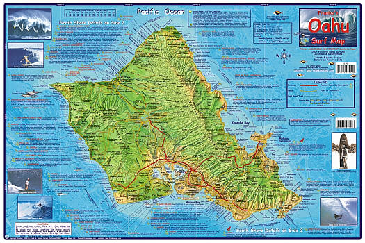
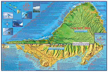 "Various scales". Size 14"x21". Franko maps edition. Laminated.
 - $13.95
Item Code : FRKO12022
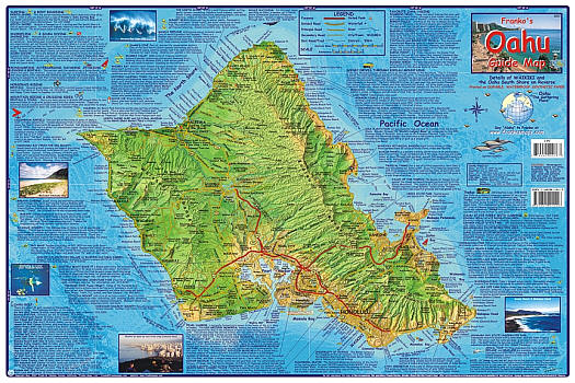
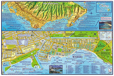
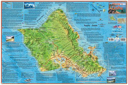
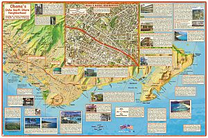
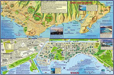 "Various scales". Size 14"x21". Franko maps edition. Laminated. Guide map of Waikiki and Oahu, with things to see and do, including information for scuba divers, snorkelers, kayakers, hikers, bicyclists, boaters, surfers, tourists, and others who love Waikiki. Side 1 is a beautiful shaded relief map of Oahu, designed to show just what Oahu has to offer to the explorer. Dozens of Oahu's most wonderful things to do are described and located. It is, in effect, a big checklist. Notable sites include the Arizona Memorial, the Polynesian Cultural Center, and Bishop Museum. Activities such as camping, bicycling, touring, surfing, and even hang gliding are explained. Oahu is fascinating and there is much to do, and this map is a perfect guide to get you going. Side 2 shows Waikiki with all of its intricate streets, sites, beaches, hotels, and shopping. Because getting in and out of Waikiki can be convoluted, a detail of the Oahu South shore is added, which will get you from Waikiki to Diamond Head, Hanauma Bay, and on around to the windward side of the island, as well as over to the Aloha Tower, Iolani Palace, Ala Moana Shopping Center, and other places that you'll want to go. The map locates 90 hotels, and serves as a perfect walking guide in and around the heart of Waikiki. Popular shopping areas include the International Market Place, Royal Hawaiian Shopping Center, DFS Galleria, Kings Village, Waikiki Bazaar, Eaton Square, Rainbow Bazaar, and the Ward Village shops. The map, with its beautiful colors is not just a useful tool, but makes a great and lasting souvenir.
 - $14.95
Item Code : FRKO12025
 "Various scales". Size 20"x40". Franko maps edition. Laminated.
 - $10.95
Item Code : FRKO12026
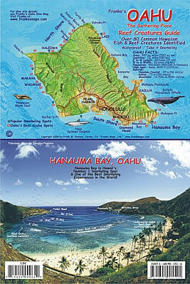
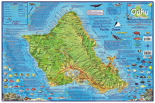
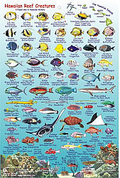 Size 6"x9". Franko maps edition. Laminated. Side 1 shows a mini-map of Oahu with a few of its best diving and snorkeling spots located, most notably Hanauma Bay. The map is a scaled-down version of Franko's Map of Oahu, showing the islands lovely shape and green mountains, and the beautiful surrounding Pacific Ocean. A humpback whale, spinner dolphin, and Hawaiian monk seal are depicted on the map. Oahus main towns, Pearl Harbor and its highways and freeways can be seen. Below the beautiful mini-map is a fabulous photo of Oahus most popular snorkeling destination, Hanauma Bay. There is nowhere else on earth that is snorkeled by so many. Just beyond the reef line, which can easily be seen in the photo, the snorkeling just gets better and better. There might be 2000 visitors at any time in the shallows, but out where it is 12 to 18 feet deep there will usually be no one else out there with you. Visibility might reach 80 feet or more. I just had to put it on the fish card to represent the truly fabulous underwater Oahu. Side 2 shows the wonderful reef life of Oahu. Oahu has such great snorkeling and scuba diving that it must have its own quality fish card. This is it! This picture of Oahus fish is the result of personal inspiration, as Franko has snorkeled and scuba dived all around Oahu, and especially at Hanauma Bay. The fish card, which measure 6" x 9", is printed on plastic and then laminated so that it is stiff, shiny and waterproof. It has a hole for a lanyard, so you can actually take it diving or snorkeling. I've used a thick rubber band as an effective lanyard for mine. The reef creatures depicted on these cards are taken from my own artwork on Franko's Map of Oahu. The fish shown include over 80 species, including a dozen or so that are found nowhere else on earth. The Hawaiian fish shown are selected from about 435 species that exist in Hawaii, and are based on Franko's personal exploration.
 - $10.95
Item Code : FRKO12027
 Size 16?"x25?". Franko maps edition. Obama calls Oahu his home town, he lived in Oahu with his mother and Grand parents. And now that he is one of the greatest superstars in the World tourinst want to locate his home, schools, hangout places and favorite beaches and making out places. This waterproof and tear resistant map will guide tourists to the right places.
 - $17.95
Item Code : NELS12029
Nelles Verlag edition. Please see the description above. - $12.95
Item Code : FRKO8796
 "Various scales". Size 14"x21". Franko maps edition. Laminated.
 - $10.95
Item Code : UNIV12030
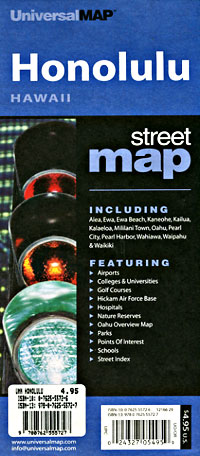
 Scale 1:35,000. Size 25"x36". Universal Map edition.
 - $10.95
Item Code : RAND12031
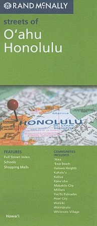
 Scale 1:38,000. Size 28"x40". Rand McNally edition. City street map.
 - $17.95
Item Code : ITMB22734
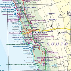 Scale 1:150,000/1:135,000. Size 27"x39". International Travel Maps edition. This Hawaii map is an excellent accompaniment for a trip to Americas vacation treasure. It is an excellent map of the island of Oahu, the main destination for visitors, along with a very good street map of Honolulu with expanded insets for the Waikiki and Pearl City areas. On the other side is a detailed map of the state, showing each island. There are several inset maps of various urban areas on different islands.
 - $10.95
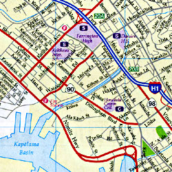
Item Code : UNIV12032
 Scale 1:35,000. Size 23"x26". Universal Map edition. Laminated.
 - $12.95
Item Code : FRKO20413
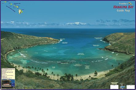
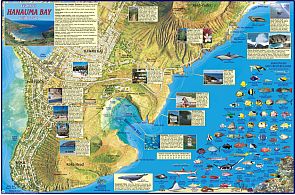 Size 14"x21". Franko maps edition. Laminated. Side 1 is a beautiful panoramic photo map of Hanauma Bay, Oahu, Hawaii. Side 2 is a dramatic releif map that includes Hanauma Bay, Koko Head and Koko Crater. It offers information on the Nature Preserve and points of interest. More than 50 species of Hanauma Bay reef creatures are colorfully illustrated and named. The map is printed on durable, waterproof material.
 - $10.95
Item Code : PHER22729
Scale 1:110,000. Phears Hawaii Maps edition. - $10.95
Item Code : UHAW12023
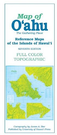 University of Hawaii Press edition. Features of the seventh edition of this full-color topographic map include detailed road networks, large-scale inset maps of towns and points of interest, hiking trails, parks, beaches, peaks, and ridges, with more than 2,200 place names.
|
Oahu Road Maps |
