
|
Norway Road Maps |
Norway
- $17.95
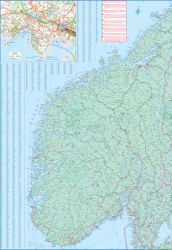
Item Code : ITMB11993
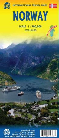
 Scale 1:650,000. Size 39"x52?". International Travel Maps edition. Indexed. English text and legends. Elevations and topographic features are shown by hypsometric color tints. Includes considerable useful travel information.
 - $17.95
Item Code : FREY11990
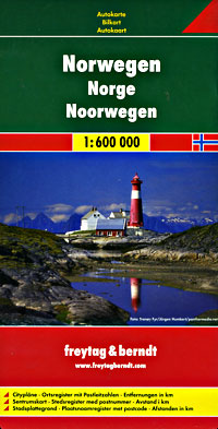
 Scale 1:600,000. Size 27"x40". Indexed. Freytag & Berndt edition. English and multilingual legends. Lots of useful travel information. Beautiful clear cartography.
 - $17.95
Item Code : MRCO20900
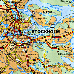
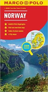 Scale 1:800,000. Marco Polo maps feature completely up-to-date, digitally generated mapping. The high quality cartography with distance indicators and scale converters aid route planning. The extensive coverage enables travellers to cross country boundaries with the same map. A fold-out overview map is ideal for route planning and 7 self-adhesive Marco Polo mark-it stickers can be used to pin-point a destination or route for future reference. Scenic routes and places of interest are highlighted - ideal for touring holidays. Contains 6 city maps: Kobenhavn, Malmo, Goteborg, Oslo, Stockholm and Trondheim. Comprehensive index.
 - $22.95
Item Code : HLWG11992
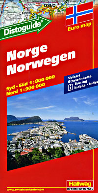
 Scale 1:900,000. Size 39"x55" (this is a big map!). Hallwag edition. Indexed. Includes the very useful "Distoguide" that tells you the distance between cities in a flash. English and multilingual legends.
 - $14.95
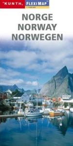
Item Code : KUNH20619
 Scale 1:800,000. Kunth Wolfgang Verlag edition.
 - $16.95
Item Code : KUNH20620
 Scale 1:1,000,000. Kunth Wolfgang Verlag edition.
 -
- $17.95
Item Code : ITMB8988
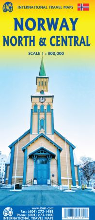
Scale 1:800,000. Size 27"x39". International Travel Maps edition.
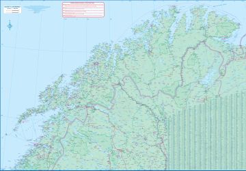
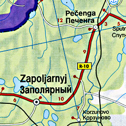
Norway is one of the more interesting countries in Europe for travellers, in that it has wide open spaces and unusual Arctic scenery, particularly in the north. Because it is a rather long and narrow country, trying to portray it adequately on a single sheet results in a lack of scale adequate for showing touristic attractions. This map covers the northern portion of the country, from Trondheim to Nordkapp and from the North Atlantic to the Russian border.
It also shows a portion of northern Sweden and a bit of Finland and Russia, but its focus is on roads, rail connections, airports, distance markers, parks, and touristic attractions in the region. Most noticeably, the rail lines leading to Trondheim and north to Bodo are clearly shown. Communities, sometimes fairly small, are included, as are ferries to outlying islands close to the coast. The reverse side shows the rail line to Narvik coming in from Sweden, and all roads and towns north to the Arctic Ocean and east to the Russian border. Border crossing to Sweden/Finland are not shown, as both countries are part of the EU, but crossings to Russia are shown, albeit closed at the moment.
- $17.95
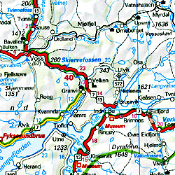
Item Code : ITMB1416
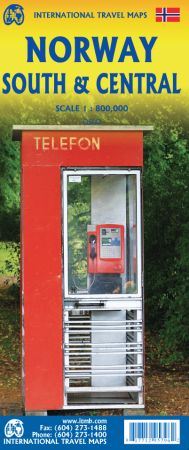
Scale 1:800,000. Size 27"x39". International Travel Maps edition.
ITMB recently published a detailed map of the northern half of Norway; now we are pleased to complete our coverage with a lovely, detailed rendition of southern and central Norway. Norway, being such a long country, suffers from an inability to be placed on a map sheet comfortably, so separating it into two double-sided maps provides the cartographer with the opportunity to portray the country at a much better scale than is possible with a map of the entire country.
This map starts in Narvik and travels south through Bodo to south of Trondheim on Side 1, showing all the roads and emphasizing the excellent rail connections. A little portion of neighbouring Sweden is shown as well. Side 2 concentrates on the southerly ‘bulge’ of Norway south to the country’s border with Sweden and west to the North Atlantic. A large inset map of Oslo, the capital, is included, as well as a list of Top attractions.
Again, both road and rail connections are shown. We try to show tunnels as well, of which there are many. Naturally, touristic sites are included, as well as a selection of camping sites. Longer distance hiking trails/cross-country ski routes are also included. The famous coastal routes of Norwegian ferries is also included, which is an excellent way to view the coastline between Stavanger and Bergen.
- $14.95
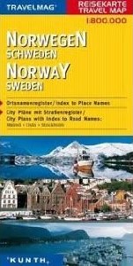
Item Code : KUNH20621
Scale 1:300,000. Kunth Wolfgang Verlag edition. - $16.95
Item Code : NATL21046
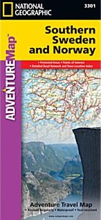
 Scale 1:975,000. Size 26"x38". National Geographic edition. National Geographic's Southern Sweden and Norway Adventure Map is designed to meet the unique needs of adventure travelers—detailed, durable, and accurate. Southern Sweden and Norway includes the locations of thousands of cities and towns with an index for easily locating them, plus a clearly marked road network complete with distances and designations for expressways, motorways, and more. Transportation within and beyond the country is made easier with the locations of airports, airfields, railroads, ferry routes, lighthouses, harbors, and international border checkpoints. What sets National Geographic Adventure Maps apart from traditional road maps are the hundreds of points of interest that highlight the diverse and unique destinations within Southern Sweden and Norway. World Heritage sites, museums, castles, archeological sites, churches, and more are included, making it invaluable to travelers hoping to experience all the history, art, and culture the region has to offer. National parks, winter sports resorts, and campsites are plentiful in both countries for those wishing to explore Southern Sweden and Norway’s picturesque mountains, extensive coastlines, fjords, and ancient forests. The northern half of the region is shown on the front side of the map spanning from the counties of Nordland to Hordaland in Norway and Norbotten to Kopparberg in Sweden. The reverse side of the map covers the southern portion of Norway from Bergen south to include the cities of Stavanger, Oslo, and Kristiansand. It also shows the southernmost section of Sweden from the city of Malmo on its border with Denmark north to Borlange. Popular places included on the map: Oslo, Rondane National Park, Bergen, Hardangervidda National Park, Stavanger, Folgefonna National Park, Trondheim, Borgefjell National Park, Lillehammer, Kristiansand, Stockholm, Malmo, Gotland, Oland, Tyresta National Park, Gothenburg, Uppsala, Skuleskogens National Park, Sanfjallet National Park.
 - $17.95
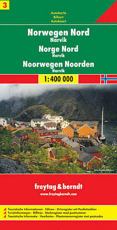
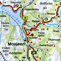
Item Code : FREY12005
 Scale 1:400,000. Size 38"x49".
 -
- $48.95 + $8.50 p & h or $36.50 foreign delivery
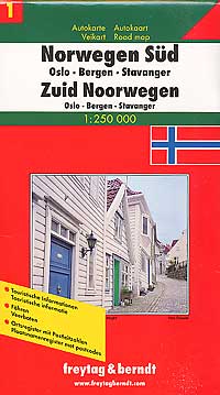
Item Code : FREY12001
 Scale 1:250,000 and 1:400,000. Size 8?"x12". Indexed. Freytag-Berndt edition. 464 pages (this is a big atlas). Spiral bound. Very detailed. English and multilingual legends.
 - $17.95
Item Code : MICH11998
 Includes Norway, Sweden, Denmark, and Finland. Scale 1:1,500,000. Size 40" across x 61" high. Michelin edition. This entire map is printed on one side. Would also make a great wall map!
 - $11.95
Item Code : CART11997
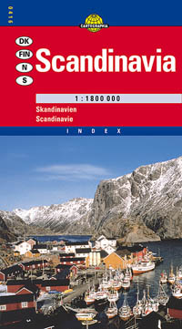
 Scale 1:1,800,000. Size 26"x38". Cartographia edition. Northern Scandinavia is shown at 1:3,000,000 scale.
 - $22.95
Item Code : KUMR11996
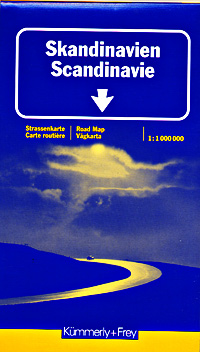
 Printed on both sides. Scale 1:1,000,000. Size 36"x45" (big map!). Kummerly + Frey edition. Large-scale. Very detailed.
 -
- $17.95
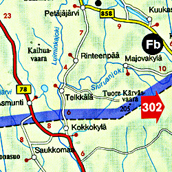
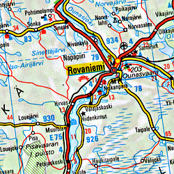
Item Code : FREY12003
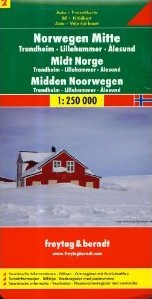
 Scale 1:250,000. Explore central Norway with this Freytag&Berndt double-sided road map. The best way to plan your trip, prepare your itinerary, and to travel independently in this region that covers Lillehammer, Nordfjordeid, Alesund, and Trondheim. Place name index in a booklet attached to the cover. Touristic information on the map: places of interest, castles and manor-houses, antique sites, monuments, religious buildings, golf-courses, spas, camp-grounds, youth hostels, museums, waterfalls, lighthouses, airports, marinas. The legend is in English, Norwegian, French, German, Italian, Spanish, Dutch, Hungarian, Slovak, and Czech.
 -

|
Norway Road Maps |
