
North Carolina Road Maps | Detailed Travel Tourist Driving
|
North Carolina Road Maps |
North Carolina
- $29.95
Item Code : NATL11879
 Scale 1:40,000 & 1:70,000. Size 26"x38". National Geographic edition.
 - $12.95
Item Code : ADCM11883
ADC edition - $12.95
Item Code : ADCM11884
ADC edition - $16.95
Item Code : NATL20996
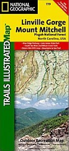
 Scale 1:65,000. Size 26"x38". National Geographic edition. This Trails Illustrated topographic map is the most comprehensive and complete recreational map for the Linville Gorge and Mt. Mitchell area of Pisgah National Forest in North Carolina. All trails, campsites, and recreational features are included. Highlights include: Pisgah National Forest; Grandfather and Appalachian Ranger Districts; Blue Ridge Parkway; Linville Gorge Wilderness area; Mount Mitchell State Park; Grandfather Mountain Biosphere Reserve; Wilson Creek Wild and Scenic River and much more. The towns of Black Mountain, Marion, Morganton, Linville and Burnsville are also included.
 - $17.95
Item Code : TRAL11885
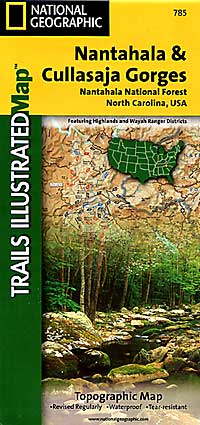
 Scale 1:70,000. Size 26"x38". Trails Illustrated edition. Printed on waterproof, tear-resistant, paper-like plastic. This Trails Illustrated topographic map is the most comprehensive recreational map for the Nantahala & Cullasaja Gorges area of North Carolina. Coverage includes: Nantahala National Forest - Nantahala & Cullasaja Gorges area; Ellicott Rock and Middle Prong Wilderness Areas; Blue Ridge Parkway; Chattooga Wild and Scenic River; towns of Franklin, Sylva, Highlands, and Cashiers.
 - $12.95
Item Code : ADCM11886
ADC edition. - $17.95
Item Code : TRAL11887
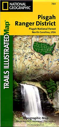
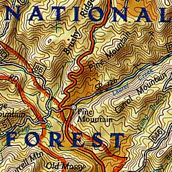
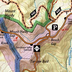 Scale 1:45,000. Size 26"x38". Trails Illustrated edition. Printed on waterproof, tear-resistant, paper-like plastic. This Trails Illustrated topographic map is the most comprehensive recreational map for North Carolina's Pisgah Ranger District area. Coverage includes Pisgah National Forest; Shining Rock and Middle Prong wilderness areas; Bent Creek Research and Demonstration Forest; North Carolina Arboretum; Blue Ridge Parkway; Mountains-to-Sea Trail; Looking Glass Rock; Cold Mountain; Sliding Rock and Mount Pisgah recreation areas; Looking Glass Falls; and the Cradle of Forestry in America National Historic Site.
|
North Carolina Road Maps |
My Wish List
Last Added Items
You have no items in your wish list.
