
|
~ New York State Road Maps ~ |
New York State
- $17.95
Item Code : ITMB4226
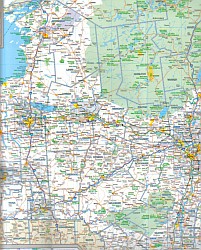
 Scale 1:800,000. Size 27"x39". International Travel Maps edition. ITMB expands its coverage of the USA with a detailed map of New York State and New England on a double-sided map at a very detailed scale. The one side covers most of the state and the southern portion of the New England states, along with an inset map of the greater NYC area, the other side covers from Boston and Cape cod to the northern extremes of Maine and west into Vermont, with inset maps of Boston and Boston Region. The reality of mapping the USA is that it is too large a country and too populous to be mapped in detail except by regions. As a sophisticated economy, it has thousands of towns and an intensive road/rail network. Most American mapping companies took the easy route and mapped one state at a time. As some states are relatively small, this resulted in a visitor needing to acquire dozens of maps to cover the extent of their visit. Our approach is to map the USA in logical regions. Eventually, all of the USA will be mapped; this map is a giant step forward in providing sensible mapping for a great country to visit.
 - $10.95
Item Code : UNIV11350
 Various Scales. Size 28"x40". Universal Map edition.
 - $16.95
Item Code : NATL11351
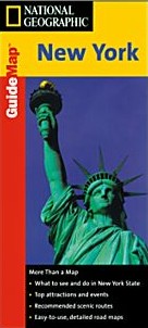
 Scale 1:1,000,000. Size 18"x25". National Geographic edition. The front side is an easy-to-read road map with insets of: Rochester; Syracuse; Utica; Binghamton; Albany/Schenectady/Troy. The back includes: Map and information for New York City and Buffalo/Niagara Falls; Points of interest; Scenic drives; Park Service sites for New York State.
 - $12.95
Item Code : JIMP11353
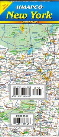
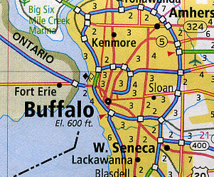
 Scale 1:1,100,000. Size 19"x25". Jimapco edition. Laminated, foldable road map of New York State. Includes inset maps of larger metro areas, with regional map of Hudson Valley to NYC Shows interstate rest stops, colleges, recreation areas and more. Fully indexed.
 - $10.95
Item Code : AMER11354
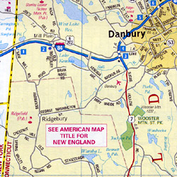 Scale 1:710,000. Size 24"x36". American Map Company edition.
 - $11.95
Item Code : RAND11355
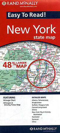
 Scale 1:539,000. Size 36"x45". Rand McNally edition.
 - $12.95
Item Code : JIMP11356
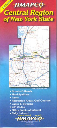
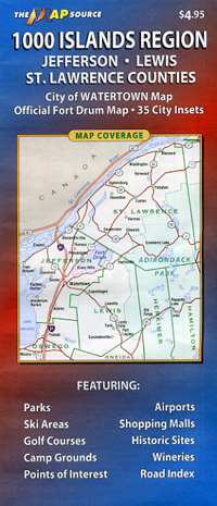
 Scale 1:270,000. Size 24"x37". Jimapco edition. Major routes from Binghamton to Massena; Little Falls to Auburn, including Syracuse area, Oneida, Utica, Rome, Ithaca, Oneonta, Watertown, Oswego, Auburn, and more.
 - $27.95 + $7.50 p&h or $28.50 foreign delivery
Item Code : DELR11362
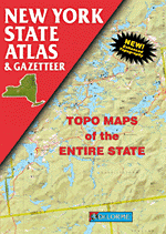
 Scale 1:150,000. Full size, 11"x15?". 104 pages. DeLorme Publishers edition. Designed for those who want to get off the beaten path, this atlas shows all types of roads and tracks, cities, towns, hamlets, and provides topographic maps that show hiking trails, campgrounds, fishing spots, ski areas, and more. Contains a guide to state and national parks and recreation areas, historic sites, and unique natural areas. Comprehensive index enables the user to find locations quickly and easily. Great for car or backpack! Saddle-stitched, durable laminated paper cover.
 - $17.95
Item Code : TRAL11371
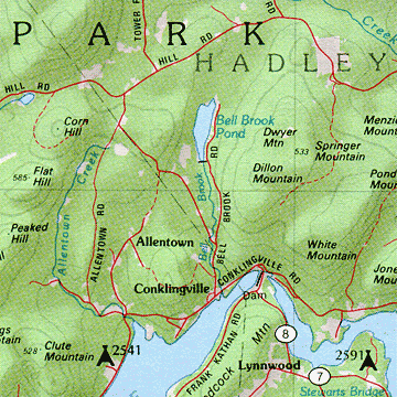
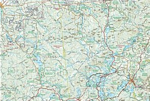
 Scale 1:75,000. Size 26"x38". Trails Illustrated edition. Printed on waterproof, tear-resistant, lightweight, paper-like plastic. This Trails Illustrated map, produced in cooperation with the Adirondack Mountain Club, includes comprehensive coverage of the Lake Placid/High Peaks region of New York's Adirondack Park. Includes UTM grids for use with your GPS unit and a trail mileage matrix. Coverage includes: Mt. Marcy, High Peaks, Dix Mountain, Jay Mountain and Sentinel Range Wilderness Areas; Adirondack Mountain Reserve; Hurricane Mountain Primitive Area; Vanderwhacker Mountain Wild Forest; and the Northville-Lake Placid Trail from Blue Mountain Wild Forest to Lake Placid. Also includes Ray Brook, Newcomb, Elizabethtown, and Keeseville.
 - $17.95
Item Code : TRAL11372
 Scale 1:75,000. Size 26"x38". Trails Illustrated edition. Printed on waterproof, tear-resistant, lightweight, paper-like plastic.
 - $17.95
Item Code : TRAL11373
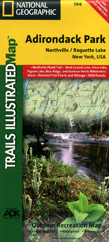
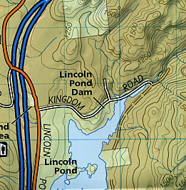
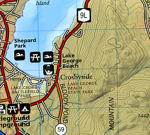
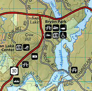 Scale 1:75,000. Size 26"x38". Trails Illustrated edition. Printed on waterproof, tear-resistant, lightweight, paper-like plastic. This Trails Illustrated map, produced in cooperation with the Adirondack Mountain Club, includes comprehensive coverage of the Northville and Raquette Lake areas of New York's Adirondack Park. All data is updated to reflect road closings, new trails, and campground relocation. Includes UTM grids for use with your GPS unit and a trail mileage matrix. Coverage includes: Siamese Ponds, Silver Lake, West Canada Lake, and Blue Ridge Wilderness Areas; Wilcox Lake, Shaker Mountain, Ferris Lake, Moose River Plains, Sargent Ponds, Blue Mountain, and Vanderwhacker Mountain Wild Forests; and the Northville-Lake Placid Trail from Northville to Blue Mountain Wild Forest. Also includes Mayfield, Speculator, Indian Lake, and North Creek.
 - $17.95
Item Code : TRAL11374
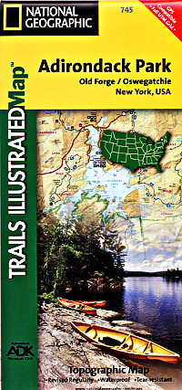
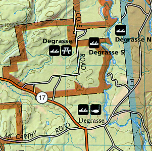
 Scale 1:75,000. Size 26"x38". Trails Illustrated edition. Printed on waterproof, tear-resistant, lightweight, paper-like plastic. This Trails Illustrated map, produced in cooperation with the Adirondack Mountain Club, includes comprehensive coverage of the Old Forge and Oswegatchie Trail areas of New York's Adirondack Park. Includes UTM grids for use with your GPS unit and a trail mileage matrix. Coverage includes Ha-de-ron-dah, Pigeon Lake, Pepperbox, and Five Ponds Wilderness Areas; Black River, Fulton Chain, Independence River, Watson's East Triangle, Aldrich Pond, Cranberry Lake, and Horseshoe Lake Wild Forests; Lake Lila Primitive Area; Little Tupper Lake, Inlet, Star Lake, and Tupper Lake.
 - $17.95
Item Code : TRAL11375
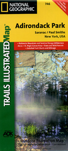
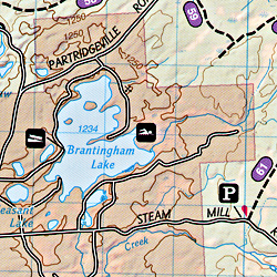
 Scale 1:75,000. Size 26"x38". Trails Illustrated edition. Printed on waterproof, tear-resistant, lightweight, paper-like plastic. This Trails Illustrated map, produced in cooperation with the Adirondack Mountain Club, includes comprehensive coverage of the Saranac and Paul Smiths areas of New York's Adirondack Park. Includes UTM grids for use with your GPS unit and a trail mileage matrix. Coverage includes McKenzie Mountain and Sentinel Range Wilderness Areas; Raquette Boreal, Whitehill, Saranac Lakes, Debar Mountain and Taylor Pond Wild Forests; Saint Regis Canoe Area; Saint Regis Falls, Lyon Mountain, and Au Sable Forks.
 - $10.95
Item Code : UNIV11384

 "Various scales". Size 18"x24". Universal Map edition.
 - $10.95
Item Code : MSOR11387
 "Various scales". Size 27"x39". Map Source edition.
 - $16.95
Item Code : NATL20995
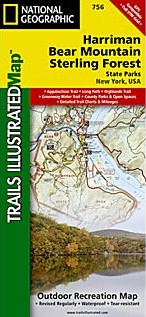
 Scale 1:25,000. Size 26"x38". National Geographic edition. National Geographic's recreational map of Harriman/Bear Mountain/Sterling Forest State Parks is a two-sided, waterproof map designed to meet the needs of outdoor enthusiasts with unmatched durability and detail. Loaded with valuable safety tips, guidelines for outdoor recreation, park contact information and more, the map also includes a UTM and Latitude/Longitude grid, as well as selected waypoints and a scale bar for easy and accurate navigation. The Appalachian Trail, Long Path Trail, and other national recreational trails wind through the region. Each trail is clearly indicated as is trail mileage, park and forest boundaries, parking areas, and access points. Trail use is noted for horseback riding, cross-country skiing, and biking. Whether RV camping or “roughing it,” campers will appreciate the inclusion of RV dump stations, group campsites, shelters, restrooms, and more. Year-round activities abound in the region and the location of scenic overlooks, lookout towers, downhill ski areas, boat rentals, fishing access points, and other points of interest make this map as highly functional as it is remarkably crafted. The front or south side of the map includes the southern portion of Harriman and Sterling Forest State Parks, stretching from the New Jersey border and the southern tip of the Ramapo Mountains north to Mombasha Lake and Lake Tiorati. The back of the map shows the northern half of the two parks and Bear Mountain State Park on the Hudson River.
 - $16.95
Item Code : NATL21012
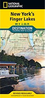
 Scale 1:235,000. Size 26"x38". National Geographic edition. National Geographic’s Finger Lakes Destination Map strikes the perfect balance between map and guidebook and is an ideal resource for touring this culturally and geographically unique region of New York State. The front includes a topographic map of the region and an inset about the town of Ithaca, home to Cornell University. The reverse has insets about history, geology, outdoor activities, and places to visit, including historic and cultural attractions as well as farms and wineries.
 - $16.95
Item Code : NATL21060
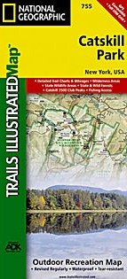
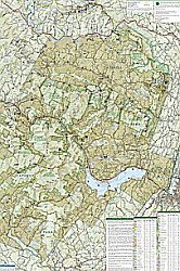 Scale 1:25,000. Size 26"x38". National Geographic edition. National Geographic's recreational map of Catskill Park is a two-sided, waterproof map designed to meet the needs of outdoor enthusiasts with unmatched durability and detail. This map was created in partnership with the Adirondack Mountain Club (ADK) which provided trail information from its Forest Preserve Series of trail guides. Loaded with valuable information about recreating in the park, the map also includes a UTM and Latitude/Longitude grid, as well as selected waypoints and a scale bar for easy and accurate navigation. Year-round activities abound in the park and the location of scenic viewpoints, boat launches and canoe carry downs, swimming areas, fishing access points, ski areas, and other points of interest are clearly marked as are park and forest boundaries. Campers will appreciate the attention paid to noting the variety of facilities available including primitive campsites, shelters, picnic areas, restrooms, parking, RV dump stations, and universal access areas for the handicapped. Whether driving the NY Scenic Byway, camping and hiking at Little Pond, or boating and fishing on the Ashokan Reservoir, these maps perform as highly functional travel tools that are as useful as they are remarkably crafted. The front of the Catskill Park map details the western half of the park from its tip near the Bear Spring Mountain Wildlife Management Area and Pepacton Reservoir to the western edge of Sundown Wild Forest and the Beaver Kill Range in the Big Indian Wilderness. The eastern half of the park appears on the back of the map and also includes Schoharie Reservoir and Ashland Pinnacle State Forest to the north stretching south to Rondout Reservoir and Vernooy Kill State Forest.
 - $29.95
Item Code : NATL21078
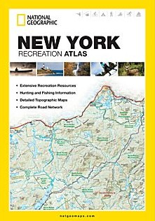
 Scale 1:150,000. Size 11"x15". National Geographic edition. National Geographic's New York Recreation Atlas is the ideal resource for any recreation activity from hunting and fishing to camping, golfing, hiking, and more. This durable, easy-to-use atlas includes up-to-date topographic maps, a comprehensive road network, informative recreation guides, and a detailed index. All road types are clearly identified, making each atlas a useful planning tool for motorcycle and off-road adventures. Maps include bold boundaries for parks and federal lands, and clearly labeled lakes, rivers, and streams. On each map page you will find a convenient map legend, easy-to-read page numbers, a latitude and longitude grid for use with GPS, and fact-checked points of interest. Also included are cross-referenced charts of fishing areas with species information, game management units, campgrounds and attractions charts, state park maps and facilities, hiking, golfing, skiing and paddling destinations, climate information, and more. Detailed topographic maps with shaded relief for the entire state Each labeled feature is up-to-date and verified by satellite image Comprehensive, easy-to-read road network Boundaries for parks and federal lands Clearly-labeled lakes, rivers and streams Durable laminated cover Robust travel and recreation information Cross-referenced chart of fishing areas with species information Game management units Campgrounds and attraction charts State Parks maps and facilities Hiking, golfing, skiing, and paddling destinations Climate information
 - $259.95 + $24.80 p&h
Item Code : RAND11363
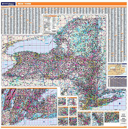 Scale 1:750,000. Size 60" W x 60" H. Laminated. Rand McNally's regional wall map of New York is ideal for anyone needing a comprehensive representation of the area for planning, routing, or reference. It's a great choice for business and sales strategy, urban development, social work outreach, education, and marketing. New York residents, businesses, and government offices are sure to find this wonderful reference tool irreplaceable. ?The laminated wall map is printed with UV-resistant ink to help prevent color fading. ?Map details include state highways, federal highways, county highways, county boundaries, city shading, cities and towns, major waterways, state/national parks, campsites, exit numbers, rest areas, military installations, airports, golf courses, universities, and much more. ?You'll also find a city/county index on the map, a mileage chart with 900 mileage pairs between 30 cities, and a driving times map between major cities in the region. ?This truly complete wall map even includes a hanging kit with rails for easy mounting just about anywhere. Inset maps include: Albany/Schenectady; Binghamton; Buffalo/Niagara Falls; Elmira; Central Long Island; New York & Vicinity; New York downtown; Rochester; Syracuse; Utica; and White Plains.
| Postage and handling is $3.50 for the first map and $1.50 for each additional map. ~ ~ ~ ~ ~ ~ Foreign delivery is $7.80 for the first map and $5.00 for each additional map. |
| ** Click here! to view our collection of New York State Travel VIDEOS ** |
|
~ New York State Road Maps ~ |
