
|
Nevada Road Maps |
Nevada
- $17.95
Item Code : ITMB20936
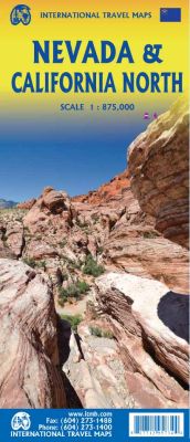
Scale 1:875,000. Size 27"x39". International Travel Maps edition.
The USA is one of the most challenging countries to map due to its strong identification with state boundaries. Last month, we introduced two new maps of Idaho and Montana; this month, we wish to introduce Nevada. As a state, Nevada is mostly desert-like and is lightly populated.
Its two major urban areas, Las Vegas and Reno, are extremely popular travel destinations. In addition, Nevada offers the Hoover Dam, one of the seven wonders of the modern world, a national park with 5,000-year-old pine trees, America’s second deepest lake (Tahoe), the eighth highest mountain peak in the USA, and the biggest air force bombing range in the world (Nellis). The map is double-sided, and covers northern California on the other side.
This includes such treasures as Death Valley, part of the Mojave Desert, Yosemite National Park, the beautiful sequoia trees in the far northeast corner, and man-made wonders such as the Golden Gate Bridge and Highway 1 along the Big Sur coastline. Nevada is a valuable addition to ITMB’s growing line of State maps; after all, it’s about the size of France!
- $10.95
Item Code : NORT11052
 Scale 1:1,500,000. Size 18"x28". North Star edition.
 - $10.95
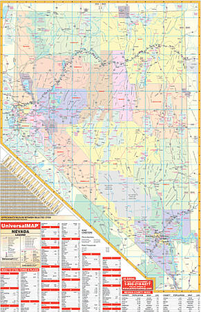
Item Code : UNIV11051
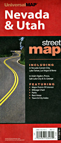
 Various Scales. Size 18"x27?". Universal Map edition.
 - $10.95
Item Code : UNIV11050
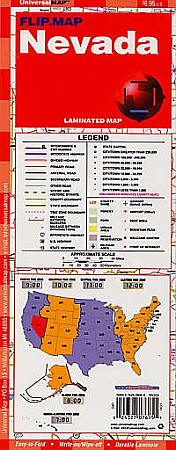
 Scale 1:2,250,000. Size 11"x24". Universal Map edition. Laminated.
 - $14.95
Item Code : GRTA22915
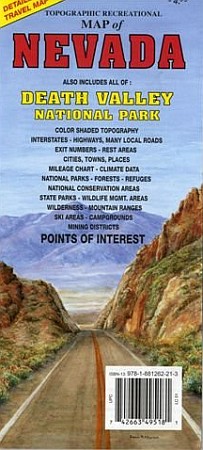
 GTR Mapping Company edition. Also includes all of Death Valley National Park. Detailed travel map - Interstates, most exit numbers, highways, many (not all) local roads. Topographic contours each 1,000 feet. Color shaded each 2,000 feet above 6,000 feet. Features include national forests, wilderness, campgrounds, parks, national conservation areas, wildlife refuges, state wildlife management areas, ski areas, mining districts, points of interest, and more.
 - $11.95
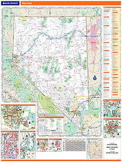
Item Code : RAND22917
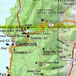
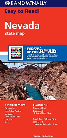 Rand McNally edition. The map has clearly labeled Interstate, U.S., state, and county highways; a mileage chart and a Mileages & Driving Times Map; indications of parks, points of interest, airports, county boundaries, and more; easy-to-use legend; and a detailed index. Detailed inset maps include: Carson City, Lake Mead National Recreation Area, Lake Tahoe Region, Las Vegas, Las Vegas Strip, Laughlin, and Reno.
 - $12.95
Item Code : BENC22916
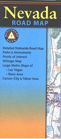
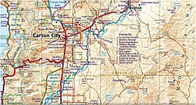
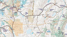 Scale 1:950,400. Benchmark Maps edition. Benchmark's Nevada Road Map is the ideal portable planning tool and GPS companion for fast statewide travel. It's the only Nevada road map that benefits from Benchmark's extensive field-checking, proven accuracy and cartographic excellence. Beautiful shaded-relief road map of Nevada is on one side including mileage chart and placename index. The reverse side shows the urban regions of Las Vegas, Reno, and Carson City & Tahoe.
 - $27.95 + $7.50 p&h or $28.80 foreign delivery
Item Code : BENC11059
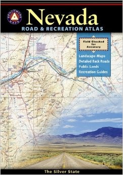
 Scale 1:280,000. Size 11"x16". 96 pages. Indexed. Benchmark Maps edition. Nevada is known as the wildest adventure state in the lower 48. Finally there's an atlas to fully corral all of Nevada's outdoor potential. Careful and thorough field checking and local research have made this atlas an essential resource for both town and country. The Recreation Guide features maps with hunting unit boundaries over public lands tints and emphasize historic trails and points of interest.
 - $27.95 + $7.50 p&h or $28.50 foreign delivery
Item Code : DELR11058
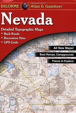
 Scale 1:1,000,500. Full size, 11"x15?". 72 pages. DeLorme edition. Designed for those who want to get off the beaten path, this atlas shows all types of roads and tracks, cities, towns, hamlets, and provides topographic maps that show hiking trails, campgrounds, fishing spots, ski areas, and more. Contains a guide to state and national parks and recreation areas, historic sites, and unique natural areas. Comprehensive index enables the user to find locations quickly and easily. Great for car or backpack! Saddle-stitched, durable laminated paper cover.
 - $259.00 Shipped rolled in a tube + $24.80 p&h or $64.80 foreign delivery
Item Code : RAND11055
 Scale 1:748,000. Size 46"x60". Rand McNally edition. Laminated. Professional Grade. Rand McNally's regional wall map of Nevada is ideal for anyone needing a comprehensive representation of the area for planning, routing, or reference. It's a great choice for business and sales strategy, urban development, social work outreach, education, and marketing. Nevada residents, businesses, and government offices are sure to find this wonderful reference tool irreplaceable. ?The laminated wall map is printed with UV-resistant ink to help prevent color fading. ?Map details include state highways, federal highways, county highways, county boundaries, city shading, cities and towns, major waterways, state/national parks, campsites, exit numbers, rest areas, military installations, airports, golf courses, universities, and much more. ?You'll also find a city/county index on the map, Rand McNally Express Access Codes for more information online, and a driving times map between major cities in the region. ?This truly complete wall map even includes a hanging kit with rails for easy mounting just about anywhere. Inset maps include: Las Vegas, Las Vegas Strip, Lake Mead Recreational Area, Carson City, Laughlin, Reno, and Lake Tahoe Region.
 - $249.95 + $24.80 p&h (add $40 for spring rollers)
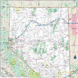
Item Code : UNIV11056
 Size 46" W x 64" H. Laminated. The Nevada Wall Map by Universal Map includes all state and federal highways, major waterways, military installations, state parks, major airports, state universities, cities, towns, wildlife areas, and assorted points of interest. Special features for this map are color-coded counties and a mileage chart between major cities. The map is protected with a laminate finish which is both markable and washable. This map is indexed on the face of the map. Framing rails are included on top and bottom for easy wall mounting. Railed wall maps can be turned into pull down maps on spring rollers for an additional $40.
 - $10.95
Item Code : SCAL11060
Southern California Automobile Association edition. Covers the most popular stretches of the Colorado River, from Lake Mead, Nevada, to Yuma, Arizona. Includes information on water sports, campgrounds, fishing, hunting, and golf. - $12.95
Item Code : EART11061
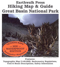
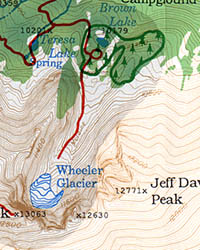 Scale 1:48,000. Size 18"x27". Earthwalk Press edition.
 - $12.95
Item Code : FRKO11062
 Size 18?"x26?". Franko maps edition. Laminated.
 - $16.95
Item Code : NATL20967
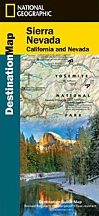
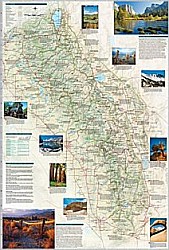 Scale 1:543,000. Size 26"x38". National Geographic edition. The newly redesigned National Geographic DestinationMaps series strikes the perfect balance between map and guidebook, and they are the ideal resource for touring culturally and geographically unique areas. All maps are double-sided with beautiful photos and detailed travel information, including comprehensive road networks, local information and natural, historical and cultural places of interest. The maps are printed on durable, waterproof, tear-resistant material that is lightweight and easily folded to fit in your pocket.
|
Nevada Road Maps |
