
Michigan Road Maps | Detailed Travel Tourist Drivig
|
Michigan Road Maps |
Michigan
- $259.00 Shipped rolled in a tube + $18.80 p&h
Item Code : RAND10526
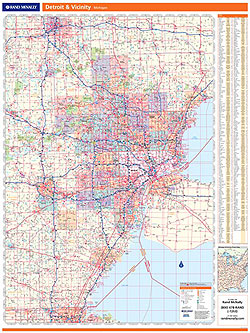
 Scale 1:114,000. Size 46"x60". Rand McNally edition. Laminated. Professional Grade.
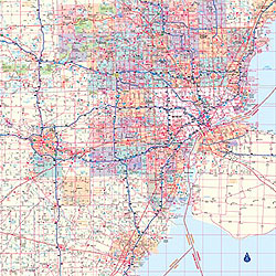
 - $249.95 + $24.80 p&h (add $40 for spring rollers)
Item Code : UNIV10527
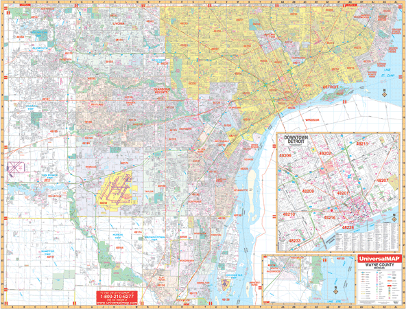 Size 70" W x 54" H. Laminated. The 3rd edition Detroit and Wayne County, Michigan and adjacent areas Wall Map by Universal Map. Up-to-date cartography in complete street detail including all new streets and changes. The map has been printed in color with a markable and washable laminated surface. Streets have been indexed in a separate book. Covers all of Wayne County with the following boundaries:North: Wayne County line-Oakland; South: Wayne County line-Monroe; East: Wayne County line-Ontario, Canada; West: Wayne County line-Washtenaw. Includes an inset map of downtown Detroit. The special features and data are as follows: all streets and highways, government buildings, airports, golf courses and country clubs, railroads, water features, ZIP codes and ZIP code boundaries, shopping centers, recreational parks, mileage circles, cemeteries, educational facilities, hospitals, post offices, city limits and annexations, fire and police stations, section/township/range lines, longitude and latitude lines, and miscellaneous points of interest. Special features on the map include a grid to section, township and range is compatible with existing realtor grids, including the Realtor MLS numbers. Framing rails are included on top and bottom for easy wall mounting. Railed wall maps can be turned into pull down maps on spring rollers for an additional $40.
 - $10.95
Item Code : UNIV10531
 Scale 1:41,000. Size 24"x36". Universal Map edition.
 - $10.95
Item Code : UNIV10532
 Scale 1:41,000. Size 34"x44". Universal Map edition.
 -
- $19.95 + $7.50 p & h or $28.50 foreign delivery
Item Code : UNIV10533
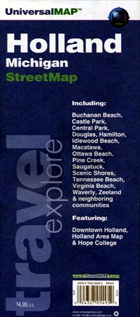
 Scale 1:35,000. Size 8?"x11". 74 pages. Universal Map edition.
 - $249.95 + $24.80 p&h (add $40 for spring rollers)
Item Code : UNIV10535
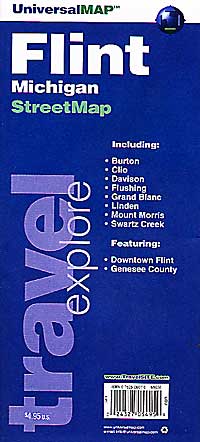
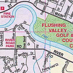
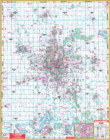 Scale 1:2,480. Size 54" W x 70" H. Laminated. The 5th edition Flint, Genesee County, Michigan Wall Map by Universal Map. Printed in color with a laminated surface that is both markable and washable. Included is all of Genesee County with the following boundaries: North: to the Saginaw-Tuscola County lines; South: to the Livingston-Oakland County lines including Holly in Oakland County; East: to the Lapeer County line; West: to the Shiawassee County line. There is also an inset map of Downtown Flint. The special features and data are as follows: all streets and highways, government buildings, airports, golf courses and country clubs, railroads, ZIP codes and ZIP code boundaries, shopping centers, water features, recreational parks, cemeteries, educational facilities, hospitals, post offices, city limits and annexations, section/township/range lines, block numbers, mileage circles, fire and police stations, and miscellaneous points of interest. Framing rails are included on top and bottom for easy wall mounting. Railed wall maps can be turned into pull down maps on spring rollers for an additional $40.
 - $10.95
Item Code : UNIV10536
 "Various scales". Size 22"x27". Universal Map edition.
 - $10.95
Item Code : RAND10538
 Scale 1:32,000. Size 27"x37". Rand McNally edition.
 - $10.95
Item Code : UNIV10539
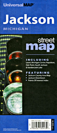
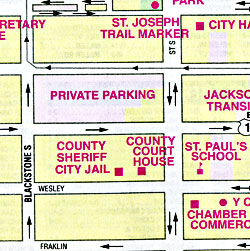
 Scale 1:31,000. Size 35"x45". Universal Map edition.
 - $14.95
Item Code : GMJO22875
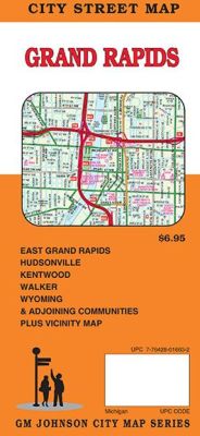
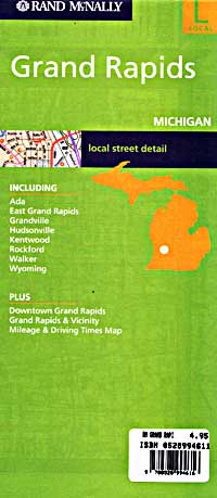
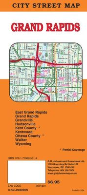 Scale 1:32,000. Size 27"x39". G.M. Johnson edition. This Map Coverage Area are East Grand Rapids, Grand Rapids, Grandville, Hudsonville, Kentwood, Walker, Wyoming, Ottawa County, Kent County, Partial Coverage.
 - $10.95
Item Code : RAND10537
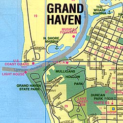
Glen Haven and Muskegon, Michigan, America. - $249.95 + $24.80 p&h (add $40 for spring rollers)
Item Code : UNIV10541
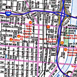
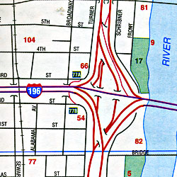
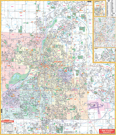 Scale 1:1,554. Size 54" W x 64" H. Laminated. The Grand Rapids, Michigan Wall Map by Universal Map shows complete street detail. Protected by a laminate surface which is both markable and washable. Indexed in a separate book. Framing rails are included on top and bottom for easy wall mounting. Boundaries as follows: North: to 8 Mile Rd ; South: to 76th. Street; East: to Cascade including Kent County International Airport; West: to the Kent County line. Includes inset map of Jenison, Rockford, and Kent County. The special features and data are as follows: all streets/highways, government buildings, airports, golf courses and country clubs, railroads, longitude/latitude lines, ZIP codes/boundaries, shopping centers, recreational parks, mileage circles, cemeteries, educational facilities, hospitals, post offices, city limits and annexations, fire/police stations, and miscellaneous points of interest. Railed wall maps can be turned into pull down maps on spring rollers for an additional $40.
 - $249.95 + $24.80 p&h (add $40 for spring rollers)
Item Code : UNIV10542
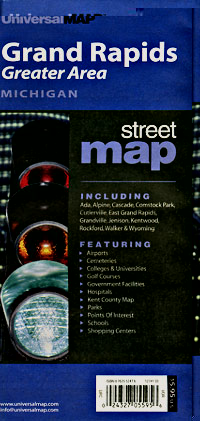
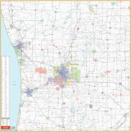 Scale 1:150,000. Size 58" W x 59" H. Laminated. The Grand Rapids and Vicinity, Michigan Wall Map by Universal Map includes the surrounding 7 counties in an approximate 45-mile radius. Printed in color with a markable/washable-laminated surface. Cities are indexed on the face of the map. Includes hanging rails mounted top and bottom. The area of coverage includes the counties of Allegan, Barry, Ionia, Kent, Montcalm, Muskegon, and Ottawa with portions of Eaton, Isabella, Mecosta, Newaygo, and Oceana. Boundaries are as follows: North: approximately 50 miles north to include Shelby in Oceana County, White Cloud in Newaygo County, and Canadian Lakes in Mecosta County; South: approximately 35 miles south including all of Allegan and Barry Counties and Bellevue in Eaton County; East: all of Ionia and Montcalm Counties and Charlotte in Eaton County; West: approximately 40 miles west to Lake Michigan. Details: major streets and all highways, county lines and names, mileage circles, ZIP codes/boundaries, airports, parks, water features, and longitude/latitude lines. Railed wall maps can be turned into pull down maps on spring rollers for an additional $40.
 - $10.95
Item Code : UNIV10543
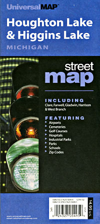
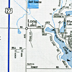
 Scale 1:23,000. Size 28"x40". Universal Map edition.
 - $10.95
Item Code : UNIV10545
 "Various scales". Size 24"x36". Universal Map edition.
 - $16.95
Item Code : NATL21033
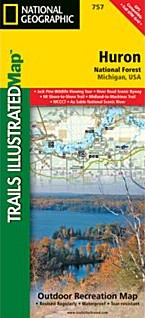
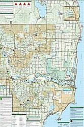 Scale 1:75,000. Size 26"x38". National Geographic edition. National Geographic's Trails Illustrated map of Michigan's Huron National Forest is a two-sided, waterproof map designed to meet the needs of outdoor enthusiasts with unmatched durability and detail. This map was created in conjunction with local land management agencies and is loaded with valuable recreation information. Trails Illustrated maps are expertly researched and frequently updated. The maps are printed in the United States on durable synthetic paper, making them waterproof, tear-resistant, and trail tough—capable of going anywhere you do.
 -
- $17.95
Item Code : TRAL10502
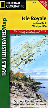
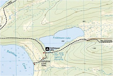 Scale 1:50,000. Size 25"x37". Trails Illustrated edition. Printed on waterproof, tear-resistant, lightweight, paper-like plastic. Isle Royale National Park is north of the Upper Peninsula of Michigan in Lake Superior. This map is the most comprehensive guide for hiking, paddling, boating, biking, exploring, climbing, camping, and sightseeing in this beautiful area. The map includes Isle Royale, Washington Island, Grace Island, Johns Island, Thompson Island, Amygdaloid Island, Belle Island, Passage Island, Windigo, Minong Ridge, Greenstone Ridge, Feldtmann Ridge, Malone Bay, Siskiwit Lake, Lake Richie, Chickenbone Lake, Moskey Basin, Rock Harbor, and much more. Includes UTM grids for use with your GPS unit.
 - $10.95
Item Code : UNIV10546
 Scale 1:35,000. Size 27"x40". Universal Map edition.
|
Michigan Road Maps |
