
|
Maryland Road Maps |
Maryland
- $249.95 + $24.80 p&h (add $40 for spring rollers)
Item Code : KAPA21110
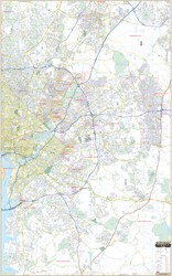
 Our Montgomery County, MD Wall Map, with adjacent areas, measures 78" x 57" (6'6" W x 4'9" H) and features up-to-date cartography, with new streets and changes in complete street detail; is printed in color, with a markable and washable laminated surface; and offers a street index in a separate book-format. The area of coverage includes all of Montgomery County, with the following boundaries: - North to the Montgomery County line - South to Hyattsville, the intersection of VA 267 & I-495, and Washington, DC - East to Laurel, Centennial Park, and Fairway Hills Golf Club, in Howard County - West to Leesburg Details and features include: - AIRPORTS - BLOCK NUMBERS - CEMETERIES - CITY LIMITS - EDUCATIONAL INSTITUTIONS - GOLF & COUNTRY CLUBS - GOVERNMENT BUILDINGS - HOSPITALS - LIBRARIES - POINTS OF INTEREST - POLICE STATIONS - RAILROADS - RECREATIONAL PARKS - SHOPPING CENTERS - STREETS & HIGHWAYS - WATER FEATURES - ZIP CODE BOUNDARIES Framing rails are included, top and bottom, for easy wall mounting. Spring roller mounting is also available, for an additional $40.
 - $10.95
Item Code : ADCM10102
 Scale 1:80,000. Size 22"x34". ADC Maps edition.
 - $10.95
Item Code : UNIV10104
 Scale 1:31,000. Size 22"x36". Universal Map edition.
 - $10.95
Item Code : RLEY10105
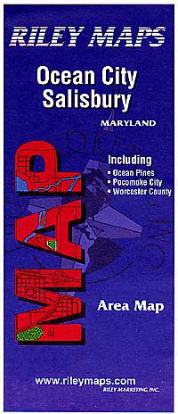
 Scale 1:23,000. Size 18?"x24". Riley Marketing edition.
 - $14.95
Item Code : GMJO21175
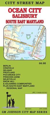
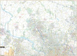
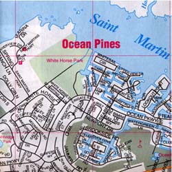
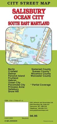 Scale 1:32,000. Size 27"x39". G.M. Johnson edition. This Map Coverage Area are erlin, Crisfield, Delmar, Fenwick Island, Fruitland, Hebron, Ocean City, Pocomoke City, Princess Anne, Salisbury, Snow Hill, Somerset County, Sussex County, Wicomico County, Worcester County, Partial Coverage.
 - $249.95 + $24.80 p&h (add $40 for spring rollers)
Item Code : KAPA21111
 Kappa Map Group is proud to announce the publication or our new Prince George's County Wall Map. Measuring 4'2" x 6'7" (50" x 79"), with up-to-date cartography, including complete street detail at a scale of 1" = 2000 ft.; laminated surface that is markable and washable; and street indexing in a separate book. The area of coverage runs: North: All of the City of Laurel; South: to Brandywine and the Piscataway Creek; East: to Prince George's County Line; West: covering all of Fort Washington. Details and features: all streets, hospitals, railroads, airports, cemeteries, shopping centers, water features, recreational parks, governmental buildings, police stations, educational facilities, golf courses and country clubs, ZIP codes and boundaries, points of interest and more. Framing rails are included on top and bottom for easy wall mounting. Railed wall maps can be turned into pull down maps on spring rollers for an additional $40.
 - $22.95 + $5.80 p&h or $14.80 foreign delivery
Item Code : ADCM22841
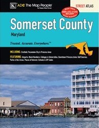 ADC Maps edition. The Somerset County, MD Atlas is a full-color street detail atlas, including: Crisfield, Pocomoke City, and Princess Anne; and features: Airports, Block Numbers, Colleges and Universities, Downtown Princess Anne, Golf Courses, Parks and Rec Areas, Places of Interest, Schools, and ZIP Codes.
 - $10.95
Item Code : UNIV10108
 Scale 1:43,000. Size 28"x40". Universal Map edition.
 - $10.95
Item Code : RAND10110
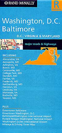
 and Baltimore, Maryland, America. Scale 1:147,000. Size 26"x37". Rand McNally edition.
|
Maryland Road Maps |
My Wish List
Last Added Items
You have no items in your wish list.
