
Iran City Maps | Detailed, Travel, Tourist, Street
|
Iran City Street Maps |
Iran City Maps
-
-
-
- $39.95
Item Code : GITA9337
Gita Shenassi edition. This English-language city street map of Tehran is the best tourist map of Tehran. The map shows the major streets, but not the smaller streets and alleys. The map uses numbered symbols to locate tourist sites such as hotels, embassies, international agencies, museums, and lists them individually on the reverse. The reverse of the map includes descriptions, a regional map, photographs, along with the aforementioned lists. This is the map we recommend if you are visiting as a tourist, or for public libraries or general reference collections. If you are visiting on business or have a more developed interest in Tehran, then we recommend one of the larger scale maps above, or the administrative series of maps below. #293 - $28.95
Item Code : GITA9339
Scale 1:30,000. Indexed. Separate street index booklet. English and Farsi text. Excellent! - $38.95
Item Code : GITA9340
Scale 1:50,000. Gita Shenassi edition. This is a topographic city street map that includes the suburbs of Tehran. The map uses symbols extensively to locate numerous sites and tourist facilities such as mosques, police, gas stations, fishing areas, animal husbandry farms, poultry farms, monuments, and much more. Includes 4 sheets of color photographs of various sites in Tehran. English and Farsi text. - $17.95
Item Code : ITMB9336
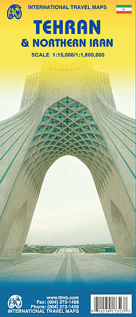
Scale 1:15,000/1:1,800,000. Size 27"x39". International Travel Maps edition.
For years, Iran has been vilified as a threat to world peace, a supplier of arms to fuel insurrections around the world, and an ‘enemy’ rogue state. Is it? This is a cultured and educated society that has its faults, but I suspect that much of its militancy is contrived and encouraged by a militant few to maintain their grip on power. Tehran is a huge urban area, modernizing and changing with each passing year, building subways and expressways, hotels, and schools.
This is the first map of the city published outside of the country, and I think our team of researchers has created a lovely piece of artwork that can only get better as time passes. We have also updated and printed a very detailed sectional map of the northern half of Iran on the reverse side.
- $39.95
Item Code : GITA9338
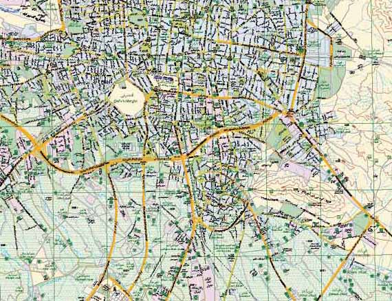 Scale 1:20,000. Size 100 x 140 cms. Gita Shenassi edition. This is a more detailed and larger-scale version of Tehran. Persian text. This new map shows all of the Tehran metropolitan area in relatively good detail. The detail of the downtown region is better on earlier maps, but all earlier maps lack the suburban coverage. This map includes separate annexed directory (only in Persian unfortunately) and four large color photographs of Tehran. All geographic features are labeled in Persian; the legend is in English and Persian. Size is 100 x 140 cm. This is our best detailed city street map covering all of Tehran. Not intended to be a tourist map, but a map where you can find everything.
 - $44.95
Item Code : GITA9341
Size 15 x 12 cms. Gita Shenassi edition. English and Farsi text - $34.95
Item Code : GITA9342
Scale 1:15,000. Gita Shenassi edition. This Farsi-only street atlas covers Tehran in detail. There are 83 pages of maps and a 47-page street index. There is some descriptive text in the beginning, along with some color photographs. Reads "right-to-left" and "back to front". -
|
Iran City Street Maps |
