
|
India Road Maps |
India Road Maps
- $17.95
Item Code : ITMB18732
 Scale 1:2,100,000. Size 27" across x 40" high. Indexed. International Travel Maps edition. English text and legends. Elevation and topographic features are shown by hypsometric color tints. Good Super large-scale physical and tourist map, with lots of useful travel information.
 - $17.95
Item Code : FREY18731
 Scale 1:2,750,000. Size 38"x54". Indexed. Freytag-Berndt edition. English and multilingual legends.
 - $19.95
Item Code : REIS18728
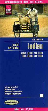
 Scale 1:2,900,000. Size 28"x40". Reis Know How edition. Very detailed India, Nepal, and Sri Lanka road map. English and multi-lingual legends. Printed on tear-resistant, waterproof, paper-like plastic. It can bend and fold without cracking and is writable as normal paper, non-toxic and recyclable. Perfect for tourist adventures and independent travel and for driving tours. Includes topographic contour lines and hypsometric color tints which show height levels, along with elevation numbers. Shows all major and secondary roads and tertiary roads, with distances between points in kilometers. Fully indexed. Beautiful cartography.
 - $14.95
Item Code : CART18736
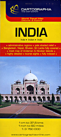
 Scale 1:3,750,000. Size 27"x39". Indexed. Cartographia edition. English and multilingual legends. Good map! Easy-to-read cartography.
 - $14.95
Item Code : GIZI18730
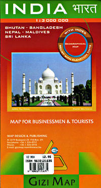
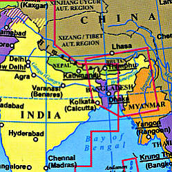 Scale 1:3,000,000. Size 34"x49". Gizi edition.
 - $12.95
Item Code : PERI18733
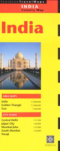
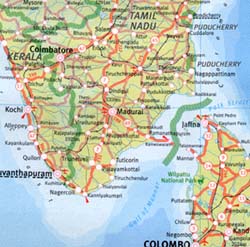 Scale 1:7,000,000. Size 34". Periplus edition.
 - $13.95
Item Code : HEMA18734
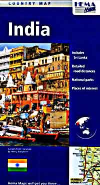
 Scale 1:5,000,000. Size 39"x52". Hema maps edition.
 - $14.95
Item Code : HILD18735
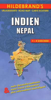
 Scale 1:4,250,000. Indexed. Hildebrand edition. English and multilingual legends. Beautiful shaded relief cartography.
 - $17.95
Item Code : NELS18740
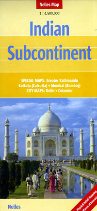
 Scale 1:4,500,000. Size 20"x31". Nelles Verlag edition.
 - $16.95
Item Code : NATL21034
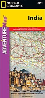 Scale 1:3,150,000. Size 26"x38". National Geographic edition. National Geographic's India Adventure Map is designed to meet the unique needs of adventure travelers with its durability and detailed, accurate information. The map includes the locations of thousands of cities and towns with a user-friendly index, as well as a clearly marked road network complete with distances and designations for highways, major routes and secondary roads. The India Adventure Map differs from a traditional road map for it includes hundreds of points of interest that highlight diverse and unique destinations in the region. The map features UNESCO World Heritage sites, national parks, archaeological sites, nature reserves, Hindu and Buddhist temples, and other points of interest, making it an invaluable resource to travelers hoping to experience all the history and culture India has to offer. Additional travel aids include the location of airports, rail lines, harbors and ferry routes. The front side of the map covers India’s southern half, from the Vindhya Range extending south to the city of Trivandrum. The map also includes the island of Sri Lanka and an inset map of the Andaman and Nicobar Islands in the Bay of Bengal. The reverse side of the map features the northern half of the country, spanning its borders with Pakistan, China, Nepal, Bhutan, Myanmar (Burma) and Bangladesh. The India Adventure Map is printed in the United States on a durable synthetic paper, making it waterproof, tear-resistant and tough—capable of withstanding the rigors of international travel. Key Features: Waterproof and tear-resistant Detailed topography complete with activity symbols, ideal for exploring the country Hundreds of points of interest including UNESCO World Heritage sites, archaeological sites, Hindu and Buddhist temples Thousands of place names Important travel aids including airports, ferry routes, and rail lines
 - $14.95
Item Code : CLNS18741
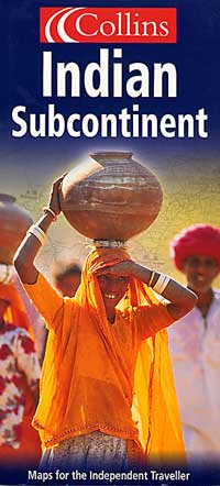
 Scale 1:4,000,000. Size 77x102 cms. Collins edition. Shows elevation by hypsometric tinting. English text and legends. Good physical and travel map.
 - $17.95
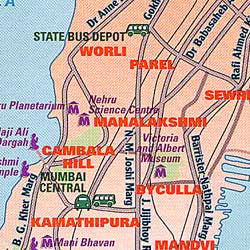
Item Code : BORC18742
 Scale 1:3,000,000. Size 27"x39". Borch edition.
 - $17.95
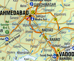
Item Code : BORC18744
 Scale 1:3,000,000. Size 27"x39". Borch edition.
 - $17.95
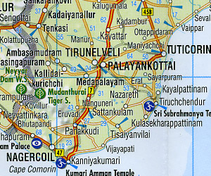
Item Code : ITMB18745
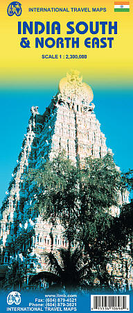
 Scale 1:2,300,000. International Travel Maps edition.
 - $16.95
Item Code : NATL21035
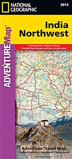 Scale 1:1,400,000. Size 26"x38". National Geographic edition. National Geographic's India Northwest Adventure Map is designed to meet the unique needs of adventure travelers with its durability and detailed, accurate information. The map includes the locations of thousands of cities and towns with a user-friendly index, as well as a clearly marked road network complete with distances and designations for highways, major routes and secondary roads. The India Northwest Adventure Map differs from a traditional road map for it includes hundreds of points of interest that highlight diverse and unique destinations in the region. The map features UNESCO World Heritage sites, national parks, archaeological sites, wildlife sanctuaries, Hindu, Buddhist and Sikh temples, forts, palaces and other points of interest, making it an invaluable resource to travelers hoping to experience all the history and culture India has to offer. Additional travel aids include the location of airports, harbors, and ferry routes. The front side of the map covers India’s far northwestern corner, including the Kashmir region and the great Himalaya range, as well as the states Haryana, Himachal Pradesh, Punjab, Rajasthan, Uttarakhand, Uttar Pradesh, and the National Capital Territory. The reverse includes coverage of the border area with Pakistan to the west, the southern part of Rajasthan and Uttar Pradesh, as well as Madhta Pradesh and the cities of Bhopal, Gujarat and Ahmadabad to the Kathiawar Peninsula. The India Northwest Adventure Map is printed in the United States on a durable synthetic paper, making it waterproof, tear-resistant and tough—capable of withstanding the rigors of international travel. Key Features: Waterproof and tear-resistant Detailed topography complete with activity symbols, ideal for exploring the country Hundreds of points of interest including UNESCO World Heritage sites, archaeological sites, Hindu and Buddhist temples Thousands of place names Important travel aids including airports, ferry routes, and rail lines
 - $16.95
Item Code : NATL21039
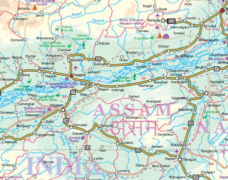
 Scale 1:1,400,000. Size 26"x38". National Geographic edition. National Geographic's India Northeast Adventure Map is designed to meet the unique needs of adventure travelers with its durability and detailed, accurate information. The map includes the locations of thousands of cities and towns with a user-friendly index, as well as a clearly marked road network complete with distances and designations for highways, major routes and secondary roads. The India Northeast Adventure Map differs from a traditional road map for it includes hundreds of points of interest that highlight the diverse and unique destinations found in this region. The map features UNESCO World Heritage sites, archaeological sites, wildlife sanctuaries, Hindu and Buddhist temples, forts, ruins, caves and other points of interest, making it an invaluable resource to travelers hoping to experience all the history and culture this part of India has to offer. Additional travel aids include the location of airports, ports and ferry routes. The front side of the map covers the far northeastern corner of India, from its border with China and Bhutan to the north; Myanmar (Burma) to the east; and Bangladesh to the south. The states of Arunachal Pradesh, Assam, Manipur, Meghalaya, Mizoram, Nagaland and Tripura are included. The reverse side shows the region extending from Nepal in the north to the Bay of Bengal in the south, Kolkata (Calcutta), as well as the states of Andhra Pradesh, Bihar, Chhattisgarh, Jharkhand, Madhya Pradesh, Orissa, Uttar Pradesh and West Bengal. The India Northeast Adventure Map is printed in the United States on a durable synthetic paper, making it waterproof, tear-resistant and tough—capable of withstanding the rigors of international travel. Key Features: Waterproof and tear-resistant Detailed topography complete with activity symbols, ideal for exploring the country Hundreds of points of interest including UNESCO World Heritage sites, archaeological sites, Hindu and Buddhist temples Thousands of place names Important travel aids including airports, ferry routes, and rail lines
 - $10.95
Item Code : TTKP18737
Scale 1:4,400,000. Size 71x101 cms ( = 28"x40"). Indexed. TTK Pharma edition. Shows all major and secondary roads, road numbers, distances between points in kilometers, railways, cities, towns, and villages, major tourist centers. States are displayed in different colors. Includes an 18-page tourist information booklet, and a distances table for the 70 largest cities. English text. Excellent travel map! SAMPLE MAP - $10.95
Item Code : TTKP18746
Scale 1:4,400,000. English text - $12.95
Item Code : TTKP18747
Includes a 96-page tourist information booklet. Superb! Shows all the wildlife preserves in India and the types of animals that occupy those preserves. - $10.95
Item Code : TTKP18738
(Same as above) Printed on waterproof, tear-resistant, lightweight, plastic synthetic paper SAMPLE MAP
|
India Road Maps |
