
|
Illinois Road Maps |
Illinois
- $10.95
Item Code : AMER8934
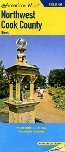
 Scale 1:31,000. Size 25"x40". American Map Company edition.
 - $10.95
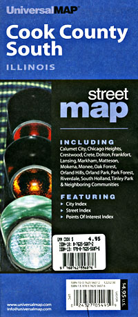
Item Code : UNIV8935
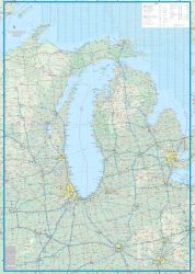
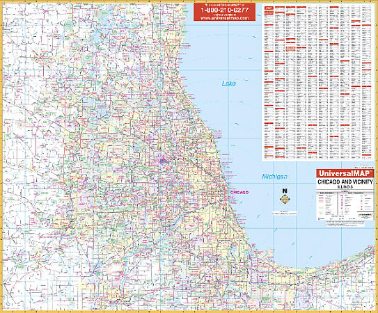
 Scale 1:34,000. Size 28"x40". Universal Map edition.
 - $10.95
Item Code : UNIV8936
 Scale 1:34,000. Size 28"x40". Universal Map edition.
 - $12.95
Item Code : AMER8937
 Scale 1:37,000. Size 21"x25". American Map Company edition. Laminated.
 - $17.95
Item Code : ITMB22749

Scale 1:12,500 / 1:1,000,000. Size 27"x39". International Travel Maps edition.
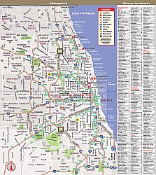
The USA continues to be a country of great interest to travelers. Chicago is the third largest city in the USA and home to many attractions and museums. This map covers the bulk of the city proper, stretching from Wrigley Ville south to Chinatown and the junctions of Interstates 90 and 55.
The core is well-presented, with particular attention being paid to pathways in parks, locators for the start of Route 66, and showing all transit lines by colour. In addition, there are two inset maps (one on the back cover) showing the transit system, another of the overall urban area, and a small one for historic Oak Park.
The reverse side shows all of Lake Michigan, with all of the State of Michigan and most of Indiana and Illinois, with a goodly chunk of Wisconsin and Ohio.
- $10.95
Item Code : VDAM22763

 VanDam Maps edition. VanDam's award winning Chicago StreetSmart maps all of Chicago's attractions, neighborhoods, museums, hotels and more at an immensely legible scale with 3D buildings. Includes details of downtown Chicago, The Loop and Hyde Park plus Chicago 'L' Transit map. This sexy laminated city map package refolds easily to 4" x 9" (24" x 9" open) and snuggly fits into your pocket. "The Map" to Chicago is updated anually! Buy this map to become as instant StreetSmart Chicagoan.
 - $14.95
Item Code : GMJO21230
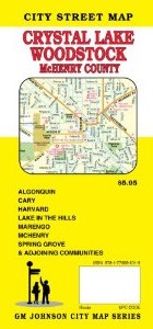 G.M. Johnson edition. An accurate and detailed city street map of Crystal Lake, IL. Also covering Woodstock and McHenry County.
 - $249.95 + $24.80 p&h (add $40 for spring rollers)
Item Code : UNIV8895
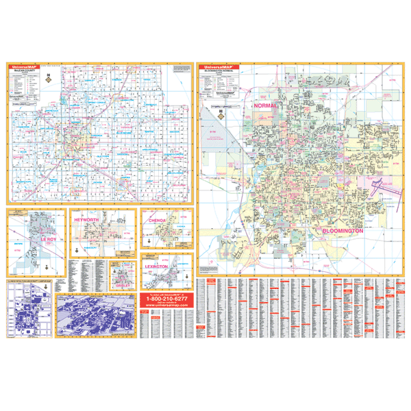 Scale 1:2,900. Size 64" W x 46" H. Laminated. Printed in color with a markable and washable surface and indexed on the face of the map. Includes hanging rails mounted top and bottom. Area of coverage includes all of Bloomington and Normal with the following boundaries: North: to the northern city limits of Normal; South: to the southern city limits of Bloomington; East: includes the Central Illinois Regional Airport; West: includes the Mitsubishi Auto plant. Insets: McLean County, towns of Leroy, Heyworth, Chenoa, and Lexington, Illinois Wesleyan University, and Illinois State University. Details included airports, cemeteries, hospitals, railroads, mileage circles, all streets and highways, water features, recreational parks, government buildings, golf courses and country clubs, educational facilities, ZIP code numbers/boundaries, and city limits/annexations. Railed wall maps can be turned into pull down maps on spring rollers for an additional $40.
 - $259.00 Shipped rolled in a tube + $28.80 p&h
Item Code : RAND8922
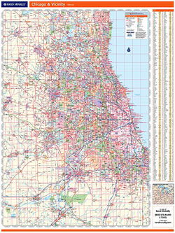
 Scale 1:114,000. Size 46"x60". Rand McNally edition. Laminated. Professional Grade.
 - $309.95 + $24.80 p&h (add $40 for spring rollers)
Item Code : UNIV8925
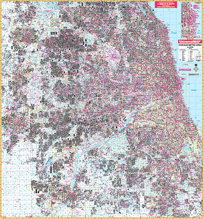
 Scale 1:3,520. Size 70" W x 76" H. Laminated. The Chicago, Illinois Metro Area Wall Map by Universal Map. Up-to-date cartography with new streets and changes, full-color, lamination, and street indexing in a separate book. Covers all of Cook and Dupage Counties and portions of Kane and Will Counties with boundaries -- North: to Barrington Hills, Wheeling, and Glencoe; South: to Joliet, New Lenox, Frankfort, and South Chicago Heights; East: to Lake Michigan including Calument City and Lynwood; West: to Aurora, Elgin, and Batavia in Kane County. Also includes an inset map of Downtown Chicago and details airports, cemeteries, hospitals, railroads, post offices, all streets/highways, shopping centers, water features, recreational parks, mileage circles, city limits and annexations, government buildings, fire/police stations, educational facilities, golf courses/country clubs, ZIP codes/boundaries, section/township/range lines, and other points of interest. Framing rails are included on top and bottom for easy wall mounting. Railed wall maps can be turned into pull down maps on spring rollers for an additional $40.
 - $249.95 + $24.80 p&h (add $40 for spring rollers)
Item Code : UNIV8898
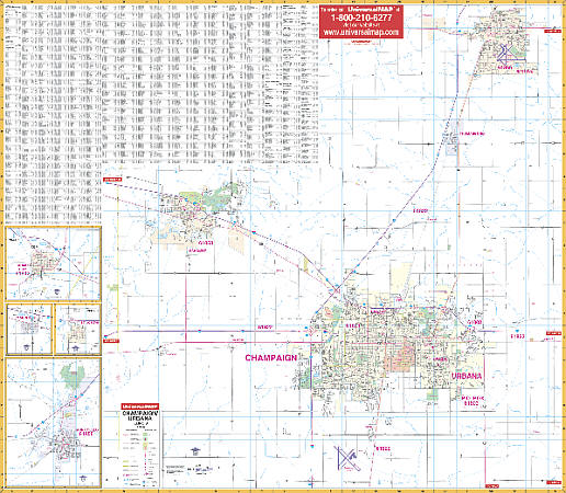 Scale 1:1,986. Size 54" W x 60" H. Laminated. Printed in color with a markable/washable -- laminated surface. Streets are indexed on the face of the map. Boundaries include north to Rantoul; south to the University of Illinois-Willard Airport; east to approximately three miles east of Urbana, and west to Piatt County Line. Includes insets for Farmer City, Mansfield, St. Joseph, and Monticello. Shows all streets/highways, educational institutions, government buildings, shopping centers, hospitals, airports, recreational parks, post offices, golf/country clubs, points of interest, city limits and annexations, railroads, mileage circles, water features, longitude/latitude lines, cemeteries, fire/police stations, ZIP codes/boundaries, and indexing on face of map. Framing rails included on top and bottom for easy wall mounting. Railed wall maps can be turned into pull down maps on spring rollers for an additional $40.
 - $229.95 + $24.80 p&h (add $40 for spring rollers)
Item Code : UNIV8923
 Size 54" W x 48" H. Laminated. The 2nd Edition Chicago, Illinois and 50 mile vicinity Wall Map by Universal Map. Uses up-to-date cartography, color, and lamination making the map markable and washable. Streets are indexed on the face of the map and framing rails are used on top and bottom for ease in hanging. Area of coverage: All of Cook, Dupage, Kane, and Lake Counties and portions of McHenry, Will, and Kendall Countie with the following boundaries: North: to the Wisconsin State line; South: includes Joliet, Frankfort, and Sauk Village; East: includes Beverly Shores and Valparaiso, IN; West: to Kane/DeKalb Co, includes city of Harvard. Details covered: airports, cemeteries, hospitals, railroads, post offices, mileage circles from Chicago City Hall, major roads and highways, shopping centers, water features, golf courses and country clubs, exit numbers, government buildings, major fire and police stations, colleges and universities, trails and recreational parks, city limits, and annexations. Railed wall maps can be turned into pull down maps on spring rollers for an additional $40.
 - $229.95 + $24.80 p&h (add $40 for spring rollers)
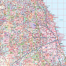
Item Code : UNIV8924
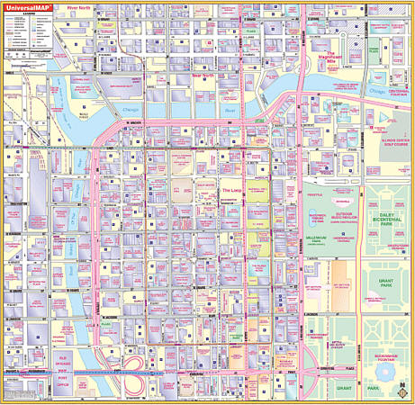 Scale 1:100,000. Size 54" W x 54" H. Laminated. The 3rd edition Chicago, Illinois Loop Wall Map by Universal Map. Printed in color with a markable/washable-laminated surface. Provided with hanging rails mounted top and bottom. The area of coverage ranges: North: to the Chicago River; South: to include Congress Parkway; East: to Columbus Drive; West: to Canal Street. Details include streets and highways, churches, retail buildings, metro lines and stations, museums and parks, government buildings, one-way streets, shopping centers, educational buildings, CTA lines, hospitals, commercial buildings, railroads, water features, and points of interest. Railed wall maps can be turned into pull down maps on spring rollers for an additional $40.
 - $10.95
Item Code : UNIV8939
 Scale 1:12,000. Size 23"x35". Universal Map edition.
 - $10.95
Item Code : RAND8940
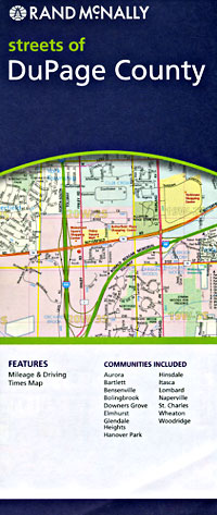
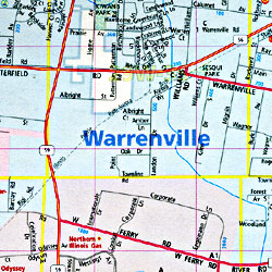 Scale 1:41,000. Size 28"x40". Rand McNally edition.
 - $10.95
Item Code : AMER8941
 Scale 1:37,000. Size 27"x40". American Map Company edition.
 - $10.95
Item Code : UNIV8942
 Scale 1:31,000. Size 27"x40". Universal Map edition.
 - $10.95
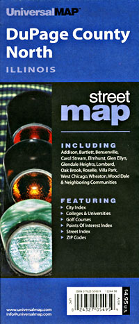
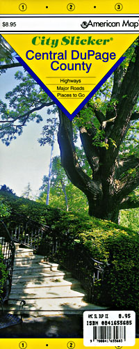
Item Code : UNIV8943
 Scale 1:31,000. Size 28"x40". Universal Map edition.
 - $12.95
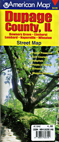
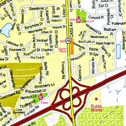
Item Code : AMER8944
 Scale 1:37,000. Size 21"x25". American Map Company edition. Laminated.
 - $229.95 + $24.80 p&h (add $40 for spring rollers)
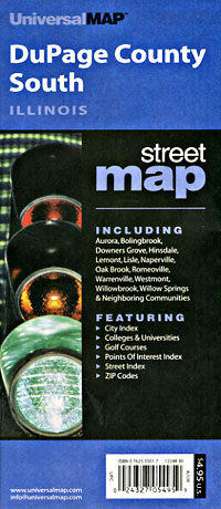
Item Code : UNIV8947
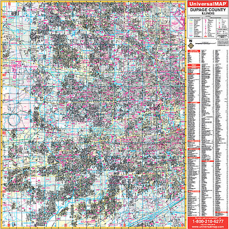 Scale 1:2,346. Size 54" W x 54" H. Laminated. The 2nd edition Dupage County, Illinois Wall Map by Universal Map. Coverage includes all of Dupage County with boundaries -- North: to the Cook County line; South: to the Will County line; East: to the Cook County line; West: to the Kane County line. Shows airports, cemeteries, hospitals, railroads, post offices, points of interest, all streets/highways, shopping centers, water features, recreational parks, mileage circles, city limits and annexations, government buildings, fire/police stations, educational facilities, golf courses/country clubs, ZIP codes/boundaries, and section/township/range lines. Framing rails are included on top and bottom for easy wall mounting. Railed wall maps can be turned into pull down maps on spring rollers for an additional $40.
|
Illinois Road Maps |
