
|
Iceland Road Maps |
Iceland
- $17.95
Item Code : FREY8863
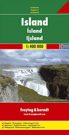
 Scale 1:400,000. Size 31"x43". Freytag-Berndt edition. This is our largest-scale and most detailed map of Iceland. English and multilingual legends. Laminated card cover. Includes considerable useful travel information.
 - $19.95
Item Code : REIS8864
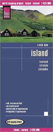
 Scale 1:425,000. Size 27"x39". Reis Know How edition. Very detailed Iceland road map. English and multi-lingual legends. Printed on tear-resistant, waterproof, paper-like plastic. It can bend and fold without cracking and is writable as normal paper, non-toxic and recyclable. Perfect for tourist adventures and independent travel and for driving tours. Includes topographic contour lines and hypsometric color tints which show height levels, along with elevation numbers. Shows all major and secondary roads and tertiary roads, with distances between points in kilometers. Fully indexed. Beautiful cartography.
 - $17.95
Item Code : ITMB8867
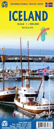
Scale 1:400,000. Size 27"x39". International Travel Maps edition. 5th Edition.
Iceland is a wonderful country to visit. It is conveniently accessible from both Europe and North America, the country has all modern conveniences, travel around the island is easy, accommodations are excellent, the scenery is marvelous, and the summers are warm.
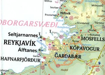
Why don't we all move to Iceland, it sounds idyllic! Really, the country is very popular and a lot of people visit. Our map shows updated road information, hotels, museums, churches, waterfalls, and most importantly, gas stations in smaller communities. The map includes illustrative pictures and capsule comment text blocks and an excellent inset map of Reykjavik, the capital.
- $14.95
Item Code : CART8868
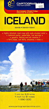
 Scale 1:550,000. Size 27"x39". Cartographia edition. Includes city street plan of Reykjavik at 1:20,000 scale. Iceland is not only a lovely country to visit, it is one of our most popular titles. This is a relatively minor updating, designed to keep our artwork fresh and up to date. We have retained the cover picture of ‘the’ geyser that gave its name to all naturally occurring fountains of water that explode out of bedrock at regular intervals, as it so perfectly represents this beautiful country. As with previous versions, this map is printed on plastic for durability. The plastic is waterproof as well, which is not a big issue in Iceland, but the map can be used as an umbrella in the event of a sudden shower.
 - $16.95
Item Code : NATL21074
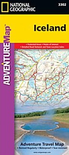
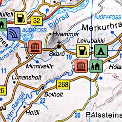
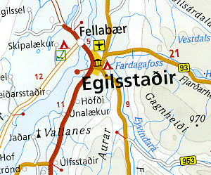
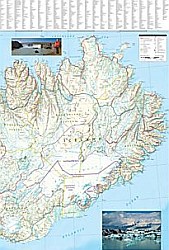 Scale 1:465,000. Size 26"x38". National Geographic edition. National Geographic's Iceland Adventure Map is designed to meet the unique needs of adventure travelers—detailed, durable, and accurate. Iceland includes the locations of thousands of cities and towns with an index for easily locating them, plus a clearly marked road network complete with distances and designations for expressways, motorways, and more. Transportation within and beyond the country is made easier with the locations of airports, airfields, railroads, ferry routes, and lighthouses. What sets National Geographic Adventure Maps apart from traditional road maps are the hundreds of points of interest that highlight the diverse and unique destinations within Iceland. Outdoor activities abound on the island and activity symbols note popular locations to ski, golf, camp, fish, and swim. Travelers will find plenty to explore in Iceland’s cities as well, including World Heritage sites, museums, churches, and other points of interest. Iceland’s western half is shown on the front side of the map including the cities of Reykjavik, Hafnarfjordur, Kopavogur, Gardabaer, Mossfellsbaer, Keflavik, Borgarnes, Stykkisholmur, and Siglufjordur. The reverse side of the map covers the eastern portion of the country showing the cities of Akureyri, Egilsstadir, Eskifjordur, Neskaupstadur, Husavik, and Hofn.
 - $17.95
Item Code : GEOC8870
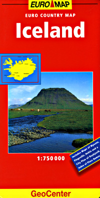
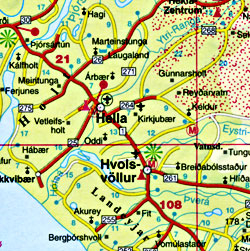 Scale 1:750,000. Indexed. GeoCenter edition. Laminated card cover. English and multilingual legends. Beautiful clear cartography.
 - $17.95
Item Code : MRCO20888
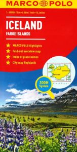 Scale 1:750,000. Marco Polo maps feature completely up-to-date, digitally generated mapping. The high quality cartography with distance indicators and scale converters aid route planning. Includes a city plan of Reykjavik. A fold-out overview map is ideal for route planning and 7 self-adhesive Marco Polo mark-it stickers can be used to pin-point a destination or route for future reference. Scenic routes and places of interest are highlighted - ideal for touring holidays. Comprehensive index.
 - $17.95
Item Code : FREY8876
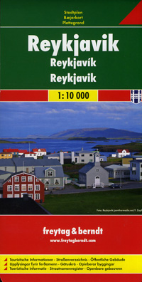
 Scale 1:10,000. Size 27"x39". Freytag & Berndt edition.
|
Iceland Road Maps |
