
|
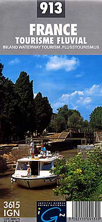
France Waterways, Canals & Rivers Map |
| What you’ll find in this section, all arranged in the following order: a. France Road and Tourist Maps Click Here b. Special Interest Tourist Maps of France Click Here c. France Road Atlases Click Here d. Waterways & Canal Maps of France (see below) e. Regional Road and Tourist Maps at 1:200,000-1:250,000 Scale Click Here f. Sectional Road and Topographic Tourist Maps at 1:100,000 Scale (IGN) Click Here g. CITY Street Plans and Atlases of France >>> A to C D to M N to Paris Q to Z Please look down the list and find the map or atlas of your choice! |
France Waterways Maps
- $14.95
Item Code : IGNF7816
 Scale 1:1,000,000. Size 43" across x 39" high (a big map). Institute Geographique National edition. Includes parts of Belgium, Luxembourg and Germany's Rhine River. France has approximately 8,500 kilometers of interconnected waterways and this map displays them with remarkable clarity. Shows all major and minor rivers and lakes, all types of roads, road numbers, airports, cities, towns, villages, notable sights, department boundaries, and nature reserves. English and multilingual text and legends. Easy to read symbols on the map indicate notable structures linked to the waterway, river ports or stopping places of interest, piers for passengers, launching places, museums of the waterway, regular water festivals of interest, and boats for hire, as well as castles, churches, and places of interest. A fascinating map. SAMPLE MAP
 -
- $24.95
Item Code : NAVI7819
La Seine amont: de Paris ? Marcilly-sur-Seine #02. - $28.95
Item Code : NAVI7820
La Marne: de Paris ? Vitry-le-Fran?ois #03. - $24.95
Item Code : NAVI7822
Mamm?s ? Chalon-s-S. Roanne-Digoin #06. - $48.95
Item Code : NAVI7828
Malo ? Arzal, de Lorient ? Nantes #12. This is an atlas book. -
- $24.95
Item Code : NAVI7823
Canal du Nivernais: de Decize ? Auxerre #07. -
- $44.95
Item Code : NAVI7825
Sambre belge: de Li?ge ? Corre #09. De la fronti?re ? Namur. This is an atlas book. - $44.95
Item Code : NAVI7826
La Sa?ne et la Seille: de Corre ? Lyon #10. - $44.95
Item Code : NAVI7827
This is an atlas book. -
- $24.95
Item Code : NAVI7829
This is an atlas book. - $48.95
Item Code : NAVI7830
Nord-Pas-de-Calais: voies navigables #14. - $44.95
Item Code : NAVI7832
? Strasbourg #17. This is an atlas book. - $44.95
Item Code : NAVI7831
Le Rh?ne: de Lyon ? la M?diterran?e #16. - $29.95
Item Code : NAVI7833
Bourgogne Volume 1: Yonne, Nivernais, Bourgogne #18. -
-
| Postage and handling is $3.50 for the first map and $1.50 for each additional map. ~ ~ ~ ~ ~ ~ Foreign delivery is $7.80 for the first map and $5.00 for each additional map. |
| ** Click here! to view our beautiful collection of France Travel VIDEOS ** |
| ** Click here! to view our French Language Courses ** |
|
France Waterways, Canals & Rivers Map |
| What you’ll find in this section, all arranged in the following order: a. France Road and Tourist Maps Click Here b. Special Interest Tourist Maps of France Click Here c. France Road Atlases Click Here d. Waterways & Canal Maps of France (see below) e. Regional Road and Tourist Maps at 1:200,000-1:250,000 Scale Click Here f. Sectional Road and Topographic Tourist Maps at 1:100,000 Scale (IGN) Click Here g. CITY Street Plans and Atlases of France >>> A to C D to M N to Paris Q to Z Please look down the list and find the map or atlas of your choice! |
