
Florida City Maps, A to N | Detailed, Folded, Travel, Tourist, Street
|
Florida City Street Maps |
Florida City Maps, A to N
- $10.95
Item Code : UNIV7359
Scale 1:42,000. Universal Maps Enterprises edition - $249.95 + $24.80 p&h (add $40 for spring rollers)
Item Code : UNIV7374
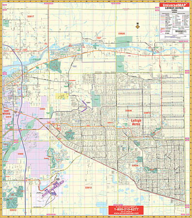
 Scale 1:2,070. Size 60" W x 66" H. Laminated. Printed in color with a markable/washable--laminated surface. Street index provided on the face of the map. Framing rails are included on top and bottom for easy wall mounting. Railed wall maps can be turned into pull down maps on spring rollers for an additional $40. Area of coverage: North: to the Charlotte County line; South: to the Southwest Florida International Airport; East: to the Hendry county line; West: to I-75 . Details include all streets and highways, government buildings, airports, water features, fire/police stations, hospitals, shopping centers, educational facilities, railroads, recreational parks, golf/country clubs, post offices, city limits/annexations, cemeteries, longitude & latitude, ZIP codes/boundaries, and points of interest.
 - $10.95
Item Code : AMER7380
 Scale 1:47,000. Size 24"x37". American Map Company edition.
 - $249.95 + $24.80 p&h (add $40 for spring rollers)
Item Code : UNIV7382

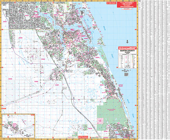 Laminated. The 2007, 5th. ed. Martin County, Florida Wall Map by Universal Map offers up-to-date cartography and complete street detail. Its durable surface lamination makes the map markable and washable. Street indexing appears on the face of the map. Framing rails are included on top and bottom for easy wall mounting. Railed wall maps can be turned into pull down maps as a $40 option. The area of coverage: ? North: to the Martin/St. Lucie County line; ? South: to the Martin/Palm Beach County line ? East: to the Atlantic Ocean; ? West: to the Cobblestone Country Club, I95. A map inset covers the community of Indiantown. Features: all streets and highways, post offices, hospitals, railroads, mileage circles, sections/townships/range lines, city limits/annexations, airports, cemeteries, shopping centers, water features, recreational parks, government buildings, fire and police stations, educational facilities, golf and country clubs, zip codes and boundaries, and latitude and longitude lines.
 - $10.95
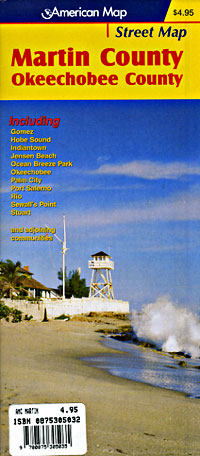
Item Code : RAND7383
 Scale 1:32,000. Size 28"x40". Rand McNally edition.
 - $12.95
Item Code : ROUG7385
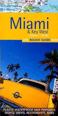
 Scale 1:28,000. Size 20"x26". Rough Guide edition. Printed on tear-resistant, waterproof, lightweight, paper-like plastic. English text and legends. Rugged and convenient.
 - $17.95
Item Code : BORC7386
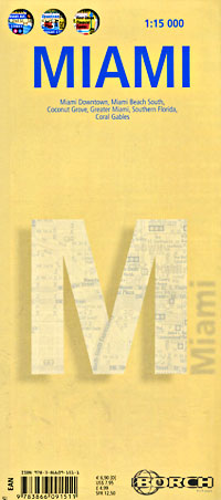
 Scale 1:15,000. Size 20"x28". Borch edition. Indexed. Printed on both sides. English and multilingual legends. Laminated, water proof, easy-fold, flexi-map. Our soft-laminated folded map of Miami shows Miami Downtown 1:15,000, Miami Beach 1:15,000, Coconut Grove 1:15,000, Greater Miami 1:350,000, Southern Florida 1:500,000, Coral Gables 1:30,000, Public Transportation Miami, Top 30 Sights, USA administrative & time zones. Borch Maps are easy to fold, durable and water-repellent with a wipeable surface. Borch Maps show hotels, museums, monuments, markets, public transport, top sights and points of interest, useful statistics, conversion charts for temperatures, weights and measurements, climate charts showing temperatures, sunshine hours, precipitation and humidity, overview maps, time zones, and much more...
 - $17.95
Item Code : ITMB7387
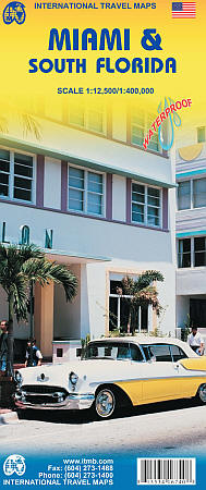
 Scale 1:12,500. Size 27"x39". International Travel Maps edition. This is a new title for ITMB. One side contains a detailed map of most of Miami and southern Miami Beach, showing the downtown, the expressways, and the cruise ship docks, as well as the major hotels along the beach. The other side covers all of Florida south of Cape Coral/West Palm Beach in excellent detail, including the famous Florida Keys. This is third most-visited touristic destination in the world, after Orlando and Las Vegas, and finally completes our detailed mapping for this densely populated US state.
 - $16.95
Item Code : NATL7388
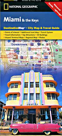
 Scale 1:15,000. Size 18"x25". National Geographic edition. Exploring Miami and The Keys is as easy as unfolding this sturdy, laminated map. The front features a large-scale city map that highlights tourist and business travel locations with 3-D styled drawings. The back includes: Regional map; Points of interest; Metrorail and Metromover maps; Airport diagrams for Miami International and Ft. Lauderdale/ Hollywood International airports; Information and map of the Florida Keys and Key West; Inset maps of the Miami area; Inset map and information about the Everglades; Multi-language legend.
 - $10.95
Item Code : MEAS7389
 "various scales". Size 18"x27". Map Easy edition. Miami offers the excitement of a major city blended with the tropical warmth and beauty of a warm-weather resort. MapEasy will give you an intimate look at the history and glamour of Miami. Explore the Art Deco masterpieces of South Beach with us, stroll through the charming neighborhood of Coconut Grove and it's many boutiques and restaurants, or take a drive down to the Everglades. If you're looking for more fun, why not visit Key West? Come along with us as we explore this southernmost point in the US, and see where Hemingway lived and worked, or do some shopping on Duval Street. The Miami/Key West Guidemap includes detailed sections for South Beach, Downtown, Coconut Grove, Greater Miami and Key West. Perfect for the intrepid or armchair traveller, this charming map combines the best of a guidebook and a location map, all in one. The map is color coded to include information about the city's hotels, restaurants, shops, and sites. Printed on tear-proof, water-resistant, lightweight, paper-like plastic, that is incredibly durable. Also includes sketches of the landscape and interesting details about the area. You'll love this map!
 - $10.95
Item Code : RAND7390
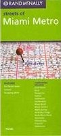
 Scale 1:32,000. Size 36"x45". Rand McNally edition.
 - $10.95
Item Code : RAND7391
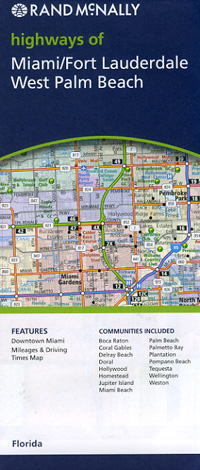
 Lauderdale and West Palm Beach, Florida, America. Scale 1:145,000. Size 28"x40". Rand McNally edition.
 - $10.95
Item Code : UNIV7392
 Scale 1:46,000. Size 27"x39". Universal Map edition.
 - $11.95
Item Code : UNIV7393

 Scale 1:47,000. Size 22"x25". Universal Map edition. Laminated.
 - $10.95
Item Code : AMER7394
 Scale 1:33,000. Size 32"x39". American Map Company edition.
 - $10.95
Item Code : AMER7397
 Scale 1:41,000. Size 10"x25". American Map Company edition. Laminated.
 - $11.95
Item Code : GUIR7399
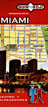
 Scale 1:12,000. Size 18"x27". Guia Roji edition.
 - $21.95 + $7.50 p&h or $28.50 foreign delivery
Item Code : AMER7400
 Scale 1:39,000. Size 13"x10". 112 pages. American Map Company edition.
 - $249.95 + $24.80 p&h (add $40 for spring rollers)
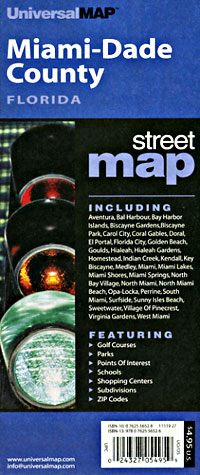
Item Code : UNIV7403
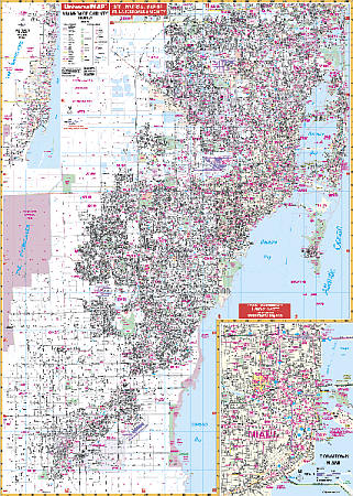
 Scale 1:1,080. Size 54" W x 74" H. Laminated. The Miami and Dade County Florida Wall Map by Universal Map includes approximately 850 new streets and changes. Shows all of Miami/Dade County, FL in complete street detail with boundaries ranging north to the Broward County line; south to include all of Florida City and Homestead; east to the Atlantic Ocean; and west to the Homestead Airport. Includes an inset of Downtown Miami at a scale of 1 inch to 1080 feet. Boundaries range north to 44th St., west to 22nd Ave., south to Viscaya Museum and Gardens. Shows all streets/highways, educational institutions, government buildings, shopping centers, hospitals, ZIP codes/boundaries, post offices, fire/police stations, airports, cemeteries, recreational parks, golf courses/country clubs, points of interest, city limits/annexations, railroads, water features, mileage circles, and township/section/range lines. Printed on #80 stock material, laminated, and includes framing rails on top and bottom for easy wall mounting. Railed wall maps can be turned into pull down maps on spring rollers for an additional $40.
 - $14.95
Item Code : GMJO22659
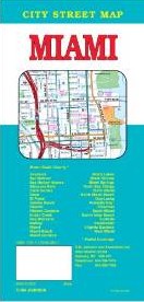
 G.M. Johnson edition. A detailed and accurate city street map of Miami, FL. Also covers Coral Gables, Doral, Hialeah, Key Biscayne, Miami Beach, Miami Gardens & Adjoining Communities plus downtown maps of Miami and Miami beach. Produced using the latest computer mapping technology.
|
Florida City Street Maps |
