
Europe Road Maps | Detailed Travel Tourist Driving
|
Europe Road Maps |
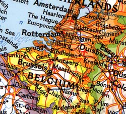
Europe
- $17.95
Item Code : FREY7096
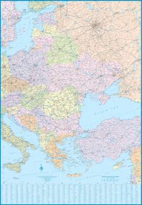
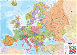
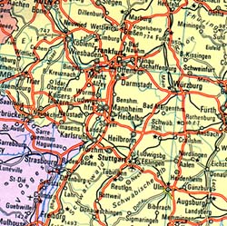
 Scale 1:2,000,000. Size 42"x34". Freytag & Berndt edition.
 - $17.95
Item Code : FREY7097
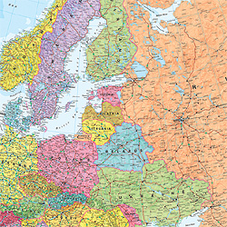
 Scale 1:2,000,000. Size 35?"x49". Freytag & Berndt edition.
 - $17.95
Item Code : ITMB7076

 Scale 1:3,350,000. Size 27"x39". International Travel Maps edition. Our Europe Rail Map has proven to be a best seller, so obviously meets a market demand. This most recent edition updates recent completions of the new 'fast train' network that is gradually transforming transportation of passengers in Europe. Much of this will consist of extensions to line already in place. We have included the east-west link through London, which is still under construction, but not the future line to Birmingham. In France, the western portion of the line to Caen is open, but not the link to Paris. The Spanish system is mostly in place and Italy is now completed as far south as Salerno. Connecting links between countries is, however, mostly a future hope. The regular rail system is shown in black and is quite extensive. For the sake of convenience, the motorway and main road networks of Europe are included, but the strength of this map is its emphasis upon train travel. As an additional feature of this map, we have added a side panel that shows each country's flags, shows where it 'fits' into Europe, what its car decal designation is, its capital, its area, and its population.
 - $18.95
Item Code : COOK7075
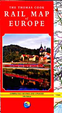
 Scale 1:3,750,000. Siz3 27"x39". Indexed. Thomas Cook edition. Includes a European Railways map at 1:3,750,000 scale; a Central European Railways map at 1:1,500,000 scale; and a Scandinavian Railways map at 1:6,00,000 scale. Excellent!. English text and legends.
 - $179.95 Rolled + $24.80 p&h
Item Code : UNIV7088
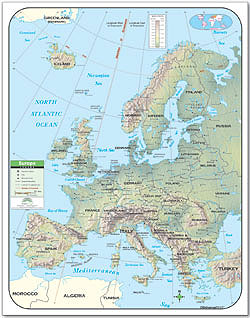
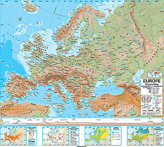 Size 54"x64". Universal Map edition. Laminated. The Europe Advanced Physical Classroom Wall Map includes insets of Annual Rainfall, Energy-Manufacturing-Trade, Population Density, and Natural Vegetation and Environment. The Advanced Physical Classroom Wall Map features innovative shaded relief detail of the world, continents, and the United States. This high quality series is appropriate for grades 6-12, and includes content that meets national and state curriculum standards. Four thematic inset maps enhance the value of the main map. The world map features the Van Der Grinten projection. Wall maps measure 64"x54". Mounted on roller with backboard. This product is ideal for public, private, parochial, and home schools.
 - $179.95 Rolled + $24.80 p&h
Item Code : UNIV7089
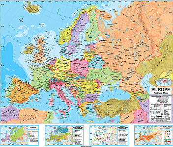 Size 54"x64". Universal Map edition. Laminated. The Europe Advanced Political Classroom Wall Map features four insets: Climate; Energy, Manufacturing, and Trade; Population Density; and Natural Vegetation and Environment. Mounted on roller with backboard. The Advanced Political Classroom Wall map series provides a wealth of valuable information including country and state boundaries as well as capitals, major waterways, and major cities. Created with legibility in mind these brightly colored maps highlight the world, its continents, and the United States with detailed cartography. Appropriate for grades 6-12 and satisfying state and national curriculum standards, the Advanced Political Classroom Wall Map is a must have for every classroom. Wall maps measure 64" x 54". This product is ideal for public, private, parochial, and home schools.
 - $179.95 Rolled + $24.80 p&h
Item Code : UNIV7090
 Size 54"x64". Universal Map edition. Laminated. The Europe Essential Classroom Wall Map measures 54" x 69". Includes all the European countries plus most of Russia, Iceland, Northern Africa, and northern Turkey. Mounted on roller with backboard. The Essential Series features an enhanced legend and pictorial landform illustrations for intermediate level use. Also shows deserts & wetlands. The inset map locator illustrates the location of each continent in the world. Appropriate for grades 4 - 8. This product is ideal for public, private, parochial, and home schools.
 - $179.95 Rolled + $24.80 p&h
Item Code : UNIV7091
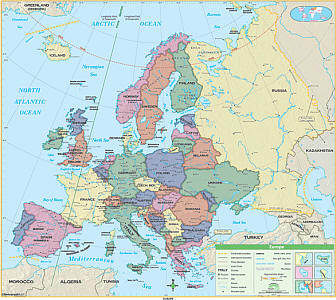
 Size 54"x64". Universal Map edition. Laminated. This Primary Classroom Wall Map of Europe by Universal Map features color-coded countries and measure 54" W x 69" H. The laminated surface makes it both markable and washable. There is an inset map of the world showing the relative position of Europe. The area of coverage runs: North: to Greenland and Denmark Strait; South: to the Mediterranean; East: to Russia and Turkey; West: to the North Atlantic Ocean. Details included with this map are national capitals, national boundaries, the Prime Meridian (Greenwich), cities, mountain peaks, and latitude and longitude lines. Mounted on roller with backboard. This product is ideal for public, private, parochial, and home schools.
 - $159.95 Rolled + $24.80 p&h
Item Code : UNIV7092
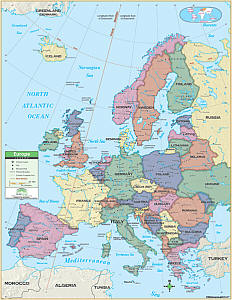 Size 54"x64". Universal Map edition. Laminated. The Wall Map of Europe by Universal Map features color-coded countries and measure 55" by 69". The map's laminated surface makes it both markable and washable and an inset map of the world shows the relative position of Europe. The map's area of coverage runs north to Greenland and Denmark Strait, south to the Mediterranean, east to Russia and Turkey, and west to the North Atlantic Ocean. Details included are national capitals, national boundaries, the Prime Meridian (Greenwich), cities, mountain peaks, and latitude and longitude lines. This product is ideal for public, private, parochial, and home schools.
 - $24.95 + $10.80 p&h or $36.80 foreign delivery
Item Code : UNIV7087
 Size 36"x48". Universal Map edition. Laminated.
 - $49.95 Rolled + $10.80 p&h or $48.80 foreign delivery
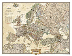
Item Code : NATL7078
 Scale 1:5,400,000. Size 35"x46". National Geographic edition. Laminated.
 - $32.95 Rolled + $10.80 p&h or $48.80 foreign delivery
Item Code : NATL7079

 Scale 1:5,400,000. Size 35"x46". National Geographic edition. NOT laminated.
 - $26.95 Rolled + $8.80 p&h or $34.80 foreign delivery
Item Code : NATL7080
 Scale 1:8,400,000. Size 24"x31". National Geographic edition. Laminated.
 - $20.95 Rolled + $8.80 p&h or $34.80 foreign delivery
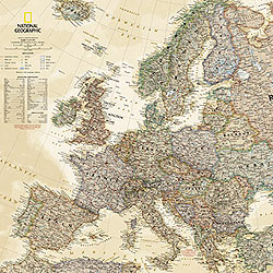
Item Code : NATL7081

 Scale 1:8,400,000. Size 24"x31". National Geographic edition. NOT Laminated.
 - $29.95 Rolled + $10.80 p&h or $48.80 foreign delivery
Item Code : NATL7082
 Scale 1:5,400,000. Size 35"x45". National Geographic edition.
 - $20.95 Rolled + $8.80 p&h or $34.80 foreign delivery
Item Code : NATL7083

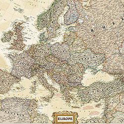 Scale 1:8,400,000. Size 24"x30". National Geographic edition.
 - $44.95 Rolled + $12.80 p&h or $56.80 foreign delivery
Item Code : HEMA7084
 Scale 1:4,300,000. Size 39"x55". Hema maps edition. Laminated.
 - $29.95 Rolled + $12.80 p&h or $56 .80 foreign delivery
Item Code : HEMA7085

 Scale 1:4,300,000. Size 40"x55". Hema maps edition.
 - $34.95 Rolled + $12.80 p&h or $56 .80 foreign delivery
Item Code : KUMR7086
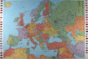
 Scale 1:4,500,000. Size 36"x55". Kummerly and Frey edition.
|
Europe Road Maps |
