
Plan your recreational activities with the California Recreation Maps
So you have planned to visit California this holiday? What all activities should you do? Which places should you visit? What recreation activities does California offer? The questions are many. And consequently the answers are many too.
But you don’t need to worry. We are here to simplify everything for you. We present to you some of the top recreational activities you can do in California.:
- Visit the Walt Disney Family Museum in San Francisco to know and explore the history of Disney.
- How does a Wine tour seem to you? Appealing!! Then there is Green Dream Tours- Wine Country Tour Specialists. They will take you on a wine tour.
- How about a tour in water? You can go on a Boat Tour in Alcatraz islands for sightseeing.
- Fancy watching the sea in the night? The view is spectacular. You can go for a luxury Dinner cruise in San Diego.
- Visit the Napa Valley in style from San Francisco. Board the Napa Valley Wine Train. Enjoy the picturesque views of the valley with a fine gourmet meal and a lot of wine tasting.
- For a little adrenaline rush, go for a hot air balloon ride in Napa Valley.
- The Glacier Point in Yosemite National Park is worth to go to. How about a hike to the Glacier point.
- For some adventure, there is a 3 lap ride at Mazda Raceway Laguna Seca with a professional driver.
- Go to skydiving in Los Angeles. For the first timers they have indoor skydiving facilities too.
- Go on a Walking tour to Little Italy and North Beach. Enjoy the exotic food and culture in the tour.
- Go for a Whale Watching Excursion at Dana Point.
If you want to look for some more recreational activities in California, there is an all new California Recreation Map. It will give you a clear and accurate picture of all the places in California that you can visit for recreation.
California Recreation Maps for Tourists and TravelersDetailed Recreation Map of CaliforniaBuy travel maps for California tourist attractions, recreation, road trips, street guide, driving directions and more |
California Recreation Maps
- $11.95
Item Code : TOMH5984
Scale 1:63,360. Tom Harrison Press edition. - $11.95
Item Code : TOMH5989
Scale 1:63,360. - $11.95
Item Code : TOMH5992
Scale 1:42,240. - $11.95
Item Code : TOMH5993
Scale 1:63,360. - $10.95
Item Code : MEAS5994
MapEasy edition. Also includes a separate map of the Russian River, Healdsburg, & the Alexander Valley. Perfect for the intrepid or armchair traveller, this charming map combines the best of a guidebook and a location map, all in one. The map is color coded to include information about the Napa & Sonoma Valleys' most interesting wineries and sites, hotels, restaurants, and shops. Printed on tear-proof, water-resistant, lightweight, paper-like plastic, that is incredibly durable. Also includes interesting details about all the important tourist areas. You'll love this map! - $12.95
Item Code : FRKO5996
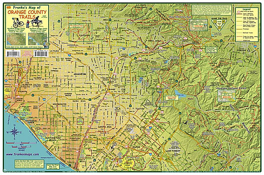
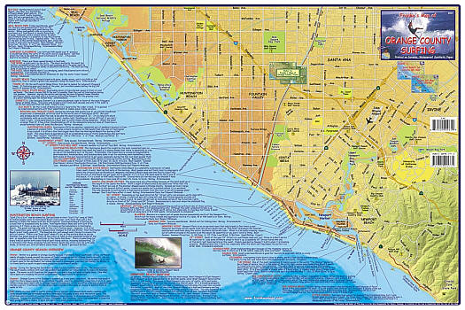
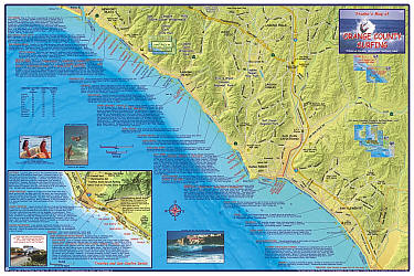
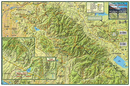
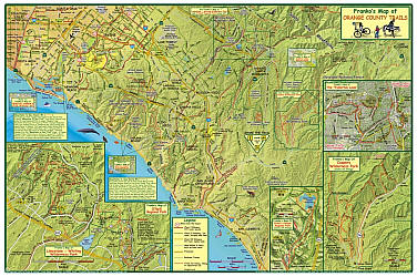 Scale 1:100,000. Size 13"x21". Franko maps edition. Laminated. Franko's Maps produces recreation maps for the land and water of selected tourist destinations. The maps are all printed on plasticized paper so they are water resistant.
 - $12.95
Item Code : FRKO5997
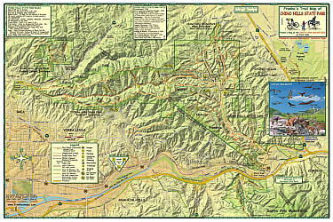
 Scale 1:63,360. Size 14"x21". Franko maps edition. Laminated. Franko's Maps produces recreation maps for the land and water of selected tourist destinations. The maps are all printed on plasticized paper so they are water resistant.
 - $12.95
Item Code : FRKO5998
 Size 14"x21". Franko maps edition. Laminated. Franko's Maps produces recreation maps for the land and water of selected tourist destinations. The maps are all printed on plasticized paper so they are water resistant.
 - $10.95
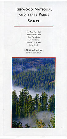
Item Code : REDW5999
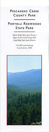
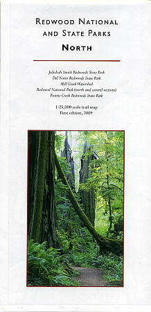
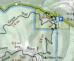 Scale 1:25,000. Size 17"x22". Redwood Hikes Press edition.
 - $11.95
Item Code : TOMH6000
Scale 1:48,000. Tom Harrison Press edition. - $17.95
Item Code : TRAL6002
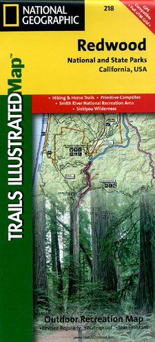
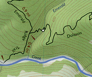
 Scale 1:70,000. Size 25"x37". Trails Illustrated edition. Printed on waterproof, tear-resistant, lightweight, plastic synthetic paper. This Trails Illustrated topographic map is the most comprehensive recreational map for Redwood National Park located along California's scenic northern coast. Included are Prairie Creek Redwoods State Park, Harry A. Merlo State Recreation Area, Humboldt Lagoons State Park, Yurok Indian Reservation, Smith River National Recreation Area, Six Rivers National Forest, Siskiyou Wilderness, the North Fork Smith River Botanical Area, the Broken Rib Botanical Area, and Klamath National Forest. The trails have been enhanced and road and trail mileage have been added to create a more usable map. Includes UTM grids for use with your GPS unit.
 - $10.95
Item Code : REDW6003
 Scale 1:25,000. Size 25"x39". Redwood Hikes Press edition.
 - $10.95
Item Code : REDW6004
 Scale 1:25,000. Size 25"x39". Redwood Hikes Press edition.
 - $12.95
Item Code : FRKO6007
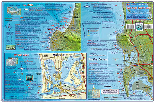
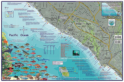
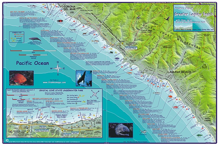
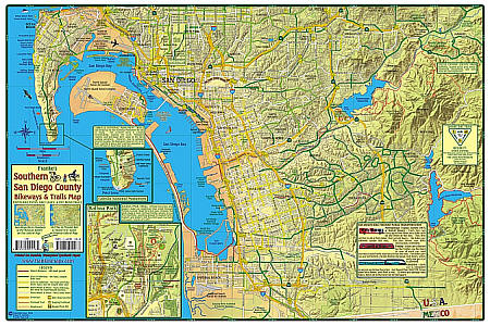
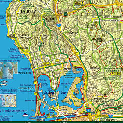
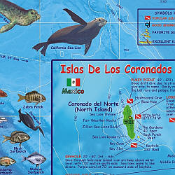 "Various scales". Size 14"x21". Franko maps edition. Laminated. Franko's Dive Map of the San Diego Coast is a recreational map for scuba divers, snorkelers, beach lovers, kayakers, boaters, and explorers. Details the dive sites and beach tourist information from Oceanside to Los Coronados, including insets for Mission Bay, La Jolla and Wreck Alley. San Clemente Island and Islas de los Coronados are on the reverse along with beautiful, accurate drawings of San Diego kelp forest sealife. Franko's Maps produces recreation maps for the land and water of selected tourist destinations. The maps are all printed on plasticized paper so they are water resistant.
 - $10.95
Item Code : FRKO6008
 Size 14"x22". Franko maps edition.
 - $12.95
Item Code : FRKO6009
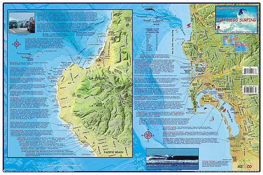
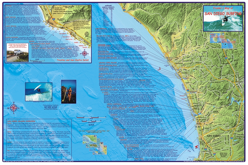 Scale 1:95,000. Size 14"x21". Franko maps edition. Laminated.
 - $10.95
Item Code : FRKO6010
 Size 14"x22". Franko maps edition.
 - $12.95
Item Code : FRKO6011
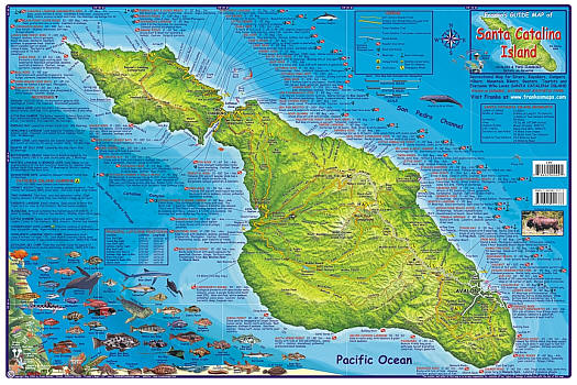
 Scale 1:100,000. Size 16?"x25?". Franko maps edition. Laminated. Franko's Maps produces recreation maps for the land and water of selected tourist destinations. The maps are all printed on plasticized paper so they are water resistant.
 - $12.95
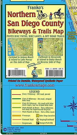
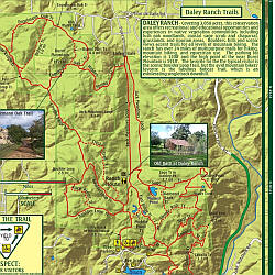
Item Code : FRKO6014
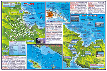
 "Various scales". Size 14"x21". Franko maps edition. Laminated.
 - $12.95
Item Code : FRKO6015
 Size 14"x21". Franko maps edition. Laminated
| Postage and handling is $4.40 for the first map and $1.80 for each additional map. ~ ~ ~ ~ ~ ~ Foreign delivery is $15.80 for the first map and $7.60 for each additional map. ~ ~ ~ ~ ~ ~ Canada delivery is $15.80 for the first map and $7.60 for each additional map. |
| Postage and handling is $4.40 for the first map and $1.80 for each additional map. ~ ~ ~ ~ ~ ~ Foreign delivery is $15.80 for the first map and $7.60 for each additional map. ~ ~ ~ ~ ~ ~ Canada delivery is $15.80 for the first map and $7.60 for each additional map. |
Plan your recreational activities with the California Recreation Maps
So you have planned to visit California this holiday? What all activities should you do? Which places should you visit? What recreation activities does California offer? The questions are many. And consequently the answers are many too.
But you don’t need to worry. We are here to simplify everything for you. We present to you some of the top recreational activities you can do in California.:
- Visit the Walt Disney Family Museum in San Francisco to know and explore the history of Disney.
- How does a Wine tour seem to you? Appealing!! Then there is Green Dream Tours- Wine Country Tour Specialists. They will take you on a wine tour.
- How about a tour in water? You can go on a Boat Tour in Alcatraz islands for sightseeing.
- Fancy watching the sea in the night? The view is spectacular. You can go for a luxury Dinner cruise in San Diego.
- Visit the Napa Valley in style from San Francisco. Board the Napa Valley Wine Train. Enjoy the picturesque views of the valley with a fine gourmet meal and a lot of wine tasting.
- For a little adrenaline rush, go for a hot air balloon ride in Napa Valley.
- The Glacier Point in Yosemite National Park is worth to go to. How about a hike to the Glacier point.
- For some adventure, there is a 3 lap ride at Mazda Raceway Laguna Seca with a professional driver.
- Go to skydiving in Los Angeles. For the first timers they have indoor skydiving facilities too.
- Go on a Walking tour to Little Italy and North Beach. Enjoy the exotic food and culture in the tour.
- Go for a Whale Watching Excursion at Dana Point.
If you want to look for some more recreational activities in California, there is an all new California Recreation Map. It will give you a clear and accurate picture of all the places in California that you can visit for recreation.
California Recreation Maps for Tourists and TravelersDetailed Recreation Map of CaliforniaBuy travel maps for California tourist attractions, recreation, road trips, street guide, driving directions and more |
