
Plan your recreational activities with the California Recreation Maps
So you have planned to visit California this holiday? What all activities should you do? Which places should you visit? What recreation activities does California offer? The questions are many. And consequently the answers are many too.
But you don’t need to worry. We are here to simplify everything for you. We present to you some of the top recreational activities you can do in California.:
- Visit the Walt Disney Family Museum in San Francisco to know and explore the history of Disney.
- How does a Wine tour seem to you? Appealing!! Then there is Green Dream Tours- Wine Country Tour Specialists. They will take you on a wine tour.
- How about a tour in water? You can go on a Boat Tour in Alcatraz islands for sightseeing.
- Fancy watching the sea in the night? The view is spectacular. You can go for a luxury Dinner cruise in San Diego.
- Visit the Napa Valley in style from San Francisco. Board the Napa Valley Wine Train. Enjoy the picturesque views of the valley with a fine gourmet meal and a lot of wine tasting.
- For a little adrenaline rush, go for a hot air balloon ride in Napa Valley.
- The Glacier Point in Yosemite National Park is worth to go to. How about a hike to the Glacier point.
- For some adventure, there is a 3 lap ride at Mazda Raceway Laguna Seca with a professional driver.
- Go to skydiving in Los Angeles. For the first timers they have indoor skydiving facilities too.
- Go on a Walking tour to Little Italy and North Beach. Enjoy the exotic food and culture in the tour.
- Go for a Whale Watching Excursion at Dana Point.
If you want to look for some more recreational activities in California, there is an all new California Recreation Map. It will give you a clear and accurate picture of all the places in California that you can visit for recreation.
California Recreation Maps for Tourists and TravelersDetailed Recreation Map of CaliforniaBuy travel maps for California tourist attractions, recreation, road trips, street guide, driving directions and more |
California Recreation Maps
- $16.95
Item Code : NATL20997
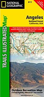
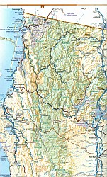
 Scale 1:80,000. Size 26"x38". National Geographic edition. National Geographic's Trails Illustrated map of Angeles National Forest in California is a two-sided, waterproof map designed to meet the needs of outdoor enthusiasts with unmatched durability and detail. This map was created in conjunction with local land management agencies and is loaded with valuable recreation information. Trails Illustrated maps are expertly researched and frequently updated. The maps are printed in the United States on durable synthetic paper, making them waterproof, tear-resistant, and trail tough—capable of going anywhere you do.
 - $12.95
Item Code : FRKO5946
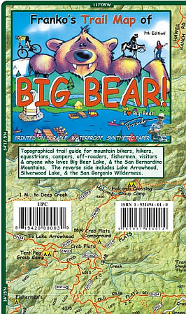
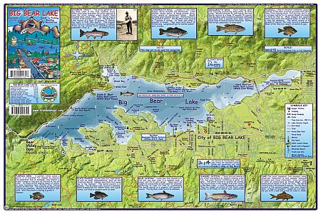
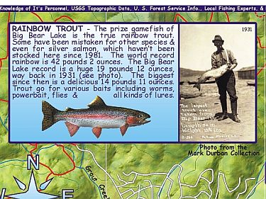
 "Various scales". Size 14"x21". Franko maps edition. Laminated. The Big Bear Lake map is a guide map to fishing, boating and recreation. A map of Big Bear Lake, California is on one side of the map with drawings and information on fish. The reverse side has information on regulations, community directory, and a listing of recreation facilities. Franko's Maps produces recreation maps for the land and water of selected tourist destinations. The maps are all printed on plasticized paper so they are water resistant.
 - $12.95
Item Code : FRKO5947
 Size 6"x9". Franko maps edition. The Big Bear Lake map is a guide map to fishing, boating and recreation. A map of Big Bear Lake, California is on one side of the map with drawings and information on fish. The reverse side has information on regulations, community directory, and a listing of recreation facilities. Franko's Maps produces recreation maps for the land and water of selected tourist destinations. The maps are all printed on plasticized paper so they are water resistant.
 - $16.95
Item Code : NATL21575
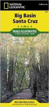 National Geographic edition. National Geographic's Trails Illustrated map of Big Basin/Santa Cruz Parks and Preserves is a two-sided, waterproof map designed to meet the needs of outdoor enthusiasts with unmatched durability and detail.
 - $12.95
Item Code : BENC22499
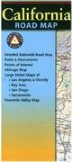
 Scale 1:1,318,821. Benchmark Maps edition. This is the most detailed single-sheet road map of California that is available. Includes state parks and numerous recreation opportunities and information.
 - $17.95
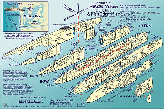
Item Code : FRKO5949
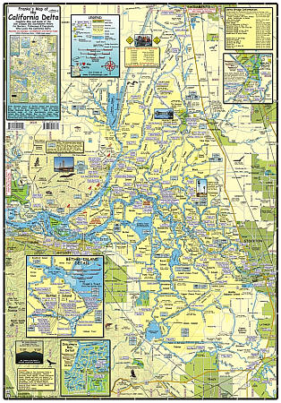
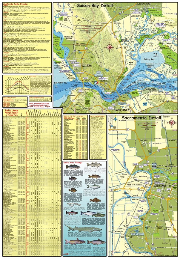 Scale 1:70,000. Size 19"x27". Franko maps edition. Laminated. The California Delta map and guide covers the San Joaquin and Sacramento Rivers for boaters, fishermen and delta travelers. Includes detailed insets of Bethel Island and Discovery Bay, air and water temperature chart, and Delta Bridge clearance data. The reverse side of map includes detailed maps of the Sacramento area, and Suisun Bay from Honker Bay to the Napa River, plus a list of marinas, resorts, launches and piers, tide corrections data, and fish guide. Franko's Maps produces recreation maps for the land and water of selected tourist destinations. The maps are all printed on plasticized paper so they are water resistant.
 - $10.95
Item Code : FRKO5950
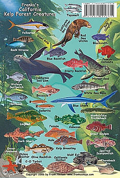
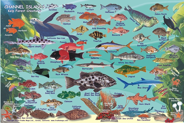
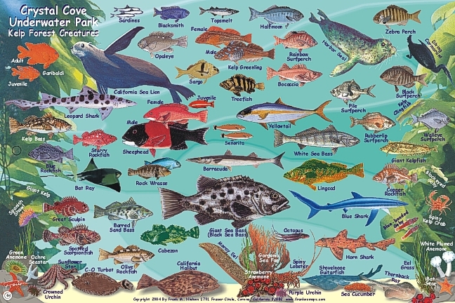
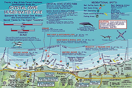
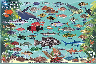
 Size 4"x6". Franko maps edition. Laminated. This mini, laminated card features beautiful and accurate drawings of kelp forest creatures from all over California's kelp forests, including fishes, sea lions, sea stars, rays, the octopus, the spiny lobster, colorful anemones, urchins, the brilliant Spanish shawl, and even a diving cormorant. Franko's Maps produces recreation maps for the land and water of selected tourist destinations. The maps are all printed on plasticized paper so they are water resistant.
 - $11.95
Item Code : EART5951
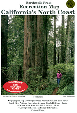
 Scale 1:62,500. Size 27"x39". Earthwalk Press edition.
 - $10.95
Item Code : FRKO5953
 "Various scales". Size 15"x22". Franko maps edition.
 - $10.95
Item Code : SCAL5958
Southern California Automobile Association edition. Covers the most popular stretches of the Colorado River, from Lake Mead, Nevada, to Yuma, Arizona. Includes information on water sports, campgrounds, fishing, hunting, and golf. - $11.95
Item Code : TOMH5959
Scale 1:24,000. Printed on weather-resistant "Polyart". - $16.95
Item Code : NATL21053
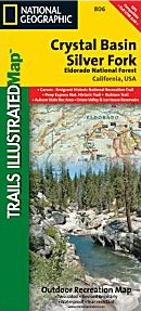
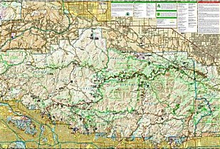
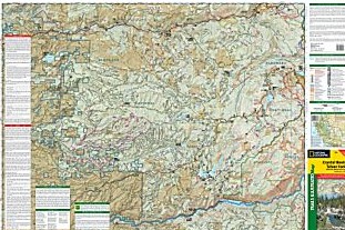 Scale 1:63,360. Size 26"x38". National Geographic edition. Part of our coverage for California's Central Sierra Nevada, our Crystal Basin & Silver Fork Trails Illustrated map details the high use recreation areas of Eldorado National Forest stretching from Hell Hole Reservoir and Tahoe National Forest at the North, to Salt Springs Reservoir and Stanislaus National Forest to the South. This popular stretch of the Sierras contains year-round recreation opportunities for outdoor enthusiasts of all interests. Crystal was developed in cooperation with the Eldorado National Forest Interpretive Association, ensuring the accuracy of information. Coverage Highlights: High Use areas of Eldorado National Forest; Auburn State Recreation Area; Western extent of the Desolation Wilderness; Rubicon Trail; Highway 50 Corridor; Carson-Emigrant National Recreation Trail; Portions of the Pony Express National Historic Trail; Camp Eldorado & Minkalo (BSA); Middle and South Forks of the American River; Rubicon River; Ice House, Union Valley, and Salt Springs Reservoirs; Hiking, Biking, Horse, Multi-Use, OHV, and Snowmobile Trails; Forest Service Roads with Numbers; Public and Private Land Boundaries; UTM and Lat/Lon Grids and Select Waypoints.
 - $12.95
Item Code : FRKO5954
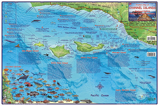
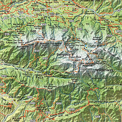
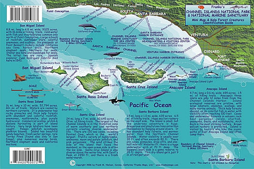
 "Various scales". Size 14"x21". Franko maps edition. Laminated. It shows the Santa Barbara-Ventura Coast of California with the five islands (San Miguel Island, Santa Rosa Island, Santa Cruz Island, Anacapa Island, and Santa Barbara Island) in fabulous green shaded relief to show their hills and valleys, as they sit in an ocean of descending blue contours. Shaded-relief accuracy is via USGS data, and ocean depth contours are from NOAA data. Map includes A brief summary description of each island, beautiful underwater wildlife photos, drawings of dozens of local undersea critters and dive sites.
 - $10.95
Item Code : FRKO5955
 Size 6"x9". Franko maps edition. Laminated.
 - $17.95
Item Code : TRAL5957
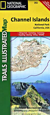
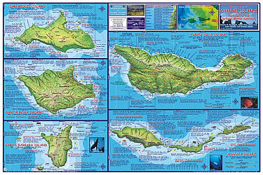
 Scale 1:50,000. Size 26"x38". Trails Illustrated edition. This two-sided map of San Miguel, Santa Rosa, Santa Cruz, Santa Barbara, and Anacapa Islands combines beautiful cartography that shows the topology and natural features of each island, along with hiking trails, camping spots, rest areas, notable ship wrecks, marine reserves, and other features to help get you around each of the islands. Large scale insets of Santa Cruz's Scorpion Area, Santa Barbara Island, and Anacapa Island show trail detail, camping, picnic areas, and facilities. Also included are detailed descriptions of each island, along with safety information, regulations and guidelines, hiking information and camping information. Includes UTM grids for use with your GPS unit.
 - $10.95
Item Code : FRKO5960
 Size 6"x9". Franko maps edition. Laminated.
 - $17.95
Item Code : TRAL5961
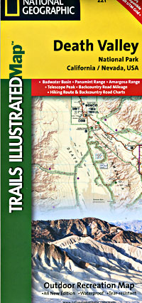
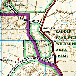 Scale 1:165,000. Size 25"x37". Trails Illustrated edition. Printed on waterproof, tear-resistant, lightweight, paper-like plastic. Death Valley National Park, which straddles the border of eastern California and western Nevada, encompasses the hottest, driest, and lowest places in the U.S. Within its three million acres you will find oceans of sand dunes, dramatic snow-capped mountains, spectacular geological formations, and breathtaking views. This map includes the entire national park area, with detailed trails and topographic information. The trails have been enhanced, and road and trail mileage have been added to create a map that is an essential guide for the area. Includes UTM grids for use with your GPS unit.
 - $11.95
Item Code : TOMH5962
Scale 1:250,000. Tom Harrison Press edition. Printed on weather-resistant "Polyart". - $11.95
Item Code : TOMH5964
Scale 1:42,240. Printed on weather-resistant "Polyart". - $10.95
Item Code : FRKO5968
 Size 6"x9". Franko maps edition. Laminated.
| Postage and handling is $4.40 for the first map and $1.80 for each additional map. ~ ~ ~ ~ ~ ~ Foreign delivery is $15.80 for the first map and $7.60 for each additional map. ~ ~ ~ ~ ~ ~ Canada delivery is $15.80 for the first map and $7.60 for each additional map. |
| Postage and handling is $4.40 for the first map and $1.80 for each additional map. ~ ~ ~ ~ ~ ~ Foreign delivery is $15.80 for the first map and $7.60 for each additional map. ~ ~ ~ ~ ~ ~ Canada delivery is $15.80 for the first map and $7.60 for each additional map. |
Plan your recreational activities with the California Recreation Maps
So you have planned to visit California this holiday? What all activities should you do? Which places should you visit? What recreation activities does California offer? The questions are many. And consequently the answers are many too.
But you don’t need to worry. We are here to simplify everything for you. We present to you some of the top recreational activities you can do in California.:
- Visit the Walt Disney Family Museum in San Francisco to know and explore the history of Disney.
- How does a Wine tour seem to you? Appealing!! Then there is Green Dream Tours- Wine Country Tour Specialists. They will take you on a wine tour.
- How about a tour in water? You can go on a Boat Tour in Alcatraz islands for sightseeing.
- Fancy watching the sea in the night? The view is spectacular. You can go for a luxury Dinner cruise in San Diego.
- Visit the Napa Valley in style from San Francisco. Board the Napa Valley Wine Train. Enjoy the picturesque views of the valley with a fine gourmet meal and a lot of wine tasting.
- For a little adrenaline rush, go for a hot air balloon ride in Napa Valley.
- The Glacier Point in Yosemite National Park is worth to go to. How about a hike to the Glacier point.
- For some adventure, there is a 3 lap ride at Mazda Raceway Laguna Seca with a professional driver.
- Go to skydiving in Los Angeles. For the first timers they have indoor skydiving facilities too.
- Go on a Walking tour to Little Italy and North Beach. Enjoy the exotic food and culture in the tour.
- Go for a Whale Watching Excursion at Dana Point.
If you want to look for some more recreational activities in California, there is an all new California Recreation Map. It will give you a clear and accurate picture of all the places in California that you can visit for recreation.
California Recreation Maps for Tourists and TravelersDetailed Recreation Map of CaliforniaBuy travel maps for California tourist attractions, recreation, road trips, street guide, driving directions and more |
