
California City Maps S to Z | Detailed Travel Tourist Street
Exploring California through city maps- San Francisco to Z.
The most populous state of the powerful country U.S., California is the most culturally diverse area of U.S. It is the third largest state of U.S. in terms of area and has beautiful forests and beaches.
California, due to its mesmerizing beauty, has always been the favorite tourist place for people across the globe. Moat area of this state has the Mediterranean climate. However, people find it amusing as there are beaches to chill out in summers and forests to enjoy winters.
Apart from this, California is also rich in infrastructure. It has the Hollywood entertainment industry in Los Angeles and the popular Golden Gate Bridge in San Francisco. San Francisco is the hilly area of California. It is one of the most beautiful counties of California.
California has many counties, cities and towns, one of them being San Francisco. It is named after St. Francis of Assisi.
San Francisco is said to be the cultural, financial and commercial center of northern California. It is the most popular tourist places in California because of its extremely cool weather and rich habitat. San Francisco is known by various names such as San Fran, Fog city, The city of Bay, The Paris of West and many more.
The tourism for San Francisco is open through out the year due to its leasing environment. Only concern for the people is the fog in the city because this city can be really foggy during some times of the year. It is highly recommended to hire guides while visiting San Fran because there are many astonishing places that are not much popular but you will be stunned after visiting them. City maps also help here. The maps have all guide lines and all land marks marked so that you miss none of them.
California City Street Maps for Tourists and TravelersDetailed Road Map of California Cities (S to Z)Buy travel maps for California City tourist attractions, road trips, street guide, driving directions and more |
California City Maps, San Francisco to Z
-
- $10.95
Item Code : KING5922
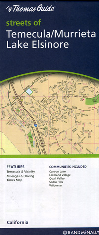
Temecula and Murrieta, California, America. -
- $10.95
Item Code : KING5925
King of the Road edition. - $14.95
Item Code : GMJO21234

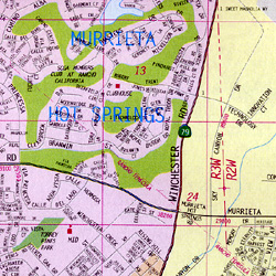
 G.M. Johnson edition. Detailed street map of Temecula/Murrieta and Lake Elsinore Including Canyon Lake, Rancho California and Wildomar.
 - $10.95
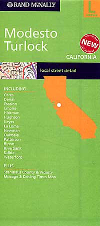
Item Code : RAND5921
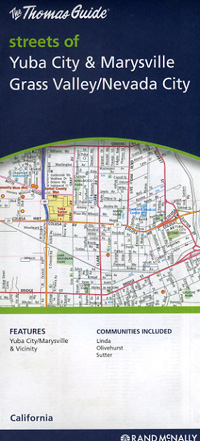
 Scale 1:34,000. Size 28"x40". Rand McNally edition.
 - $10.95
Item Code : RAND5923
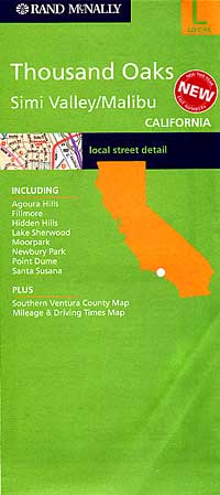
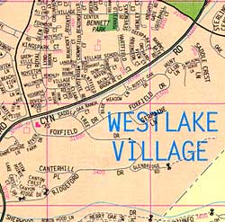 Scale 1:34,000. Size 28"x40". Rand McNally edition. Also includes the Agoura Hills, Fillmore, Hidden Hills, Lake Sherwood, Moorpark, Newbury Park, Point Dume, Santa Susana, Westlake Village, Southern Ventura County, and more.
 - $10.95
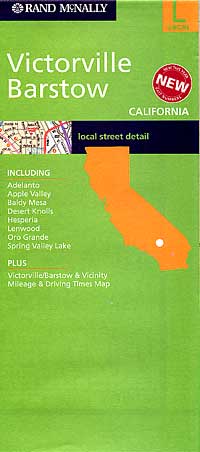
Item Code : RAND5926
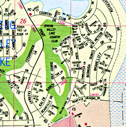
 Scale 1:40,000. Size 28"x40". Rand McNally edition.
 - $10.95
Item Code : RAND5927
 Scale 1:33,000. Size 27"x39". Rand McNally edition.
 - $10.95
Item Code : RAND5930
 Scale 1:36,000. Size 28"x40". Rand McNally edition.
 - $10.95
Item Code : RAND5931
 Scale 1:34,000. Size 28"x40". Rand McNally edition.
 -
-
- $10.95
Item Code : KING5932
King of the Road edition. - $14.95
Item Code : GMJO22574
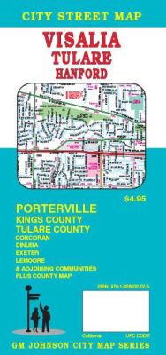
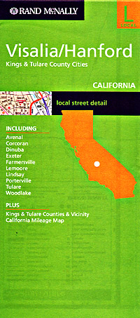
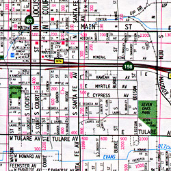
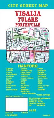 Scale 1:36,000. Size 27"x39". G.M. Johnson edition. This Map Coverage Area are Alpaugh, Armona, Avenal, Camp Nelson, Corcoran, Dinuba, Ducor, Earlimart, Exeter, Farmersville, Globe, Hanford, Home Garden, Ivanhoe, Kettleman City, Lemoncove, Lemoore, Lemoore Station, Lindsay, Orosi, Pixley, Ponderosa, Poplar, Porterville, Santa Rosa, Indian Rancheria, Seville, Springville, Stratford, Strathmore, Terra Bella, Three Rivers, Tipton, Traver, Tulare, Visalia, Woodlake, Kings County, Tulare County, Partial Coverage.
 - $10.95
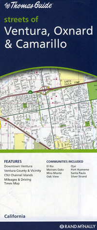
Item Code : AMER5929
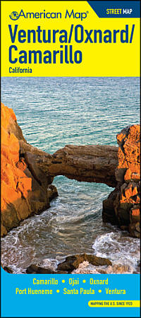 Size 27"x39". American Map Company edition. The Ventura/Oxnard/Camarillo Street Map covers Camarillo, Ojai, Oxnard, Port Hueneme, Santa Paula, and Ventura. It also includes a listing of parks, beaches, campsites, picnic areas, schools, libraries, post offices, zip codes, points of interest, and more.
 - $10.95
Item Code : RAND5933
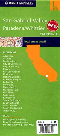
 Scale 1:35,000. Size 28"x40". Rand McNally edition. Also includes Alhambra, Arcadia, Baldwin Park, City of Commerce, City of Industry, Downey, East Los Angeles, El Monte, Hacienda Heights, La Habra Heights, La Puente, Monrovia, Montebello, Monterey Park, Pico Rivera, Rosemead, San Gabriel, Santa Fe Springs, South El Monte, South Pasadena, South San Gabriel, and Temple City.
 - $10.95
Item Code : RAND5935
 Scale 1:28,500. Size 18"x26?". Rand McNally edition.
Exploring California through city maps- San Francisco to Z.
The most populous state of the powerful country U.S., California is the most culturally diverse area of U.S. It is the third largest state of U.S. in terms of area and has beautiful forests and beaches.
California, due to its mesmerizing beauty, has always been the favorite tourist place for people across the globe. Moat area of this state has the Mediterranean climate. However, people find it amusing as there are beaches to chill out in summers and forests to enjoy winters.
Apart from this, California is also rich in infrastructure. It has the Hollywood entertainment industry in Los Angeles and the popular Golden Gate Bridge in San Francisco. San Francisco is the hilly area of California. It is one of the most beautiful counties of California.
California has many counties, cities and towns, one of them being San Francisco. It is named after St. Francis of Assisi.
San Francisco is said to be the cultural, financial and commercial center of northern California. It is the most popular tourist places in California because of its extremely cool weather and rich habitat. San Francisco is known by various names such as San Fran, Fog city, The city of Bay, The Paris of West and many more.
The tourism for San Francisco is open through out the year due to its leasing environment. Only concern for the people is the fog in the city because this city can be really foggy during some times of the year. It is highly recommended to hire guides while visiting San Fran because there are many astonishing places that are not much popular but you will be stunned after visiting them. City maps also help here. The maps have all guide lines and all land marks marked so that you miss none of them.
California City Street Maps for Tourists and TravelersDetailed Road Map of California Cities (S to Z)Buy travel maps for California City tourist attractions, road trips, street guide, driving directions and more |
