
Exploring California through city maps- San Francisco to Z.
The most populous state of the powerful country U.S., California is the most culturally diverse area of U.S. It is the third largest state of U.S. in terms of area and has beautiful forests and beaches.
California, due to its mesmerizing beauty, has always been the favorite tourist place for people across the globe. Moat area of this state has the Mediterranean climate. However, people find it amusing as there are beaches to chill out in summers and forests to enjoy winters.
Apart from this, California is also rich in infrastructure. It has the Hollywood entertainment industry in Los Angeles and the popular Golden Gate Bridge in San Francisco. San Francisco is the hilly area of California. It is one of the most beautiful counties of California.
California has many counties, cities and towns, one of them being San Francisco. It is named after St. Francis of Assisi.
San Francisco is said to be the cultural, financial and commercial center of northern California. It is the most popular tourist places in California because of its extremely cool weather and rich habitat. San Francisco is known by various names such as San Fran, Fog city, The city of Bay, The Paris of West and many more.
The tourism for San Francisco is open through out the year due to its leasing environment. Only concern for the people is the fog in the city because this city can be really foggy during some times of the year. It is highly recommended to hire guides while visiting San Fran because there are many astonishing places that are not much popular but you will be stunned after visiting them. City maps also help here. The maps have all guide lines and all land marks marked so that you miss none of them.
California City Street Maps for Tourists and TravelersDetailed Road Map of California Cities (S to Z)Buy travel maps for California City tourist attractions, road trips, street guide, driving directions and more |
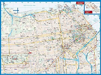
California City Maps, San Francisco to Z
- $10.95
Item Code : AMER5882
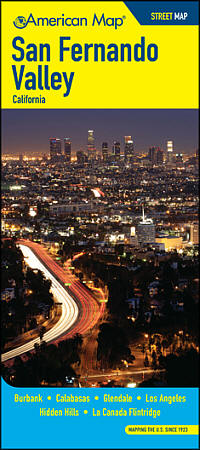 Scale 1:31,000. Size 27"x39". American Map Company edition. This map features clear detailed mapping of the San Fernando Valley area including Burbank, Calabasas, Glendale, Los Angeles, Hidden Hills, and La Canada Flintridge. It also includes block numbers, zip codes, shopping centers, golf courses and country clubs, schools and universities, parks, airports, hospitals, cemeteries, and much more!
 -
- $12.95
Item Code : ROUG5883
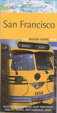
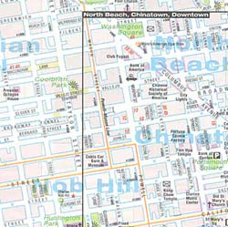 Scale 1:14,400. Size 20"x25". Rough Guide edition. Printed on tear-resistant, waterproof, lightweight, paper-like plastic. English text and legends. Rugged and convenient.
 - $17.95
Item Code : BORC5884
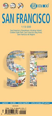
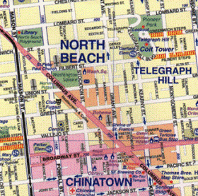
 Scale 1:13,000. Size 19?"x26". Borch edition. Indexed. Legend includes museums, monuments, churches, synagogues, golf/tennis courts, bus stations, international airports, airfields, points of interest, cable car routes, hotels, nature preserves, view points, camping sites, beaches. Includes inset of Alcatraz Island (1;15,000), Golden Gate Park (1:13,000), S.F. Bay Area (1:400,000), S.F. and Region (1:150,000), BART System and Muni Metro System map. A month-by-month chart shows average high temperatures, precipitation, humidity, and hours of sunshine per day.
 - $14.95
Item Code : GMJO1493
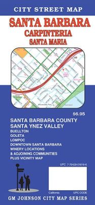
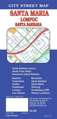 Scale 1:32,000. Size 27"x39". G.M. Johnson edition. This Map Coverage Area are Santa Ynez Valley, Santa Barbara, Buellton, Carpinteria, Goleta, Guadalupe, Lompoc, Los Alamos, Solvang, Montecito, Santa Barbara, Santa Maria, Vanderberg AFB, Winery Locations, Santa Barbara County.
 - $17.95
Item Code : ITMB5885
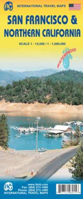
 Scale 1:12,500. Size 26"x38". International Travel Maps edition. Indexed. This most recent edition of our popular San Francisco and region map arrives just at the start of the summer season. Sans Francisco must be one of the most interesting and livable cities in America; certainly a great favorite of mine. The entire city is shown in great detail, along with one of the special features of ITM maps the entire rapid transit system. The road network, with one-way streets is clearly shown, and as many touristic attractions as we could fit without over-crowding. The regional map covering the road network from Bakersfield north to the Oregon border has also been updated, comprising the touristic highlights : Yosemite, Death Valley, Kings Canyon, Sequoia, Redwood, Lassen National Parks, State Parks and National Forests. The map is printed on durable plastic paper with complete index of all cities and towns in the map.
 - $16.95
Item Code : NATL5886
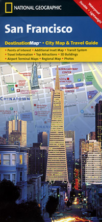
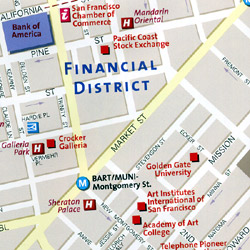 Scale 1:10,100. Size 18"x25". National Geographic edition. Beautiful, large-scale map. Very detailed. Easy to read. Exploring San Francisco is as easy as unfolding this sturdy, laminated map. The front features a large-scale city map that highlights tourist and business travel locations with 3-D styled drawings. The back includes: Regional map; Points of interest; Airport diagrams for San Francisco International and Oakland International airports; Inset map of San Francisco - North, which includes Golden Gate Park and the Presidio; Bay Area Rapid Transit (BART) map; Multi-language legend.
 - $14.95
Item Code : GMJO2458
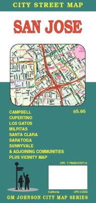
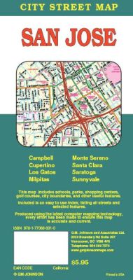 Scale 1:32,000. Size 27"x39". G.M. Johnson edition. This Map Coverage Area are Campbell, Cupertino, Los Gatos, Milpitas, Monte Sereno, Saratoga, Santa Clara, Sunnyvale.
 - $12.95
Item Code : MART5887
 Scale 1:24,000. Size 27"x39". MapArt edition.
 - $14.95
Item Code : GMJO2487
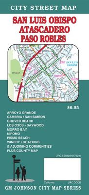
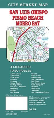 Scale 1:36,000. Size 27"x39". G.M. Johnson edition. This Map Coverage Area are Arroyo Grande, Atascadero, Avila Beach, Cambria, Cayucos, Grover Beach, Heritage Ranch, Los Osos – Baywood, Morro Bay, Nipomo, Oak Shores, Oceano, Paso Robles, Pismo Beach, San Luis Obispo, San Miguel, San Simeon Acres, Santa Margarita, Shandon, Shell Beach, Templeton, San Luis Obispo County.
 - $14.95
Item Code : GMJO3987
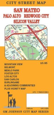
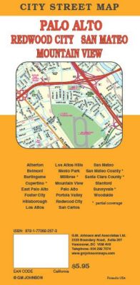 Scale 1:28,000. Size 27"x39". G.M. Johnson edition. This Map Coverage Area are Atherton, Belmont, Burlingame, Cupertino, East Palo Alto, Foster City, Hillsborough, Los Altos, Los Altos Hills, Menlo Park, Millbrae, Mountain View, Palo Alto, Portola Valley, Redwood City, San Carlos, San Mateo, Stanford, Sunnyvale, Woodside, San Mateo County, Santa Clara County, Partial Coverage.
 - $10.95
Item Code : RAND5890
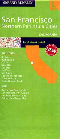
 Scale 1:22,500. Size 28"x40". Rand McNally edition. Includes Downtown San Francisco, San Francisco International Airport, plus includes Brisbane, Burlingame, Colma, Daley City, Milbrae, Pacifiica, San Bruno, South San Francicso, Treasure Island, and Yerba Buena Islands.
 - $14.95
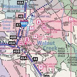
Item Code : GMJO7241
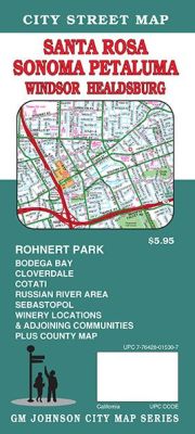
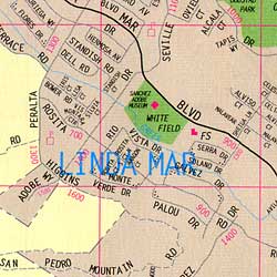
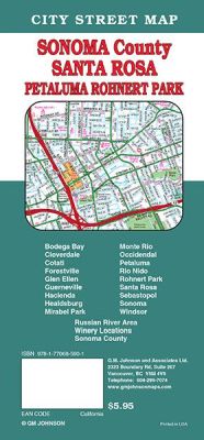 Scale 1:32,000. Size 27"x39". G.M. Johnson edition. This Map Coverage Area are Bodega Bay, Cloverdale, Cotati, Forestville, Glen Ellen, Guerneville, Hacienda, Healdsburg, Mirabel Park, Monte Rio, Occidendal, Petaluma, Rio Nido, Rohnert Park, Santa Rosa, Sebastopol, Sonoma, Windsor, Russian River Area, Winery Locations, Sonoma County.
 - $10.95
Item Code : RAND5891
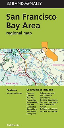
 Scale 1:190,000. Size 25"x36". Rand McNally edition. Includes the communities of Berkeley, Concord, Fairfield, Fremont, Hayward, Napa, Novato, Oakland, Peninsula Cities, Richmond, San Jose, San Rafael, Santa Rosa, Silicon Valley, Sonoma, and Vallejo.
 - $14.95
Item Code : GMJO8798
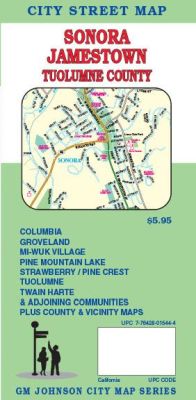
 Scale 1:32,000. Size 27"x20". G.M. Johnson edition. This Map Coverage Area are Tuolumne, Strawberry, Pine Crest, Groveland, Mi-wuk Village, Pine Mountain Lake, Columbia.
 - $17.95
Item Code : MRCO2145
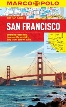 Scale 1:15,000. Marco Polo maps feature completely up-to-date, digitally generated mapping. The high quality cartography with distance indicators and scale converters aid route planning. The extensive coverage of the maps enables travellers to cross country boundaries with the same map. A fold-out overview map is ideal for route planning and 7 self-adhesive Marco Polo mark-it stickers can be used to pin-point a destination or route for future reference. Scenic routes and places of interest are highlighted - ideal for touring holidays. The maps also contain a comprehensive index and inset street plans of major cities.
 - $10.95
Item Code : CMEN5892
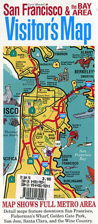
 Size 18"x24". Carol Mendel edition.
 - $10.95
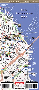
Item Code : VDAM22577
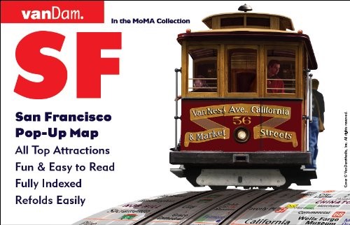
 Vandam edition. Published by the award-winning graphic artist and cartographer Stephen Van Dam, these laminated pocket maps offer superb detail in a handy pocket-sized format. The maps include shopping information, subway system information, images of major landmark buildings to help you orient yourself in the city, a street index, blow-ups of the main city-center tourist area, and much more. VanDam offers three different formats. Streetsmart is their main line of laminated detailed acordian-folded city maps. Popups are their small, shirt-pocket-sized maps with the flooming-flower-style fold pattern. The Unfolds maps are larger versions of the Popup maps and use the same blooming-flower style of folding.
 - $10.95
Item Code : VDAM22578

 Vandam edition. Published by the award-winning graphic artist and cartographer Stephen Van Dam, these laminated pocket maps offer superb detail in a handy pocket-sized format. The maps include shopping information, subway system information, images of major landmark buildings to help you orient yourself in the city, a street index, blow-ups of the main city-center tourist area, and much more. VanDam offers three different formats. Streetsmart is their main line of laminated detailed acordian-folded city maps. Popups are their small, shirt-pocket-sized maps with the flooming-flower-style fold pattern. The Unfolds maps are larger versions of the Popup maps and use the same blooming-flower style of folding.
 - $14.95
Item Code : GMJO21572
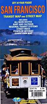 Size 23"x28". G.M. Johnson edition. Folded paper public and road transportation map.
| Postage and handling is $4.40 for the first map and $1.80 for each additional map. ~ ~ ~ ~ ~ ~ Foreign delivery is $15.80 for the first map and $7.60 for each additional map. ~ ~ ~ ~ ~ ~ Canada delivery is $15.80 for the first map and $7.60 for each additional map. |
Exploring California through city maps- San Francisco to Z.
The most populous state of the powerful country U.S., California is the most culturally diverse area of U.S. It is the third largest state of U.S. in terms of area and has beautiful forests and beaches.
California, due to its mesmerizing beauty, has always been the favorite tourist place for people across the globe. Moat area of this state has the Mediterranean climate. However, people find it amusing as there are beaches to chill out in summers and forests to enjoy winters.
Apart from this, California is also rich in infrastructure. It has the Hollywood entertainment industry in Los Angeles and the popular Golden Gate Bridge in San Francisco. San Francisco is the hilly area of California. It is one of the most beautiful counties of California.
California has many counties, cities and towns, one of them being San Francisco. It is named after St. Francis of Assisi.
San Francisco is said to be the cultural, financial and commercial center of northern California. It is the most popular tourist places in California because of its extremely cool weather and rich habitat. San Francisco is known by various names such as San Fran, Fog city, The city of Bay, The Paris of West and many more.
The tourism for San Francisco is open through out the year due to its leasing environment. Only concern for the people is the fog in the city because this city can be really foggy during some times of the year. It is highly recommended to hire guides while visiting San Fran because there are many astonishing places that are not much popular but you will be stunned after visiting them. City maps also help here. The maps have all guide lines and all land marks marked so that you miss none of them.
California City Street Maps for Tourists and TravelersDetailed Road Map of California Cities (S to Z)Buy travel maps for California City tourist attractions, road trips, street guide, driving directions and more |
