Have a Look at the Ancient City of Armenia with Maps
Armenia is positioned in the southern Caucasus Mountains and is the littlest of the previous Soviet republics. It is bordered on the north by Georgia, on east Azerbaijan, on south Iran, and on the west by Turkey. A territory of rocky mountains plus wiped out volcanoes, its top point is Mount Aragats which is 13,435 ft (4,095 m).
Travel Tourism plays a very important role in the economy of the country, however, traveling in Armenia is not very easy. The English language is not extensively spoken as well as one cannot reach the country easily. In spite of these blockages, millions of tourists even now visit this country which has very old churches, monasteries, plus loads of concealed treasures. Mount Atarat’s view is magnificent when seen from the Khor Virap Monastery which is a 17th-century church and has its own history.
Yerevan the capital of Armenia is also home to a lot of architectural as well as religious treasures. Etchmiadzin Cathedral plus the Garni Temple are the famous attractions of the city.
Other admired tourist destinations are Dilijan which is a popular forest resort; Jermuk is well known for its mineral waters, and Tsaghkadzor is a trendy ski destination.
Armenia Maps
Armenia is a non-coastal mountainous state in Eurasia. Armenia spans the boundary between Europe as well as Asia, both geographically plus culturally. With its harsh past optimistically behind it, Armenia now looks forward to developing and growing in the next coming years. The country, in fact, offers a unique opportunity to visit a place that is on the verge of several major changes. If you are planning to visit this country then make it a point to have a map in your hands. Our maps are informative and they will guide you through the nook and corner of the country efficiently.
Armenia Road Maps for Tourists and TravelersDetailed Road Map of ArmeniaBuy travel maps for Armenia tourist attractions, road trips, street guide, driving directions and more |
Armenia
- $17.95
Item Code : ITMB5086
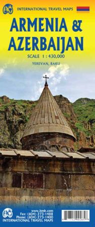
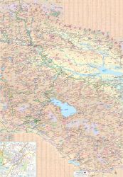
Scale 1:430,000. Size 27"x39". International Travel Maps edition.
It is unfortunate that these two neighbouring countries dislike each other so much, because both are lovely countries to visit. Due to the way the two became separate political entities, both have enclaves surrounded by the other and it is impossible to map one without mapping both unless one wipes out roads leading through the other's territory, resuming the roads and towns once it returns to the politically correct entity.
The two have to be mapped as one, and visited as one; internally, the Armenians tend to inhabit the western third and portions of the centre, the Azeri most of the rest of the area, with enclaves of Avars, Lezgins, Cachuri, and Talys in specific areas. A second problem with mapping the two countries is that each insists that roads that used to be main transportation conduits were severed during the nationalistic creation of both entities, but both sides insist that these non-usable roads are still the main, or national, highways.
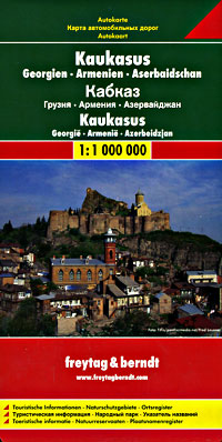
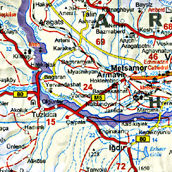
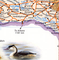
Which ones are open, which ones have new by-pass routes, and which are closed is exceptionally difficult to record. We have done our best, and in our opinion, our map is more realistic than others on the market. Of course, the map shows points of interest, museums, churches of note, historic sites, airports etc. Detailed inset maps of Yerevan "capital of Armenia" and Baku "Azerbaijan" are included.
- $17.95
Item Code : FREY5087
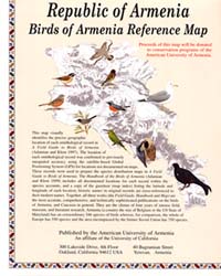
- $12.95
Item Code : AUAC5089
| Postage and handling is $4.40 for the first map and $1.80 for each additional map. ~ ~ ~ ~ ~ ~ Foreign delivery is $15.80 for the first map and $7.60 for each additional map. ~ ~ ~ ~ ~ ~ Canada delivery is $15.80 for the first map and $7.60 for each additional map. |
Have a Look at the Ancient City of Armenia with Maps
Armenia is positioned in the southern Caucasus Mountains and is the littlest of the previous Soviet republics. It is bordered on the north by Georgia, on east Azerbaijan, on south Iran, and on the west by Turkey. A territory of rocky mountains plus wiped out volcanoes, its top point is Mount Aragats which is 13,435 ft (4,095 m).
Travel Tourism plays a very important role in the economy of the country, however, traveling in Armenia is not very easy. The English language is not extensively spoken as well as one cannot reach the country easily. In spite of these blockages, millions of tourists even now visit this country which has very old churches, monasteries, plus loads of concealed treasures. Mount Atarat’s view is magnificent when seen from the Khor Virap Monastery which is a 17th-century church and has its own history.
Yerevan the capital of Armenia is also home to a lot of architectural as well as religious treasures. Etchmiadzin Cathedral plus the Garni Temple are the famous attractions of the city.
Other admired tourist destinations are Dilijan which is a popular forest resort; Jermuk is well known for its mineral waters, and Tsaghkadzor is a trendy ski destination.
Armenia Maps
Armenia is a non-coastal mountainous state in Eurasia. Armenia spans the boundary between Europe as well as Asia, both geographically plus culturally. With its harsh past optimistically behind it, Armenia now looks forward to developing and growing in the next coming years. The country, in fact, offers a unique opportunity to visit a place that is on the verge of several major changes. If you are planning to visit this country then make it a point to have a map in your hands. Our maps are informative and they will guide you through the nook and corner of the country efficiently.
Armenia Road Maps for Tourists and TravelersDetailed Road Map of ArmeniaBuy travel maps for Armenia tourist attractions, road trips, street guide, driving directions and more |


