
|
United States Road Maps |
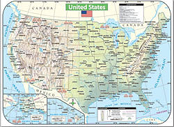
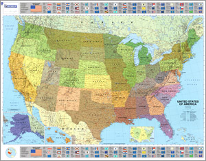
United States
- $32.95 Rolled + $7.80 p&h or $24.80 foreign delivery
Item Code : NATL4768

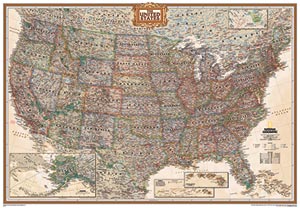
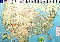
 Scale 1:4,560,000. Size 30"x43". National Geographic edition. Laminated. This is a beautiful map that looks much clearer and better than this illustration. The states are shown in slightly different color hues and the shaded relief of the mountains is dramatic.
 - $24.95 Rolled + $7.80 p&h or $24.80 foreign delivery
Item Code : NATL4769
 Scale 1:4,560,000. Size 30"x43". National Geographic edition. Not laminated.
 - $44.95 Rolled + $10.80 p&h or $48.80 foreign delivery
Item Code : HEMA4772
 Scale 1:4,250,000. Size 39"x47". Hema maps edition. Laminated.
 - $29.95 Rolled + $10.80 p&h or $48.80 foreign delivery
Item Code : HEMA4773

 Scale 1:4,250,000. Size 39"x47". Hema maps edition.
 - $24.95 + $12.80 p&h or $46.80 foreign delivery
Item Code : UNIV4778
 Size 36"x48". Universal Map edition. Laminated.
 - $38.95 + $12.80 p&h or $46.80 foreign delivery
Item Code : MICH4779
 Scale 1:3,450,000. Size 40"x50". Michelin edition. Laminated. This is a totally beautiful map.
 - $28.95 + $12.80 p&h or $46.80 foreign delivery
Item Code : MICH4780
 Scale 1:3,500,000. Size 40"x56". Michelin edition.
 - $28.95 + $12.80 p&h or $46.80 foreign delivery
Item Code : MICH4781
 Scale 1:3,450,000. Size 40"x56". Michelin edition.
 - $22.95 Rolled + $10.80 p&h or $46.80 foreign delivery
Item Code : NATL4791
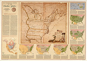
 Size 31"x44". National Geographic edition.
 - $440.95 + $34.80 p&h
Item Code : UNIV4770
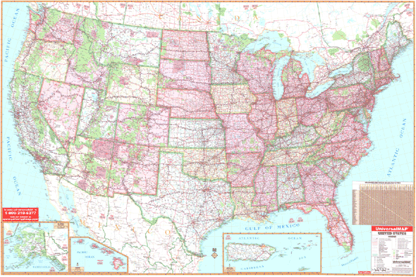 Size 140" W x 90" H. Laminated. The 3rd edition Wall Map of the United States by Universal Map measures at a scale of 1" = approximately 23 1/2 miles. Published with a laminated surface that is both markable and washable. Indexed in a separate book. Features color-coded states, insets of Alaska, Hawaii, and Puerto Rico. Includes a mileage chart between major cities. Details include state highways, interstate highways, mountain ranges, cities and towns, state lines, time zones, and longitude and latitude lines. DOES NOT INCLUDE HANGING RAILS OR ROLLER OPTIONS.
 - $399.95 + $32.80 p&h
Item Code : UNIV4771
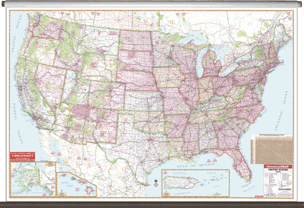
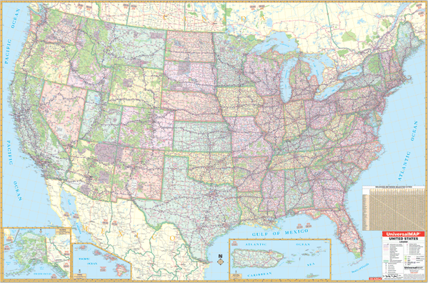 Scale 1:3,200,000. Size 108" W x 72" H. Laminated. The 3rd edition Wall Map of the United States by Universal Map measures at a scale of 1" = approximately 32 miles. Published with a laminated surface that is both markable and washable. Indexed in a separate book. Features color-coded states, insets of Alaska, Hawaii and Puerto Rico, and a mileage chart between major cities. Details include state highways, interstate highways, freeways, rivers and lakes, national forests, mountain ranges, cities and towns, state lines, time zones, and longitude and latitude lines. DOES NOT INCLUDE HANGING RAILS OR ROLLER OPTION.
 - $229.95 + $24.80 p&h (add $40 for spring rollers)
Item Code : UNIV4782
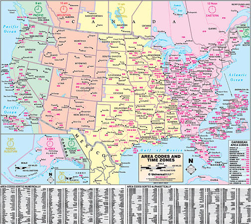 Size 60" W x 54" H. Laminated. The 3rd Edition Area Code and Time Zone Wall Map of the United States by Universal Map and is printed in color with a markable and washable laminated surface. Features include color shaded time zones, area codes and boundaries, charts sorting area codes numerically and alphabetically, and an inset of Caribbean area codes. Framing rails are included on top and bottom for easy wall mounting. Railed wall maps can be turned into pull down maps on spring rollers for an additional $40.
 - $229.95 + $24.80 p&h (add $40 for spring rollers)
Item Code : UNIV4783
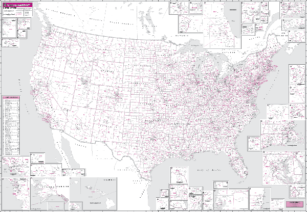
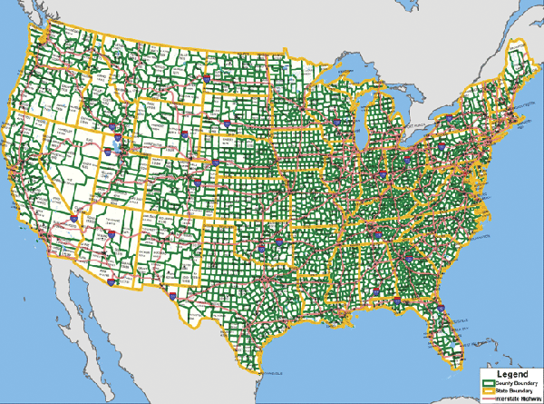 Scale 1:35,00,000. Size 75" W x 54" H. Laminated. This edition wall map of the United States with County Populations by Universal Map measures. Printed in color with a markable and washable laminated surface. Has hanging rails on top and bottom for ease in mounting. Details include state names and boundaries, time zones, U.S. Interstate highways, county names and boundaries, and county populations from 2000 Census. Railed wall maps can be turned into pull down maps on spring rollers for an additional $40.
 - $229.95 + $24.80 p&h (add $40 for spring rollers)
Item Code : UNIV4784
 Scale 1:40,00,000. Size 77" W x 54" H. Laminated. The 2nd edition United States Dispatcher's Wall Map by Universal Map shows Weigh Station locations. Uses up-to-date cartography. Surface is laminated, markable, and washable. Indexed in a separate book, has hanging rails mounted on top and bottom. Special features include color coded states, a mileage chart between major cities, insets of Alaska, Hawaii, and Puerto Rico, and a list of weigh station locations on the face of the map. Details include state highways, interstate highways, freeways, rivers and lakes, national forests, mountain ranges, cities and towns, state lines, time zones, longitude & latitude lines, and interchange & exit numbers. Railed wall maps can be turned into pull down maps on spring rollers for an additional $40.
 - $229.95 + $24.80 p&h (add $40 for spring rollers)
Item Code : UNIV4785
 Scale 1:50,00,000. Size 60" W x 40" H. Laminated. The United States Wall Map is published by Universal map. Provides inset maps of Alaska and Hawaii. Printed on a laminated surface that is both markable and washable. Indexed in a separate book. Mounted on hanging rails both top and bottom. Map details include state and interstate highways, freeways, rivers and lakes, national forests, mountain ranges, cities and towns, national monuments, historical sites, state lines, time zones, longitude and latitude lines, and color-coded states. Railed wall maps can be turned into pull down maps on spring rollers for an additional $40.
 - $229.95 + $24.80 p&h (add $40 for spring rollers)
Item Code : UNIV4787
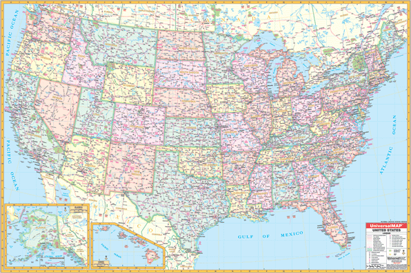
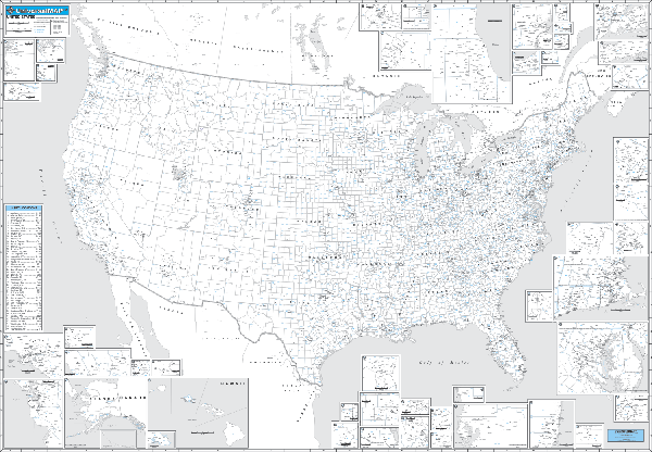
 Size 77" W x 54" H. Laminated. Bright, contrasting colors clearly identify political divisions on this 2nd edition Wall Map of the United States by Universal Map. The Special Features and Data contained on this large scale wall map of the United States are as follows: interstate highways, all state highways, time zones, interstate highways, freeways, rivers and lakes, national forests, state lines, mountain ranges, cities and towns. Map Insets Include: Alaska, Hawaii, and Puerto Rico. A special feature of this map is the color coded states. The map is protected with a laminated finish, which is both markable and washable. Framing rails are included on top and bottom for easy wall mounting. Railed wall maps can be turned into pull down maps on spring rollers for an additional $40.
 - $129.95 + $24.80 p&h
Item Code : UNIV4788
 Size 64" W x 45" H. Laminated. The United States Rush Hour Wall Map by Universal Map is printed in color with a laminated surface. This surface is both markable and washable. Rush Hour Zips-3 digit zip code: Boundaries and Numbers. Other details included are cities and towns of a 5,000 plus population, state names and boundaries, and county names and boundaries. Special map features include insets of Alaska, Hawaii, and Puerto Rico; and insets of 46 cities in more detail. Framing rails are included on top and bottom for easy wall mounting.
 - $129.95 + $24.80 p&h
Item Code : UNIV4789
 Size 64" W x 45" H. Laminated. The United States Rush Hour Wall Map by Universal Map is printed in color with a laminated surface. This surface is both markable and washable. The map measures and includes Rush Hour MSA (Metropolitan Statistical Area): Boundaries and Numbers. Other details included are cities and towns of a 5,000 plus population, state names and boundaries, and county names and boundaries. Special map features include insets of Alaska, Hawaii, and Puerto Rico; and insets of 46 cities in more detail. Framing rails are included on top and bottom for easy wall mounting.
 - $229.95 + $24.80 p&h (add $40 for spring rollers)
Item Code : UNIV4790
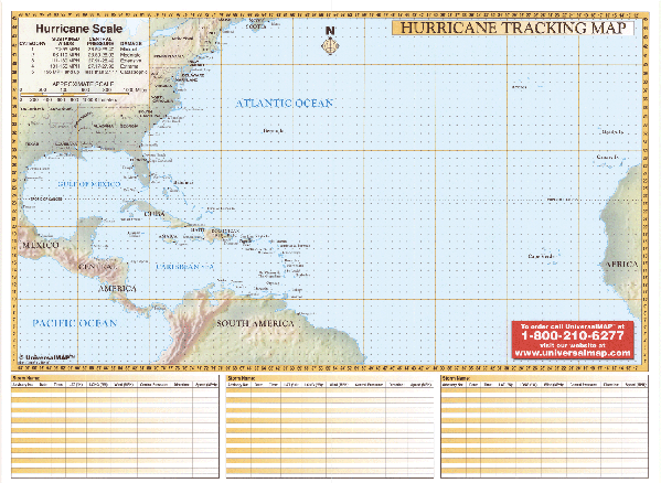 Size 67" W x 50" H. Laminated. The Hurricane Tracking Chart Wall Map by Universal Map includes boundaries ranging north to the Maine-Nova Scotia Coast; south to the South American Northern Coastline; east to the African Coastline; and west to the Texas-Mexican coast and Central American coast. Features gridded longitude/latitude lines, a hurricane scale chart, and three storm tracking charts lithographed in eight colors, and laminated. Framing rails are included on top and bottom for easy wall mounting. Railed wall maps can be turned into pull down maps on spring rollers for an additional $40.
 - $269.95 Rolled + $24.80 p&h
Item Code : UNIV4792
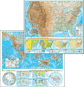 Size 54"x64". Universal Map edition. Laminated. The U.S./World Advanced Physical Combo Classroom Wall Map features thematic inset content that includes annual rainfall, natural vegetations areas plus areas of acid rain, population density per square mile and ethnic diversity, and energy resources and manufacturing areas. The Advanced Physical Classroom Wall Map features innovative shaded relief detail of the world, continents, and the United States. This high quality series is appropriate for grades 6-12, and includes content that meets national and state curriculum standards. Four thematic inset maps enhance the value of the main map. The world map features the Van Der Grinten projection. Wall maps measure 64" x 54." Also available in a compact 13" x 18" deskpad map format. Mounted on roller with backboard. This product is ideal for public, private, parochial, and home schools.
|
United States Road Maps |
