
Algeria – Let’s Collect All the Cherries and Dates
Algeria connects Africa to Europe. It is the largest country in Africa and the world’s tenth largest with 2,381,741 square Kilometers or 919,595 square Miles in area. The Mediterranean Sea in the northern border of Algeria, while Morocco is in the west, Tunisia is to the northeast, Libya to the east, and Mauritania, Mali and Niger in the south.
Owing to the Mediterranean Sea, Algeria has a pleasant climate throughout the year, however, the weather is dry in the south due to the Sahara Desert. The cultivation of cherries and dates is a result of this climatic condition.
Algeria’s terrain is mostly high plateaus and desert along with some mountains and narrow, discontinuous coastal plains.
Algeria and officially the People’s Democratic Republic of Algeria celebrate Revolution Day as an Independence Day. They are hospitable and offer dates with milk to their guests and are cordial to friends as well as strangers. Courtesy and formality a national character of the Algerians.
In Algeria, there are seven UNESCO World Heritage Sites mainly city-ruins built by the native people and the Romans.
The Tassili National Park or the Plateau of the Rivers, is a huge open air museum with several prehistoric rock art drawings often called the Aliens on the rocks.in addition to archaeological sites from the Neolithic era.
Algeria produces the best citrus fruits, grapes, cherries, figs, wheat, and dates.
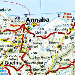
Algiers is the capital city with Ahaggar Mountains to the south. The other important cities are Oran, Constantine, and Annaba and the cities like Chlef, Batna, Blida, Djelfa, Setif, Tizi Ouzou, Oran, and Algiers have a population more than one million.
If you are planning on a visit to Algeria, the map will show you the 48 provinces and 1541 counties or communes and do not forget to collect the dates and cherries.
Algeria Road Maps for Tourists and TravelersDetailed Road Map of AlgeriaBuy travel maps for Algeria tourist attractions, road trips, street guide, driving directions and more |
Algeria
- $19.95
Item Code : REIS4686
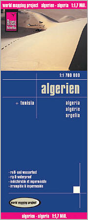
 Scale 1:1,700,000. Size 28"x36". Reis Know How edition. Very detailed Algeria road map. English and multi-lingual legends. Printed on tear-resistant, waterproof, paper-like plastic. It can bend and fold without cracking and is writable as normal paper, non-toxic and recyclable. Perfect for tourist adventures and independent travel and for driving tours. Includes topographic contour lines and hypsometric color tints which show height levels, along with elevation numbers. Shows all major and secondary roads and tertiary roads, with distances between points in kilometers. Fully indexed. Beautiful cartography.
 - $17.95
Item Code : ITMB4687
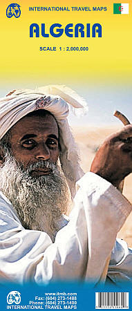
Scale 1:2,000,000. Size 27"x39". International Travel Maps edition.
Algeria is the largest country on the Mediterranean Sea, the second largest on the African continent after Sudan, and the eleventh largest country in the world. The Sahara covers more than four-fifths of its territory, where the inhabitants are concentrated in oases surrounded by desert.
This map offers an inset city map of Alger, including a separate inset of the metro system. It includes the area from above Seville in Southern Spain, including access points by ferry to France and Spain. The map also includes parts of Morocco, Mali, Mauritania, Niger, Libya and Tunisia.
Much of Algeria is now recovering and developing into an emerging economy. The high prices of oil and gas are being used by the new government to improve the country's infrastructure and especially improve industry and agricultural land.
- $17.95
Item Code : MICH7874
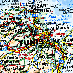
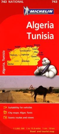 Scale 1:1,000,000. Size 38x29. Michelin edition. These Map Includes insets of Tlemcen, Tunis, Tunis region, Kabylie region, Alger, and Taghit. Names on map are Romanized, but legend is in Arabic script, French, and English and show features in shaded relief maps with some spot elevations. The roads are high lighted, with road numbers and distances well marked. Multilingual legends show points of interest such as historic sites, museums and scenic sites. Printed on one side.
 - $17.95
Item Code : GIZI4685
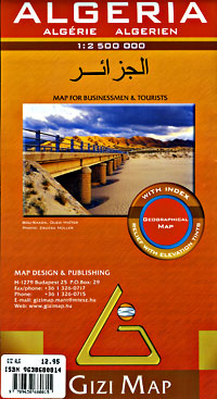
 Scale 1:2,500,000. Size 34"x39". Indexed. Gizi edition. Beautiful cartography. Very detailed.
 - $17.95
Item Code : KANE4688
Scale 1:7,500. Covers the western portion of the city, including the Port of Algiers. - $17.95
Item Code : FREY21236
Scale 1:8000,000/1:2,000,000. Freytag & Berndt edition. Explore Algeria with this Freytag&Berndt road map. The best way to plan your trip, prepare your itinerary, and to travel independently in this country.
| Postage and handling is $4.40 for the first map and $1.80 for each additional map. ~ ~ ~ ~ ~ ~ Foreign delivery is $15.80 for the first map and $7.60 for each additional map. ~ ~ ~ ~ ~ ~ Canada delivery is $15.80 for the first map and $7.60 for each additional map. |
Algeria – Let’s Collect All the Cherries and Dates
Algeria connects Africa to Europe. It is the largest country in Africa and the world’s tenth largest with 2,381,741 square Kilometers or 919,595 square Miles in area. The Mediterranean Sea in the northern border of Algeria, while Morocco is in the west, Tunisia is to the northeast, Libya to the east, and Mauritania, Mali and Niger in the south.
Owing to the Mediterranean Sea, Algeria has a pleasant climate throughout the year, however, the weather is dry in the south due to the Sahara Desert. The cultivation of cherries and dates is a result of this climatic condition.
Algeria’s terrain is mostly high plateaus and desert along with some mountains and narrow, discontinuous coastal plains.
Algeria and officially the People’s Democratic Republic of Algeria celebrate Revolution Day as an Independence Day. They are hospitable and offer dates with milk to their guests and are cordial to friends as well as strangers. Courtesy and formality a national character of the Algerians.
In Algeria, there are seven UNESCO World Heritage Sites mainly city-ruins built by the native people and the Romans.
The Tassili National Park or the Plateau of the Rivers, is a huge open air museum with several prehistoric rock art drawings often called the Aliens on the rocks.in addition to archaeological sites from the Neolithic era.
Algeria produces the best citrus fruits, grapes, cherries, figs, wheat, and dates.
Algiers is the capital city with Ahaggar Mountains to the south. The other important cities are Oran, Constantine, and Annaba and the cities like Chlef, Batna, Blida, Djelfa, Setif, Tizi Ouzou, Oran, and Algiers have a population more than one million.
If you are planning on a visit to Algeria, the map will show you the 48 provinces and 1541 counties or communes and do not forget to collect the dates and cherries.
Algeria Road Maps for Tourists and TravelersDetailed Road Map of AlgeriaBuy travel maps for Algeria tourist attractions, road trips, street guide, driving directions and more |
