
Alabama Road Maps | Detailed Travel Tourist Driving
All Roads Leading to Alabama - Road Maps
Alabama is located on the Gulf Coast and there are four states bordering it;Tennessee in the north, Georgia in the east, Florida in the south, and Mississippi in the west. The southern hospitality, its culture, racing, fine dining, and history allures tourists.
Interstate 59, Interstate 65 and Interstate 85 are the interstates running from North to South and Interstate 10 and Interstate 20 are East to West interstates. There is lots more to know about Alabama and the road maps will take you all through the cities with 11 routes.
The interstate 65 (I-65) is the longest and a major route covering 367.00 miles or 590.63 km linking six largest cities and facilitate travel between Alabama and its neighboring states. It begins from the southern terminus in Mobile and extends north through Montgomery and Birmingham and enters Tennessee.
You can drive to Georgia from the western terminus in Montgomery by taking the Interstate 85 (I-85) or from Birmingham by taking I-59 northeast.While I-10 bisects Mobile in southern Alabama and links Mississippi and Florida.
Alabama has a spectacular roadway in the world, travelers will find scenic byways enjoyable with the Appalachian Highlands Scenic Byway with the natural beauty of the Appalachian Mountains in the backdrop with lush green vegetation, fascinating geologic structures,and picturesque historical rural communities.
If you wish to go on a long drive then there are ten unforgettable scenic byways with some of the most amazing views of Alabama. You must drive through these:
- The Natchez Trace Parkway
- Lookout Mountain Parkway
- Selma to Montgomery March Byway
- Alabama's Coastal Connection Scenic Byway
- Barbour County Governors' Trail
- Talladega Scenic Drive
- Cheaha State Park Road
- Huntsville Mountaintop Road
- Black Warrior River Scenic Byway
- The Oak Alley
With the Alabama road map, you will be able to identify the best roads for a leisure drive even if you live in Alabama.
Alabama Road Maps for Tourists and TravelersDetailed Road Map of AlabamaBuy travel maps for Alabama tourist attractions, road trips, street guide, driving directions and more |
Alabama Road Maps
- $10.95
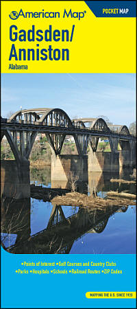
Item Code : AMER4556
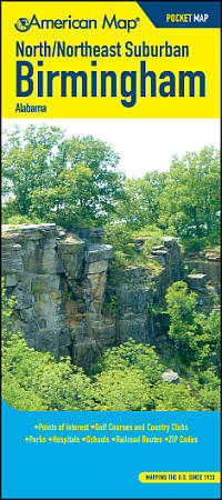 Size 4"x9" (folded). American Map Company edition. Our Maps Have It All! Up-To-Date Streets, Towns, and Places of Interest Easy-To-Read Vicinity and Detailed Maps The Perfect Complement to Your GPS System Up-To-Date Features Block Numbers ZIP Codes Shopping Centers Golf Courses and Country Clubs Schools and Universities Parks Airports Hospitals Cemeteries and much more...
 - $19.95 + $7.50 p&h or $28.50 foreign delivery
Item Code : UNIV22467
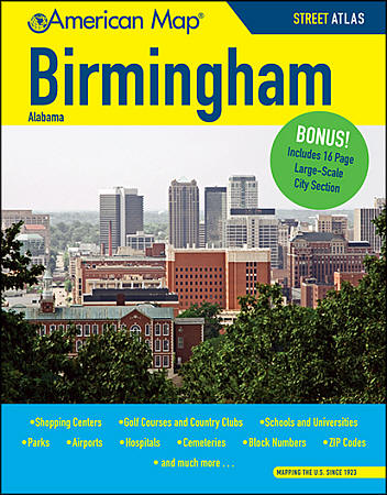
Size 8?"x11". Universal Maps edition. The Birmingham, AL Atlas is a full-color street atlas, including: Adamsville, Alabaster, Argo, Bessemer, Brookside, Chelsea, Fultondale, Gardendale, Graysville, Helena, Homewood, Hoover, Hueytown, Irondale, Midfield, Moody, Pelham, Pleasant Grove, Sylvan Springs, Tarrant, Trussville, and Vestavia Hills; and features: Birmingham Downtown, Birmingham International Airport, Birmingham Southern College, a City and Town index, Golf Courses, Government Facilities, Hospitals, Parks, Schools and Colleges, the University of Alabama, and ZIP Codes. - $24.95 + $7.50 p&h or $28.50 foreign delivery
Item Code : AMER4559
 210 pages. American Map Company edition. At home, at work or on the road, American Map atlases are a driver's best friends. Accurate, up-to-date and easy-to-read, street and road atlases provide convenient, clear reference for navigating close to home or points unknown.
 - $229.95 + $24.80 p&h (add $40 for spring rollers)
Item Code : UNIV4557
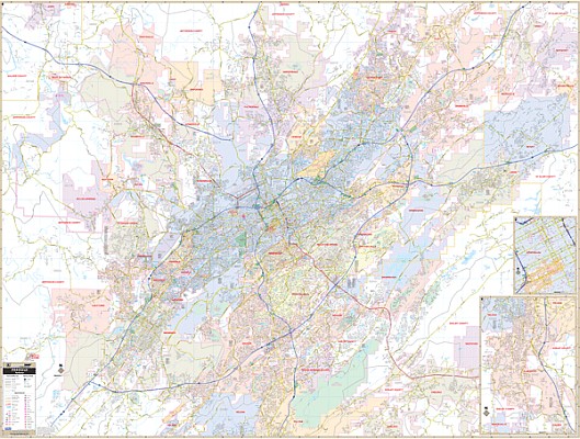
 Scale 1:3,300. Size 66" W x 54" H. Laminated. Printed in color with a markable/washable, laminated surface. Streets are indexed in a separate book. The area of coverage ranges: North: includes the city of Gardendale, Argo, and most of Margaret; South: includes the cities of Helena and Alabaster; East: includes the cities of Leeds, Moody, and Vandiver; West: approximately two miles West of Sylvan Springs and Virginia to Port Birmingham. Details include airports, all streets, post offices, hospitals, railroads, mileage circles, airports, cemeteries, shopping centers, water features, recreational parks, government buildings, fire/police stations, educational facilities, golf courses and country clubs, ZIP code numbers/boundaries, city limits and annexations, longitude & latitude lines, address system dividing lines, and points of interest. Framing rails are included on top and bottom for easy wall mounting. Railed wall maps can be turned into pull down maps on 4spring rollers for an additional $40.
 - $249.95 + $24.80 p&h (add $40 for spring rollers)
Item Code : KAPA21081
 Our Birmingham, AL Wall Map, measures 78" x 59" (6'6" W x 4'11" H) and features up-to-date cartography, with new streets and changes in complete street detail; is printed in color, with a markable and washable laminated surface; and offers a street index in a separate book-format. The area of coverage includes all of Birmingham, with the following boundaries: - North to Gardendale, Trussville, and most of Margaret - South to Oak Mountain State Park - East to Moody and Branchville - West to Black Warrior River and Locust Fork Details and features include: - AIRPORTS - BLOCK NUMBERS - CEMETERIES - CITY LIMITS (color-coded) - COMMUNITY NAMES - EDUCATIONAL INSTITUTIONS - FIRE & POLICE STATIONS - GOLF & COUNTRY CLUBS - GOVERNMENT BUILDINGS - HOSPITALS - LIBRARIES - POINTS OF INTEREST - POST OFFICES - RAILROADS - RECREATIONAL PARKS - SHOPPING CENTERS - STREETS & HIGHWAYS - WATER FEATURES - ZIP CODE BOUNDARIES Framing rails are included, top and bottom, for easy wall mounting. Spring roller mounting is also available, for an additional $40.
 - $10.95
Item Code : UNIV4562
 Scale 1:32,000. Size 18"x24". Universal Maps edition.
 -
- $10.95
Item Code : UNIV4564
 Size 24"x36". Universal Maps edition. This full-color street map of Dothan, AL includes: Avon, Cowarts, Grimes, Midland City, Napier Field, Taylor, and Webb; and features: Airports, Block Numbers, Colleges and Universities, Golf Courses, Hospitals, Parks and Rec Areas, Places of Interest, Schools, and ZIP Codes.
 -
- $10.95
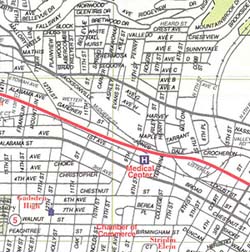
Item Code : RLEY4563

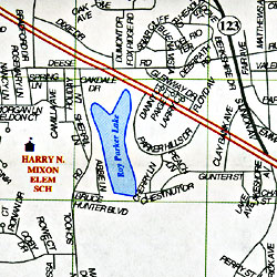 Scale 1:36,000. Size 23"x35". Riley Marketing edition.
 - $10.95
Item Code : RLEY4569
 "Various scales". Size 19"x25". Riley Marketing edition.
 -
- $10.95
Item Code : UNIV4568
 Scale 1:42,000. Size 25"x38". Universal Maps edition.
 - $14.95
Item Code : GMJO22465
 G.M. Johnson edition.
 - $249.95 + $24.80 p&h (add $40 for spring rollers)
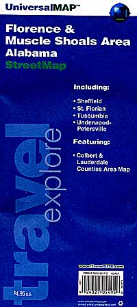
Item Code : UNIV4571
 Scale 1:1,320. Size 69" W x 50" H. Laminated. The 2nd edition Wall Map of the Florence and Muscle Shoals area. Printed in color with a markable/washable-laminated surface. Hanging rails are mounted on top and bottom for ease in hanging. Streets are indexed on the face of the map. The area of coverage includes the Florence and Muscle Shoals area with the following boundaries: North: 1 mile north of the Florence City limits; South: to Tuscumbia; East: to the Northwest Alabama Regional Airport; West: to Sheffield. The left side of the map is a street detailed map of Florence, Muscle Shoals, Tuscumbia, and Sheffield at a scale of 1" = ? mile (1,320 feet) The lower right area of the map shows Colbert. Details include airports, all streets and highways, government buildings, cemeteries, shopping centers, fire/police stations, hospitals, water features, educational facilities, railroads, recreational parks, golf courses and country clubs, post offices, mileage circles, ZIP codes and boundaries, points of interest, city limits/annexations, and longitude/latitude lines. Railed wall maps can be turned into pull down maps on spring rollers for an additional $40.
 - $10.95
Item Code : RLEY4572
 "Various scales". Size 19"x25". Riley Marketing edition.
 - $10.95
Item Code : AMER4573
 Size 4"x9" (folded). American Map Company edition. Our Maps Have It All! Up-To-Date Streets, Towns, and Places of Interest Easy-To-Read Vicinity and Detailed Maps The Perfect Complement to Your GPS System Up-To-Date Features Block Numbers ZIP Codes Shopping Centers Golf Courses and Country Clubs Schools and Universities Parks Airports Hospitals Cemeteries and much more...
 -
-
- $10.95
Item Code : UNIV4577
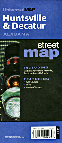
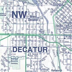
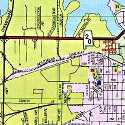 Scale 1:48,000. Size 23"x35". Universal Maps edition. This full-color street map of Huntsville, Decatur, and Athens, AL features: Airports, Block Numbers, Colleges and Universities, Golf Courses, Government Buildings, Hospitals, Parks and Rec Areas, Places of Interest, Schools, and ZIP Codes.
| Postage and handling is $4.40 for the first map and $1.80 for each additional map. ~ ~ ~ ~ ~ ~ Foreign delivery is $15.80 for the first map and $7.60 for each additional map. ~ ~ ~ ~ ~ ~ Canada delivery is $15.80 for the first map and $7.60 for each additional map. |
| ** Click here! to view our beautiful collection of Alabama Travel VIDEOS ** |
All Roads Leading to Alabama - Road Maps
Alabama is located on the Gulf Coast and there are four states bordering it;Tennessee in the north, Georgia in the east, Florida in the south, and Mississippi in the west. The southern hospitality, its culture, racing, fine dining, and history allures tourists.
Interstate 59, Interstate 65 and Interstate 85 are the interstates running from North to South and Interstate 10 and Interstate 20 are East to West interstates. There is lots more to know about Alabama and the road maps will take you all through the cities with 11 routes.
The interstate 65 (I-65) is the longest and a major route covering 367.00 miles or 590.63 km linking six largest cities and facilitate travel between Alabama and its neighboring states. It begins from the southern terminus in Mobile and extends north through Montgomery and Birmingham and enters Tennessee.
You can drive to Georgia from the western terminus in Montgomery by taking the Interstate 85 (I-85) or from Birmingham by taking I-59 northeast.While I-10 bisects Mobile in southern Alabama and links Mississippi and Florida.
Alabama has a spectacular roadway in the world, travelers will find scenic byways enjoyable with the Appalachian Highlands Scenic Byway with the natural beauty of the Appalachian Mountains in the backdrop with lush green vegetation, fascinating geologic structures,and picturesque historical rural communities.
If you wish to go on a long drive then there are ten unforgettable scenic byways with some of the most amazing views of Alabama. You must drive through these:
- The Natchez Trace Parkway
- Lookout Mountain Parkway
- Selma to Montgomery March Byway
- Alabama's Coastal Connection Scenic Byway
- Barbour County Governors' Trail
- Talladega Scenic Drive
- Cheaha State Park Road
- Huntsville Mountaintop Road
- Black Warrior River Scenic Byway
- The Oak Alley
With the Alabama road map, you will be able to identify the best roads for a leisure drive even if you live in Alabama.
Alabama Road Maps for Tourists and TravelersDetailed Road Map of AlabamaBuy travel maps for Alabama tourist attractions, road trips, street guide, driving directions and more |
