
Wisconsin Road Maps | Detailed Travel Tourist Drivimg
|
Wisconsin Road Maps |
Wisconsin
- $10.95
Item Code : UNIV14620
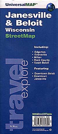
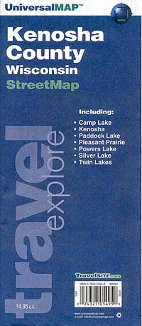
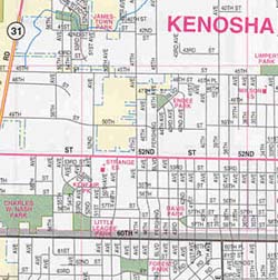
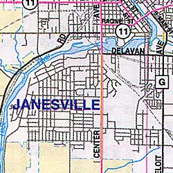 Scale 1:38,000. Size 23"x29". Universal Map edition.
 - $10.95
Item Code : RAND14621
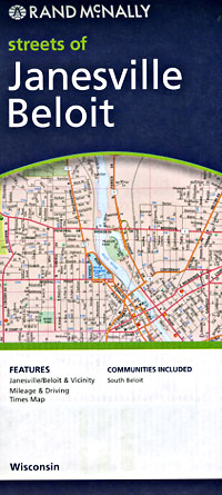
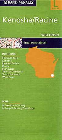
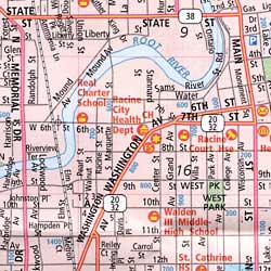
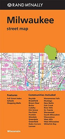
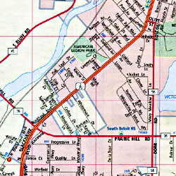 Scale 1:25,000. Size 23"x29". Rand McNally edition. Detailed city street map.
 -
- $10.95
Item Code : UNIV14623
 Scale 1:36,000. Size 23"x29". Universal Map edition.
 - $10.95
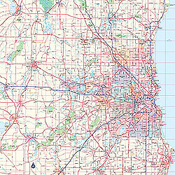
Item Code : RAND14624
 Scale 1:30,000. Size 28"x40". Rand McNally edition.
 -
- $10.95
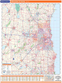
Item Code : RAND14626
 Scale 1:35,000. Size 28"x40". Rand McNally edition.
 - $11.95
Item Code : UNIV14629
 Scale 1:43,000. Size 22"x26". Universal Map edition. Laminated.
 -
- $10.95
Item Code : RAND14630
 Scale 1:41,000. Size 28"x40". Rand McNally edition. Rand McNally's folded map for Milwaukee is a must-have for anyone traveling in and around this part of Wisconsin, offering unbeatable accuracy and reliability at a great price. Our trusted cartography shows all Interstate, U.S., state, and county highways, along with clearly indicated parks, points of interest, airports, county boundaries, and streets. The easy-to-use legend and detailed index make for quick and easy location of destinations. You'll see why Rand McNally folded maps have been the trusted standard for years.
 - $14.95 + $5.50 p&h or $18.50 foreign delivery
Item Code : UNIV14632
 "Various scales". Size 8?"x11". 47 pages. Universal Map edition.
 - $10.95
Item Code : AMER21186
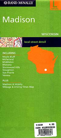
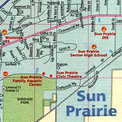
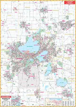
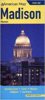 American Map Company edition. This full-color street map of Madison, WI includes: Blooming Grove, McFarland, Middleton, Monona, Shorewood Hills, Sun Prairie, Verona, Waunakee, and Westport; and features: Airports, Block Numbers, Colleges and Universities, Golf Courses, Hospitals, Parks and Rec Areas, Places of Interest, Schools, and ZIP Codes.
 - $10.95
Item Code : AMER21187
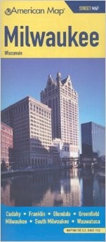 American Map Company edition. The Wisconsin State fold map is a full-color, regional map, including insets of: Appleton, Downtown Milwaukee, Green Bay, Kenosha, La Crosse, Madison, Milwaukee vicinity, Oshkosh, Racine, and Sheboygan; and features: detailed Attractions, detailed Red Areas and Trails, Interstate Exit Numbers, Latitude and Longitude information, a Mileage Chart, State Facts, and State Parks and Forests.
 - $249.95 + $24.80 p&h (add $40 for spring rollers)
Item Code : UNIV14634
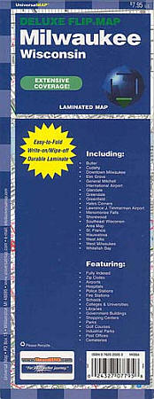
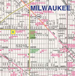
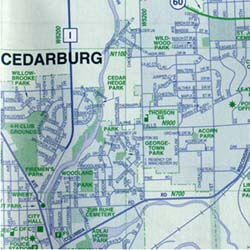
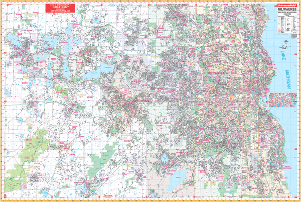 Scale 1:2,640. Size 77" W x 54" H. Laminated. Up-to-date cartography in complete street detail with new streets and changes graces this 2003, 3rd edition Wall Map of Milwaukee and Waukesha Counties, Wisconsin by Universal Map. Streets are indexed in a separate book. Includes all of the Greater Milwaukee area with the boundaries as follows: North: to the Washington/Ozaukee County lines; South: to the Walworth/Racine County lines; East: to Lake Michigan; West: to the Jefferson County line. Includes an inset map of Downtown Milwaukee. The special features and data are as follows: all streets and highways, government buildings, airports, golf courses and country clubs, railroads, ZIP codes and ZIP code boundaries, shopping centers, water features, recreational parks, cemeteries, educational facilities, hospitals, post offices, city limits and annexations, section/township/range lines, fire and police stations, and miscellaneous points of interest. Framing rails are included on top and bottom for easy wall mounting. Railed wall maps can be turned into pull down maps on spring rollers for an additional $40.
 - $249.95 + $24.80 p&h (add $40 for spring rollers)
Item Code : UNIV14635
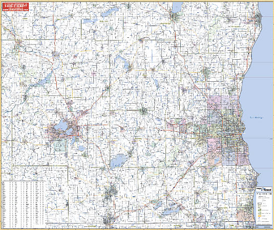 Scale 1:2,640. Size 77" W x 54" H. Laminated. Printed in color with a markable and washable laminated surface. Cities are indexed on the face of the map. Includes hanging rails that are mounted on top and bottom. Coverage includes the counties of Columbia, Dane, Dodge, Fond du Lac, Kenosha, Jefferson, Milwaukee, Ozaukee, Racine, Rock, Sheboygan, Walworth, Waukesha, and Washington. Boundaries: North: 55 miles north to Sheboygan and Fond du Lac; South: 40 miles south to the state line; East: to Lake Michigan; West: 100 miles west to the city of Madison and all of Dane County. Details include major streets and all highways, county lines and names, mileage circles, ZIP codes and boundaries, airports and parks, water features, and longitude/latitude lines. Railed wall maps can be turned into pull down maps on spring rollers for an additional $40.
 - $259.00 Shipped rolled in a tube + $18.80 p&h
Item Code : RAND14633
 Scale 1:101,000. Size 46"x60". Rand McNally edition. Laminated. Professional Grade.
 - $249.95 + $24.80 p&h (add $40 for spring rollers)
Item Code : UNIV14628
 Size 54" W x 77" H. Laminated. The Madison, Wisconsin Wall Map by Universal Map includes adjacent areas and offers up-to-date cartography with new streets and changes. The map's area of coverage ranges North to include Dane and DeForest; South to include Oregon and Stoughton; East to include Sun Prairie and Cottage Grove; and West to include Middleton and Verona. There are inset maps of Downtown Madison and the University of Wisconsin. The special features and data contained on this map are as follows: all streets, all highways, educational facilities, government buildings, shopping centers, hospitals, airports, recreational parks, post offices, golf and country clubs, points of interest, city limits and annexations, railroads, mileage circles, water features, cemeteries, fire and police stations, ZIP code and boundaries. In addition, for your convenience, the map is indexed in a separate book. Framing rails are included on top and bottom for easy wall mounting. Railed wall maps can be turned into pull down maps on spring rollers for an additional $40.
 -
- $10.95
Item Code : UNIV14637
 Scale 1:34,000. Size 23"x29". Universal Map edition.
 - $249.95 + $24.80 p&h (add $40 for spring rollers)
Item Code : UNIV14640
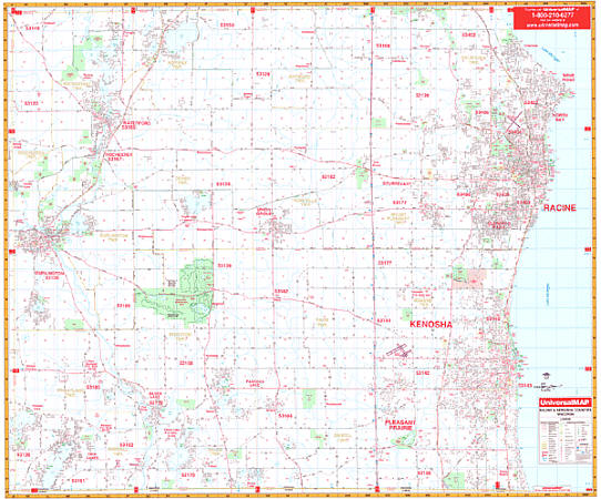 Scale 1:2,640. Size 62" W x 54" H. Laminated. Printed on a laminated surface that is both markable and washable. Street indexing appears in a separate book. Contains hanging rails mounted top and bottom. Area of coverage ranges: North: Racine County line; South: Wisconsin-Illinois state lines; East: Lake Michigan; West: Kenosha-Rachine-Walworth County lines. The special features and data are as follows: all streets and highways, government buildings, airports, golf courses and country clubs, railroads, longitude and latitude lines, block numbers, shopping centers, recreational parks, mileage circles, cemeteries, educational facilities, hospitals, post offices, city limits and annexations, water features, fire and police stations, and assorted points of interest. Railed wall maps can be turned into pull down maps on spring rollers for an additional $40.
|
Wisconsin Road Maps |
