
Utah Road Maps | Detailed Travel Tourist Driving
|
Utah Road Maps |
Utah
- $17.95
Item Code : TRAL14237
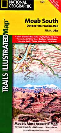
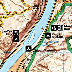 Scale 1:35,000. Size 26"x38". Trails Illustrated edition. Printed on waterproof, tear-resistant, lightweight, paper-like plastic. This Trails Illustrated topographic map is the most comprehensive and complete recreational map for the areas south of Moab, Utah. The map shows all trails, campsites, and recreational features, plus ratings and mileage for mountain biking trails and junction-to-junction road and trail mileage. Coverage area includes Moab, Dead Horse Point State Park, Behind the Rocks WSA, Hurrah Pass and Canyonland's White Rim; highlighted Jeep Safari Trails from Moab to Canyon Rims Recreation Area; and detailed 1:35,000 scale insets of Moab, Moab Rim, Poison Spider Mesa, Gold Bar Rim, and Gemini Bridges Area.
 - $17.95
Item Code : TRAL14238
Scale 1:90,000. Trails Illustrated edition. Printed on waterproof, tear-resistant, lightweight, paper-like plastic. - $10.95
Item Code : RLEY14248
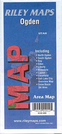
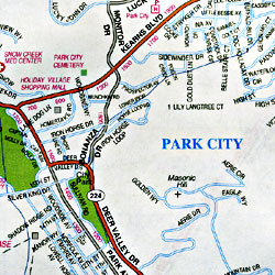
 Scale 1:30,000. Size 23"x35". Riley Marketing edition.
 - $12.95
Item Code : GMJO14249
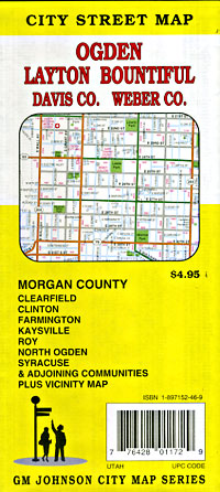
 Scale 1:32,000. Size 28"x40". G.M. Johnson edition.
 - $10.95
Item Code : RAND14250

 Scale 1:36,000. Size 28"x40". Rand McNally edition.
 - $10.95
Item Code : UNIV14251
 Scale 1:25,000. Size 24"x36". Universal Map edition.
 - $249.95 + $24.80 p&h (add $40 for spring rollers)
Item Code : UNIV14252
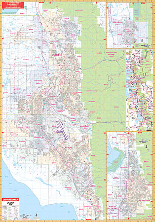 Size 54" W x 77" H. Laminated. Offers up-to-date cartography with new streets and changes. Details and special features include all streets, post offices, hospitals, railroads, mileage circles, time zones, airports, cemeteries, shopping centers, water features, recreational parks, longitude and latitude lines, government buildings, fire and police stations, educational facilities, golf courses and country clubs, ZIP codes and ZIP code boundaries, city limits, and annexations. Covers all of Ogden, Utah with the following boundaries: North: to Box Elder/Davis County line; South: to Farmington; East: to Wasatch-Cache National Forest; West: to West Point. Insets: Brigham City, Bountiful/N. Salt Lake City area extending from Farmington south-almost to the Salt Lake County line; and a vicinity map. Framing rails are included on top and bottom for easy wall mounting. Railed wall maps can be turned into pull down maps on spring rollers for an additional $40.
 - $10.95
Item Code : UNIV14253
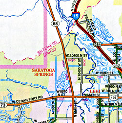
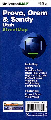
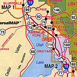
 Scale 1:28,000. Size 24"x37". Universal Map edition.
 - $12.95
Item Code : GMJO14254
 Scale 1:32,000. Size 28"x40". G.M. Johnson edition.
 - $10.95
Item Code : RLEY14256
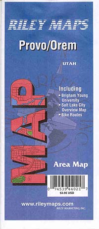
 Scale 1:35,000. Size 19"x25". Riley Marketing edition.
 - $12.95
Item Code : GMJO14257
 Scale 1:32,000. Size 28"x40". G.M. Johnson edition.
 - $10.95
Item Code : UNIV14258
 Scale 1:34,000. Size 27"x40". Universal Map edition.
 - $249.95 + $24.80 p&h (add $40 for spring rollers)
Item Code : UNIV14255
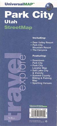
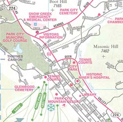
 Size 64" W x 50" H. Laminated. This map shows complete street detail and has up-to-date cartography with new streets and changes. It has been printed in color and has a laminated surface which is both markable and washable. The map's area of coverage ranges North to the Summit-Morgan County lines; South 2 miles south of the Summit-Wasatch County lines; East to the easternmost boundary of Park City; and West to the Summit-Salt Lake County lines. Insets for this map area as follows: Park City locator map; Downtown Park City; Summit County Biking and Fishing map; and Salt Lake and vicinity. The special features and data contained on this map are as follows: all streets and highways, government buildings, airports, golf courses and country clubs, railroads, ZIP codes and zip code boundaries, shopping centers, water features, recreational parks, cemeteries, educational facilities, hospitals, post offices, mileage circles, city limits and annexations, section/township/range lines, fire and police stations, and miscellaneous points of interest. Olympic venues are marked on this map as a special feature. Framing rails are included on top and bottom for easy wall mounting. Railed wall maps can be turned into pull down maps on spring rollers for an additional $40. This is a terrible photo illustration but will give you some idea of the area covered. You need to put on your 3-D glasses to view this properly, or so it seems.
 - $249.95 + $24.80 p&h (add $40 for spring rollers)
Item Code : UNIV14259
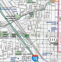
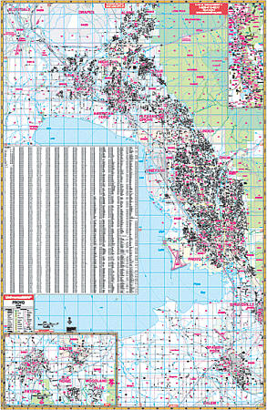 Scale 1:2,011. Size 54" W x 77" H. Laminated. The Provo, Utah Wall Map from Universal Map features complete street detail, its laminated surface is markable and washable with water-based pens. This color map offers up-to-date cartography with new streets and changes. Details and special features found with this map include all streets, post offices, hospitals, railroads, mileage circles, time zones, airports, cemeteries, shopping centers, water features, recreational parks, longitude and latitude lines, government buildings, fire and police stations, educational facilities, golf courses and country clubs, ZIP codes and ZIP code boundaries, city limits, and annexations. The area of coverage ranges: North: to include the city of Alpine; South: to include the cities of Salem, Elk Ridge, Woodland Hills, and Payson; East: to Uinta National Forest; West: to Utah Lake, Clinton, and Camp Williams. Framing rails are included on top and bottom for easy wall mounting. Railed wall maps can be turned into pull down maps on spring rollers for an additional $40.
 - $17.95
Item Code : TRAL14240
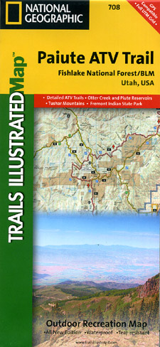
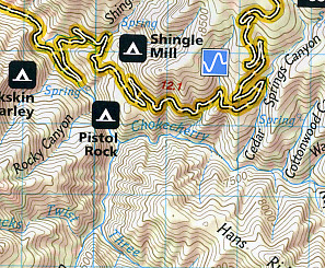 Scale 1:90,000. Size 25"x37". Trails Illustrated edition. Printed on waterproof, tear-resistant, lightweight, paper-like plastic. This Trails Illustrated topographic map is the most comprehensive recreational map for Utah's Paiute ATV Trail. Coverage includes: Fishlake National Forest; BLM - Sevier River Resource Area; Millard, Sevier and Paiute counties; complete map of Paiute ATV Trail with adjoining loop trails and town access maps; Fillmore; Richfield; Koosharem; Marysvale; Geenwich and Circleville. Piute, Otter Creek, Rocky Ford, Koosharem and Three Creeks reservoirs are also included.
 - $17.95
Item Code : TRAL14241
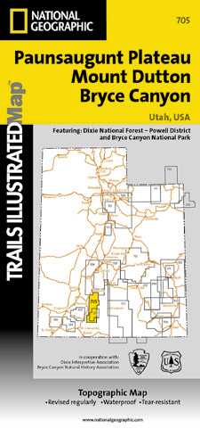
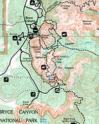 Scale 1:50,000. Size 25"x37". Trails Illustrated edition. Printed on waterproof, tear-resistant, lightweight, paper-like plastic. This Trails Illustrated topographic map is the most comprehensive and complete recreational map for Utah's Paunsaugunt Plateau/Mount Dutton/Bryce Canyon area. Coverage includes Dixie National Forest. Bryce Canyon National Park; Paunsaugunt Plateau; Red Canyon, Sunset and Pink Cliffs, Johns Valley, Casto Canyon, Swallow Park Ranch, Sevier Plateau and Pole Canyon; Tropic Reservoir, Cottonwood Creek and Sevier Creek.
 - $10.95
Item Code : UNIV14260

 Scale 1:32,000. Size 27"x39". Universal Map edition.
 - $10.95
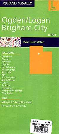
Item Code : RAND14261
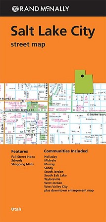
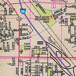
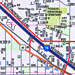
 Rand McNally edition. Scale 1:34,000. Size 36"x45". Rand McNally edition. Rand McNally's folded map for Salt Lake City is a must-have for anyone traveling in and around this part of Utah, offering unbeatable accuracy and reliability at a great price. Our trusted cartography shows all Interstate, U.S., state, and county highways, along with clearly indicated parks, points of interest, airports, county boundaries, and streets. The easy-to-use legend and detailed index make for quick and easy location of destinations. You'll see why Rand McNally folded maps have been the trusted standard for years.
 - $10.95
Item Code : RAND14262
 Scale 1:34,000. Size 28"x40". Rand McNally edition.
 - $29.95 + $7.50 p&h or $28.50 foreign delivery
Item Code : RAND14264
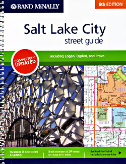
 Scale 1:32,000. Size 9"x11". 288 pages. Rand McNally edition. (We only sell the most recent edition of this atlas, whatever the year may be.)
|
Utah Road Maps |
