
Utah Road Maps | Detailed Travel Tourist Driving
|
Utah Road Maps |
Utah
- $17.95
Item Code : TRAL14219
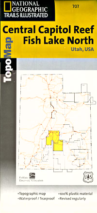
 Scale 1:90,000. Size 25"x37". Trails Illustrated edition. Printed on waterproof, tear-resistant, lightweight, paper-like plastic. This Trails Illustrated topographic map is the most comprehensive recreational map for Utah's Fish Lake North/North & Central Capitol Reef area. Coverage includes: Fishlake National Forest; Capitol Reef National Park; Waterpocket Fold and Fremont Junction; Thousand Lake Mountain; Monroe Mountain; Gooseberry Area and Boulder Mountain; Fish Lake; Bown's; Sheep Valley and Rocky Ford Reservoirs; Great Western Trail and more.
 - $12.95
Item Code : EART14220
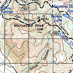
 Scale 1:62,500. Size 27"x39". Earthwalk Press edition.
 - $17.95
Item Code : TRAL14222
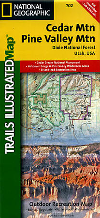
 Scale 1:75,000. Size 26"x37". Trails Illustrated edition. Printed on waterproof, tear-resistant, lightweight, paper-like plastic. This Trails Illustrated topographic map is the most comprehensive recreational map for Utah's Cedar Mountain/Pine Valley Mountain area. Coverage includes; Dixie National Forest; Ashdown Gorge Wilderness; Cedar Breaks National Monument; Brian Head; Navajo and Panguitch Lakes; Haycock Mountain; Long Valley Junction and Duck Creek. Also provides UTM grids for use with your GPS unit.
 - $16.95
Item Code : NATL21021
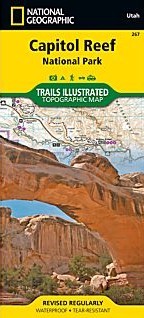
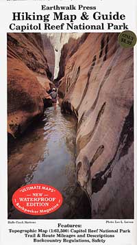
 Scale 1:75,000. Size 26"x38". National Geographic edition. National Geographic's Trails Illustrated map of Utah's Capitol Reef National Park is a two-sided, waterproof map designed to meet the needs of outdoor enthusiasts with unmatched durability and detail. This map was created in conjunction with local land management agencies and is loaded with valuable recreation information. Trails Illustrated maps are expertly researched and frequently updated. The maps are printed in the United States on durable synthetic paper, making them waterproof, tear-resistant, and trail tough—capable of going anywhere you do.
 - $16.95
Item Code : NATL20952
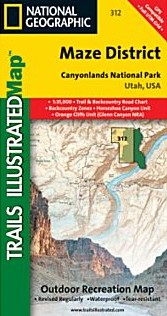 Scale 1:35,000. Size 26"x38". National Geographic edition. This sectional map of Canyonlands National Park zooms in on the Maze District in the western area of the park and provides more detail of this area than the full Canyonlands National Park map with an enhanced scale. The map includes trail and backcountry road charts, backcountry zones and campsites, trail and road mileages, as well as backcountry permit and regulations information.
 - $17.95
Item Code : TRAL14213
Scale 1:50,000. Trails Illustrated edition. Printed on waterproof, tear-resistant, lightweight, paper-like plastic. - $17.95
Item Code : TRAL14224
 Scale 1:78,000. Size 22"x38". Trails Illustrated edition. Printed on waterproof, tear-resistant, lightweight, paper-like plastic.
 - $17.95
Item Code : TRAL14223
Scale 1:90,000. Trails Illustrated edition. Printed on waterproof, tear-resistant, lightweight, paper-like plastic. - $17.95
Item Code : TRAL14226
Scale 1:90,000. Trails Illustrated edition. Printed on waterproof, tear-resistant, lightweight, paper-like plastic - $17.95
Item Code : TRAL14227
Scale 1:70,000. Trails Illustrated edition. Printed on waterproof, lightweight, tear-resistant paper-like plastic. - $17.95
Item Code : TRAL14229
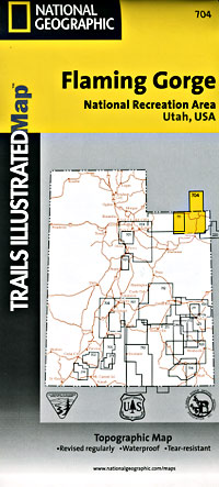
 Scale 1:90,000. Size 25"x37". Trails Illustrated edition. Printed on waterproof, tear-resistant, lightweight, paper-like plastic. This Trails Illustrated topographic map is the most comprehensive recreational map for Utah's Flaming Gorge N.R.A/Eastern Uintas area. Coverage includes; Ashley National Forest; Flaming Gorge National Recreation Area; Eastern Uinta Mountains; Steinaker State Recreation Area; Green River, Wyoming; McKinnon Junction, Dutch John, Dry Fork, Manila and Greendale; Matt Warner, Cedar View and Beaver Meadow reservoirs; and the Red Canyon of the Green River.
 - $17.95
Item Code : TRAL14228
Trails Illustrated edition. Printed on waterproof, tear-resistant, lightweight, paper-like plastic. - $17.95
Item Code : TRAL14230
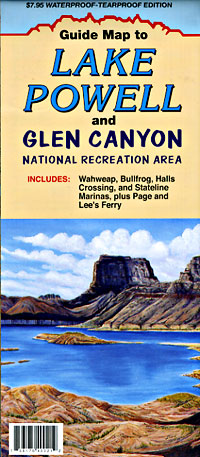
 Scale 1:177,000. Size 26"x37". Trails Illustrated edition. Printed on waterproof, tear-resistant, lightweight, paper-like plastic. NATL-glen-canyon-road-map-travel-tourist-detailed-cover.jpg
 - $17.95
Item Code : TRAL14231
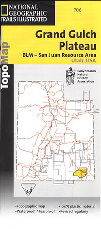
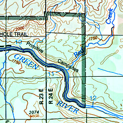
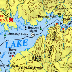
 Scale 1:63,000. Size 25"x37". Trails Illustrated edition. Printed on waterproof, tear-resistant, lightweight, paper-like plastic. This Trails Illustrated topographic map is the most comprehensive and complete recreational map for Utah's Grand Gulch Plateau area. Coverage includes BLM/San Juan Resource Area; Grand Gulch Primitive Area; Grand Flat, Northern Glen Canyon National Recreation Area, Valley of the Gods, Cedar Mesa, Snow Flat, Grand Flat and Comb Ridge; First, Fish and Owl Creek, Polly Mesa and San Juan River.
 - $17.95
Item Code : TRAL14232
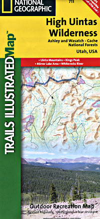
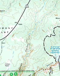
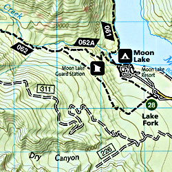 Scale 1:75,000. Size 26"x37". Trails Illustrated edition. Printed on waterproof, tear-resistant, lightweight, paper-like plastic. This Trails Illustrated topographic map is the most comprehensive recreational map for Utah's High Uintas Wilderness area. Coverage includes: Wasatch-Cache National Forest; the entire High Uintas Wilderness and surrounding backcountry; Hoop, Brown, Moon, Crystal, Little Lyman and Atwood lakes; Paradise Park, Cedar View, Upper Stillwater and Whitney reservoirs; Red Knob, Squaw, Smith Fork, Anderson, and Thompson passes.
 - $10.95
Item Code : NORT14233
 Scale 1:210,000. Size 18"x32". North Star edition.
 - $10.95
Item Code : NORT14234
 Scale 1:270,000. Size 18"x31". North Star edition.
 - $14.95
Item Code : GMJO14247
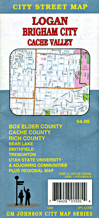
 Scale 1:32,000. Size 28"x40". G.M. Johnson edition.
 - $17.95
Item Code : TRAL14235
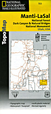
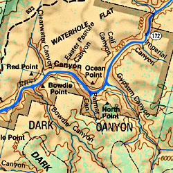
 Scale 1:90,000. Size 25"x37". Trails Illustrated edition. Printed on waterproof, tear-resistant, lightweight, paper-like plastic. This Trails Illustrated topographic map is the most comprehensive recreational map for Utah's Manti-La-Sal National Forest area. Coverage includes: Manti-La-Sal National Forest; Dark Canyon Wilderness/Primitive Area; Natural Bridges, New Mexico; Monticello, Blanding, Fry Canyon, Blue Mountains, Woodenshoe and Hammond canyons; Indian Creek and Recapture Lake.
 - $17.95
Item Code : TRAL14236
 Scale 1:70,000. Size 26"x38". Trails Illustrated edition. Printed on waterproof, tear-resistant, lightweight, paper-like plastic.
|
Utah Road Maps |
