
Tennessee Road Maps | Detailed Travel Tourist Driving
|
Tennessee Road Maps |
Tennessee
- $249.95 + $24.80 p&h (add $40 for spring rollers)
Item Code : UNIV13769
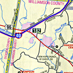
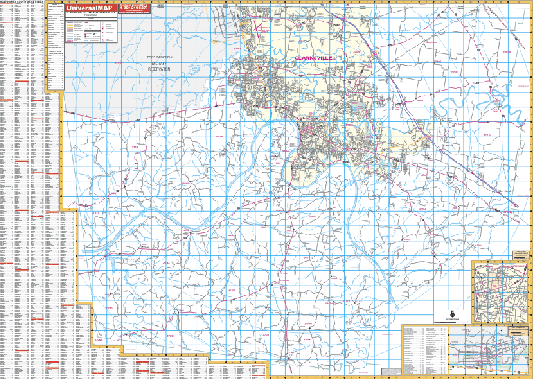 Scale 1:2,640. Size 68" W x 50" H. Laminated. The Clarksville and Montgomery County, Tennessee Wall Map by Universal Map. The area of coverage ranges: North: to the Kentucky State line; South: to the Dickson County line; East: to the Robertson County line; West: to the Stewart County line. Insets are of Downtown Clarksville and Fort Campbell Military Reservation. The special features and data are as follows: all streets and highways, government buildings, airports, golf courses and country clubs, railroads, longitude and latitude lines, ZIP code numbers/ boundaries, shopping centers, recreational parks, mileage circles, cemeteries, educational facilities, hospitals, post offices, city limits and annexations, fire and police stations, and miscellaneous points of interest. Framing rails are included on top and bottom for easy wall mounting. Railed wall maps can be turned into pull down maps on spring rollers for an additional $40.
 - $10.95
Item Code : UNIV13770
 Scale 1:25,000. Size 19"x24". Universal Map edition.
 - $10.95
Item Code : UNIV13771
 Scale 1:21,000. Size 23"x35". Universal Map edition.
 - $17.95
Item Code : TRAL13747
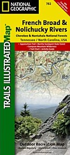
 Scale 1:63,000. Size 26"x38". Trails Illustrated edition. Printed on waterproof, tear-resistant, lightweight, paper-like plastic. This Trails Illustrated topographic map is the most comprehensive and complete recreational map for Tennessee's Cherokee National Forest, Northern Districts, French Broad & Nolichucky Rivers area. Coverage includes: Cherokee National Forest/Northern Districts; Greenville and Newport; Sampson Mountain Wilderness Area; boating access points on the Nolichucky and French Broad Rivers; Foothills Parkway and the Appalachian Trail.
 - $12.95
Item Code : EART13743
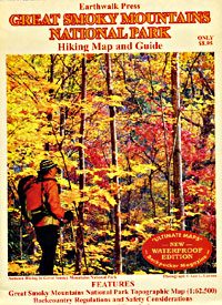
 Scale 1:62,500. Size 27"x39". Earthwalk Press edition.
 - $16.95
Item Code : NATL21054
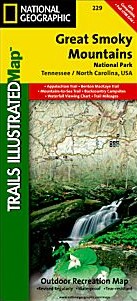
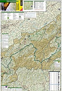
 Scale 1:70,000. Size 26"x38". National Geographic edition. America's most visited national park straddles Tennessee and North Carolina with its seemingly endless forest. The map includes the park in its entirety; the Appalachian Trail; Twentymile Trail; Lakeshore Trail; Chasteen Creek Trail; the Great Smoky Mountains; Chilowee Mountain; Little Mountain; the Blue Ridge Parkway; Cataloochee Divide; Pisgah National Forest; Cherokee National Forest; Nantahala National Forest; Little Tennessee River; Chilhowee Lake; Fontana Lake; Tuckasegee River; the cities of Maryville and Gatlinburg Tennessee, and Waynesville, North Carolina; UTM grids for use with your GPS.
 - $29.95
Item Code : NATL13744
 Scale 1:40,000 & 1:70,000. Size 26"x38". National Geographic edition.
 - $10.95
Item Code : UNIV13773
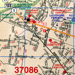
 Scale 1:28,000. Size 24"x36". Universal Map edition. Detailed city street map.
 - $249.95 + $24.80 p&h (add $40 for spring rollers)
Item Code : UNIV13775
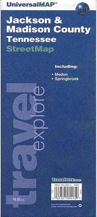
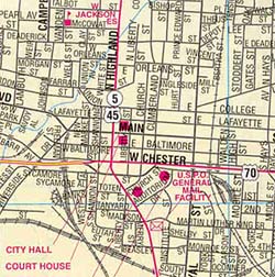
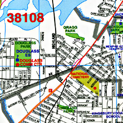
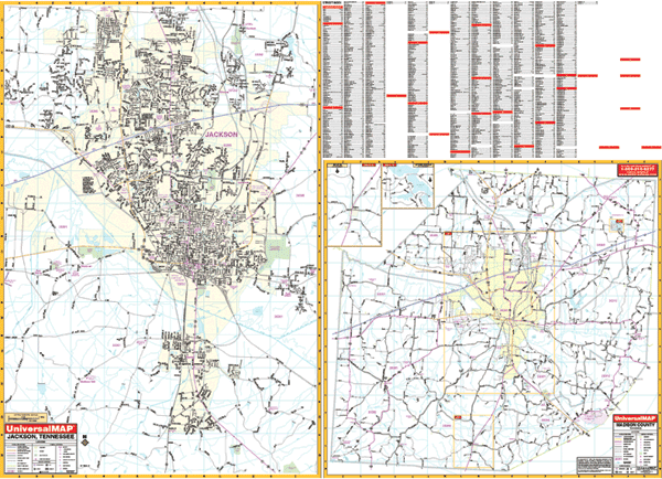 Scale 1:1,760. Size 64" W x 46" H. Laminated. This Jackson, Tennessee Wall Map by Universal Map. The special features and data are as follows: all streets and highways, government buildings, airports, golf courses and country clubs, railroads, longitude and latitude lines, ZIP codes and ZIP code boundaries, shopping centers, recreational parks, mileage circles, cemeteries, educational facilities, hospitals, post offices, city limits and annexations, fire and police stations, and miscellaneous points of interest. North: to the Jackson city limit and Ashport Rd.; South: to Mt. Pinson and Gobelett Rd.; East: to Rose Hill and East Union; West: to the Western Jackson city limit: Section two (Scale of 1" = 4,969 feet) includes Madison County and an inset of Medon and Springport. Framing rails are included on top and bottom for easy wall mounting. Railed wall maps can be turned into pull down maps on spring rollers for an additional $40.
 - $10.95
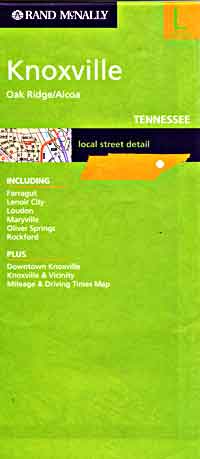
Item Code : RAND13777

 Scale 1:38,000. Size 28"x40". Rand McNally edition. Detailed city street map.
 - $10.95
Item Code : UNIV13778
 Scale 1:41,000. Size 28"x40". Universal Map edition.
 - $249.95 + $24.80 p&h (add $40 for spring rollers)
Item Code : UNIV13781
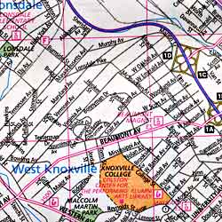
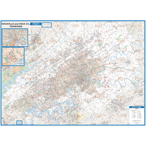 Scale 1:2,640. Size 77" W x 54" H. Laminated. Universal Map is proud to announce distribution of the Superior Mapping wall map of Knoxville, TN with adjacent areas. Printed in color with a markable/washable--laminated surface. Street index provided in a separate book. Special : page overlay with exact grid as the map book using the Minutemaster Grid System. Framing rails are included on top and bottom for easy wall mounting. Railed wall maps can be turned into pull down maps on spring rollers for an additional $40. Area of coverage: All of Knox County, with the following boundaries - North: to the Union County line; South: to Rockford; East: 1 mile east of Knox County line; and West: to Clinton. Insets: Downtown Knoxville. Details include all streets and highways, government buildings, airports, water features, fire/police stations, hospitals, shopping centers, educational institutions, railroads, recreational parks, golf and country clubs, post offices, city limits/annexations, cemeteries, ZIP codes/boundaries, subdivision names, block numbers, & points of interest.
 - $10.95
Item Code : UNIV13782
 Scale 1:105,000. Size 23"x34". Universal Map edition.
 - $249.95 + $24.80 p&h (add $40 for spring rollers)
Item Code : UNIV13783
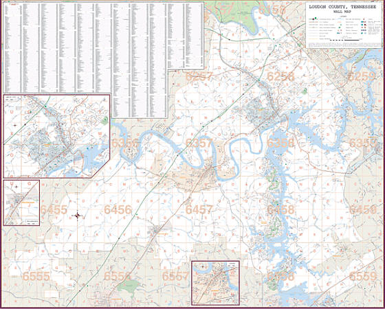 Scale 1:2,640. Size 77" W x 54" H. Laminated. Printed in color with a markable/washable--laminated surface. Street index provided in a separate book. Framing rails are included on top and bottom for easy wall mounting. Railed wall maps can be turned into pull down maps on spring rollers for an additional $40. Area of coverage: All of Loudon County including cities & towns of Loudon & Lenoir City. North: to Anderson & Knox County Line; South: to Monroe County Line; East: to Blount County Line; and West: to Roane County Line. Insets: Downtown Loudon, Lenoir City & Philadelphia. Details include all streets and highways, government buildings, airports, water features, fire/police stations, hospitals, shopping centers, educational institutions, railroads, recreational parks, golf and country clubs, post offices, city limits/annexations, cemeteries, township/range/section lines, block numbers, subdivisions, ZIP codes/boundaries, longitude & latitude, and points of interest.
 - $10.95
Item Code : RAND13786
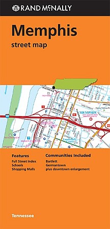
 Scale 1:45,000. Size 28"x40". Rand McNally edition. Detailed city street map. Rand McNally's folded map for Memphis is a must-have for anyone traveling in and around this part of Tennessee, offering unbeatable accuracy and reliability at a great price. Our trusted cartography shows all Interstate, U.S., state, and county highways, along with clearly indicated parks, points of interest, airports, county boundaries, and streets. The easy-to-use legend and detailed index make for quick and easy location of destinations. You'll see why Rand McNally folded maps have been the trusted standard for years.
 - $11.95
Item Code : UNIV13787
 Scale 1:41,000. Size 23"x26". Universal Map edition. Laminated.
 - $10.95
Item Code : UNIV13792
 Scale 1:17,000. Size 27"x40". Universal Map edition.
 - $10.95
Item Code : UNIV13793
 Scale 1:38,000. Size 18"x24". Universal Map edition.
 - $249.95 + $24.80 p&h (add $40 for spring rollers)
Item Code : UNIV13790
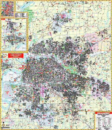 Scale 1:2,913. Size 60" W x 69" H. Laminated. The 3rd edition Wall Map of Memphis and Shelby County, Tennessee by Universal Map. Streets are indexed in a separate book. Framing rails are included on top and bottom for easy wall mounting. Covers all of Shelby County with the following boundaries: North: 2 miles north of the Tipton County line; South: to cover all of Southhaven, Olive Branch, and Horn Lake; East: to the Fayette County line including towns of Collierville and Arlington; West: to West Memphis, Arkansas. Insets are of Downtown Memphis, West Memphis, and Marion, Arkansas. Special features, data, and details covered with this map are all streets and highways, government buildings, airports, golf courses and country clubs, railroads, longitude and latitude lines, block numbers, shopping centers, recreation parks, mileage circles, cemeteries, educational facilities, hospitals, post offices, city limits and annexations, block numbers, longitude and latitude lines, township names, water features, fire and police stations, fire district lines, ZIP codes and boundaries, and assorted points of interest. Railed wall maps can be turned into pull down maps on spring rollers for an additional $40.
 - $249.95 + $24.80 p&h (add $40 for spring rollers)
Item Code : UNIV13791
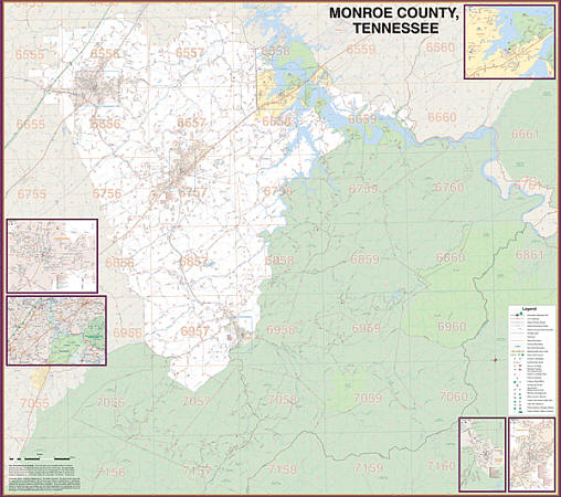 Scale 1:3,448. Size 60" W x 56" H. Laminated. Universal Map is proud to announce distribution of the Superior Mapping wall map of Monroe County, Tennessee. Printed in color with a markable/washable--laminated surface. Street index provided in a separate book. Framing rails are included on top and bottom for easy wall mounting. Railed wall maps can be turned into pull down maps on spring rollers for an additional $40. Area of coverage: All of Monroe County, including cities & towns of Madisonville, Sweetwater, Tellico Plains & Vonore. North: to Loudon County; South: to Polk County Line & North Carolina State Line; East: Blount County Line; and West: McMinn County Line. Insets: Downtown Sweetwater & Vonore. Details include all streets and highways, government buildings, airports, water features, fire/police stations, hospitals, shopping centers, educational institutions, railroads, recreational parks, golf and country clubs, post offices, city limits/annexations, cemeteries, township/range/section lines, block numbers, subdivisions, ZIP codes/boundaries, longitude & latitude, and points of interest.
|
Tennessee Road Maps |
