
Scotland Road Maps | Detailed Travel Tourist Driving
|
Scotland Road Maps |
Scotland
- $17.95
Item Code : FREY19165
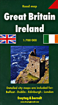
 Scale 1:700,000. Size 39"x55". Freytag & Berndt edition. Includes England, Wales, and Scotland.
 - $13.95
Item Code : GEAZ19170
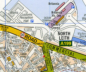 Scale 1:19,000. Size 48"x39". Geographers A-Z edition. "Premier Map". Fully indexed. Includes all streets and street names and numbers, plus one-way streets, footpaths, railways and stations, postcode boundaries, car parks, churches, hospitals, house numbers, information centers, police stations, post offices, toilets, recreational facilities, parks, public buildings, and shopping centers. Laminated card cover. Detailed city street map.
 - $17.95
Item Code : ITMB19172
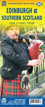
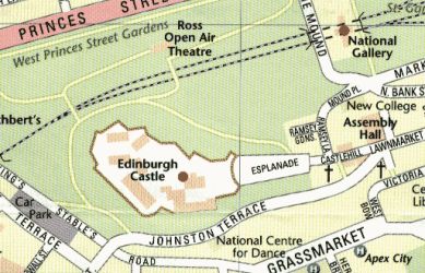
Scale 1:10,000 / 1:370,000. Size 27"x39". International Travel Maps edition.
The Royal City of Edinburgh has a long history and the sites to justify a good visit. First is Edinburgh Castle, built on a jagged rock outcrop and continuously occupied for a thousand years. Then there's the famous High Street, leading to Holyrood Palace, the Regency houses off Princes Street, and the many monuments commemorating Scotland's long history. Hotels, galleries, museums, and parks are shown as well.
This map is brand new artwork, not an update. On the reverse side, we have added a good quality map of southern Scotland for those travellers combining a visit to Edinburgh with a visit to other parts of the country.
- $18.95
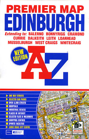
Item Code : GEAZ19173
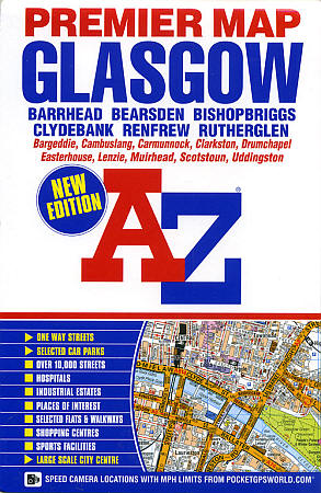
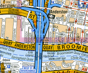 Scale 1:19,000. Size 36"x46". Geographer's A-Z edition. "Premier Map". Detailed city street map.
 - $16.95 2009 Edition Just arrived!
Item Code : ORDN19161
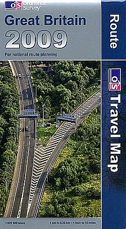 Scale 1:625,000. Size 49" across x 37" high (each side). Fully indexed. Ordnance Survey edition. Printed on both sides. Includes England, Wales, and Scotland. Road numbers and distances between points are very easy to read on this large-scale map. Shows cities, towns, villages, all types of roads, road numbers, distances between points in miles, railways, airports, ferry routes for vehicles, canals, rivers, lakes, and coastlines. ** 2009 Edition ** (now in stock!) Also includes principal in-and-out road maps for the larger cities of Bradford and Leeds, Manchester, London, Inverness, Perth, Aberdeen, Edinburgh, Glasgow, and Newcastle upon Thyme, plus separate inset maps of the national parks, forest parks, and long distance paths. English text. Laminated card cover. Printed on high-quality paper. Excellent map! BIG >> SAMPLE MAP
 - $14.95
Item Code : KUMR19166
Scale 1:800,000. Kummerly + Frey edition. Includes England, Scotland, and Wales. - $14.95
Item Code : KUMR19167
Scale 1:1,000.000. Kummerly + Frey edition. Includes England, Scotland, and Wales. - $17.95
Item Code : ITMB19168
Scale 1:1,000,000. International Travel Maps edition. Includes England, Scotland, and Wales. - $12.95
Item Code : GEAZ19169
Scale 1:15,840. Detailed city street map - $16.95
Item Code : PRED21259
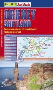 Philips Red Books edition. This double-sided leisure and tourist map of Orkney and Shetland gives detailed coverage of the islands' road network at a scale of approximately 2.5 miles to 1 inch. The Orkney Islands are featured on side one of the map, with the Shetland Islands shown on the reverse. The maps show places of tourist and historic interest, including castles, camping sites, country parks, galleries, gardens, golf courses, marinas, museums, nature trails, historic sites, sports venues, theatres, theme parks, wildlife parks and zoos. An index to principal places of interest is also featured on each side of the map for Orkney and Shetland respectively. In a convenient folded format, this double-sided sheet map is ideally suited for both leisure and business use, whether by locals or visitors to the islands.
 - $16.95
Item Code : PRED21260
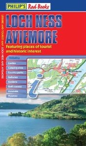 Philips Red Books edition. This leisure and tourist map of Loch Ness and Aviemore gives detailed coverage of the area's road network at a scale of approximately 2.5 miles to 1 inch. The map shows places of tourist and historic interest, including castles, camping sites, country parks, galleries, gardens, golf courses, marinas, museums, nature trails, historic sites, sports venues, theatres, theme parks, wildlife parks and zoos. An index to principal places of interest is also featured. In a convenient folded format, this single-sided sheet map is ideally suited for both leisure and business use, whether by locals or visitors.
 - $16.95
Item Code : PRED21261
Philips Red Books edition. - $16.95
Item Code : PRED21262
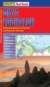 Philips Red Books edition. This leisure and tourist map of Skye and Lochalsh gives detailed coverage of the area's road network at a scale of approximately 2.25 miles to 1 inch. The map shows places of tourist and historic interest, including castles, camping sites, country parks, galleries, gardens, golf courses, marinas, museums, nature trails, historic sites, sports venues, theatres, theme parks, wildlife parks and zoos. An index to principal places of interest is also featured. In a convenient folded format, this single-sided sheet map is ideally suited for both leisure and business use, whether by locals or visitors.
 - $16.95
Item Code : PRED21263
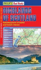 Philips Red Books edition. This leisure and tourist map of the Highlands of Scotland gives detailed coverage of the area's road network at a scale of 4.34 miles to 1 inch. The map shows places of tourist and historic interest, including castles, camping sites, country parks, galleries, gardens, golf courses, marinas, museums, nature trails, historic sites, sports venues, theatres, theme parks, wildlife parks and zoos. An index to principal places of interest is also featured. In a convenient folded format, this single-sided sheet map is ideally suited for both leisure and business use, whether by locals or visitors.
 - $16.95
Item Code : PRED21264
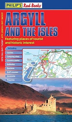 Philips Red Books edition. This leisure and tourist map of Argyll and the Isles gives detailed coverage of the area's road network at a scale of 3.16 miles to 1 inch. The map shows places of tourist and historic interest, including castles, camping sites, country parks, galleries, gardens, golf courses, marinas, museums, nature trails, historic sites, sports venues, theatres, theme parks, wildlife parks and zoos. An index to principal places of interest is also featured. In a convenient folded format, this single-sided sheet map is ideally suited for both leisure and business use, whether by locals or visitors.
 - $16.95 Rolled + $6.80 p&h or $28.80 foreign delivery
Item Code : NATL19155
Scale 1:650,000. Size 30"x36". National Geographic edition. Flat. - $19.95 Rolled + $6.80 p&h or $28.80 foreign delivery
Item Code : NATL19156
Scale 1:650,000. Size 30"x36". National Geographic edition. Tubed. - $24.95 Rolled + $8.80 p&h or $36.80 foreign delivery
Item Code : NATL19157
Scale 1:650,000. Size 30"x36". National Geographic edition. Laminated. - $16.95 Rolled + $6.80 p&h or $28.80 foreign delivery
Item Code : NATL19158
Scale 1:650,000. Size 30"x36". National Geographic edition. Flat. - $19.95 Rolled + $6.80 p&h or $28.80 foreign delivery
Item Code : NATL19159
Scale 1:650,000. Size 30"x36". National Geographic edition. Tubed.
| Postage and handling is $3.50 for the first map and $1.50 for each additional map. ~ ~ ~ ~ ~ ~ Foreign delivery is $7.80 for the first map and $5.00 for each additional map. |
| ** Click here! to view our collection of Scotland Travel VIDEOS ** |
| ** Click here! to view our collection of Gaelic Language Courses ** |
|
Scotland Road Maps |
