
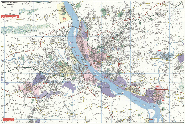
Philadelphia Street Maps | Detailed Travel Tourist City
|
Philadelphia City Street Maps |
Philadelphia
- $309.95 + $24.80 p&h (add $40 for spring rollers)
Item Code : UNIV12372
 Laminated. Universal Map Wall Maps provide up-to-date cartography showing new streets and changes. Plotted in complete street detail. Printed in color with a markable/washable-laminated surface. Provides street indexing on the face of the map or in a separate book. Framing rails are included on top and bottom for easy wall mounting. Railed wall maps can be turned into pull down maps on spring rollers for an additional $40.
 - $10.95
Item Code : RAND12373
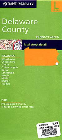
 Scale 1:31,700. Size 28"x40". Rand McNally edition.
 - $249.95 + $24.80 p&h (add $40 for spring rollers)
Item Code : KAPA21128
 Kappa Map Group Wall Maps provide up-to-date cartography showing new streets and changes. Plotted in complete street detail. Printed in color with a markable/washable-laminated surface. Provides street indexing on the face of the map or in a separate book. Framing rails are included on top and bottom for easy wall mounting. Railed wall maps can be turned into pull down maps on spring rollers for an additional $40.
 - $10.95
Item Code : UNIV12377
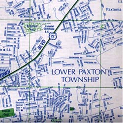
 Scale 1:34,000. Size 22"x23". Universal Map edition. Detailed city street map.
 - $249.95 + $24.80 p&h (add $40 for spring rollers)
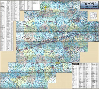
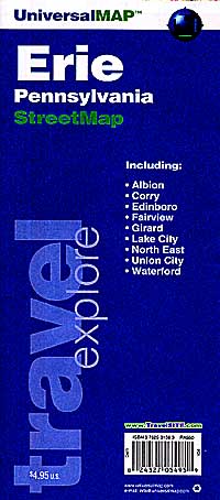
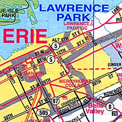
Item Code : UNIV12378
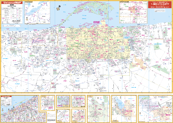 Scale 1:960. Size 63" W x 46" H. Laminated. The Erie, Pennsylvania Wall Map by Universal Map. Area of coverage ranges: North: to Lake Erie, including Presque Isle State Park; South: includes the I-90 and I-79 interchange, and Orchard Ponds Golf Course; East: to Harbor Creek and SR 531 and Depot Rd; West: includes Manchester Beach and Orchard Hills. Insets include: Albion, Corry, Edinboro, Fairview, Girard, Northeast Lake City, Union, Waterford, and Erie County. The special features and data are as follows: all streets and highways, government buildings, airports, golf courses and country clubs, railroads, longitude and latitude lines, block numbers, shopping centers, recreational parks, mileage circles, cemeteries, educational facilities, hospitals, post offices, city limits and annexations, water features, fire and police stations, and assorted points of interest. Framing rails are included on top and bottom for easy wall mounting. Railed wall maps can be turned into pull down maps on spring rollers for an additional $40.
 - $14.95
Item Code : GMJO12379
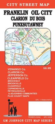
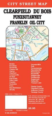 Scale 1:32,000. Size 27"x39". G.M. Johnson edition. This Map Coverage Area are Brisbin, Brockway, Brookville, Chester Hill, Clarion, Clearfield, Curwensville, Du Bois, East Brady, Falls Creek, Franklin, Houtzdale, Knox, New Bethlehem, Oil City, Osceola Mills, Polk, Punxsutawney, Reynoldsville, Rimersburg, Rouseville, Shippenville, Strattanville, Sugarcreek, Sykesville, Treasure Lake, Clarion County, Clearfield County, Jefferson County, Venango County.
 - $10.95
Item Code : UNIV12380
 "Various scales". Size 22"x35". Universal Map edition. Detailed city street map.
 - $14.95
Item Code : GMJO12381
 Scale 1:32,000. Size 28"x40". G.M. Johnson edition.
 - $48.95 + $5.80 p&h or $12.80 foreign delivery
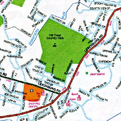
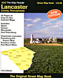
Item Code : ADCM12415
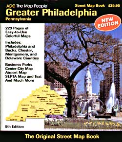
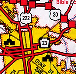
 Scale 1:27,000. Size 9?"x13". 336 pages. ADC Maps edition. (We only sell the latest edition of this atlas, whatever the year might be. The illustration is for visual purposes only.)
 - $10.95
Item Code : UNIV12382
 Scale 1:38,000. Size 24"x36". Universal Map edition.
 - $10.95
Item Code : ADCM12383
 Scale 1:31,000. Size 27"x39". ADC Maps edition.
 - $10.95
Item Code : RAND12384
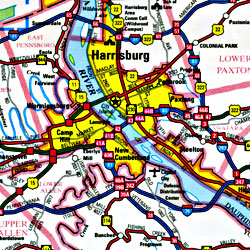
 Scale 1:36,000. Size 28"x40". Rand McNally edition. Detailed city street map.
 - $229.95 + $24.80 p&h (add $40 for spring rollers)
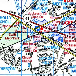
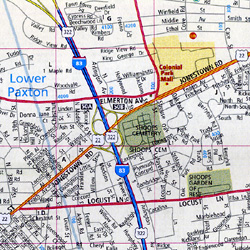
Item Code : UNIV12387
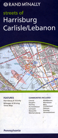
 Laminated. The Harrisburg, Pennsylvania Wall Map by Universal Map includes approximately 600 new streets and changes. Shows all of Harrisburg, PA in complete street detail with boundaries north to include Marysville, Linglestown and exit 27 on I-81; south to include all of Goldsboro and Glendale; east to include Middleton and Hummelstown; and west to State Road 114 and Wertsville. Includes all streets/highways, educational institutions, government buildings, shopping centers, hospitals, ZIP codes, post offices, fire/police stations, airports, cemeteries, recreational parks, golf/country clubs, points of interest, city limits/annexations, railroads, and water features. Printed on #80 stock material and laminated. Framing rails included on top and bottom for easy wall mounting. Railed wall maps can be turned into pull down maps on spring rollers for an additional $40.
 - $14.95
Item Code : GMJO12388
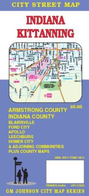
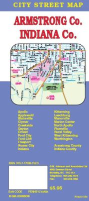 Scale 1:32,000. Size 27"x39". G.M. Johnson edition. This Map Coverage Area are Apollo, Applewold, Blairsville, Clymer, Creekside, Dayton, Ernest, Ford City, Ford Cliff, Freeport, Homer City, Indiana, Kittanning, Leechburg, Manorville, Marion Center, North Apollo, Plumville, Rural Valley, West Kittanning, Worthington, Armstrong County, Indiana County.
 - $14.95
Item Code : GMJO12389
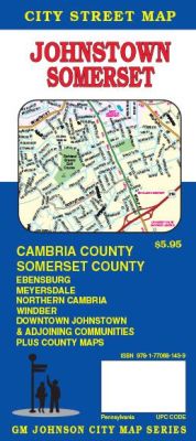
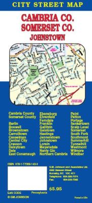 Scale 1:32,000. Size 27"x39". G.M. Johnson edition. This Map Coverage Area are Berlin, Boswell, Brownstown, Carrolltown, Casselman, Central City, Cresson, Daisytown, Dale, East Conemaugh, Ebensburg, Ehrenfeld, Ferndale, Franklin, Gallitzin, Geistown, Hastings, Jennerstown, Johnstown, Lorain, Meyersdale, Nanty Glo, Northern Cambria, Paint, Patton, Portage, Sankertown, Scalp Level, Somerset, South Fork, Southmont, Summerhill, Tunnelhill, Westmont, Wilmore, Windber, Cambria County, Somerset County.
 - $10.95
Item Code : RAND12390
 Scale 1:28,000. Size 28"x36". Rand McNally edition.
 - $10.95
Item Code : UNIV12391

 Scale 1:27,000. Size 23"x36". Universal Map edition. Detailed city street map.
 - $10.95
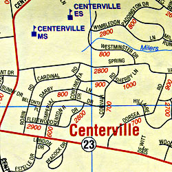
Item Code : RAND12392
 Scale 1:36,000. Size 23?"x36". Rand McNally edition.
 - $10.95
Item Code : ADCM12393
 Scale 1:34,000. Size 37"x39". ADC Maps edition. Detailed city street map.
 - $36.95 + $5.80 p&h or $12.80 foreign delivery
Item Code : ADCM12394
 Scale 1:24,000. Size 10?"x14". 124 pages. ADC Maps edition. (We only sell the latest edition of this atlas, whatever the year might be. The illustration is for visual purposes only.)
|
Philadelphia City Street Maps |
