
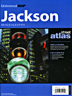
Mississippi Road Maps | Detailed Travel Tourist Driving
|
Mississippi Road Maps |
Mississippi
- $10.95
Item Code : RLEY10734
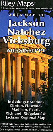
 Scale 1:50,000. Size 25"x38". Riley Marketing edition.
 - $10.95
Item Code : UNIV10735
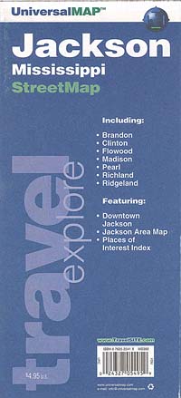
 Scale 1:43,000. Size 24"x36". Universal Map edition.
 - $11.95
Item Code : UNIV10737
 Scale 1:43,000. Size 22"x25". Universal Map edition. Laminated.
 - $10.95
Item Code : RAND10738
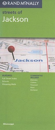
 Scale 1:44,000. Size 26"x37". Rand McNally edition.
 - $36.95 + $5.50 p&h or $18.50 foreign delivery
Item Code : UNIV10739
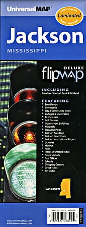
 Scale 1:24,000. Size 8?"x11". 83 pages. Universal Map edition.
 - $12.95
Item Code : GMJO22907
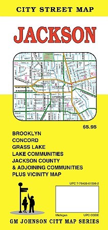 G.M Johnson Maps edition. An accurate and detailed city street map of Jackson, MI. Also covers Brooklyn, Concord, Grass Lake, Lake Community, Jackson County and Adjoining communities plus vicinity map.
 - $249.95 + $24.80 p&h (add $40 for spring rollers)
Item Code : UNIV10741
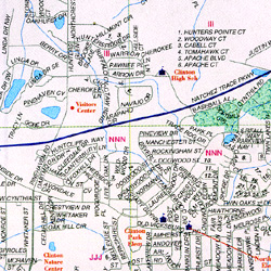
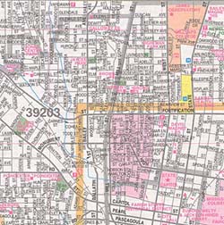
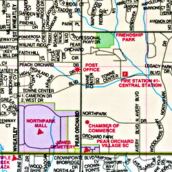
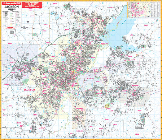
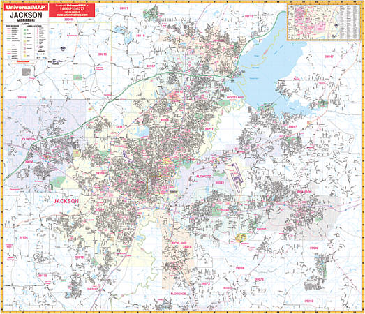 Size 54" W x 60" H. Laminated. The 2nd edition Jackson, Mississippi and adjacent area Wall Map by Universal Map. Uses up-to-date cartography showing new streets and changes and provides complete street detail. It has been printed in color with a markable and washable surface. Streets are indexed in a separate book. The area of coverage ranges: North to all of Madison, Ross Barnett Reservoir, and Whispering Lake Country Club; South to include all of Richland and Cleary; East showing all of Brandon and Willow Creek Resort; West to cover all of Clinton. Contains an inset map of Downtown Jackson. The special features and data are as follows: all streets and highways, government buildings, airports, golf courses and country clubs, railroads, ZIP codes and ZIP code boundaries, shopping centers, water features, recreational parks, cemeteries, educational facilities, hospitals, post offices, city limits and annexations, section/township/range lines, fire and police stations, and miscellaneous points of interest. Railed wall maps can be turned into pull down maps on spring rollers for an additional $40.
 - $229.95 + $24.80 p&h (add $40 for spring rollers)
Item Code : UNIV10742
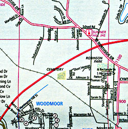
 Scale 1:180,000. Size 54" W x 65" H. Laminated. Provides up-to-date cartography with color and a markable/washable-laminated surface. Cities indexed on map's face. Hanging rails mounted top and bottom. Includes all the following 9 counties: Copiah, Hinds, Leake, Madison, Rankin, Scott, Simpson, Smith, and Yazoo. Portions of the following counties: Attala, Claiborne, Covington, East Carroll LA, Holmes, Humphreys, Issaquena, Jasper, Jefferson, Jefferson Davis, Jones, Lawrence, Lincoln, Madison LA, Neshoba, Newton, Sharkey, Tenasas, Warren, Warren LA, Washington, and Winston. North: 50 miles to include Louise, Eden, and Goodman; South: 45 miles to include Fayette, Wesson, and Collins; East: 50 miles to include Sebastopol, and Sylvarena; West: 55 miles to include Fayette and Mayersville. Details include major streets and highways, airports, parks, county lines, mileage circles, longitude/latitude, water features, ZIP codes/boundaries, and points of interest. Railed wall maps can be turned into pull down maps on spring rollers for an additional $40.
 - $10.95
Item Code : RLEY10744
 "Various scales". Size 23"x25". Riley Marketing edition.
 - $10.95
Item Code : 10745
Laurel, Mississippi, America (please turn to "Meridian and Laurel, Mississippi, America") -
- $10.95
Item Code : 10748
Moss Point, Mississippi, America (please turn to "Pascagoula and Moss Point, Mississippi, America") -
- $10.95
Item Code : 10750
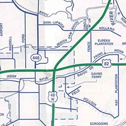
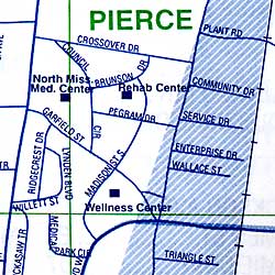
New Albany, Mississippi, America (please turn to "Tupelo and New Albany, Mississippi, America") - $10.95
Item Code : UNIV10751
Pascagoula and Moss Point, Mississippi, America - $10.95
Item Code : UNIV10752
 "Various scales". Size 23"x35". Universal Map edition.
 - $10.95
Item Code : UNIV10753
 Scale 1:27,000. Size 22"x34". Universal Map edition.
 - $10.95
Item Code : UNIV10754
 Scale 1:23,000. Size 24"x36". Universal Map edition.
 - $229.95 + $24.80 p&h (add $40 for spring rollers)
Item Code : UNIV10755
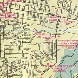
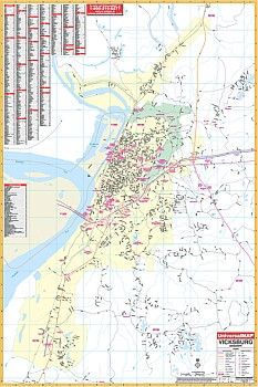 Size 42" W x 62" H. Laminated. Coverage ranges North to the intersection of US 61 and Washington St.; South to the Redbone, Vicksburg Municipal Airport; East to the Mt. Alban Rd. exit of I-20; and West to the Mississippi River. Details all streets/highways, government buildings, ZIP codes/boundaries, airports, golf courses/country clubs, railroads, post offices, shopping centers, cemeteries, city limits/annexations, educational facilities, fire/police stations, hospitals, water features, mileage circles, and points of interest. Framing rails are included on top and bottom for easy wall mounting. Railed wall maps can be turned into pull down maps on spring rollers for an additional $40.
|
Mississippi Road Maps |
