
Michigan Road Maps | Detailed Travel Tourist Drivig
|
Michigan Road Maps |
Michigan
-
-
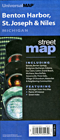
- $14.95
Item Code : GMJO22873
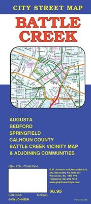
 Scale 1:28,000. Size 27"x39". G.M. Johnson edition. This Map Coverage Area are Augusta, Bedford, Brooklyn, Concord, Grass Lake, Springfield, Lake Communities, Calhoun County, Jackson County.
 - $10.95
Item Code : UNIV10510
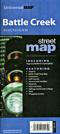
 Scale 1:34,000. Size 24"x36". Universal Map edition.
 - $10.95
Item Code : UNIV10514
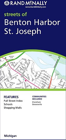
 Joseph, Michigan, America. Scale 1:53,000. Size 28"x40". Universal Map edition.
 -
- $249.95 + $24.80 p&h (add $40 for spring rollers)
Item Code : UNIV10512
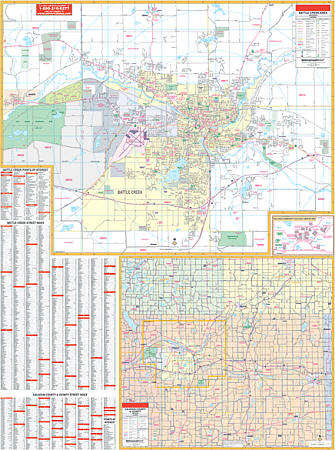 Scale 1:1,712. Size 54" W x 72" H. Laminated. Provides up-to-date cartography with new streets and changes. Printed in color with a markable/washable-laminated surface. Streets are indexed on the face of the map. Hanging rails mounted top and bottom. Area of Coverage: All of Battle Creek with the following boundaries: North: to the town of Bedford; South: Binder park and Golf Course; East: all of the town of Augusta; West: Oakland Golf Course. Inset: Kellogg Community College Campus, Calhoun County with portions of Barry & Eaton Counties. Major road detail at a scale of 1" = 1.2 miles. Details included: airports, cemeteries, hospitals, railroads, post offices, mileage circles, range/township sections (County map only), all streets & highways, shopping centers, water features, recreational parks, government buildings, fire/police stations, educational facilities, golf/country clubs, city limits/annexations, ZIP codes/boundaries, industrial/business parks, and points of interest. Railed wall maps can be turned into pull down maps on spring rollers for an additional $40.
 - $249.95 + $24.80 p&h (add $40 for spring rollers)
Item Code : UNIV10516
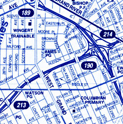
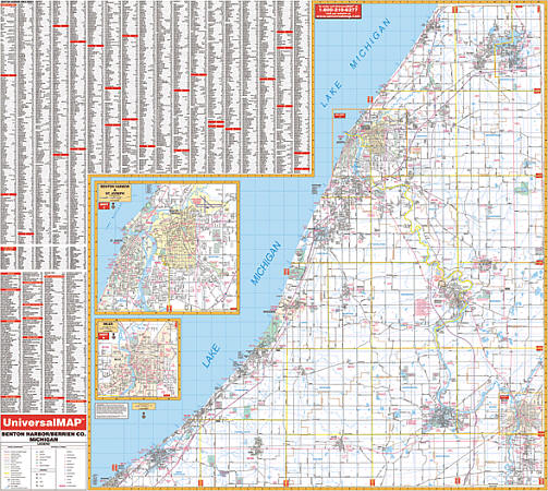 Scale 1:3,520. Size 58" W x 53" H. Laminated. The Benton Harbor/Berrien County, Michigan Wall Map by Universal Map shows complete street detail. Printed in color with a markable/washable-laminated surface. Streets indexed on face of map. Includes hanging rails mounted top and bottom. Boundaries as follows: North: to the Van Buren County line; South:to the Indiana state line; East: to the Cass County line; West: to Lake Michigan. The special features and data are as follows: all streets and highways, government buildings, airports, golf courses and country clubs, railroads, longitude and latitude lines, ZIP codes and ZIP code boundaries, shopping centers, recreational parks, mileage circles, cemeteries, educational facilities, hospitals, post offices, city limits and annexations, fire and police stations, and miscellaneous points of interest. Railed wall maps can be turned into pull down maps on spring rollers for an additional $40.
 - $14.95
Item Code : GMJO22874
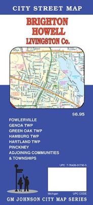 G.M Johnson Maps edition. An accurate and up to date detailed city street map of Brighton, Howell, and Livingston Co. Also covers Fowlerville, Genoa TWP, Green Oak TWP, Hamburg TWP, Hartland TWP, Pinckney & Adjoining communities and townships.
 - $10.95
Item Code : UNIV10517
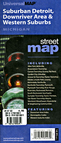
 "Various scales". Size 22"x34". Universal Map edition.
 - $10.95
Item Code : UNIV10518
 "Various scales". Size 22"x28". Universal Map edition.
 - $12.95
Item Code : MART21392
MapArt edition. City street map. - $10.95
Item Code : UNIV10519
 Scale 1:46,000. Size 27"x40". Universal Map edition.
 - $10.95
Item Code : UNIV10520
 Scale 1:41,000. Size 38"x50". Universal Map edition.
 - $11.95
Item Code : UNIV10521
 Scale 1:40,000. Size 22"x25". Universal Map edition. Laminated.
 - $12.95
Item Code : MART10522
 Scale 1:31,000. Size 28"x40". MapArt edition.
 - $10.95
Item Code : UNIV10528
 Scale 1:49,000. Size 27"x36". Universal Map edition.
 - $10.95
Item Code : RAND10529
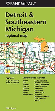
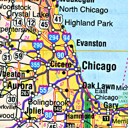
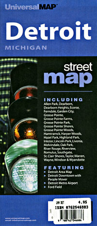
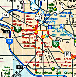 Scale 1:130,000. Size 28"x40". Rand McNally edition. Rand McNally's folded map for Detroit is a must-have for anyone traveling in and around the Detroit area and Southeastern part of Michigan, offering unbeatable accuracy and reliability at a great price. Our trusted cartography shows all Interstate, U.S., state, and county highways, along with clearly indicated parks, points of interest, airports, county boundaries, and streets. The easy-to-use legend and detailed index make for quick and easy location of destinations. You'll see why Rand McNally folded maps have been the trusted standard for years.
 - $10.95
Item Code : RAND10530
 Scale 1:38,000. Size 37"x45". Rand McNally edition.
 - $36.95 + $7.50 p & h or $28.50 foreign delivery
Item Code : UNIV10524
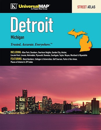
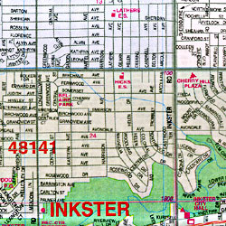
 Scale 1:34,000. Size 8?"x11". 76 pages. Universal Map edition. The Detroit and Wayne County, Michigan Street Atlas by Kappa Map Group features Downtown Detroit. Includes Allen Park, Dearborn, Dearborn Heights, Flat Rock, Grosse Pointe Woods, Harper Woods, Highland Park, Inkster, Lincoln Park, Livonia, Northville, Plymouth, Rockwood, Romulus, South Rockwood, Southgate, Taylor, Wayne, Westland, Woodhaven, and Wyandotte. Provides a map locator, maps, street indexing, and places of interest indexing. Details travel routes, railroads, boundaries, ZIP code numbers/boundaries, schools/colleges,universities, libraries, post offices, fire/police stations, shopping centers, hospitals, government facilities, boat ramps, marinas, airports, mileage circles, cemeteries, parks, and points of interest.
|
Michigan Road Maps |
