
Yucatan Road Maps | Detailed, Travel, Tourist, Driving
|
Mexico Regional Road Maps |
Mexico Regional Road Maps
- $14.95
Item Code : FRKO10348
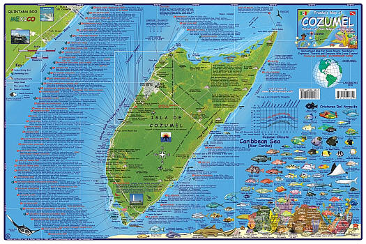
 "Various scales". Size 14"x21". Franko maps edition. Laminated. Side 1 of Franko's Map of Cozumel, which is an island just off the Yucatan Peninsula of the state of Quintana Roo, Mexico, features a layout of Isla de Cozumel, based on nautical charts and aerial photos. Includes Cozumel's roads, Maya ruins, resorts, location and detailed descriptions of 55 scuba diving and snorkeling sites, and notable surf spots. The finishing touch on side one is the reef creatures guide. This biological interpretive data includes over 100 species of fish, invertebrates, corals and sponges, depicted in full color with names for easy identification. Side 2 features a couple of zoom-ins and a Cozumel Reefs explanation and artwork. Includes Greater San Miguel, Chankanaab Park, dive spots defined on side one are more closely shown, and a few undersea photos of the reefs. Many of Cozumel's main dive shops are located in a detailed map of downtown San Miguel, along with cruise ship terminals, the route to the airport, Plaza San Miguel, hotels, and even grocery stores. Franko's Maps produces recreation maps for the land and water of selected tourist destinations. The maps are all printed on plasticized paper so they are water resistant.
 - $13.95
Item Code : QUIM10327
 Scale 1:1,750,000. Indexed. Quimera Editores edition. Covers the southeast of Mexico, including the Yucatan Peninsula, Belize, Cancun, Merida, Mexico City, Leon, Puebla, Veracruz, Acapulco, Villahermosa, Oaxaca and Chiapas. English and Spanish text.
 - $16.95
Item Code : NATL21254
 Scale 1:500,000. National Geographic edition. This map provides unmatched detail and information for the highly popular Yucatan Peninsula and its important Maya archeological sites. Detailed city inset maps of Cancun and Merida provide locations of attractions and key infrastructure. Detailed descriptions, photographs, and site maps on the reverse guide the traveler through important Maya buildings and history. Like all National Geographic Adventure Maps, Northern Yucatan is printed on durable waterproof-tear-resistant material which is designed to stand up to the rigors of international travel.
 - $17.95
Item Code : ITMB10329
Scale 1:1,000,000. International Travel Maps edition. - $10.95
Item Code : FRKO10347
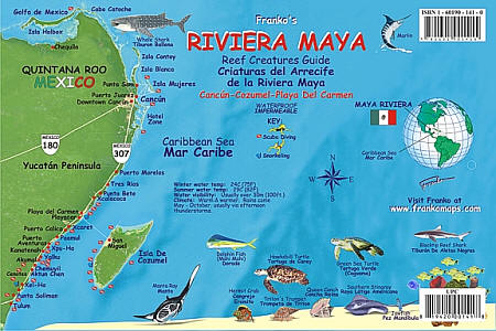
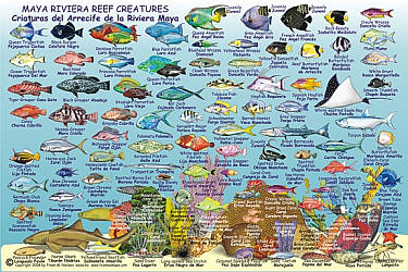 Size 6"x9". Franko maps edition. Laminated. Perfect for divers, snorkelers and nature lovers! Side One is a mini-map of Mexico's Riviera Maya from Holbox to Cancun to Tulum, with dive sites located. Side Two is a fish identification guide with nearly 100 species illustrated and named in English and Spanish. This convenient, waterproof reference is made of hard, laminated plastic with hole for lanyard.
 - $13.95
Item Code : QUIM10331
 Scale 1:1,750,000. Indexed. Quimera Editores edition. Includes all of central Mexico, covering the Rio Grande border, Ciudad Juarez, Chihuahua, Matamoros, Monterrey, Tampico, Guadalajara, Leon, Mexico City, and down to Veracruz. English and Spanish text and legend.
 - $12.95
Item Code : QUIM10345
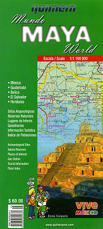
 Scale 1:1,100,000. Size 27"x36". Quimera maps edition. Includes Mexico, Guatemala, Belize, El Salvador, and Honduras.
 - $13.95
Item Code : QUIM10330
 Scale 1:1,750,000. Size 27" across x 37" high. Indexed. Quimera edition. Includes all of Baja California Peninsula, and the states of Sonora, Chihuahua, and Sinaloa which border the Sea of Cortez (also known as the Gulf of California). Shows all types of roads, road numbers, distances between points in kilometers, railways, car ferries that traverse the Sea of Cortez, time zone limits, state and international borders, rivers, lakes, national parks, deserts, cities, town, villages, places of tourist interest, airports, altitudes in meters, archaeological sites, caves, and petrol stations. English and Spanish text and legends. Excellent map! SAMPLE MAP
 - $19.95
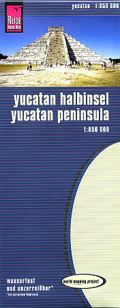
Item Code : REIS10341
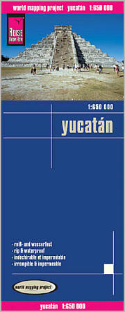 Scale 1:650,000. Reis Know How edition. Very detailed Yucatan road map. English and multi-lingual legends. Printed on tear-resistant, waterproof, paper-like plastic. It can bend and fold without cracking and is writable as normal paper, non-toxic and recyclable. Perfect for tourist adventures and independent travel and for driving tours. Includes topographic contour lines and hypsometric color tints which show height levels, along with elevation numbers. Shows all major and secondary roads and tertiary roads, with distances between points in kilometers. Fully indexed. Beautiful cartography.
 - $19.95
Item Code : REIS10342
 Scale 1:650,000. Size 27"x39". Reis Know How edition.
 - $17.95
Item Code : ITMB10343
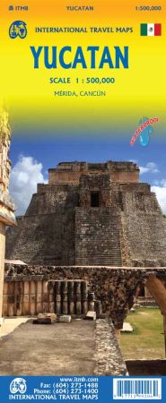

Scale 1:500,000. Size 27"x39". International Travel Maps edition. Indexed.
The peninsula of Mexico that juts eastward and upwards into the Caribbean is probably the most popular visitor destination in all of Latin America it certainly is our best-selling map of any part of Mexico.
Historically, it was the centre of the wonderful Mayan civilization, the remains of which are still easily visited in Mexican, Belician, and Guatemalan portions of the great Yucatan. Touristically, it is a magnet for sun lovers, with the Cancun area in particular being a massive concentration of resort hotels The area south of Playa del Carmen and the nearby island of Cozumel are also touristic magnets. Yucatan is, however, a lovely place to explore. The city of Valladolid is an ancient Spanish town, replete with lovely churches and a town plaza to die for.
Merida’s cathedral is one of the most ornate in Mexico. Further south, Belize is easily accessible, with its preserved Mayan ruins, and there is a good road into Guatemala to explore the famous Tikal ruins. Our map actually shows 19 sets of ruins in Guatemala alone. Naturally, the focus of this map is on the Mexican portion of the peninsula, and no visit would be complete without exploring Chitzen Itza, or the coastal remains of Tulum. This is truly a marvelous
- $17.95
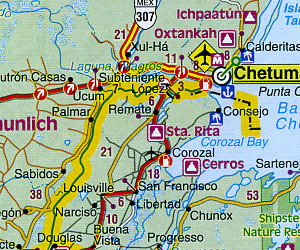
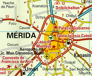
Item Code : BORC10344
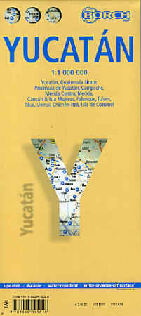
Scale 1:1,000,000. Size 20" x 35". Fully indexed. Borch edition.
English and multilingual text. Shows all types of roads, road numbers, distances between points in kilometers, churches and monasteries, castles, Mayan temples, theatres, cinemas, museums, libraries, monuments, lighthouses, altitude in meters, caves, information centers, post offices, golf courses, badminton courts , airports, bus stations, rent-a-car locations, points of interest, hospitals, beaches, ancient sites, nature preserves, bird sanctuaries, national parks, riding stables, viewpoints, camping sites, markets, petrol stations, police stations, embassies, car parks, hotels, national marine parks, fishing areas, caves, cenotes, harbors, water skiing areas, beaches, snorkelling areas, shipwrecks, waterfalls, windsurfing and surfing areas, parasailing, scuba diving areas, yachting, car ferries, reefs, mangroves, and swamps.
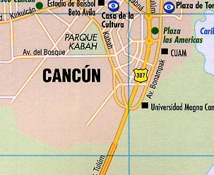
Laminated, easy-fold, flexi-map. On the reverse side are beautiful detailed indexed city street plans of M?rida at 1:10,000 scale, Canc?n at 1:10,000, plus a M?rida Environs Road and Tourist Map at 1:100,000 scale, a Canc?n & Isla Mujeres Regional Road and Tourist Map at 1:100,000 scale, and an Isla de Cozumel Road and Tourist Map at 1:250,000 scale.
In addition there are five easy to read archeological site maps of Uxmal, Tul?m, Palenque, Chich?n-Itz?, and Tikal. This is an excellent map! BIG >> SAMPLE MAP
|
Mexico Regional Road Maps |
