
Maine Road Maps | Detiled Travel Tourist Driving
|
Maine Road Maps |
Maine
- $10.95
Item Code : DELR22826
Scale 1:36,000. Size 18"x24". DeLorme Publishers edition. Same level of detail as Portland Street Atlas; covers all or parts of Arundel, Biddeford, Kennebunk, Kennebunkport, Old Orchard Beach, Saco and Wells. - $16.95
Item Code : NATL21059
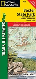
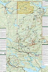 Scale 1:63,360. Size 26"x38". National Geographic edition. National Geographic's recreational map of Baxter State Park/Mount Katahdin is a two-sided, waterproof map designed to meet the needs of outdoor enthusiasts with unmatched durability and detail. Loaded with valuable information about hiking, camping, and fishing in the park, the map also includes a UTM and latitude/longitude grid, as well as compass rose and scale bar for easy and accurate navigation. Year-round activities abound in the park and the location of scenic viewpoints, wildlife viewing, boat launches and canoe carry downs, lookout towers, amphitheaters, ATV trails, and other points of interest are clearly marked as are park boundaries and access points. Campers will appreciate the attention paid to noting the variety of camping facilities available including primitive campsites, group campsites, rental cabins, RV camping, picnic shelters, restrooms, parking, and trailheads. Appalachian Mountain Club operated lodges, huts, backcountry shelters and campsites are included as well. Whether paddling the Northern Forest Canoe Trail, camping in the North Maine Woods, or hiking the Appalachian Trail, these maps perform as highly functional travel tools that are as useful as they are remarkably crafted. The front of the Baxter State Park map details the south half of the park from the lower half of the Main Public Woods – Nahmakanta Lake Unit and includes Roach Ponds, the Katahdin Iron Works, and the KI-JO Mary Multiple Use Forest. The northern half of the park appears on the back of the map and includes Mount Katahdin as well as the Main Public Woods – Telos Unit, the Debsconeag Lakes Wilderness Area, and the upper half of the Nahmakanta Lake Unit.
 - $11.95
Item Code : DELR9978
DeLorme Publishers edition - $11.95
Item Code : DELR9979
DeLorme Publishers edition - $11.95
Item Code : DELR9980
DeLorme Publishers edition - $16.95 + $6.50 p&h
Item Code : AROW9984
 Arrow Maps edition
 -
- $10.95
Item Code : UNIV9988

 Scale 1:33,000. Size 25"x37". Universal Map edition.
 - $10.95
Item Code : AMER9989
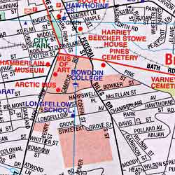
 Scale 1:27,000. Size 27"x40". American Map Company edition.
 - $249.95 + $24.80 p&h (add $40 for spring rollers)
Item Code : UNIV9990
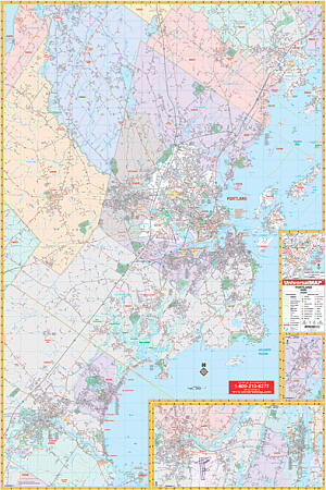 Scale 1:1,980. Size 51" W x 76" H. Laminated. Provides up-to-date cartography. Printed in color with a markable/washable-laminated surface. Streets indexed in a separate book. Includes hanging rails mounted top and bottom. The area of coverage ranges: North: to include all of Yarmouth, most of Windham to St. Joseph's college in Standish; South: to include Biddeford and Saco in York County; East: to the Atlantic Ocean; West: to Biddeford and Gorham. Insets: Downtown Portland, Freeport, and Brunswick. Details include airports, cemeteries, hospitals, railroads, post offices, all streets and highways, shopping centers, water features, recreational parks, mileage circles, city limits/annexations, government buildings, fire/police stations, educational facilities, golf/country clubs, ZIP codes/boundaries, and points of interest. Railed wall maps can be turned into pull down maps on spring rollers for an additional $40.
 - $11.95
Item Code : DELR9982
DeLorme Publishers edition - $12.95
Item Code : GMJO22827
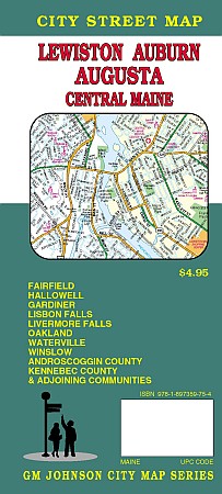 G.M Johnson Maps edition. An accurate and detailed city street map of Lewiston,Auburn, Augusta. Including Fairfield, Hallowell, Gardiner, Lisbon Falls, Livermore Falls, Oakland, Waterville, Winslow, Androscoggin County, Kennebec County & Adjoining Communities.
|
Maine Road Maps |
My Wish List
Last Added Items
You have no items in your wish list.
