
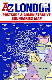
London Street Map | Detailed, Travel, Tourist, City
|
London Street Maps |
London Street Maps
- $18.95
Item Code : GEAZ9846
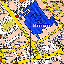
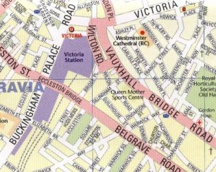
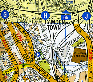
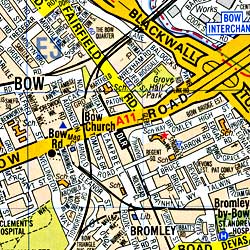
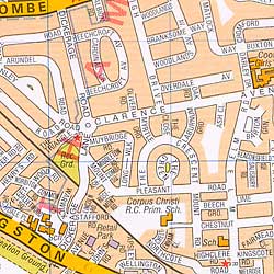
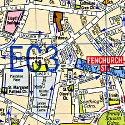 Scale 1:7,000. Size 38"x48". Geographers A-Z edition. Indexed. Easy to read. So large scale that you can see the outlines of all the major buildings within the center city. Shows one way streets, post code boundaries, the location of railway stations, the Underground, light railway stations, cinemas, theatres, information centers, police stations, and post offices. Very colorful. Laminated card cover. This is my favorite map! BIG >> SAMPLE MAP London street map << Small sample map
 - $14.95
Item Code : GEAZ9848
 Scale 1:9,000. Size 26"x40". Geographer's A-Z edition. London street map
 - $17.95
Item Code : BORC9850
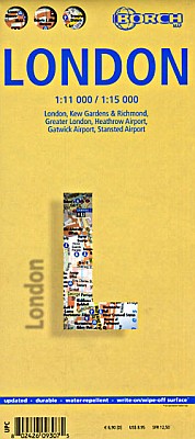
 Scale 1:11,000. Size 20"x26". Borch edition. Indexed. Printed on both sides. English and multilingual legends. Laminated, water proof, easy-fold, flexi-map. London street map
 - $14.95
Item Code : GEAZ9851
 Scale 1:10,500. Size 23"x35". Geographer's A-Z edition. Detailed city street map. London street map
 - $12.95
Item Code : MEAS9853
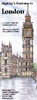
 Scale 1:6,000. Size 18"x27". Map Easy edition. Perfect for the intrepid or armchair traveller, this charming map combines the best of a guidebook and a location map, all in one. The map is color coded to include information about the city's hotels, restaurants, shops, and sites. Printed on tear-proof, water-resistant, lightweight, paper-like plastic, that is incredibly durable. Also includes sketches of the landscape and interesting details about the area. You'll love this map! London is one of the most exciting and dynamic cities in the world. With so much to explore, MapEasy is the perfect guide to help you tour and discover the history and culture of London. Join us as we walk along the Thames, visit the National Portrait Gallery, take photos at Big Ben, and stroll past the gates of Buckingham Palace. Few cities match London for shopping, and we show you where everything is, whether you are looking for something at Harrod's, some new woolens at the Scotch House, or some edibles at Fortnum & Mason. When choosing hotels, London offers you a vast selection, including the old standards and some great new boutique hotels. MapEasy locates and evaluates each of them for you. The London Guidemap includes detailed sections for Covent Garden/Soho, Greater London, and the Underground. MapEasy Guidemaps are made of a tear-resistant and waterproof material that will endure even the most rigorous of travels! Each Guidemap is geographically accurate and to-scale, and contains useful information on hotels and restaurants (including price ranges) as well as facts on museums, cultural events, attractions, and retail shops. All of the information is color-coded, easy-to-use, and fun!
 - $10.95
Item Code : HLWG9855
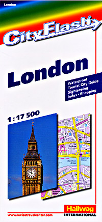
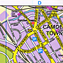 Scale 1:17,500. Size 9?"x39". Hallwag edition. Waterproof. London street map
 - $12.95
Item Code : CART9856
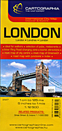
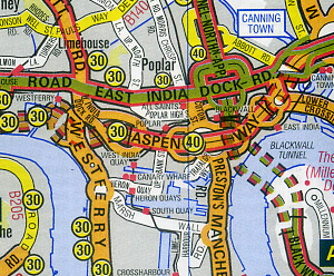
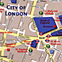
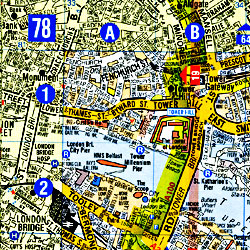
 Scale 1:12,500. Size 25"x35". Cartographia edition. Detailed map of London at 1:13,500 scale, showing streets, schools, museums, monuments, churches and theatres. The city center is shown at 1:7,500 scale (great for walking tours), size 7"x7". Also included are small maps of the Tower of London, size 4"X6", Westminster Abbey, size 5"X3", Greater London, size 9"X6", London Environs at 1:1,000,000 scale, size 9"x5", and the Underground System, size 8"X5".
 - $19.95
Item Code : GEAZ9857

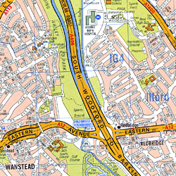 Scale 1:21,000. Size 38"x48". Geographers A-Z edition. Very detailed. London street map
 - $17.95
Item Code : GEAZ9858
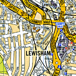
 Scale 1:64,000. Size 36"x46". Geographers A-Z edition. London street map
 - $16.95
Item Code : GEAZ9859
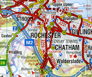 Scale 1:222,000. Size 36"x46". Geographers A-Z edition. London street map
 - $16.95
Item Code : NATL9860
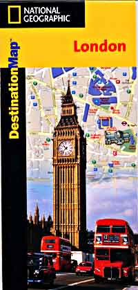
 Scale 1:10,700. Size 18"x25". National Geographic edition. London street map. Exploring London is as easy as unfolding this sturdy, laminated map. The front features a map of the London Underground and a large-scale city map that highlights tourist and business travel locations with 3-D styled drawings. The back includes: Regional map; Points of interest; Airport diagrams for Heathrow and Gatwick; Inset map for Hyde Park and Kensington; Information on transportation, museums, and more; Multi-language legend.
 - $17.95
Item Code : ITMB9862
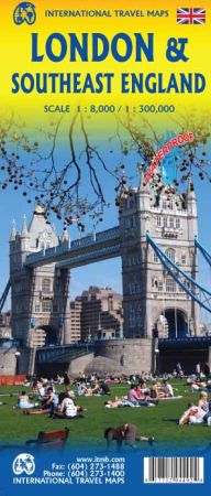
Scale 1:8,000/1:300,000. Size 27"x39". International Travel Maps edition.
Although the cover picture hasn’t changed, the London map has undergone an extensive revision, adding more hotels, pubs, and attractions. While it is not practical to show all such buildings on a map, we are hoping to achieve a representative sample. The ‘tube’ or underground lines have also been re-drawn and emphasized.
Rail lines are shown from their appropriate rail station outwards. There is one north-south rail line through London, and an east-west line under construction, but we are leaving these off our map until the second line is completed. Also, the overground lines are an increasingly important method of travel around London, and these have been shown where appropriate.
The big change on this map, and the reason for its new ISBN, is the enhanced and expanded map on the second side of South East England at 1:300,000 scale. This would be ideal for day trips out of London or for those driving. The western edge of the map is Bath and the northern extreme is either Northampton or Cambridge.
The main roads in and out of London are shown, with motorways in blue, A roads in green and thousands of B roads wend their way to lovely villages and secondary towns. Both sides of the map include our Top Attractions list. The map is printed on high density plastic paper, both for durability and for inclement weather.
- $24.95 + $6.80 p&h or $14.80 foreign delivery
Item Code : GEAZ9866
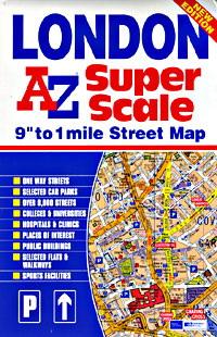
 Scale 1:22,000. Size 5"x7?". 430 pages. Geographers A-Z edition.
 - $36.95 + $6.80 p&h or $16.80 foreign delivery
Item Code : GEAZ9867
 Scale 1:15,000. Size 8"x11". 302 pages. Geographers A-Z edition.
 - $24.95 + $6.80 p&h or $14.80 foreign delivery
Item Code : GEAZ9868
 Scale 1:21,000. Size 4"x6". 368 pages. Geographers A-Z edition.
 - $42.95 + $7.80 p&h or $18.80 foreign delivery
Item Code : GEAZ9869
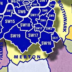
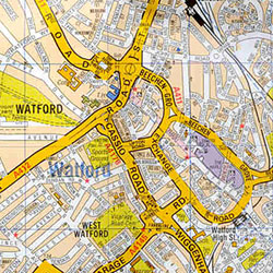
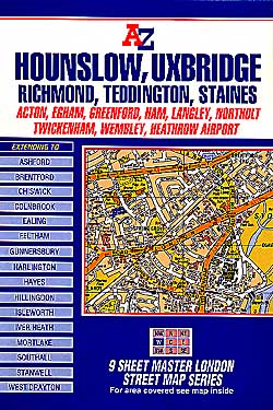
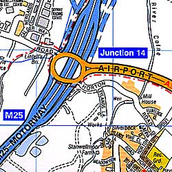
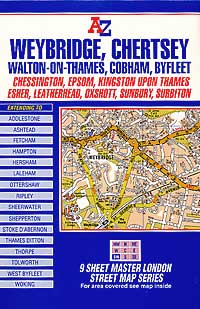
 Scale 1:20,500. Size 7"x10". 328 pages. Geographers A-Z edition. Fully indexed. Spiral binding makes this atlas so convenient to use. Features: 328 pages of street maps, with overlaps to adjoining pages; 18 pages of maps at 1:7,000 scale give additional clarity and detail in the congested central areas including one-way streets and toilets. 8 pages of Road Maps at 1:21,000 scale, show access routes to London and cover much of the Home Counties area. Also included are colored Underground Map, London Connections Railway Map, West End Cinema and Theatre Maps; 114 pages of index to streets; indexes to Places and Areas, Hospitals, Stations and Places of Interest. This Street Atlas covers the Greater London area; it is printed in full color to show motorways, A and B roads; postal districts and postcode boundaries; borough bound?aries, built-up areas, green areas and water features. It extends to Potters Bar, Epping, Brentwood, Gravesend, Sevenoaks, Caterham, Leatherhead, Woking, Windsor, Slough, and Chorleywood. The Master Atlas uses index references identical with the Nine Sheet Master Map series listed below, although with differing limits they can be used in conjunction with each other.
 - $16.95
Item Code : GEAZ9871
 Scale 1:64,000. Size 36"x46". Geographer's A-Z edition.
 -
-
-
|
London Street Maps |
